Pricing Guides & Dictionary of Makers Marks for Antiques & Collectibles
Appraise and find values for
(13) Pcs Hazel Atlas mid-century...
From
marks4antiques.com
- The most updated price guide and makers' marks research online
As a member, you have access to a team of experts
and assistance is always available to you for free
An example from the millions of items in our Price Guide:
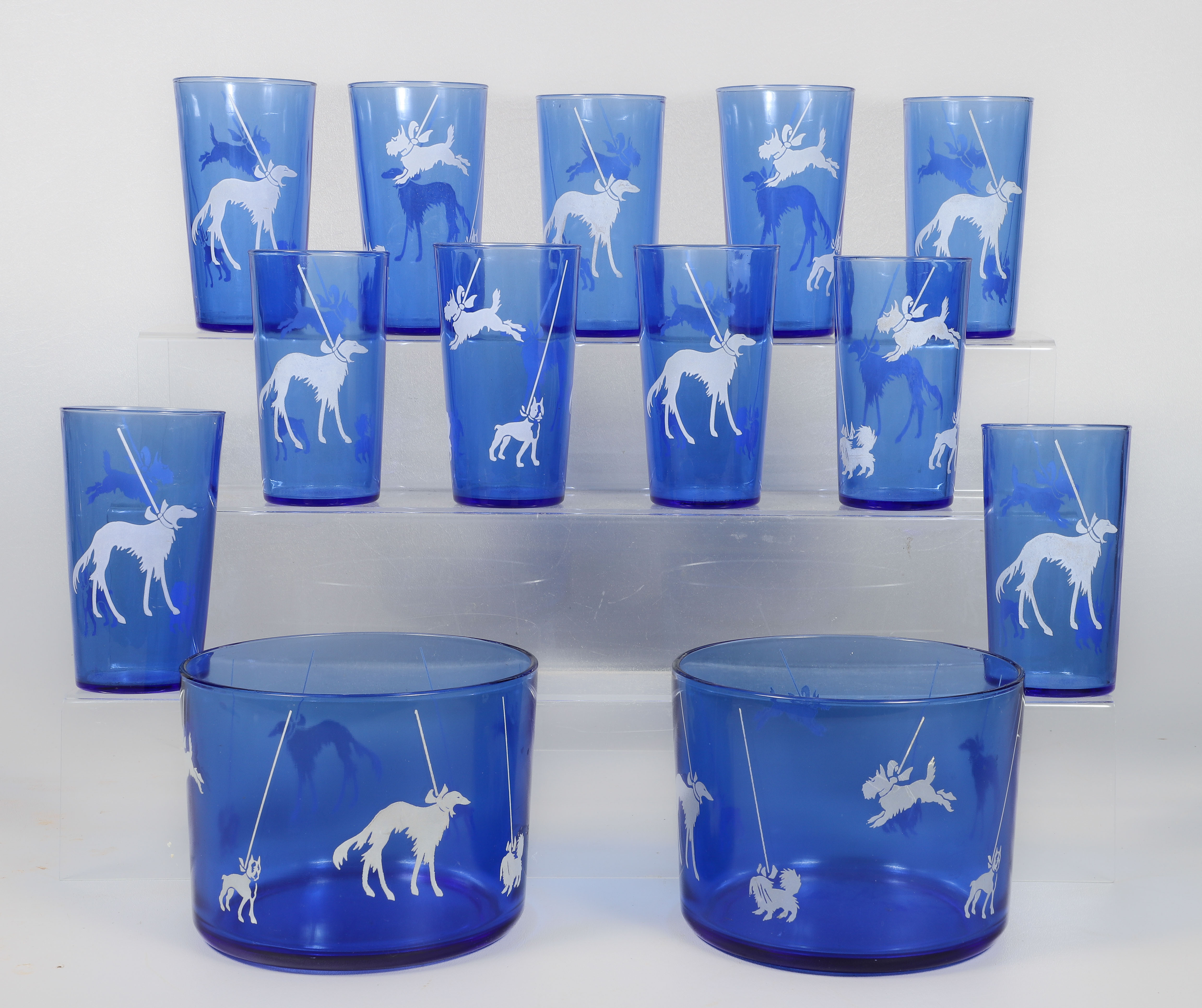
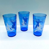
(13) Pcs Hazel Atlas mid-century glassware, Sportsman Series, cobalt blue with white dogs on leash (Scottie, Shih Tzu, Boxer, Afghan), c/o (2) 5-5/8"...
This is an example from our
values4antiques price guide
We do not buy or sell any items
See more price guides
Check our other research services:
IDENTIFY WORLDWIDE MAKERS' MARKS & HALLMARKS
marks4ceramics:
Porcelain, Pottery, Chinaware, Figurines, Dolls, Vases...
marks4silver
:
Silver, Jewelry, Pewter, Silverplate, Copper & Bronze...
Explore other items from our
Antiques & Collectibles Price Guide
-
 COLLECTION OF CONTRACTS, PHOTOS, AND OTH
[more like this]
COLLECTION OF CONTRACTS, PHOTOS, AND OTH
[more like this]
-
 3PC HAZEL-ATLAS GLASS COMPANY SYRUP PITC
[more like this]
3PC HAZEL-ATLAS GLASS COMPANY SYRUP PITC
[more like this]
-
 HAZEL-ATLAS GLASS COMPANY MEASURING CUPA
[more like this]
HAZEL-ATLAS GLASS COMPANY MEASURING CUPA
[more like this]
-
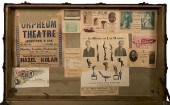 HAZEL KOLAR’S STEAMER TRUNK.Kolar, Hazel
[more like this]
HAZEL KOLAR’S STEAMER TRUNK.Kolar, Hazel
[more like this]
-
 KOLAR, HAZEL. PORTRAIT OF ESCAPE ARTIST
[more like this]
KOLAR, HAZEL. PORTRAIT OF ESCAPE ARTIST
[more like this]
-
 KOLAR, HAZEL. PORTRAIT OF MIND READER HA
[more like this]
KOLAR, HAZEL. PORTRAIT OF MIND READER HA
[more like this]
-
 6PC ASSORTED ANTIQUE 1870'S ATLASES Unit
[more like this]
6PC ASSORTED ANTIQUE 1870'S ATLASES Unit
[more like this]
-
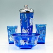
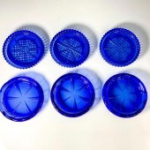
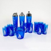 20PC HAZEL ATLAS COBALT BLUE SAILBOAT CO
[more like this]
20PC HAZEL ATLAS COBALT BLUE SAILBOAT CO
[more like this]
-
 5 KENTUCKY AND TENNESSEE MAPS1st item: "
[more like this]
5 KENTUCKY AND TENNESSEE MAPS1st item: "
[more like this]
-
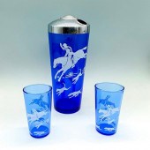
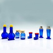
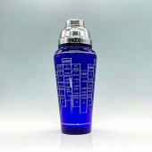 HAZEL ATLAS COBALT BLUE COCKTAIL SHAKER
[more like this]
HAZEL ATLAS COBALT BLUE COCKTAIL SHAKER
[more like this]
-
 3PC HAZEL ATLAS COBALT BLUE COCKTAIL SHA
[more like this]
3PC HAZEL ATLAS COBALT BLUE COCKTAIL SHA
[more like this]
-
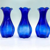 3PC HAZEL ATLAS COBALT BLUE GLASS VASESA
[more like this]
3PC HAZEL ATLAS COBALT BLUE GLASS VASESA
[more like this]
-
 3PC HAZEL ATLAS COBALT BLUE GLASS, CITRU
[more like this]
3PC HAZEL ATLAS COBALT BLUE GLASS, CITRU
[more like this]
-
 3PC HAZEL ATLAS NURSERY RHYME GLASSES, T
[more like this]
3PC HAZEL ATLAS NURSERY RHYME GLASSES, T
[more like this]
-
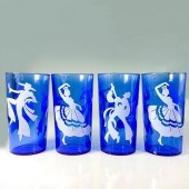 4PC HAZEL ATLAS COBALT BLUE GLASS, DANCI
[more like this]
4PC HAZEL ATLAS COBALT BLUE GLASS, DANCI
[more like this]
-
 4PC HAZEL ATLAS COBALT GLASS COCKTAIL SH
[more like this]
4PC HAZEL ATLAS COBALT GLASS COCKTAIL SH
[more like this]
-
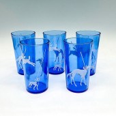 5PC ART DECO HAZEL ATLAS SHOW DOG GLASSE
[more like this]
5PC ART DECO HAZEL ATLAS SHOW DOG GLASSE
[more like this]
-
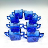
 5PC HAZEL ATLAS BLUE CHEVRON RITZ PITCHE
[more like this]
5PC HAZEL ATLAS BLUE CHEVRON RITZ PITCHE
[more like this]
-
 6PC HAZEL ATLAS COBALT BLUE GLASS, COAST
[more like this]
6PC HAZEL ATLAS COBALT BLUE GLASS, COAST
[more like this]
-
 8PC HAZEL ATLAS COBALT BLUE GLASS, ASHTR
[more like this]
8PC HAZEL ATLAS COBALT BLUE GLASS, ASHTR
[more like this]
-
 8PC HAZEL ATLAS COBALT BLUE GLASS, SALT
[more like this]
8PC HAZEL ATLAS COBALT BLUE GLASS, SALT
[more like this]
-
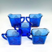
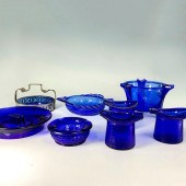
 8PC HAZEL ATLAS COBALT BLUE SERVING CREA
[more like this]
8PC HAZEL ATLAS COBALT BLUE SERVING CREA
[more like this]
-
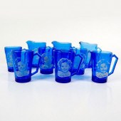 9PC HAZEL ATLAS MUGS AND PITCHERS SET, S
[more like this]
9PC HAZEL ATLAS MUGS AND PITCHERS SET, S
[more like this]
-
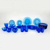
 16PC HAZEL ATLAS COBALT BLUE GLASS, CUST
[more like this]
16PC HAZEL ATLAS COBALT BLUE GLASS, CUST
[more like this]
-
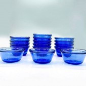
 34PC HAZEL ATLAS COBALT BLUE MODERNSTONE
[more like this]
34PC HAZEL ATLAS COBALT BLUE MODERNSTONE
[more like this]
-
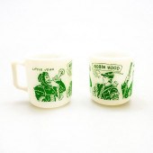 2 HAZEL ATLAS PLATONITE CHILD'S MILK GLA
[more like this]
2 HAZEL ATLAS PLATONITE CHILD'S MILK GLA
[more like this]
-
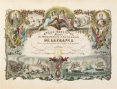 (ATLAS FRONTISPIECES) A group of four ti
[more like this]
(ATLAS FRONTISPIECES) A group of four ti
[more like this]
-
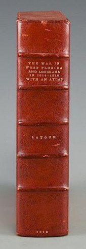 LATOUR WAR IN WEST FLORIDA LA 1814-1815,
[more like this]
LATOUR WAR IN WEST FLORIDA LA 1814-1815,
[more like this]
-
 HAZEL GUGGENHEIM MCKINLEY KING-FARLOW (N
[more like this]
HAZEL GUGGENHEIM MCKINLEY KING-FARLOW (N
[more like this]
-
 HAZEL MASSEY (AMERICAN/TEXAS 1907-1990)
[more like this]
HAZEL MASSEY (AMERICAN/TEXAS 1907-1990)
[more like this]
-
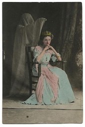
 CABINET PHOTO OF HAZEL KOLAR IN RESTRAIN
[more like this]
CABINET PHOTO OF HAZEL KOLAR IN RESTRAIN
[more like this]
-
 PAIR OF HAZEL KOLAR PORTRAITS, INCLUDING
[more like this]
PAIR OF HAZEL KOLAR PORTRAITS, INCLUDING
[more like this]
-
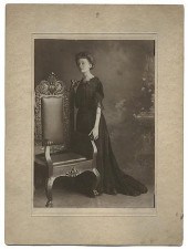 GROUP OF FIVE CABINET PHOTOS OF HAZEL KO
[more like this]
GROUP OF FIVE CABINET PHOTOS OF HAZEL KO
[more like this]
-
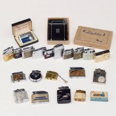 LRG GRP: ASSORTED MECHANICAL LIGHTERS AN
[more like this]
LRG GRP: ASSORTED MECHANICAL LIGHTERS AN
[more like this]
-
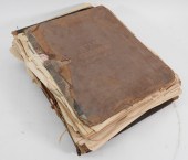
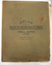 4 vols. (Philadelphia Property Atlases)
[more like this]
4 vols. (Philadelphia Property Atlases)
[more like this]
-
 4 vols. (Pennsylvania Property Atlases
[more like this]
4 vols. (Pennsylvania Property Atlases
[more like this]
This list is limited to only a few results.
Many more items are available to our members in our
Price Guide!
Ideal research tools for Collectors, Personal Property Appraisers, Antiques & Collectibles
Dealers, Auction Houses, Museums, eBayers or
other online
sellers (Rubylane, Etsy etc) and curious minds interested in appraising & identifying collectibles

EASY. FAST. ACCURATE.
Research at its best

Our research tools include:


