Pricing Guides & Dictionary of Makers Marks for Antiques & Collectibles
Appraise and find values for
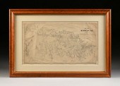
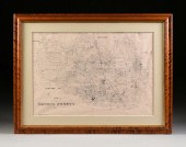
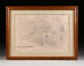
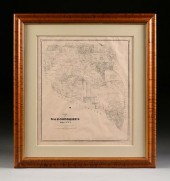
AN ANTIQUE CADASTRAL MAP, "FORT...
From
marks4antiques.com
- The most updated price guide and makers' marks research online
As a member, you have access to a team of experts
and assistance is always available to you for free
An example from the millions of items in our Price Guide:
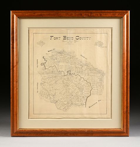
AN ANTIQUE CADASTRAL MAP, "FORT BEND COUNTY, GENERAL LA...AN ANTIQUE CADASTRAL MAP, "Fort Bend County, General Land Office, March 1893, " LATE 19TH/EARLY...
This is an example from our
values4antiques price guide
We do not buy or sell any items
See more price guides
Check our other research services:
IDENTIFY WORLDWIDE MAKERS' MARKS & HALLMARKS
marks4ceramics:
Porcelain, Pottery, Chinaware, Figurines, Dolls, Vases...
marks4silver
:
Silver, Jewelry, Pewter, Silverplate, Copper & Bronze...
Explore other items from our
Antiques & Collectibles Price Guide
-
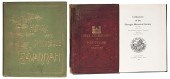
 BRITANNIA, VOL. I & II CAMDEN 1722Camden
[more like this]
BRITANNIA, VOL. I & II CAMDEN 1722Camden
[more like this]
-
 A COMPLETE SYSTEM OF GEOGRAPHY, VOL. I B
[more like this]
A COMPLETE SYSTEM OF GEOGRAPHY, VOL. I B
[more like this]
-
 IMPORTANT ANTIQUE ATLAS DU VOYAGE DE LA
[more like this]
IMPORTANT ANTIQUE ATLAS DU VOYAGE DE LA
[more like this]
-
 Books on the Battle of Fort Pulaski and
[more like this]
Books on the Battle of Fort Pulaski and
[more like this]
-
 USS Brooklyn Landsman George Tittle Civi
[more like this]
USS Brooklyn Landsman George Tittle Civi
[more like this]
-
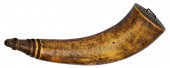 French and Indian War Map Horn--Forbes T
[more like this]
French and Indian War Map Horn--Forbes T
[more like this]
-
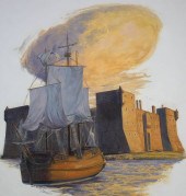 SHANNON STIRNWEIS (B. 1931) "FT. CHAMBLY
[more like this]
SHANNON STIRNWEIS (B. 1931) "FT. CHAMBLY
[more like this]
-
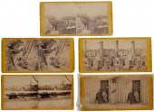 Civil War Stereo Views "Photographic His
[more like this]
Civil War Stereo Views "Photographic His
[more like this]
-
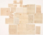 FORT FAMILY OF NC/TN ARCHIVE, 19 ITEMS I
[more like this]
FORT FAMILY OF NC/TN ARCHIVE, 19 ITEMS I
[more like this]
-
 5 KENTUCKY AND TENNESSEE MAPS1st item: "
[more like this]
5 KENTUCKY AND TENNESSEE MAPS1st item: "
[more like this]
-
 A LATE MEXICAN-AMERICAN WAR ERA MAP, "MA
[more like this]
A LATE MEXICAN-AMERICAN WAR ERA MAP, "MA
[more like this]
-
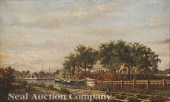 William Henry Buck (Norwegian/New Orlean
[more like this]
William Henry Buck (Norwegian/New Orlean
[more like this]
-
 CIVIL WAR ARCHIVE, INCL. GEN. BATE ON DE
[more like this]
CIVIL WAR ARCHIVE, INCL. GEN. BATE ON DE
[more like this]
-
 A RARE ANTIQUE CIVIL WAR ERA MAP, "PRESS
[more like this]
A RARE ANTIQUE CIVIL WAR ERA MAP, "PRESS
[more like this]
-
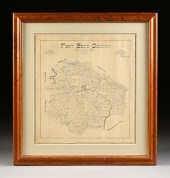 AN ANTIQUE CADASTRAL MAP, "FORT BEND COU
[more like this]
AN ANTIQUE CADASTRAL MAP, "FORT BEND COU
[more like this]
-
 3 KY & TN MAPS: VANCE, TANNER, JOHNSON1s
[more like this]
3 KY & TN MAPS: VANCE, TANNER, JOHNSON1s
[more like this]
-
 8 TENNESSEE MILITARY & SURVEY MAPSAssort
[more like this]
8 TENNESSEE MILITARY & SURVEY MAPSAssort
[more like this]
-
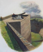 SHANNON STIRNWEIS (B. 1931) "FORT #1 POI
[more like this]
SHANNON STIRNWEIS (B. 1931) "FORT #1 POI
[more like this]
-
 A FACSIMILE CADASTRAL MAP, "MAP OF BRAZO
[more like this]
A FACSIMILE CADASTRAL MAP, "MAP OF BRAZO
[more like this]
-
 AN ANTIQUE CADASTRAL MAP, "MAP OF BANDER
[more like this]
AN ANTIQUE CADASTRAL MAP, "MAP OF BANDER
[more like this]
-
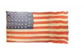 LT. COMMANDER JAMES PARKER'S FLAG FROM T
[more like this]
LT. COMMANDER JAMES PARKER'S FLAG FROM T
[more like this]
-
 4 TN & KY MAPS, 3 FRAMED1st item: "Tenne
[more like this]
4 TN & KY MAPS, 3 FRAMED1st item: "Tenne
[more like this]
-
 A Very Large Collection of Maps, 19th/e
[more like this]
A Very Large Collection of Maps, 19th/e
[more like this]
-
 AN ANTIQUE CADASTRAL MAP, "MAP OF DUVAL
[more like this]
AN ANTIQUE CADASTRAL MAP, "MAP OF DUVAL
[more like this]
-
 16TH / 18TH C. EUROPEAN MAPS OF NEW SPAI
[more like this]
16TH / 18TH C. EUROPEAN MAPS OF NEW SPAI
[more like this]
-
 AN IMPORTANT REPUBLIC OF TEXAS MAP, "MAP
[more like this]
AN IMPORTANT REPUBLIC OF TEXAS MAP, "MAP
[more like this]
-
 AN ANTIQUE CADASTRAL MAP, "ZAVALA COUNTY
[more like this]
AN ANTIQUE CADASTRAL MAP, "ZAVALA COUNTY
[more like this]
-
 AN ANTEBELLUM MAP, "J. DE CORDOVA'S MAP
[more like this]
AN ANTEBELLUM MAP, "J. DE CORDOVA'S MAP
[more like this]
-
 A TOPOGRAPHICAL MAP OF THE ENVIRONS OF L
[more like this]
A TOPOGRAPHICAL MAP OF THE ENVIRONS OF L
[more like this]
-
 11 PC. MAP COLLECTION: Comprising; 1- La
[more like this]
11 PC. MAP COLLECTION: Comprising; 1- La
[more like this]
-
 AN ANTIQUE RECONSTRUCTION ERA MAP, "KOSS
[more like this]
AN ANTIQUE RECONSTRUCTION ERA MAP, "KOSS
[more like this]
-
 A FACSIMILE CADASTRAL MAP, "MAP OF HARRI
[more like this]
A FACSIMILE CADASTRAL MAP, "MAP OF HARRI
[more like this]
-
 A FACSIMILE CADASTRAL MAP, "MAP OF BEXAR
[more like this]
A FACSIMILE CADASTRAL MAP, "MAP OF BEXAR
[more like this]
-
 A FACSIMILE CADASTRAL MAP, "MAP OF HARRI
[more like this]
A FACSIMILE CADASTRAL MAP, "MAP OF HARRI
[more like this]
-
 A FACSIMILE CADASTRAL MAP, "MAP OF GALVE
[more like this]
A FACSIMILE CADASTRAL MAP, "MAP OF GALVE
[more like this]
-
 A FACSIMILE CADASTRAL MAP, "MAP OF NACOG
[more like this]
A FACSIMILE CADASTRAL MAP, "MAP OF NACOG
[more like this]
This list is limited to only a few results.
Many more items are available to our members in our
Price Guide!
Ideal research tools for Collectors, Personal Property Appraisers, Antiques & Collectibles
Dealers, Auction Houses, Museums, eBayers or
other online
sellers (Rubylane, Etsy etc) and curious minds interested in appraising & identifying collectibles

EASY. FAST. ACCURATE.
Research at its best

Our research tools include:


