Pricing Guides & Dictionary of Makers Marks for Antiques & Collectibles
Appraise and find values for
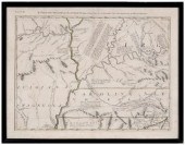
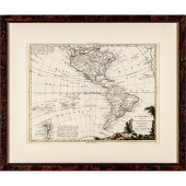
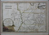
Antonia Zatta (Italian, 1757-1797),...
From
marks4antiques.com
- The most updated price guide and makers' marks research online
As a member, you have access to a team of experts
and assistance is always available to you for free
An example from the millions of items in our Price Guide:
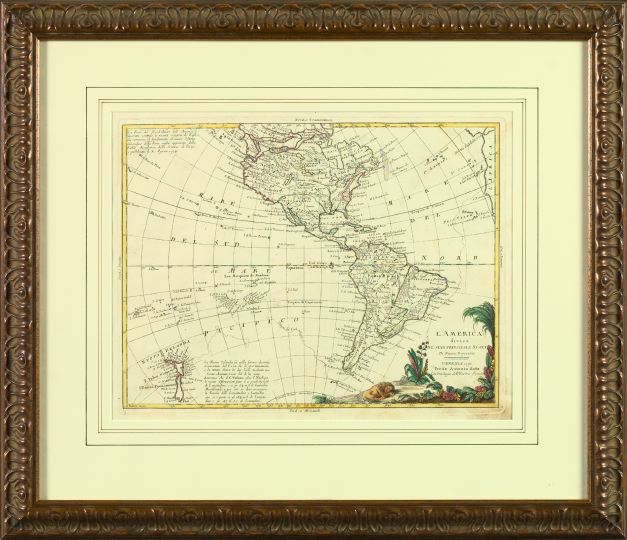
Antonia Zatta (Italian, 1757-1797), hand-colored engraved map of North and South America, dated 1776, presented in a striped French mat within a carved...
This is an example from our
values4antiques price guide
We do not buy or sell any items
See more price guides
Check our other research services:
IDENTIFY WORLDWIDE MAKERS' MARKS & HALLMARKS
marks4ceramics:
Porcelain, Pottery, Chinaware, Figurines, Dolls, Vases...
marks4silver
:
Silver, Jewelry, Pewter, Silverplate, Copper & Bronze...
Explore other items from our
Antiques & Collectibles Price Guide
-
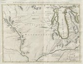 ZATTA, 1778 ITALIAN MAP OF NORTHWEST TER
[more like this]
ZATTA, 1778 ITALIAN MAP OF NORTHWEST TER
[more like this]
-
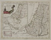 A 1785 ANTONIO ZATTA MAP OF THE HOLY LAN
[more like this]
A 1785 ANTONIO ZATTA MAP OF THE HOLY LAN
[more like this]
-
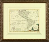 Antonia Zatta (Italian, 1757-1797), han
[more like this]
Antonia Zatta (Italian, 1757-1797), han
[more like this]
-
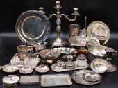 SILVER. ASSORTED STERLING AND SILVER HOL
[more like this]
SILVER. ASSORTED STERLING AND SILVER HOL
[more like this]
-
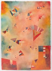 ANTONIA GUZMAN, 1954, CARTA A KANDINSKY
[more like this]
ANTONIA GUZMAN, 1954, CARTA A KANDINSKY
[more like this]
-
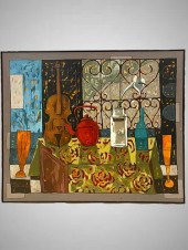
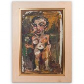 ANTONIA EIRIZ (CUBAN, 1929 - 1995) OIL O
[more like this]
ANTONIA EIRIZ (CUBAN, 1929 - 1995) OIL O
[more like this]
-
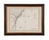
 18th century map of North Carolina, &quo
[more like this]
18th century map of North Carolina, &quo
[more like this]
-
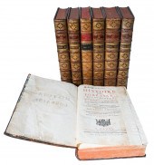 'HISTOIRE DE LORRAINE: VOLUMES I-VII', N
[more like this]
'HISTOIRE DE LORRAINE: VOLUMES I-VII', N
[more like this]
-
 LATE. 18TH C. PARTIAL MAP OF THE ATLANTI
[more like this]
LATE. 18TH C. PARTIAL MAP OF THE ATLANTI
[more like this]
-
 1770 PUBLISHED HAND-COLORED ENGRAVED MAP
[more like this]
1770 PUBLISHED HAND-COLORED ENGRAVED MAP
[more like this]
-
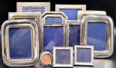 STERLING. (12) ASSORTED STERLING PICTURE
[more like this]
STERLING. (12) ASSORTED STERLING PICTURE
[more like this]
-
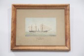 ''U.S.S. ANTONIA'' BY HORATIO L. WAIT (A
[more like this]
''U.S.S. ANTONIA'' BY HORATIO L. WAIT (A
[more like this]
-
 ANTONIA MARTINEZ ALBAREZ CALLENO (B. 20T
[more like this]
ANTONIA MARTINEZ ALBAREZ CALLENO (B. 20T
[more like this]
-
 AFTER ANTON RAPHAEL MENGS MARIA ANTONIA
[more like this]
AFTER ANTON RAPHAEL MENGS MARIA ANTONIA
[more like this]
-
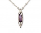 AN ANTONIA PINEDA SILVER, AMETHYST, AND
[more like this]
AN ANTONIA PINEDA SILVER, AMETHYST, AND
[more like this]
-
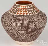
 FREDERICA V. ANTONIA, GEOMETRIC BLACK ON
[more like this]
FREDERICA V. ANTONIA, GEOMETRIC BLACK ON
[more like this]
-
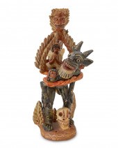
 ANTONIA MONTES DE ORCA (VENEZUELAN, B.19
[more like this]
ANTONIA MONTES DE ORCA (VENEZUELAN, B.19
[more like this]
-
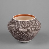
 FREDERICA V. ANTONIA ACOMA INDIAN POTTER
[more like this]
FREDERICA V. ANTONIA ACOMA INDIAN POTTER
[more like this]
-
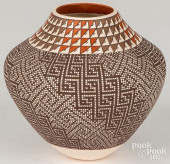 FREDERICA V. ANTONIA ACOMA INDIAN POTTER
[more like this]
FREDERICA V. ANTONIA ACOMA INDIAN POTTER
[more like this]
-
 AFTER ANTON RAPHAEL MENGS MARIA ANTONIA
[more like this]
AFTER ANTON RAPHAEL MENGS MARIA ANTONIA
[more like this]
-
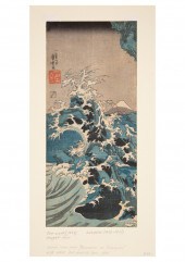 COLLECTION OF SEVEN JAPANESE WOODBLOCK P
[more like this]
COLLECTION OF SEVEN JAPANESE WOODBLOCK P
[more like this]
-
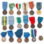 (18PC) ITALIAN AL VALORE MILITARE & COMM
[more like this]
(18PC) ITALIAN AL VALORE MILITARE & COMM
[more like this]
-
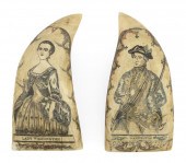 PAIR OF EXCEPTIONAL POLYCHROME SCRIMSHAW
[more like this]
PAIR OF EXCEPTIONAL POLYCHROME SCRIMSHAW
[more like this]
-
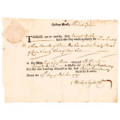 1757 CUSTOM-HOUSE, PHILADELPHIA, FRENCH
[more like this]
1757 CUSTOM-HOUSE, PHILADELPHIA, FRENCH
[more like this]
-
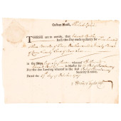 1757 CUSTOM-HOUSE, PHILADELPHIA, FRENCH
[more like this]
1757 CUSTOM-HOUSE, PHILADELPHIA, FRENCH
[more like this]
-
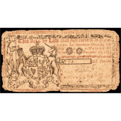 COLONIAL CURRENCY NOTE, NJ. NOV. 20, 175
[more like this]
COLONIAL CURRENCY NOTE, NJ. NOV. 20, 175
[more like this]
-
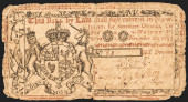 COLONIAL CURRENCY NOTE, NJ. NOV. 20, 175
[more like this]
COLONIAL CURRENCY NOTE, NJ. NOV. 20, 175
[more like this]
-
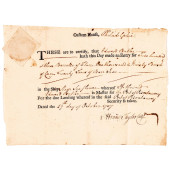 1757 CUSTOM-HOUSE, PHILADELPHIA, FRENCH
[more like this]
1757 CUSTOM-HOUSE, PHILADELPHIA, FRENCH
[more like this]
-
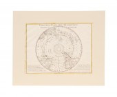 C. 1779, ANTARCTICA & CAPTAIN COOK'S TRA
[more like this]
C. 1779, ANTARCTICA & CAPTAIN COOK'S TRA
[more like this]
-
 GIOVANNI MARIA CASSINI (ITALIAN, 1745-CI
[more like this]
GIOVANNI MARIA CASSINI (ITALIAN, 1745-CI
[more like this]
-
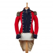 RARE IRISH MILITIA FIELD OFFICER'S RED C
[more like this]
RARE IRISH MILITIA FIELD OFFICER'S RED C
[more like this]
-
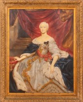
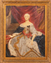
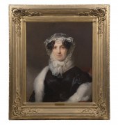 THOMAS SULLY (PA/UK, 1783-1872) Portrait
[more like this]
THOMAS SULLY (PA/UK, 1783-1872) Portrait
[more like this]
-
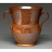 A Derbyshire saltglazed brown stoneware
[more like this]
A Derbyshire saltglazed brown stoneware
[more like this]
-
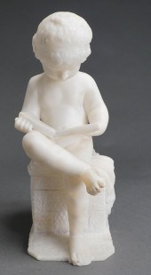 AFTER ANTONIO CANOVA, ITALIAN B. 1757-18
[more like this]
AFTER ANTONIO CANOVA, ITALIAN B. 1757-18
[more like this]
-
 AFTER ANTONIO CANOVA (ITALIAN, 1757-1822
[more like this]
AFTER ANTONIO CANOVA (ITALIAN, 1757-1822
[more like this]
-
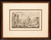 AFTER GIUSEPPE GALLI BIBIENA (ITALIAN, 1
[more like this]
AFTER GIUSEPPE GALLI BIBIENA (ITALIAN, 1
[more like this]
This list is limited to only a few results.
Many more items are available to our members in our
Price Guide!
Ideal research tools for Collectors, Personal Property Appraisers, Antiques & Collectibles
Dealers, Auction Houses, Museums, eBayers or
other online
sellers (Rubylane, Etsy etc) and curious minds interested in appraising & identifying collectibles

EASY. FAST. ACCURATE.
Research at its best

Our research tools include:


