Pricing Guides & Dictionary of Makers Marks for Antiques & Collectibles
Appraise and find values for
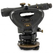
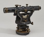
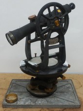
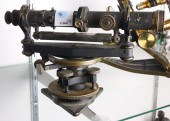
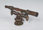
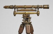
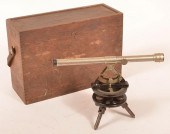
BRASS AND MARBLE SURVEY TRANSIT...
From
marks4antiques.com
- The most updated price guide and makers' marks research online
As a member, you have access to a team of experts
and assistance is always available to you for free
An example from the millions of items in our Price Guide:
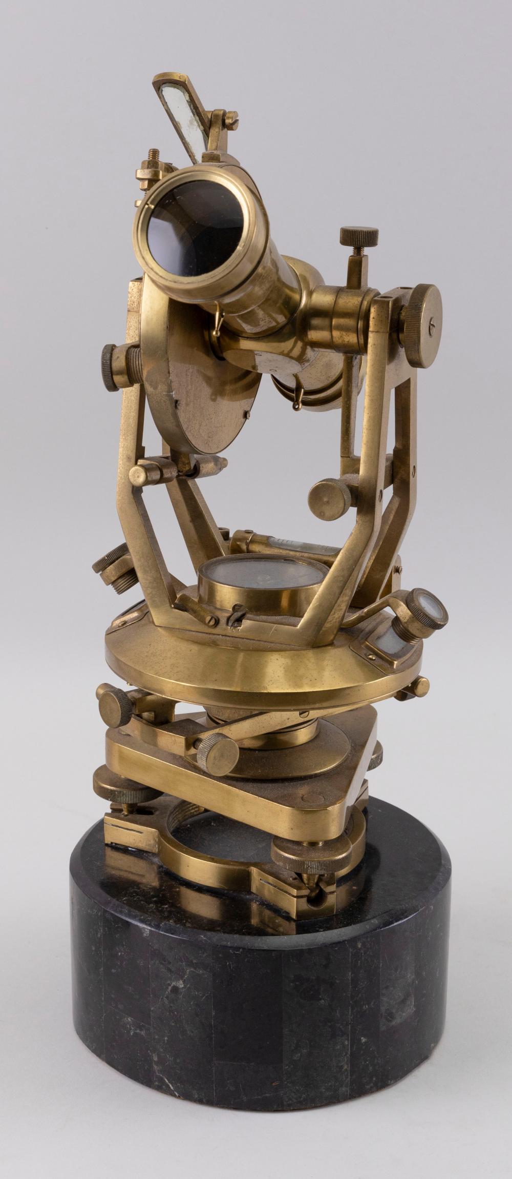
BRASS AND MARBLE SURVEY TRANSIT 20TH CENTURY HEIGHT 16”.BRASS AND MARBLE SURVEY TRANSIT, 20th Century, Unmarked. Dimensions: Height 16"....
This is an example from our
values4antiques price guide
We do not buy or sell any items
See more price guides
Check our other research services:
IDENTIFY WORLDWIDE MAKERS' MARKS & HALLMARKS
marks4ceramics:
Porcelain, Pottery, Chinaware, Figurines, Dolls, Vases...
marks4silver
:
Silver, Jewelry, Pewter, Silverplate, Copper & Bronze...
Explore other items from our
Antiques & Collectibles Price Guide
-
 8 TENNESSEE MILITARY & SURVEY MAPSAssort
[more like this]
8 TENNESSEE MILITARY & SURVEY MAPSAssort
[more like this]
-
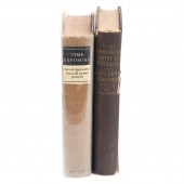 TWO BOOKS: FIRST EDITION OF "TIME EXPOSU
[more like this]
TWO BOOKS: FIRST EDITION OF "TIME EXPOSU
[more like this]
-
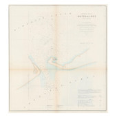
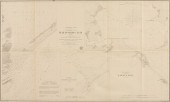 AN ANTIQUE SURVEY MAP, "PRELIMINARY CHAR
[more like this]
AN ANTIQUE SURVEY MAP, "PRELIMINARY CHAR
[more like this]
-
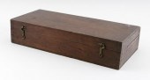
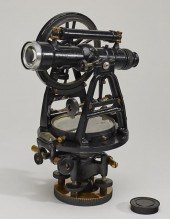 GURLEY BRASS CASED SURVEY TRANSIT WITH W
[more like this]
GURLEY BRASS CASED SURVEY TRANSIT WITH W
[more like this]
-
 CL BERGER SURVEYOR'S TRANSIT, LEVEL MODE
[more like this]
CL BERGER SURVEYOR'S TRANSIT, LEVEL MODE
[more like this]
-
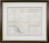
 AN ANTIQUE SURVEY MAP, "U.S. COAST SURVE
[more like this]
AN ANTIQUE SURVEY MAP, "U.S. COAST SURVE
[more like this]
-
 AN ANTIQUE SURVEY MAP, "U.S. COAST SURVE
[more like this]
AN ANTIQUE SURVEY MAP, "U.S. COAST SURVE
[more like this]
-
 AN ANTIQUE SURVEY MAP, "PRELIMINARY CHAR
[more like this]
AN ANTIQUE SURVEY MAP, "PRELIMINARY CHAR
[more like this]
-
 BRASS AND MARBLE SURVEY TRANSIT 20TH CEN
[more like this]
BRASS AND MARBLE SURVEY TRANSIT 20TH CEN
[more like this]
-
 ERASMUS A. KURTZ CASED BRASS SURVEYOR’S
[more like this]
ERASMUS A. KURTZ CASED BRASS SURVEYOR’S
[more like this]
-
 OLD KEUFFEL & ESSEX CO. SURVEYORS SURVEY
[more like this]
OLD KEUFFEL & ESSEX CO. SURVEYORS SURVEY
[more like this]
-
 Five damaged or partial instruments: 19t
[more like this]
Five damaged or partial instruments: 19t
[more like this]
-
 KEUFFEL & ESSER PRELIMINARY SURVEY TRANS
[more like this]
KEUFFEL & ESSER PRELIMINARY SURVEY TRANS
[more like this]
-
 KEUFFEL & ESSER CO NEW YORK SURVEYORS SU
[more like this]
KEUFFEL & ESSER CO NEW YORK SURVEYORS SU
[more like this]
-
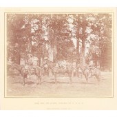 WILLIAM HENRY JACKSON ORIGINAL FRAMED AL
[more like this]
WILLIAM HENRY JACKSON ORIGINAL FRAMED AL
[more like this]
-
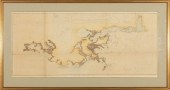
 1853 MAP OF NANTUCKET HARBOR SURVEY OF T
[more like this]
1853 MAP OF NANTUCKET HARBOR SURVEY OF T
[more like this]
-
 AN ANTIQUE RECONSTRUCTION ERA SURVEY MAP
[more like this]
AN ANTIQUE RECONSTRUCTION ERA SURVEY MAP
[more like this]
-
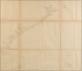
 CIVIL WAR ERA U.S. COAST SURVEY CHART OF
[more like this]
CIVIL WAR ERA U.S. COAST SURVEY CHART OF
[more like this]
-
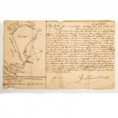
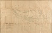
 1720-DATED LAND SURVEY OF 27 ACRES IN PR
[more like this]
1720-DATED LAND SURVEY OF 27 ACRES IN PR
[more like this]
-
 GURLEY BRASS SURVEYORS TRANSIT IN CASE:
[more like this]
GURLEY BRASS SURVEYORS TRANSIT IN CASE:
[more like this]
-
 SURVEYOR'S TRANSIT - KY TIENSCH & STANCL
[more like this]
SURVEYOR'S TRANSIT - KY TIENSCH & STANCL
[more like this]
-
 W & LE GURLEY BRASS SURVEY LEVEL TRIPOD
[more like this]
W & LE GURLEY BRASS SURVEY LEVEL TRIPOD
[more like this]
-
 PENNSYLVANIA POCKET SURVEYOR'S TRANSIT.
[more like this]
PENNSYLVANIA POCKET SURVEYOR'S TRANSIT.
[more like this]
-
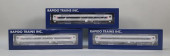 RAPIDO TRAINS INC - 3 TRAINS - COACH/COA
[more like this]
RAPIDO TRAINS INC - 3 TRAINS - COACH/COA
[more like this]
-
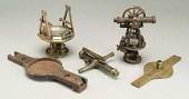
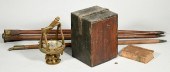
 Collection of Gurley's manuals, rela
[more like this]
Collection of Gurley's manuals, rela
[more like this]
-
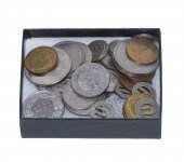 BOX OF WORLD COINS & BALTIMORE TRANSIT T
[more like this]
BOX OF WORLD COINS & BALTIMORE TRANSIT T
[more like this]
-
 STARRETT SURVEYORS TRANSIT NO. 99F.Starr
[more like this]
STARRETT SURVEYORS TRANSIT NO. 99F.Starr
[more like this]
-
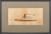 WATERCOLOUR OF THE "TRANSIT"A marine wat
[more like this]
WATERCOLOUR OF THE "TRANSIT"A marine wat
[more like this]
-
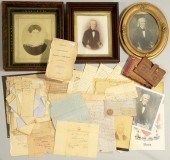 JOHN DAVIS AND FAMILY ARCHIVEArchive of
[more like this]
JOHN DAVIS AND FAMILY ARCHIVEArchive of
[more like this]
-
 SURVEY FOR ROBERT CARTER, GREAT FALLS, V
[more like this]
SURVEY FOR ROBERT CARTER, GREAT FALLS, V
[more like this]
-
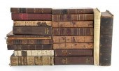 Rare books: Ottoman Empire history and r
[more like this]
Rare books: Ottoman Empire history and r
[more like this]
-
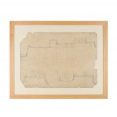 SIR EDWIN LUTYENS (1869-1944)
SURVEY OF
[more like this]
SIR EDWIN LUTYENS (1869-1944)
SURVEY OF
[more like this]
-
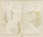
 ANTIQUE COAST SURVEY MAP OF COASTAL LOUI
[more like this]
ANTIQUE COAST SURVEY MAP OF COASTAL LOUI
[more like this]
-
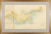
 US COAST SURVEY MAP OF THE LOUISIANA COA
[more like this]
US COAST SURVEY MAP OF THE LOUISIANA COA
[more like this]
-
 US COAST SURVEY MAP CONNECTICUT & NEW YO
[more like this]
US COAST SURVEY MAP CONNECTICUT & NEW YO
[more like this]
-
 AN ANTIQUE SURVEY MAP, "BOUNDARY OF THE
[more like this]
AN ANTIQUE SURVEY MAP, "BOUNDARY OF THE
[more like this]
This list is limited to only a few results.
Many more items are available to our members in our
Price Guide!
Ideal research tools for Collectors, Personal Property Appraisers, Antiques & Collectibles
Dealers, Auction Houses, Museums, eBayers or
other online
sellers (Rubylane, Etsy etc) and curious minds interested in appraising & identifying collectibles

EASY. FAST. ACCURATE.
Research at its best

Our research tools include:


