Pricing Guides & Dictionary of Makers Marks for Antiques & Collectibles
Appraise and find values for
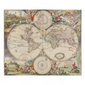
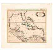
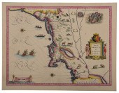
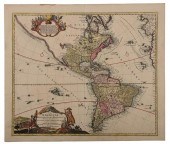
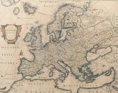
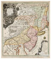
DANCKERTS, JUSTUS. NOVA TOTIUS...
From
marks4antiques.com
- The most updated price guide and makers' marks research online
As a member, you have access to a team of experts
and assistance is always available to you for free
An example from the millions of items in our Price Guide:
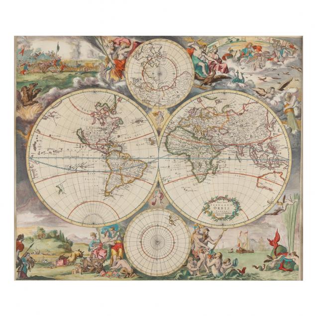
DANCKERTS, JUSTUS. NOVA TOTIUS TERRARUM ORBIS (Amsterdam, circa 1680), copperplate engraving with hand color, depicts the two hemispheres and poles with...
This is an example from our
values4antiques price guide
We do not buy or sell any items
See more price guides
Check our other research services:
IDENTIFY WORLDWIDE MAKERS' MARKS & HALLMARKS
marks4ceramics:
Porcelain, Pottery, Chinaware, Figurines, Dolls, Vases...
marks4silver
:
Silver, Jewelry, Pewter, Silverplate, Copper & Bronze...
Explore other items from our
Antiques & Collectibles Price Guide
-
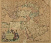 TURKISH EMPIRE MAP, JUSTUS DANCKERTS 168
[more like this]
TURKISH EMPIRE MAP, JUSTUS DANCKERTS 168
[more like this]
-
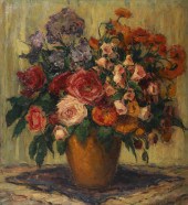
 MEL CRAWFORD (B. 1925) "NOVA SCOTIA" ORI
[more like this]
MEL CRAWFORD (B. 1925) "NOVA SCOTIA" ORI
[more like this]
-
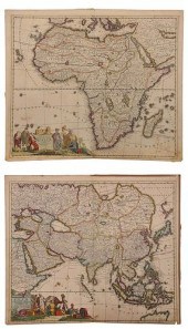 DANCKERTS FAMILY - TWO MAPS OF AFRICA AN
[more like this]
DANCKERTS FAMILY - TWO MAPS OF AFRICA AN
[more like this]
-
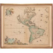
 DANCKERTS, JUSTUS. NOVA TOTIUS TERRARUM
[more like this]
DANCKERTS, JUSTUS. NOVA TOTIUS TERRARUM
[more like this]
-
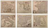 DE WIT - SIX MAPS OF EUROPE AND ASIAFred
[more like this]
DE WIT - SIX MAPS OF EUROPE AND ASIAFred
[more like this]
-
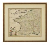 DANCKERTS ATLAS MAP OF FRANCE, C.1680Fra
[more like this]
DANCKERTS ATLAS MAP OF FRANCE, C.1680Fra
[more like this]
-
 1720 HANDCOLORED HOMANN MAP TOTIUS AMERI
[more like this]
1720 HANDCOLORED HOMANN MAP TOTIUS AMERI
[more like this]
-
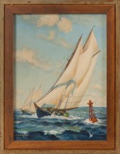
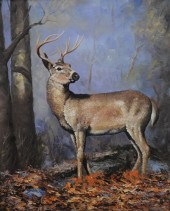 JUSTUS (20TH CENTURY), AUTUMN BUCK, OIL
[more like this]
JUSTUS (20TH CENTURY), AUTUMN BUCK, OIL
[more like this]
-
 WAYNE JUSTUS (B.1952) WESTERN, "MORNING
[more like this]
WAYNE JUSTUS (B.1952) WESTERN, "MORNING
[more like this]
-
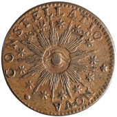 1783 NOVA CONSTELLATIO WITH POINTED RAYS
[more like this]
1783 NOVA CONSTELLATIO WITH POINTED RAYS
[more like this]
-
 CORNELIUS DANCKERTS, CARIBBEAN & FLORIDA
[more like this]
CORNELIUS DANCKERTS, CARIBBEAN & FLORIDA
[more like this]
-
 MANTON JUDAH NICKERSON (NOVA SCOTIA, 187
[more like this]
MANTON JUDAH NICKERSON (NOVA SCOTIA, 187
[more like this]
-
 MANTON JUDAH NICKERSON (NOVA SCOTIA, 187
[more like this]
MANTON JUDAH NICKERSON (NOVA SCOTIA, 187
[more like this]
-
 MANTON JUDAH NICKERSON (NOVA SCOTIA, 187
[more like this]
MANTON JUDAH NICKERSON (NOVA SCOTIA, 187
[more like this]
-
 16TH / 18TH C. EUROPEAN MAPS OF NEW SPAI
[more like this]
16TH / 18TH C. EUROPEAN MAPS OF NEW SPAI
[more like this]
-
 BLAEU - NOVA BELGICA ET ANGLIA NOVA, MAP
[more like this]
BLAEU - NOVA BELGICA ET ANGLIA NOVA, MAP
[more like this]
-
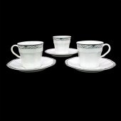 3 STUDIO NOVA CUP AND SAUCER SETS, SYNTH
[more like this]
3 STUDIO NOVA CUP AND SAUCER SETS, SYNTH
[more like this]
-
 EARLY MAP, NOVA BELGICA ET ANGLIA NOVA,
[more like this]
EARLY MAP, NOVA BELGICA ET ANGLIA NOVA,
[more like this]
-
 JOHANNES BAPTIST HOMANN, (1663-1724), "T
[more like this]
JOHANNES BAPTIST HOMANN, (1663-1724), "T
[more like this]
-
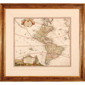
 FREDERICK DE WIT, TOTIUS AMERICAE DESCRI
[more like this]
FREDERICK DE WIT, TOTIUS AMERICAE DESCRI
[more like this]
-
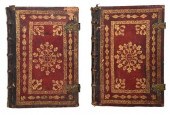 TWO VOLUMES 18TH CENTURY PAPAL TOMESincl
[more like this]
TWO VOLUMES 18TH CENTURY PAPAL TOMESincl
[more like this]
-
 HOMANN - TOTIUS AMERICAE SEPTENTRIONALIS
[more like this]
HOMANN - TOTIUS AMERICAE SEPTENTRIONALIS
[more like this]
-
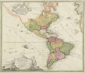 AN ANTIQUE MAP, "TOTIUS AMERICAE SEPTENT
[more like this]
AN ANTIQUE MAP, "TOTIUS AMERICAE SEPTENT
[more like this]
-
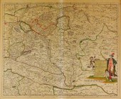 MAP: "HUNGARIA TABULA", 1684, BY PIERRE
[more like this]
MAP: "HUNGARIA TABULA", 1684, BY PIERRE
[more like this]
-
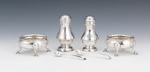 Mid 18th Century English Master Salts wi
[more like this]
Mid 18th Century English Master Salts wi
[more like this]
-
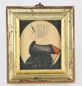 AMERICAN MINIATURE PORTRAIT ATTRIBUTED T
[more like this]
AMERICAN MINIATURE PORTRAIT ATTRIBUTED T
[more like this]
-
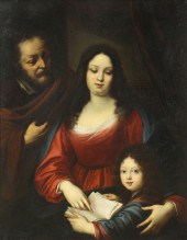 PAINTING, AFTER JUSTUS SUSTERMANS After
[more like this]
PAINTING, AFTER JUSTUS SUSTERMANS After
[more like this]
-
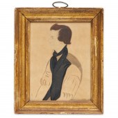 JUSTUS DALEE (MANNER), FOLK ART PORTRAIT
[more like this]
JUSTUS DALEE (MANNER), FOLK ART PORTRAIT
[more like this]
-
 Elizabeth Breen-Justus (German. b 1872)
[more like this]
Elizabeth Breen-Justus (German. b 1872)
[more like this]
-
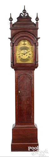 SIMEON JOCELIN, NEW HAVEN, TALL CLOCK<br
[more like this]
SIMEON JOCELIN, NEW HAVEN, TALL CLOCK<br
[more like this]
-
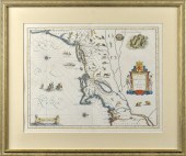
 FRAMED EUROPEAN MAP: Hand-colored map of
[more like this]
FRAMED EUROPEAN MAP: Hand-colored map of
[more like this]
-
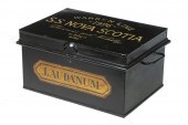 SHIP'S DRUG SAFE, BRITISH MERCHANT NAVY,
[more like this]
SHIP'S DRUG SAFE, BRITISH MERCHANT NAVY,
[more like this]
-
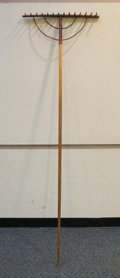 NOVA SCOTIA PRIMITIVE WOOD RAKE WITH OLD
[more like this]
NOVA SCOTIA PRIMITIVE WOOD RAKE WITH OLD
[more like this]
-
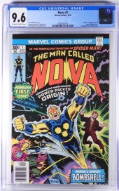 MARVEL COMICS NOVA #1 CGC 9.6 United Sta
[more like this]
MARVEL COMICS NOVA #1 CGC 9.6 United Sta
[more like this]
-
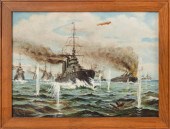
 TOBIAS CONRAD LOTTER & GEORG MATTHäUS SE
[more like this]
TOBIAS CONRAD LOTTER & GEORG MATTHäUS SE
[more like this]
-
 THREE PIECES OF FOLK ART: SID HOWARD (NO
[more like this]
THREE PIECES OF FOLK ART: SID HOWARD (NO
[more like this]
This list is limited to only a few results.
Many more items are available to our members in our
Price Guide!
Ideal research tools for Collectors, Personal Property Appraisers, Antiques & Collectibles
Dealers, Auction Houses, Museums, eBayers or
other online
sellers (Rubylane, Etsy etc) and curious minds interested in appraising & identifying collectibles

EASY. FAST. ACCURATE.
Research at its best

Our research tools include:


