Pricing Guides & Dictionary of Makers Marks for Antiques & Collectibles
Appraise and find values for
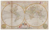
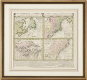
HERMAN MOLL 18TH C. MAP OF ASIA....
From
marks4antiques.com
- The most updated price guide and makers' marks research online
As a member, you have access to a team of experts
and assistance is always available to you for free
An example from the millions of items in our Price Guide:
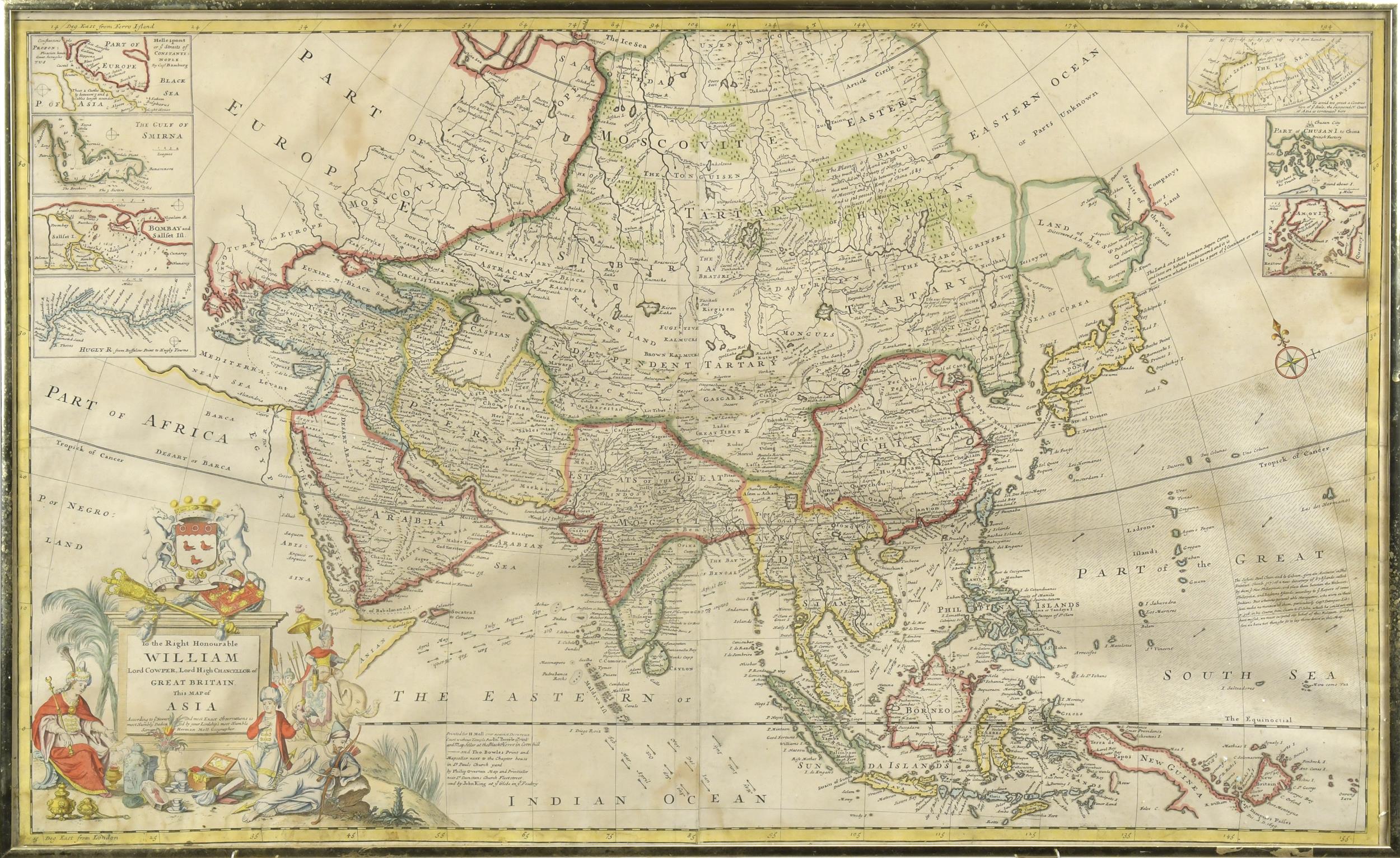
HERMAN MOLL 18TH C. MAP OF ASIA. Engraved and hand colored “Map of Asia According to the Newest and Most Exact Observations”, London, C 1730: H. Moll...
This is an example from our
values4antiques price guide
We do not buy or sell any items
See more price guides
Check our other research services:
IDENTIFY WORLDWIDE MAKERS' MARKS & HALLMARKS
marks4ceramics:
Porcelain, Pottery, Chinaware, Figurines, Dolls, Vases...
marks4silver
:
Silver, Jewelry, Pewter, Silverplate, Copper & Bronze...
Explore other items from our
Antiques & Collectibles Price Guide
-
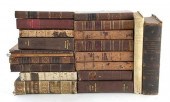
 BRITANNIA, VOL. I & II CAMDEN 1722Camden
[more like this]
BRITANNIA, VOL. I & II CAMDEN 1722Camden
[more like this]
-
 A COMPLETE SYSTEM OF GEOGRAPHY, VOL. I B
[more like this]
A COMPLETE SYSTEM OF GEOGRAPHY, VOL. I B
[more like this]
-
 IMPORTANT ANTIQUE ATLAS DU VOYAGE DE LA
[more like this]
IMPORTANT ANTIQUE ATLAS DU VOYAGE DE LA
[more like this]
-
 11 PC. MAP COLLECTION: Comprising; 1- La
[more like this]
11 PC. MAP COLLECTION: Comprising; 1- La
[more like this]
-
 5 KENTUCKY AND TENNESSEE MAPS1st item: "
[more like this]
5 KENTUCKY AND TENNESSEE MAPS1st item: "
[more like this]
-
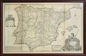
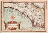 Colonial maps of Carolina by Speed and M
[more like this]
Colonial maps of Carolina by Speed and M
[more like this]
-
 A RARE ANTIQUE CIVIL WAR ERA MAP, "PRESS
[more like this]
A RARE ANTIQUE CIVIL WAR ERA MAP, "PRESS
[more like this]
-
 3 KY & TN MAPS: VANCE, TANNER, JOHNSON1s
[more like this]
3 KY & TN MAPS: VANCE, TANNER, JOHNSON1s
[more like this]
-
 A Very Large Collection of Maps, 19th/e
[more like this]
A Very Large Collection of Maps, 19th/e
[more like this]
-
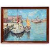 EVERT MOLL (DUTCH, 1878-1955) OIL PAINTI
[more like this]
EVERT MOLL (DUTCH, 1878-1955) OIL PAINTI
[more like this]
-
 4 TN & KY MAPS, 3 FRAMED1st item: "Tenne
[more like this]
4 TN & KY MAPS, 3 FRAMED1st item: "Tenne
[more like this]
-
 8 TENNESSEE MILITARY & SURVEY MAPSAssort
[more like this]
8 TENNESSEE MILITARY & SURVEY MAPSAssort
[more like this]
-
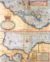
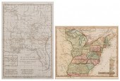
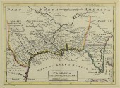 18TH C. FLORIDA MAP - HERMAN MOLLFLORIDA
[more like this]
18TH C. FLORIDA MAP - HERMAN MOLLFLORIDA
[more like this]
-
 16TH / 18TH C. EUROPEAN MAPS OF NEW SPAI
[more like this]
16TH / 18TH C. EUROPEAN MAPS OF NEW SPAI
[more like this]
-
 HERMAN MOLL 18TH C. MAP OF ASIA. Engrave
[more like this]
HERMAN MOLL 18TH C. MAP OF ASIA. Engrave
[more like this]
-
 A TOPOGRAPHICAL MAP OF THE ENVIRONS OF L
[more like this]
A TOPOGRAPHICAL MAP OF THE ENVIRONS OF L
[more like this]
-
 Rare books: Ottoman Empire history and r
[more like this]
Rare books: Ottoman Empire history and r
[more like this]
-
 MAP, HERMAN MOLL Herman Moll (German, 16
[more like this]
MAP, HERMAN MOLL Herman Moll (German, 16
[more like this]
-
 A LATE MEXICAN-AMERICAN WAR ERA MAP, "MA
[more like this]
A LATE MEXICAN-AMERICAN WAR ERA MAP, "MA
[more like this]
-
 AN IMPORTANT REPUBLIC OF TEXAS MAP, "MAP
[more like this]
AN IMPORTANT REPUBLIC OF TEXAS MAP, "MAP
[more like this]
-
 AN ANTIQUE RECONSTRUCTION ERA MAP, "KOSS
[more like this]
AN ANTIQUE RECONSTRUCTION ERA MAP, "KOSS
[more like this]
-
 3 19TH CENT. AL, KY, & TN MAPS1st item:
[more like this]
3 19TH CENT. AL, KY, & TN MAPS1st item:
[more like this]
-
 MAP AND ATLAS LOT, 3 PCS INCL. MELISH DI
[more like this]
MAP AND ATLAS LOT, 3 PCS INCL. MELISH DI
[more like this]
-
 5 CIVIL WAR MAPSLot of five Civil War ma
[more like this]
5 CIVIL WAR MAPSLot of five Civil War ma
[more like this]
-
 NATIVE AMERICAN/WESTERN U.S. EXPEDITION
[more like this]
NATIVE AMERICAN/WESTERN U.S. EXPEDITION
[more like this]
-
 HERMAN MOLL; AND THOMAS BOWLES AND SONS
[more like this]
HERMAN MOLL; AND THOMAS BOWLES AND SONS
[more like this]
-
 WILLIAM HACKE AND ROBERT MORDEN, 17TH C.
[more like this]
WILLIAM HACKE AND ROBERT MORDEN, 17TH C.
[more like this]
-
 RARE 1865 MONTANA TERRITORY MAP BY W.W.
[more like this]
RARE 1865 MONTANA TERRITORY MAP BY W.W.
[more like this]
-
 2 MAPS, LA/FL AND US, LATE 18TH AND EARL
[more like this]
2 MAPS, LA/FL AND US, LATE 18TH AND EARL
[more like this]
-
 JOHN MOLL, AMERICAN 1910-1991, CHESAPEAK
[more like this]
JOHN MOLL, AMERICAN 1910-1991, CHESAPEAK
[more like this]
-
 JOHN MOLL (AMERICA, 1910-1991), A CABIN
[more like this]
JOHN MOLL (AMERICA, 1910-1991), A CABIN
[more like this]
-
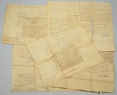 FIVE 18TH CENTURY NC/TN LAND GRANTSGroup
[more like this]
FIVE 18TH CENTURY NC/TN LAND GRANTSGroup
[more like this]
-
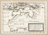 HERMAN MOLL, ENGLISH 1650?-1732, NEW GUI
[more like this]
HERMAN MOLL, ENGLISH 1650?-1732, NEW GUI
[more like this]
-
 HOMANN MAP, BRITISH TERRITORIES IN NORTH
[more like this]
HOMANN MAP, BRITISH TERRITORIES IN NORTH
[more like this]
-
 HERMAN MOLL COLOR ENGRAVED MAPHerman Mol
[more like this]
HERMAN MOLL COLOR ENGRAVED MAPHerman Mol
[more like this]
-
 AN ANTIQUE REPUBLIC OF TEXAS MAP, "MAP O
[more like this]
AN ANTIQUE REPUBLIC OF TEXAS MAP, "MAP O
[more like this]
This list is limited to only a few results.
Many more items are available to our members in our
Price Guide!
Ideal research tools for Collectors, Personal Property Appraisers, Antiques & Collectibles
Dealers, Auction Houses, Museums, eBayers or
other online
sellers (Rubylane, Etsy etc) and curious minds interested in appraising & identifying collectibles

EASY. FAST. ACCURATE.
Research at its best

Our research tools include:


