Pricing Guides & Dictionary of Makers Marks for Antiques & Collectibles
Appraise and find values for
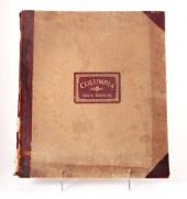
SANBORN MAP COMPANY, NEW YORK,...
From
marks4antiques.com
- The most updated price guide and makers' marks research online
As a member, you have access to a team of experts
and assistance is always available to you for free
An example from the millions of items in our Price Guide:
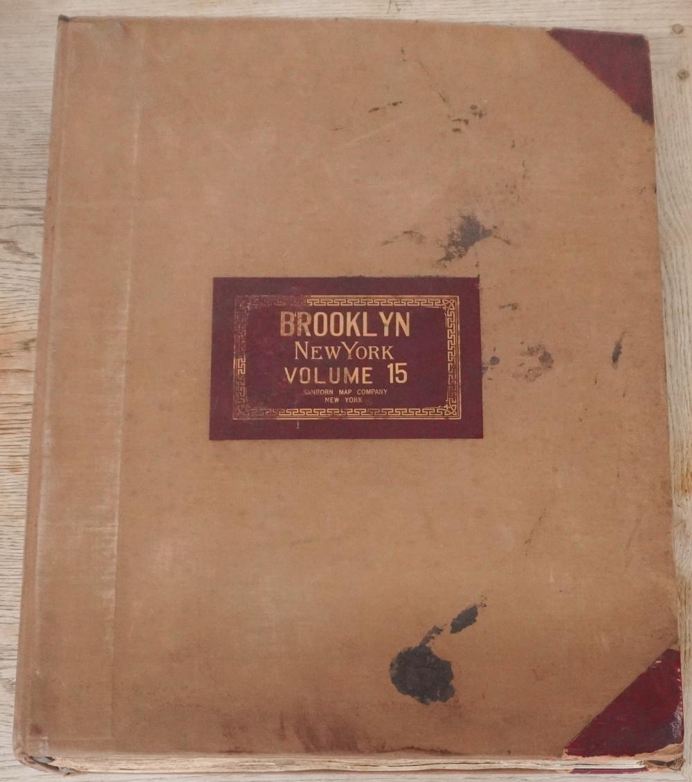
SANBORN MAP COMPANY, NEW YORK, TWO VOLUMES OF INSURANCE MAPS OF THE CITIES OF BROOKLYN AND QUEENSSanborn Map Company, New York, Two Volumes of Insurance...
This is an example from our
values4antiques price guide
We do not buy or sell any items
See more price guides
Check our other research services:
IDENTIFY WORLDWIDE MAKERS' MARKS & HALLMARKS
marks4ceramics:
Porcelain, Pottery, Chinaware, Figurines, Dolls, Vases...
marks4silver
:
Silver, Jewelry, Pewter, Silverplate, Copper & Bronze...
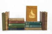
Explore other items from our
Antiques & Collectibles Price Guide
-
 BRITANNIA, VOL. I & II CAMDEN 1722Camden
[more like this]
BRITANNIA, VOL. I & II CAMDEN 1722Camden
[more like this]
-
 A COMPLETE SYSTEM OF GEOGRAPHY, VOL. I B
[more like this]
A COMPLETE SYSTEM OF GEOGRAPHY, VOL. I B
[more like this]
-
 IMPORTANT ANTIQUE ATLAS DU VOYAGE DE LA
[more like this]
IMPORTANT ANTIQUE ATLAS DU VOYAGE DE LA
[more like this]
-
 5 KENTUCKY AND TENNESSEE MAPS1st item: "
[more like this]
5 KENTUCKY AND TENNESSEE MAPS1st item: "
[more like this]
-
 4 TN & KY MAPS, 3 FRAMED1st item: "Tenne
[more like this]
4 TN & KY MAPS, 3 FRAMED1st item: "Tenne
[more like this]
-
 3 KY & TN MAPS: VANCE, TANNER, JOHNSON1s
[more like this]
3 KY & TN MAPS: VANCE, TANNER, JOHNSON1s
[more like this]
-
 LRG GRP: BOOKS ON AFRICA AND AFRICAN ART
[more like this]
LRG GRP: BOOKS ON AFRICA AND AFRICAN ART
[more like this]
-
 A RARE ANTIQUE CIVIL WAR ERA MAP, "PRESS
[more like this]
A RARE ANTIQUE CIVIL WAR ERA MAP, "PRESS
[more like this]
-
 8 TENNESSEE MILITARY & SURVEY MAPSAssort
[more like this]
8 TENNESSEE MILITARY & SURVEY MAPSAssort
[more like this]
-
 A LATE MEXICAN-AMERICAN WAR ERA MAP, "MA
[more like this]
A LATE MEXICAN-AMERICAN WAR ERA MAP, "MA
[more like this]
-
 NATIVE AMERICAN/WESTERN U.S. EXPEDITION
[more like this]
NATIVE AMERICAN/WESTERN U.S. EXPEDITION
[more like this]
-
 A Very Large Collection of Maps, 19th/e
[more like this]
A Very Large Collection of Maps, 19th/e
[more like this]
-
 16 SARTORIAL AND SOCIETY HARDCOVER VOLUM
[more like this]
16 SARTORIAL AND SOCIETY HARDCOVER VOLUM
[more like this]
-
 16TH / 18TH C. EUROPEAN MAPS OF NEW SPAI
[more like this]
16TH / 18TH C. EUROPEAN MAPS OF NEW SPAI
[more like this]
-
 AN IMPORTANT REPUBLIC OF TEXAS MAP, "MAP
[more like this]
AN IMPORTANT REPUBLIC OF TEXAS MAP, "MAP
[more like this]
-
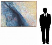
 THOMAS KOETHER (NY, FL B. 1940) "RED PRO
[more like this]
THOMAS KOETHER (NY, FL B. 1940) "RED PRO
[more like this]
-
 THOMAS KOETHER (NY, FL B. 1940) "CREVICE
[more like this]
THOMAS KOETHER (NY, FL B. 1940) "CREVICE
[more like this]
-
 THOMAS KOETHER (NY B 1940) "SOMETHING FE
[more like this]
THOMAS KOETHER (NY B 1940) "SOMETHING FE
[more like this]
-
 A TOPOGRAPHICAL MAP OF THE ENVIRONS OF L
[more like this]
A TOPOGRAPHICAL MAP OF THE ENVIRONS OF L
[more like this]
-
 3 19TH CENT. AL, KY, & TN MAPS1st item:
[more like this]
3 19TH CENT. AL, KY, & TN MAPS1st item:
[more like this]
-
 11 PC. MAP COLLECTION: Comprising; 1- La
[more like this]
11 PC. MAP COLLECTION: Comprising; 1- La
[more like this]
-
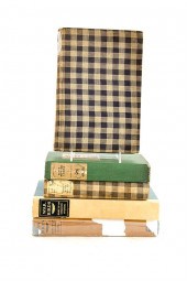 Books: Important collection of books by
[more like this]
Books: Important collection of books by
[more like this]
-
 AN ANTIQUE RECONSTRUCTION ERA MAP, "KOSS
[more like this]
AN ANTIQUE RECONSTRUCTION ERA MAP, "KOSS
[more like this]
-
 AN ANTIQUE RECONSTRUCTION ERA MAP, "TRAV
[more like this]
AN ANTIQUE RECONSTRUCTION ERA MAP, "TRAV
[more like this]
-
 Charles Hook Armco Steel Company Lot of
[more like this]
Charles Hook Armco Steel Company Lot of
[more like this]
-
 MAP AND ATLAS LOT, 3 PCS INCL. MELISH DI
[more like this]
MAP AND ATLAS LOT, 3 PCS INCL. MELISH DI
[more like this]
-
 5 CIVIL WAR MAPSLot of five Civil War ma
[more like this]
5 CIVIL WAR MAPSLot of five Civil War ma
[more like this]
-
 4 EARLY AMERICAN MAPS: OVERTON, THIERRY,
[more like this]
4 EARLY AMERICAN MAPS: OVERTON, THIERRY,
[more like this]
-
 Book: Sanborn Fire Insurance Maps of Col
[more like this]
Book: Sanborn Fire Insurance Maps of Col
[more like this]
-
 Books: By and about Du Bose Heyward auth
[more like this]
Books: By and about Du Bose Heyward auth
[more like this]
-
 COLLECTION OF FIFTEEN FIRST OR EARLY EDI
[more like this]
COLLECTION OF FIFTEEN FIRST OR EARLY EDI
[more like this]
-
 Books: Extensive collection of books by
[more like this]
Books: Extensive collection of books by
[more like this]
-
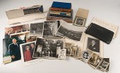
 CSA Colonel John Singleton Mosby Fine Co
[more like this]
CSA Colonel John Singleton Mosby Fine Co
[more like this]
-
 GARY KOMARIN, NEW YORK, CONNECTICUT (B.
[more like this]
GARY KOMARIN, NEW YORK, CONNECTICUT (B.
[more like this]
-
 GARY KOMARIN, NEW YORK, CONNECTICUT (B.
[more like this]
GARY KOMARIN, NEW YORK, CONNECTICUT (B.
[more like this]
-
 GARY KOMARIN, NEW YORK, CONNECTICUT (B.
[more like this]
GARY KOMARIN, NEW YORK, CONNECTICUT (B.
[more like this]
This list is limited to only a few results.
Many more items are available to our members in our
Price Guide!
Ideal research tools for Collectors, Personal Property Appraisers, Antiques & Collectibles
Dealers, Auction Houses, Museums, eBayers or
other online
sellers (Rubylane, Etsy etc) and curious minds interested in appraising & identifying collectibles

EASY. FAST. ACCURATE.
Research at its best

Our research tools include:


