Pricing Guides & Dictionary of Makers Marks for Antiques & Collectibles

Appraise and find values for
Southeastern United States map by...
From
marks4antiques.com
- The most updated price guide and makers' marks research online
As a member, you have access to a team of experts
and assistance is always available to you for free
An example from the millions of items in our Price Guide:
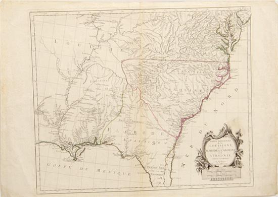
Southeastern United States map by D'Anville D'Anville Jean Baptiste Bourguignon. PARTIE MERIDIONALE DE LA LOUISIANE AVEC LA FLORIDE LA CAROLINE ET LA...
This is an example from our
values4antiques price guide
We do not buy or sell any items
See more price guides
Check our other research services:
IDENTIFY WORLDWIDE MAKERS' MARKS & HALLMARKS
marks4ceramics:
Porcelain, Pottery, Chinaware, Figurines, Dolls, Vases...
marks4silver
:
Silver, Jewelry, Pewter, Silverplate, Copper & Bronze...
Explore other items from our
Antiques & Collectibles Price Guide
-
 BRITANNIA, VOL. I & II CAMDEN 1722Camden
[more like this]
-
 A COMPLETE SYSTEM OF GEOGRAPHY, VOL. I B
[more like this]
-
 IMPORTANT ANTIQUE ATLAS DU VOYAGE DE LA
[more like this]
-
 A LATE MEXICAN-AMERICAN WAR ERA MAP, "MA
[more like this]
-
 5 KENTUCKY AND TENNESSEE MAPS1st item: "
[more like this]
-
 A RARE ANTIQUE CIVIL WAR ERA MAP, "PRESS
[more like this]
-
 3 KY & TN MAPS: VANCE, TANNER, JOHNSON1s
[more like this]
-
 NATIVE AMERICAN/WESTERN U.S. EXPEDITION
[more like this]
-
 MAP AND ATLAS LOT, 3 PCS INCL. MELISH DI
[more like this]
-
 8 TENNESSEE MILITARY & SURVEY MAPSAssort
[more like this]
-
 TN CIVIL WAR BROADSIDE, PAMPHLET, LETTER
[more like this]
-
 4 TN & KY MAPS, 3 FRAMED1st item: "Tenne
[more like this]
-
 3 19TH CENT. AL, KY, & TN MAPS1st item:
[more like this]
-
 5 CIVIL WAR MAPSLot of five Civil War ma
[more like this]
-
 16TH / 18TH C. EUROPEAN MAPS OF NEW SPAI
[more like this]
-
 A Very Large Collection of Maps, 19th/e
[more like this]
-
 AN IMPORTANT REPUBLIC OF TEXAS MAP, "MAP
[more like this]
-
 A TOPOGRAPHICAL MAP OF THE ENVIRONS OF L
[more like this]
-
 11 PC. MAP COLLECTION: Comprising; 1- La
[more like this]
-
 AN ANTEBELLUM MAP, "J. DE CORDOVA'S MAP
[more like this]
-
 AN ANTIQUE RECONSTRUCTION ERA MAP, "KOSS
[more like this]
-
 2 MAPS, LA/FL AND US, LATE 18TH AND EARL
[more like this]
-
 RARE 1865 MONTANA TERRITORY MAP BY W.W.
[more like this]
-
 4 EARLY AMERICAN MAPS: OVERTON, THIERRY,
[more like this]
-
 AN ANTIQUE RECONSTRUCTION ERA MAP, "TRAV
[more like this]
-
 AN ANTIQUE POCKET MAP, "MAP OF MEXICO AN
[more like this]
-
 A REPUBLIC OF TEXAS MAP, "MAP OF THE UNI
[more like this]
-
 VINTAGE PUZZLE, MAP OF UNITED STATES, "D
[more like this]
-
 COLLECTION OF LEDOUX'S MAPS AND CATALOGS
[more like this]
-
 COLLECTION OF LEDOUX'S MAPS AND CATALOGS
[more like this]
-
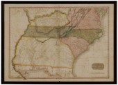 19th Century Map of the Southeastern Uni
[more like this]
-
 AN ANTIQUE MAP, "GENERAL TOPOGRAPHICAL M
[more like this]
-
 1730 ORIGINAL SEUTTER MAP NEW ENGLAND, N
[more like this]
-
 AN ANTIQUE REPUBLIC OF TEXAS MAP, "MAP O
[more like this]
-
 AN ANTIQUE REPUBLIC OF TEXAS MAP, "MAP O
[more like this]
-
 A RENAISSANCE MAP, "PTOLEMY MAP OF THE W
[more like this]
This list is limited to only a few results.
Many more items are available to our members in our
Price Guide!


