Pricing Guides & Dictionary of Makers Marks for Antiques & Collectibles
Appraise and find values for
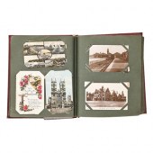
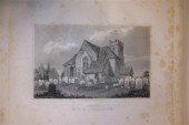
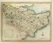
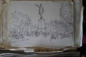
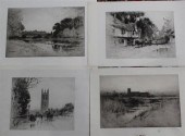
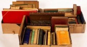
UK topography: A collection of...
From
marks4antiques.com
- The most updated price guide and makers' marks research online
As a member, you have access to a team of experts
and assistance is always available to you for free
An example from the millions of items in our Price Guide:
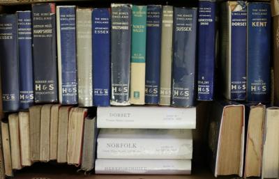
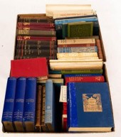
UK topography: A collection of Mee's 'King's England' series plus many other books, guides and pamphlets - mainly post-war (quantity)/Provenance: The...
This is an example from our
values4antiques price guide
We do not buy or sell any items
See more price guides
Check our other research services:
IDENTIFY WORLDWIDE MAKERS' MARKS & HALLMARKS
marks4ceramics:
Porcelain, Pottery, Chinaware, Figurines, Dolls, Vases...
marks4silver
:
Silver, Jewelry, Pewter, Silverplate, Copper & Bronze...
Explore other items from our
Antiques & Collectibles Price Guide
-
 Rare book: Topography of Athens Leake Wi
[more like this]
Rare book: Topography of Athens Leake Wi
[more like this]
-
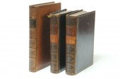
 GROUP OF THREE BOOKS: W. SEMNER, THE ANT
[more like this]
GROUP OF THREE BOOKS: W. SEMNER, THE ANT
[more like this]
-
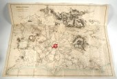
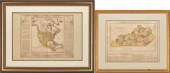 2 FRAMED HISTORICAL MAPS, NORTH AMERICA
[more like this]
2 FRAMED HISTORICAL MAPS, NORTH AMERICA
[more like this]
-
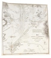
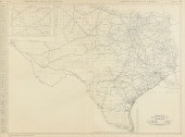
 AN ANTIQUE SURVEY MAP, "U.S. COAST SURVE
[more like this]
AN ANTIQUE SURVEY MAP, "U.S. COAST SURVE
[more like this]
-
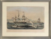 HAND-COLORED LITHOGRAPH "PÊCHE A LA BALE
[more like this]
HAND-COLORED LITHOGRAPH "PÊCHE A LA BALE
[more like this]
-
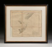
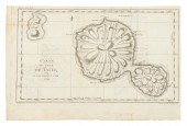 CHART "CARTE DE L'ISLE DE TAITI, PAR LE
[more like this]
CHART "CARTE DE L'ISLE DE TAITI, PAR LE
[more like this]
-
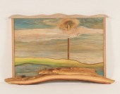
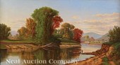
 WALTER PARKE (1909-1994) REGIONALIST OIL
[more like this]
WALTER PARKE (1909-1994) REGIONALIST OIL
[more like this]
-
 BOOK: ROME & ITS VICINITY, 1834—3 VOL—DR
[more like this]
BOOK: ROME & ITS VICINITY, 1834—3 VOL—DR
[more like this]
-
 AN VINTAGE MAP, "BLACK AND WHITE MILEAGE
[more like this]
AN VINTAGE MAP, "BLACK AND WHITE MILEAGE
[more like this]
-
 3 19TH CENT. AL, KY, & TN MAPS1st item:
[more like this]
3 19TH CENT. AL, KY, & TN MAPS1st item:
[more like this]
-
 A collection of postcards, early 20th c,
[more like this]
A collection of postcards, early 20th c,
[more like this]
-
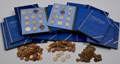 LARGE GROUPING OF US COIN COLLECTION SET
[more like this]
LARGE GROUPING OF US COIN COLLECTION SET
[more like this]
-
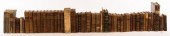
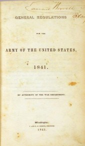 2 vols. American 19th-Century Military
[more like this]
2 vols. American 19th-Century Military
[more like this]
-
 Don Weisflog (American, 1922-2006) Abstr
[more like this]
Don Weisflog (American, 1922-2006) Abstr
[more like this]
-
 CENTURY SCHOOL SUPPLY PORTFOLIO. Chicag
[more like this]
CENTURY SCHOOL SUPPLY PORTFOLIO. Chicag
[more like this]
-
 TWO WORKS ON EUROPEAN HISTORY. Includes
[more like this]
TWO WORKS ON EUROPEAN HISTORY. Includes
[more like this]
-
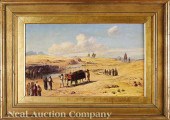 Frederick Goodall R.A. (British 1822-190
[more like this]
Frederick Goodall R.A. (British 1822-190
[more like this]
-
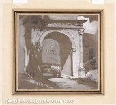 John Ruskin (British 1819-1900) "The Rom
[more like this]
John Ruskin (British 1819-1900) "The Rom
[more like this]
-
 Robert S. Duncanson (American/Ohio 1821-
[more like this]
Robert S. Duncanson (American/Ohio 1821-
[more like this]
-
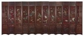 A Fine Chinese Twelve-Panel Carved Hards
[more like this]
A Fine Chinese Twelve-Panel Carved Hards
[more like this]
-
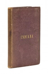 * (AMERICANA MIDWEST) FISHER RICHARD S.
[more like this]
* (AMERICANA MIDWEST) FISHER RICHARD S.
[more like this]
-
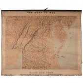 Rare Topographic Civil War Map Birds Eye
[more like this]
Rare Topographic Civil War Map Birds Eye
[more like this]
-
 HORSFIELD (T) THE HISTORY ANTIQUITIES AN
[more like this]
HORSFIELD (T) THE HISTORY ANTIQUITIES AN
[more like this]
-
 NIGHTINGALE (J) ENGLISH TOPOGRAPHY...COU
[more like this]
NIGHTINGALE (J) ENGLISH TOPOGRAPHY...COU
[more like this]
-
 Sydney Maiden (Exh.1928-1936) folio of w
[more like this]
Sydney Maiden (Exh.1928-1936) folio of w
[more like this]
-
 Sydney Maiden (Exh.1928-1936) folio of p
[more like this]
Sydney Maiden (Exh.1928-1936) folio of p
[more like this]
-
 Sydney Maiden (Exh.1928-1936) three foli
[more like this]
Sydney Maiden (Exh.1928-1936) three foli
[more like this]
-
 Percy Robertson (1868-1934) twelve etchi
[more like this]
Percy Robertson (1868-1934) twelve etchi
[more like this]
-
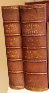 HORSFIELD (T) THE HISTORY ANTIQUITIES AN
[more like this]
HORSFIELD (T) THE HISTORY ANTIQUITIES AN
[more like this]
-
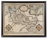 JOHN SPEED (ENGLAND, 1551 OR 1552 ? 1629
[more like this]
JOHN SPEED (ENGLAND, 1551 OR 1552 ? 1629
[more like this]
-
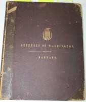 REPORT ON THE DEFENSES OF WASHINGTON TO
[more like this]
REPORT ON THE DEFENSES OF WASHINGTON TO
[more like this]
-
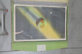
 HENRY PEARSON, AMERICAN (1914-2006), UNS
[more like this]
HENRY PEARSON, AMERICAN (1914-2006), UNS
[more like this]
-
 Dictionnaire Grammatical de la Langue Fr
[more like this]
Dictionnaire Grammatical de la Langue Fr
[more like this]
-
 British and European Travel and Topograp
[more like this]
British and European Travel and Topograp
[more like this]
-
 British and European Travel and Topograp
[more like this]
British and European Travel and Topograp
[more like this]
-
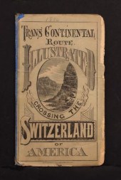 VERY RARE 1876 TRANS CONTINENTAL RR POCK
[more like this]
VERY RARE 1876 TRANS CONTINENTAL RR POCK
[more like this]
This list is limited to only a few results.
Many more items are available to our members in our
Price Guide!
Ideal research tools for Collectors, Personal Property Appraisers, Antiques & Collectibles
Dealers, Auction Houses, Museums, eBayers or
other online
sellers (Rubylane, Etsy etc) and curious minds interested in appraising & identifying collectibles

EASY. FAST. ACCURATE.
Research at its best

Our research tools include:


