Pricing Guides & Dictionary of Makers Marks for Antiques & Collectibles
Appraise and find values for
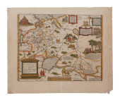
ABRAHAM ORTELIUS, MEDITERRANEAN MAP...
From
marks4antiques.com
- The most updated price guide and makers' marks research online
As a member, you have access to a team of experts
and assistance is always available to you for free
An example from the millions of items in our Price Guide:
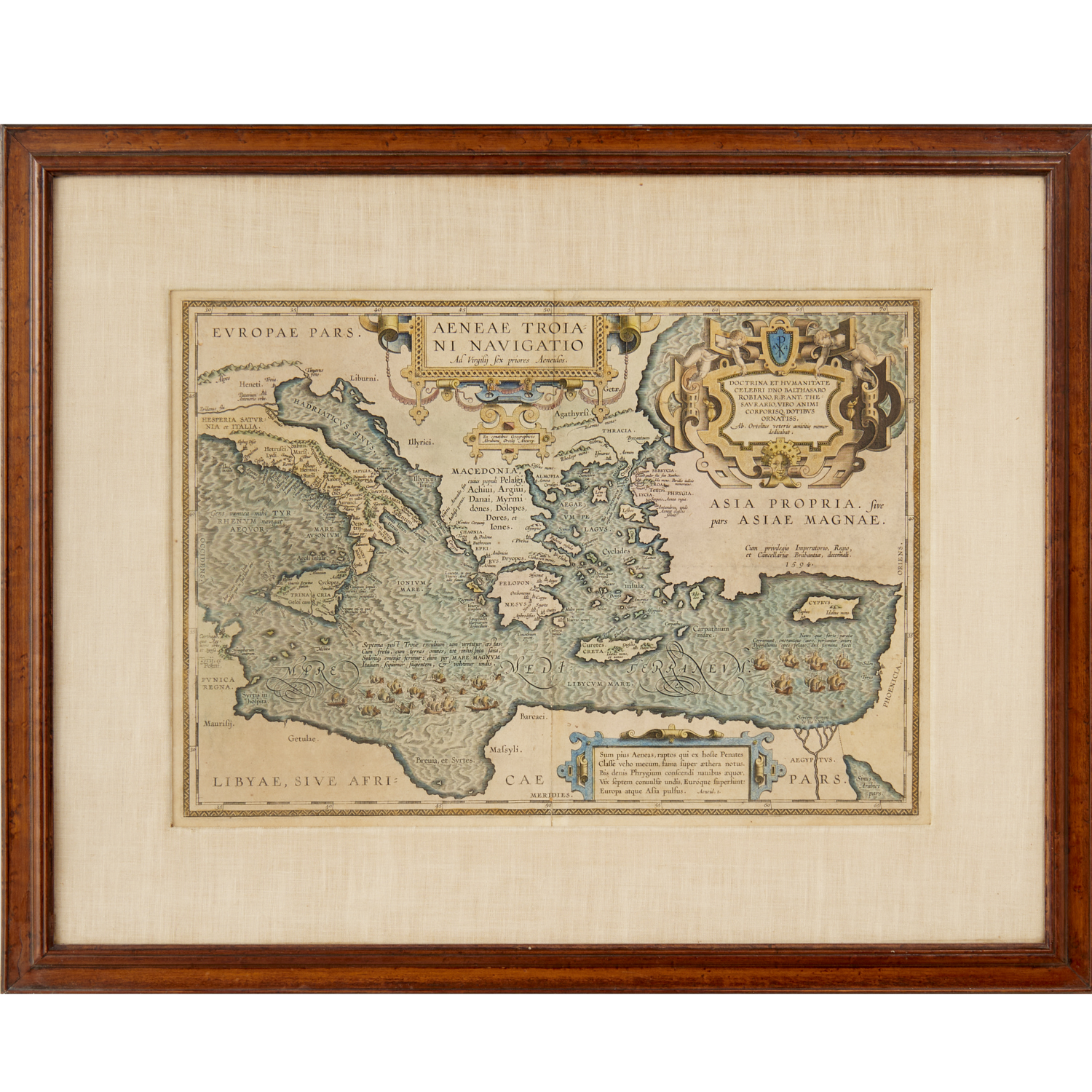
ABRAHAM ORTELIUS, MEDITERRANEAN MAP "Aeneae Troiani Navigatio Ad Virgilij Sex priores Aeneidos", hand-colored engraving, possibly 1624 or later, matted and...
This is an example from our
values4antiques price guide
We do not buy or sell any items
See more price guides
Check our other research services:
IDENTIFY WORLDWIDE MAKERS' MARKS & HALLMARKS
marks4ceramics:
Porcelain, Pottery, Chinaware, Figurines, Dolls, Vases...
marks4silver
:
Silver, Jewelry, Pewter, Silverplate, Copper & Bronze...
Explore other items from our
Antiques & Collectibles Price Guide
-
 BRITANNIA, VOL. I & II CAMDEN 1722Camden
[more like this]
BRITANNIA, VOL. I & II CAMDEN 1722Camden
[more like this]
-
 A COMPLETE SYSTEM OF GEOGRAPHY, VOL. I B
[more like this]
A COMPLETE SYSTEM OF GEOGRAPHY, VOL. I B
[more like this]
-
 IMPORTANT ANTIQUE ATLAS DU VOYAGE DE LA
[more like this]
IMPORTANT ANTIQUE ATLAS DU VOYAGE DE LA
[more like this]
-
 5 KENTUCKY AND TENNESSEE MAPS1st item: "
[more like this]
5 KENTUCKY AND TENNESSEE MAPS1st item: "
[more like this]
-
 A RARE ANTIQUE CIVIL WAR ERA MAP, "PRESS
[more like this]
A RARE ANTIQUE CIVIL WAR ERA MAP, "PRESS
[more like this]
-
 3 KY & TN MAPS: VANCE, TANNER, JOHNSON1s
[more like this]
3 KY & TN MAPS: VANCE, TANNER, JOHNSON1s
[more like this]
-
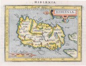
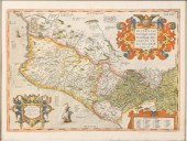
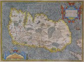 MAP: MAP OF IRELAND, 16TH C., BY ABRAHAM
[more like this]
MAP: MAP OF IRELAND, 16TH C., BY ABRAHAM
[more like this]
-
 A Very Large Collection of Maps, 19th/e
[more like this]
A Very Large Collection of Maps, 19th/e
[more like this]
-
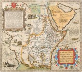
 ORTELIUS MAP OF DACIA & MOESIA, ABRAHAM
[more like this]
ORTELIUS MAP OF DACIA & MOESIA, ABRAHAM
[more like this]
-
 A RENAISSANCE MAP, "EUROPæ," ABRAHAM ORT
[more like this]
A RENAISSANCE MAP, "EUROPæ," ABRAHAM ORT
[more like this]
-
 4 TN & KY MAPS, 3 FRAMED1st item: "Tenne
[more like this]
4 TN & KY MAPS, 3 FRAMED1st item: "Tenne
[more like this]
-
 ABRAHAM ORTELIUS, BELGIAN 1522-1598, MAP
[more like this]
ABRAHAM ORTELIUS, BELGIAN 1522-1598, MAP
[more like this]
-
 ABRAHAM ORTELIUS, FLEMISH 1527-1598, TYP
[more like this]
ABRAHAM ORTELIUS, FLEMISH 1527-1598, TYP
[more like this]
-
 MAP: ABRAHAM ORTELIUS (FLEMISH, 1527-159
[more like this]
MAP: ABRAHAM ORTELIUS (FLEMISH, 1527-159
[more like this]
-
 8 TENNESSEE MILITARY & SURVEY MAPSAssort
[more like this]
8 TENNESSEE MILITARY & SURVEY MAPSAssort
[more like this]
-
 A TOPOGRAPHICAL MAP OF THE ENVIRONS OF L
[more like this]
A TOPOGRAPHICAL MAP OF THE ENVIRONS OF L
[more like this]
-
 11 PC. MAP COLLECTION: Comprising; 1- La
[more like this]
11 PC. MAP COLLECTION: Comprising; 1- La
[more like this]
-
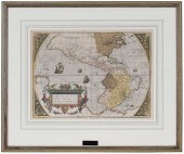
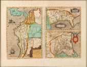
 16TH / 18TH C. EUROPEAN MAPS OF NEW SPAI
[more like this]
16TH / 18TH C. EUROPEAN MAPS OF NEW SPAI
[more like this]
-
 ABRAHAM ORTELIUS - 16TH CENTURY MAP OF N
[more like this]
ABRAHAM ORTELIUS - 16TH CENTURY MAP OF N
[more like this]
-
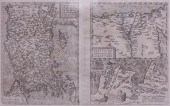
 RUSSIA MAP ORTELIUS, RUSSIAE, MOSCOVIAE<
[more like this]
RUSSIA MAP ORTELIUS, RUSSIAE, MOSCOVIAE<
[more like this]
-
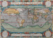
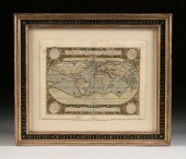 A RENAISSANCE MAP, "TYPUS ORBIS TERRARUM
[more like this]
A RENAISSANCE MAP, "TYPUS ORBIS TERRARUM
[more like this]
-
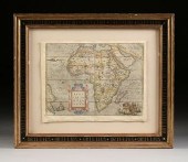 A RENAISSANCE MAP, "AFRICæ TABULA NOVA,"
[more like this]
A RENAISSANCE MAP, "AFRICæ TABULA NOVA,"
[more like this]
-
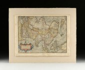 A RENAISSANCE MAP, "ASIæ NOVA DESCRIPTIO
[more like this]
A RENAISSANCE MAP, "ASIæ NOVA DESCRIPTIO
[more like this]
-
 ABRAHAM ORTELIUS, BELGIAN 1522-1598, MAP
[more like this]
ABRAHAM ORTELIUS, BELGIAN 1522-1598, MAP
[more like this]
-
 A LATE MEXICAN-AMERICAN WAR ERA MAP, "MA
[more like this]
A LATE MEXICAN-AMERICAN WAR ERA MAP, "MA
[more like this]
-
 AN IMPORTANT REPUBLIC OF TEXAS MAP, "MAP
[more like this]
AN IMPORTANT REPUBLIC OF TEXAS MAP, "MAP
[more like this]
-
 AN ANTIQUE RECONSTRUCTION ERA MAP, "KOSS
[more like this]
AN ANTIQUE RECONSTRUCTION ERA MAP, "KOSS
[more like this]
-
 3 19TH CENT. AL, KY, & TN MAPS1st item:
[more like this]
3 19TH CENT. AL, KY, & TN MAPS1st item:
[more like this]
-
 MAP AND ATLAS LOT, 3 PCS INCL. MELISH DI
[more like this]
MAP AND ATLAS LOT, 3 PCS INCL. MELISH DI
[more like this]
-
 5 CIVIL WAR MAPSLot of five Civil War ma
[more like this]
5 CIVIL WAR MAPSLot of five Civil War ma
[more like this]
-
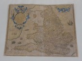 ORTELLIUS 1573 MAP OF ENGLAND AND WALES.
[more like this]
ORTELLIUS 1573 MAP OF ENGLAND AND WALES.
[more like this]
-
![DOROTHY ASHLEY, DINé [NAVAJO],](/images/dorothy-ashley-dine-navajo-2--362ed2-medium.jpg) DOROTHY ASHLEY, DINé [NAVAJO], 2 SILVER
[more like this]
DOROTHY ASHLEY, DINé [NAVAJO], 2 SILVER
[more like this]
-
 FRENCH BURGUNDY 1579 MAP BURGUNDIAE BY F
[more like this]
FRENCH BURGUNDY 1579 MAP BURGUNDIAE BY F
[more like this]
-
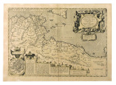
 AFTER ABRAHAM ORTELIUS, MAP OF EGYPT, NA
[more like this]
AFTER ABRAHAM ORTELIUS, MAP OF EGYPT, NA
[more like this]
-
 ABRAHAM ORTELIUS, FLEMISH 1527-1598, MAP
[more like this]
ABRAHAM ORTELIUS, FLEMISH 1527-1598, MAP
[more like this]
-
 ABRAHAM ORTELIUS, FLEMISH 1527-1598, MAP
[more like this]
ABRAHAM ORTELIUS, FLEMISH 1527-1598, MAP
[more like this]
This list is limited to only a few results.
Many more items are available to our members in our
Price Guide!
Ideal research tools for Collectors, Personal Property Appraisers, Antiques & Collectibles
Dealers, Auction Houses, Museums, eBayers or
other online
sellers (Rubylane, Etsy etc) and curious minds interested in appraising & identifying collectibles

EASY. FAST. ACCURATE.
Research at its best

Our research tools include:


