Pricing Guides & Dictionary of Makers Marks for Antiques & Collectibles
Appraise and find values for
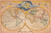
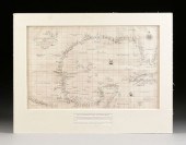
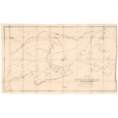
BUACHE & DEZAUCHE - MAP OF THE GULF...
From
marks4antiques.com
- The most updated price guide and makers' marks research online
As a member, you have access to a team of experts
and assistance is always available to you for free
An example from the millions of items in our Price Guide:
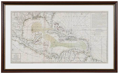
BUACHE & DEZAUCHE - MAP OF THE GULF OF MEXICOREDO Condition: scattered light staining throughout, some toning at edges, held in on mat under corner tabs...
This is an example from our
values4antiques price guide
We do not buy or sell any items
See more price guides
Check our other research services:
IDENTIFY WORLDWIDE MAKERS' MARKS & HALLMARKS
marks4ceramics:
Porcelain, Pottery, Chinaware, Figurines, Dolls, Vases...
marks4silver
:
Silver, Jewelry, Pewter, Silverplate, Copper & Bronze...
Explore other items from our
Antiques & Collectibles Price Guide
-
 BRITANNIA, VOL. I & II CAMDEN 1722Camden
[more like this]
BRITANNIA, VOL. I & II CAMDEN 1722Camden
[more like this]
-
 A COMPLETE SYSTEM OF GEOGRAPHY, VOL. I B
[more like this]
A COMPLETE SYSTEM OF GEOGRAPHY, VOL. I B
[more like this]
-
 IMPORTANT ANTIQUE ATLAS DU VOYAGE DE LA
[more like this]
IMPORTANT ANTIQUE ATLAS DU VOYAGE DE LA
[more like this]
-
 5 KENTUCKY AND TENNESSEE MAPS1st item: "
[more like this]
5 KENTUCKY AND TENNESSEE MAPS1st item: "
[more like this]
-
 A LATE MEXICAN-AMERICAN WAR ERA MAP, "MA
[more like this]
A LATE MEXICAN-AMERICAN WAR ERA MAP, "MA
[more like this]
-
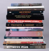
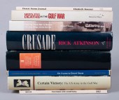 GROUP OF BOOKS ABOUT THE GULF WARGROUP O
[more like this]
GROUP OF BOOKS ABOUT THE GULF WARGROUP O
[more like this]
-
 A RARE ANTIQUE CIVIL WAR ERA MAP, "PRESS
[more like this]
A RARE ANTIQUE CIVIL WAR ERA MAP, "PRESS
[more like this]
-
 3 KY & TN MAPS: VANCE, TANNER, JOHNSON1s
[more like this]
3 KY & TN MAPS: VANCE, TANNER, JOHNSON1s
[more like this]
-
 4 TN & KY MAPS, 3 FRAMED1st item: "Tenne
[more like this]
4 TN & KY MAPS, 3 FRAMED1st item: "Tenne
[more like this]
-
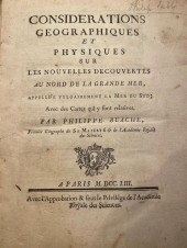 BUACHE, PHILIPPE. CONSIDERATIONS GEOGRAP
[more like this]
BUACHE, PHILIPPE. CONSIDERATIONS GEOGRAP
[more like this]
-
 A Very Large Collection of Maps, 19th/e
[more like this]
A Very Large Collection of Maps, 19th/e
[more like this]
-
 8 TENNESSEE MILITARY & SURVEY MAPSAssort
[more like this]
8 TENNESSEE MILITARY & SURVEY MAPSAssort
[more like this]
-
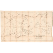
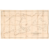
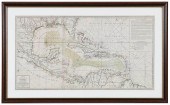 BUACHE & DEZAUCHE - MAP OF THE GULF OF M
[more like this]
BUACHE & DEZAUCHE - MAP OF THE GULF OF M
[more like this]
-
 GROUP OF HISTORY AND REFERENCE BOOKS ON
[more like this]
GROUP OF HISTORY AND REFERENCE BOOKS ON
[more like this]
-
 A TOPOGRAPHICAL MAP OF THE ENVIRONS OF L
[more like this]
A TOPOGRAPHICAL MAP OF THE ENVIRONS OF L
[more like this]
-
 11 PC. MAP COLLECTION: Comprising; 1- La
[more like this]
11 PC. MAP COLLECTION: Comprising; 1- La
[more like this]
-
 16TH / 18TH C. EUROPEAN MAPS OF NEW SPAI
[more like this]
16TH / 18TH C. EUROPEAN MAPS OF NEW SPAI
[more like this]
-
 AN IMPORTANT REPUBLIC OF TEXAS MAP, "MAP
[more like this]
AN IMPORTANT REPUBLIC OF TEXAS MAP, "MAP
[more like this]
-
 AN ANTIQUE RECONSTRUCTION ERA MAP, "KOSS
[more like this]
AN ANTIQUE RECONSTRUCTION ERA MAP, "KOSS
[more like this]
-
 3 19TH CENT. AL, KY, & TN MAPS1st item:
[more like this]
3 19TH CENT. AL, KY, & TN MAPS1st item:
[more like this]
-
 MAP AND ATLAS LOT, 3 PCS INCL. MELISH DI
[more like this]
MAP AND ATLAS LOT, 3 PCS INCL. MELISH DI
[more like this]
-
 5 CIVIL WAR MAPSLot of five Civil War ma
[more like this]
5 CIVIL WAR MAPSLot of five Civil War ma
[more like this]
-
 1 piece. Hand-Colored Engraved Double-H
[more like this]
1 piece. Hand-Colored Engraved Double-H
[more like this]
-
 NATIVE AMERICAN/WESTERN U.S. EXPEDITION
[more like this]
NATIVE AMERICAN/WESTERN U.S. EXPEDITION
[more like this]
-
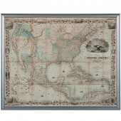 Colton's 1849 Map of the U.S. Showing Ca
[more like this]
Colton's 1849 Map of the U.S. Showing Ca
[more like this]
-
 RARE 1865 MONTANA TERRITORY MAP BY W.W.
[more like this]
RARE 1865 MONTANA TERRITORY MAP BY W.W.
[more like this]
-
 GUILLAUME DE L'ISLE AND PHILIPPE BUACHE
[more like this]
GUILLAUME DE L'ISLE AND PHILIPPE BUACHE
[more like this]
-
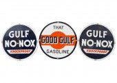 THREE GULF ADVERTISING SIGNSComprising:
[more like this]
THREE GULF ADVERTISING SIGNSComprising:
[more like this]
-
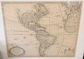
 AN ANTIQUE MAP, "AMERICA, CARTA PARTICOL
[more like this]
AN ANTIQUE MAP, "AMERICA, CARTA PARTICOL
[more like this]
-
 1853 MAP OF PORTION OF BRITISH NORTH AME
[more like this]
1853 MAP OF PORTION OF BRITISH NORTH AME
[more like this]
-
 1853 MAP OF PORTION OF BRITISH NORTH AME
[more like this]
1853 MAP OF PORTION OF BRITISH NORTH AME
[more like this]
-
 1853 MAP OF PORTION OF BRITISH NORTH AME
[more like this]
1853 MAP OF PORTION OF BRITISH NORTH AME
[more like this]
-
 AN ANTIQUE MAP, "A.R. ROESSLER'S LATEST
[more like this]
AN ANTIQUE MAP, "A.R. ROESSLER'S LATEST
[more like this]
-
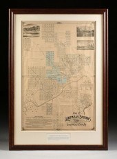 AN ANTIQUE MAP, "MAP OF LAMPASAS SPRINGS
[more like this]
AN ANTIQUE MAP, "MAP OF LAMPASAS SPRINGS
[more like this]
-
 AN ANTIQUE MAP, "GENERAL TOPOGRAPHICAL M
[more like this]
AN ANTIQUE MAP, "GENERAL TOPOGRAPHICAL M
[more like this]
-
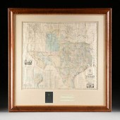
 TWO ANTIQUE ANTEBELLUM MAPS, "MAP OF TEX
[more like this]
TWO ANTIQUE ANTEBELLUM MAPS, "MAP OF TEX
[more like this]
This list is limited to only a few results.
Many more items are available to our members in our
Price Guide!
Ideal research tools for Collectors, Personal Property Appraisers, Antiques & Collectibles
Dealers, Auction Houses, Museums, eBayers or
other online
sellers (Rubylane, Etsy etc) and curious minds interested in appraising & identifying collectibles

EASY. FAST. ACCURATE.
Research at its best

Our research tools include:


