Pricing Guides & Dictionary of Makers Marks for Antiques & Collectibles
Appraise and find values for
CARY'S NEW MAP OF LONDON & ITS...
From
marks4antiques.com
- The most updated price guide and makers' marks research online
As a member, you have access to a team of experts
and assistance is always available to you for free
An example from the millions of items in our Price Guide:
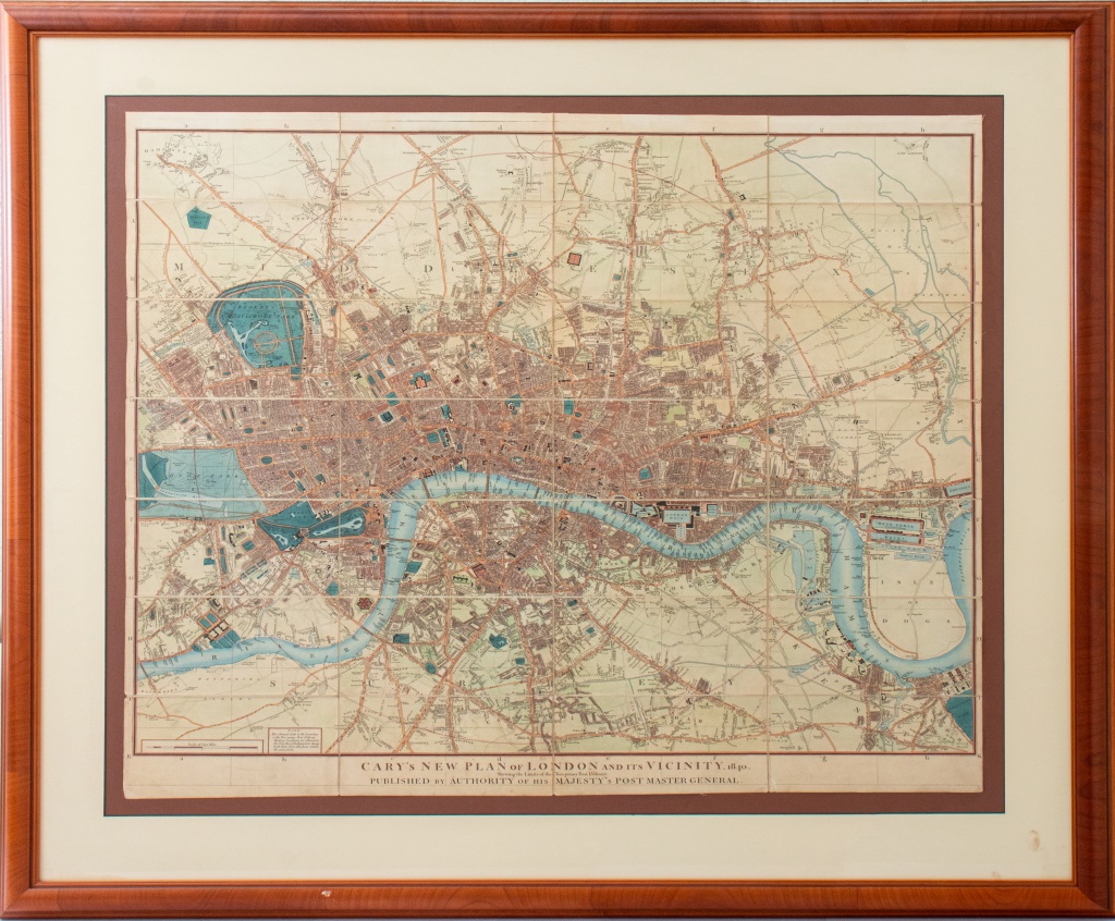
CARY'S NEW MAP OF LONDON & ITS VICINITY, 1840 Cary's New Map of London and its Vicinity, hand-colored engraving, inscribed "Cary's New Map of London and...
This is an example from our
values4antiques price guide
We do not buy or sell any items
See more price guides
Check our other research services:
IDENTIFY WORLDWIDE MAKERS' MARKS & HALLMARKS
marks4ceramics:
Porcelain, Pottery, Chinaware, Figurines, Dolls, Vases...
marks4silver
:
Silver, Jewelry, Pewter, Silverplate, Copper & Bronze...
Explore other items from our
Antiques & Collectibles Price Guide
-
 BRITANNIA, VOL. I & II CAMDEN 1722Camden
[more like this]
BRITANNIA, VOL. I & II CAMDEN 1722Camden
[more like this]
-
 A COMPLETE SYSTEM OF GEOGRAPHY, VOL. I B
[more like this]
A COMPLETE SYSTEM OF GEOGRAPHY, VOL. I B
[more like this]
-
 IMPORTANT ANTIQUE ATLAS DU VOYAGE DE LA
[more like this]
IMPORTANT ANTIQUE ATLAS DU VOYAGE DE LA
[more like this]
-
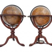
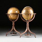 A MATCHED PAIR OF REGENCY CARY'S NEW TER
[more like this]
A MATCHED PAIR OF REGENCY CARY'S NEW TER
[more like this]
-
 5 KENTUCKY AND TENNESSEE MAPS1st item: "
[more like this]
5 KENTUCKY AND TENNESSEE MAPS1st item: "
[more like this]
-
 J&W CARY (LONDON) 1816 CELESTIAL AND TER
[more like this]
J&W CARY (LONDON) 1816 CELESTIAL AND TER
[more like this]
-
 2 CARY TERRESTRIAL AND CELESTIAL GLOBES,
[more like this]
2 CARY TERRESTRIAL AND CELESTIAL GLOBES,
[more like this]
-
 3 KY & TN MAPS: VANCE, TANNER, JOHNSON1s
[more like this]
3 KY & TN MAPS: VANCE, TANNER, JOHNSON1s
[more like this]
-
 A RARE ANTIQUE CIVIL WAR ERA MAP, "PRESS
[more like this]
A RARE ANTIQUE CIVIL WAR ERA MAP, "PRESS
[more like this]
-
 A TOPOGRAPHICAL MAP OF THE ENVIRONS OF L
[more like this]
A TOPOGRAPHICAL MAP OF THE ENVIRONS OF L
[more like this]
-
 A LATE MEXICAN-AMERICAN WAR ERA MAP, "MA
[more like this]
A LATE MEXICAN-AMERICAN WAR ERA MAP, "MA
[more like this]
-
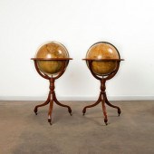
 An Associated Pair of Regency Twelve-Inc
[more like this]
An Associated Pair of Regency Twelve-Inc
[more like this]
-
 4 TN & KY MAPS, 3 FRAMED1st item: "Tenne
[more like this]
4 TN & KY MAPS, 3 FRAMED1st item: "Tenne
[more like this]
-
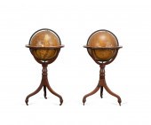
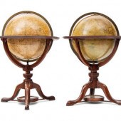 An Associated Pair of English Twelve-Inc
[more like this]
An Associated Pair of English Twelve-Inc
[more like this]
-
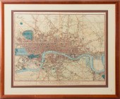 CARY'S NEW MAP OF LONDON & ITS VICINITY,
[more like this]
CARY'S NEW MAP OF LONDON & ITS VICINITY,
[more like this]
-
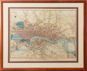 CARY'S NEW MAP OF LONDON & ITS
[more like this]
CARY'S NEW MAP OF LONDON & ITS
[more like this]
-
 8 TENNESSEE MILITARY & SURVEY MAPSAssort
[more like this]
8 TENNESSEE MILITARY & SURVEY MAPSAssort
[more like this]
-
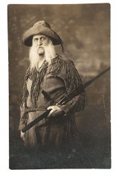 Western Artist William de la Montagne Ca
[more like this]
Western Artist William de la Montagne Ca
[more like this]
-
 16TH / 18TH C. EUROPEAN MAPS OF NEW SPAI
[more like this]
16TH / 18TH C. EUROPEAN MAPS OF NEW SPAI
[more like this]
-
 A Very Large Collection of Maps, 19th/e
[more like this]
A Very Large Collection of Maps, 19th/e
[more like this]
-
 4 EARLY AMERICAN MAPS: OVERTON, THIERRY,
[more like this]
4 EARLY AMERICAN MAPS: OVERTON, THIERRY,
[more like this]
-
 11 PC. MAP COLLECTION: Comprising; 1- La
[more like this]
11 PC. MAP COLLECTION: Comprising; 1- La
[more like this]
-
 [A PRIVATE SCOTTISH COLLECTION, EDINBURG
[more like this]
[A PRIVATE SCOTTISH COLLECTION, EDINBURG
[more like this]
-
 3 19TH CENT. AL, KY, & TN MAPS1st item:
[more like this]
3 19TH CENT. AL, KY, & TN MAPS1st item:
[more like this]
-
 AN IMPORTANT REPUBLIC OF TEXAS MAP, "MAP
[more like this]
AN IMPORTANT REPUBLIC OF TEXAS MAP, "MAP
[more like this]
-
 5 CIVIL WAR MAPSLot of five Civil War ma
[more like this]
5 CIVIL WAR MAPSLot of five Civil War ma
[more like this]
-
 AN ANTIQUE RECONSTRUCTION ERA MAP, "KOSS
[more like this]
AN ANTIQUE RECONSTRUCTION ERA MAP, "KOSS
[more like this]
-
 MAP AND ATLAS LOT, 3 PCS INCL. MELISH DI
[more like this]
MAP AND ATLAS LOT, 3 PCS INCL. MELISH DI
[more like this]
-
 NATIVE AMERICAN/WESTERN U.S. EXPEDITION
[more like this]
NATIVE AMERICAN/WESTERN U.S. EXPEDITION
[more like this]
-
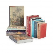
 59 vols. E.F. Benson & Brother - Benson
[more like this]
59 vols. E.F. Benson & Brother - Benson
[more like this]
-
 Books: Fine art furniture decorative art
[more like this]
Books: Fine art furniture decorative art
[more like this]
-
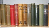
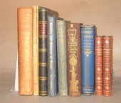 9 vols. (1 wrappers) London - Descripti
[more like this]
9 vols. (1 wrappers) London - Descripti
[more like this]
-
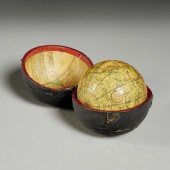 JOHN AND WILLIAM CARY POCKET GLOBE IN CA
[more like this]
JOHN AND WILLIAM CARY POCKET GLOBE IN CA
[more like this]
-
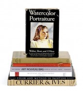
 COLLECTION OF ART REFERENCE BOOKS
ON ASI
[more like this]
COLLECTION OF ART REFERENCE BOOKS
ON ASI
[more like this]
-
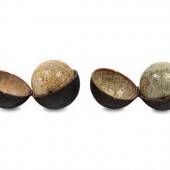 Two English Three-Inch Terrestrial and C
[more like this]
Two English Three-Inch Terrestrial and C
[more like this]
-
 AN ANTIQUE REPUBLIC OF TEXAS MAP, "MAP O
[more like this]
AN ANTIQUE REPUBLIC OF TEXAS MAP, "MAP O
[more like this]
This list is limited to only a few results.
Many more items are available to our members in our
Price Guide!
Ideal research tools for Collectors, Personal Property Appraisers, Antiques & Collectibles
Dealers, Auction Houses, Museums, eBayers or
other online
sellers (Rubylane, Etsy etc) and curious minds interested in appraising & identifying collectibles

EASY. FAST. ACCURATE.
Research at its best

Our research tools include:


