Pricing Guides & Dictionary of Makers Marks for Antiques & Collectibles
Appraise and find values for
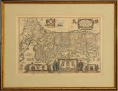
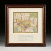
DUTCH HAND-COLORED MAP HOLY LAND,...
From
marks4antiques.com
- The most updated price guide and makers' marks research online
As a member, you have access to a team of experts
and assistance is always available to you for free
An example from the millions of items in our Price Guide:
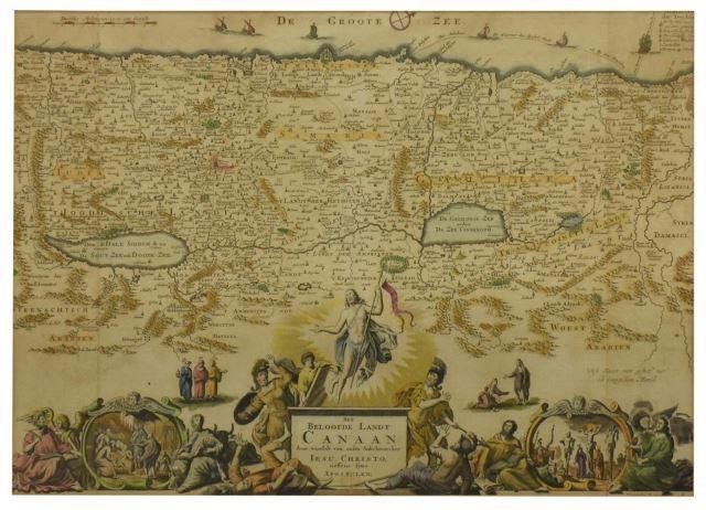
DUTCH HAND-COLORED MAP HOLY LAND, STOOPENDAALFramed hand-colored engraving on paper, Map of Canaan (Israel, Palestine, Holy Land), Amsterdam, Daniel...
This is an example from our
values4antiques price guide
We do not buy or sell any items
See more price guides
Check our other research services:
IDENTIFY WORLDWIDE MAKERS' MARKS & HALLMARKS
marks4ceramics:
Porcelain, Pottery, Chinaware, Figurines, Dolls, Vases...
marks4silver
:
Silver, Jewelry, Pewter, Silverplate, Copper & Bronze...
Explore other items from our
Antiques & Collectibles Price Guide
-
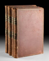
 BRITANNIA, VOL. I & II CAMDEN 1722Camden
[more like this]
BRITANNIA, VOL. I & II CAMDEN 1722Camden
[more like this]
-
 A COMPLETE SYSTEM OF GEOGRAPHY, VOL. I B
[more like this]
A COMPLETE SYSTEM OF GEOGRAPHY, VOL. I B
[more like this]
-
 IMPORTANT ANTIQUE ATLAS DU VOYAGE DE LA
[more like this]
IMPORTANT ANTIQUE ATLAS DU VOYAGE DE LA
[more like this]
-
 A RARE ANTIQUE CIVIL WAR ERA MAP, "PRESS
[more like this]
A RARE ANTIQUE CIVIL WAR ERA MAP, "PRESS
[more like this]
-
 5 KENTUCKY AND TENNESSEE MAPS1st item: "
[more like this]
5 KENTUCKY AND TENNESSEE MAPS1st item: "
[more like this]
-
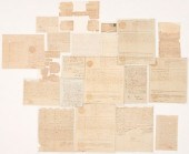
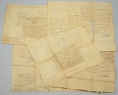 FIVE 18TH CENTURY NC/TN LAND GRANTSGroup
[more like this]
FIVE 18TH CENTURY NC/TN LAND GRANTSGroup
[more like this]
-
 ANTIQUARIAN JERUSALEM AND HOLY LAND BOOK
[more like this]
ANTIQUARIAN JERUSALEM AND HOLY LAND BOOK
[more like this]
-
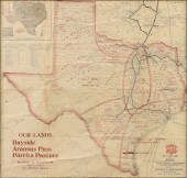
 AN IMPORTANT REPUBLIC OF TEXAS MAP, "MAP
[more like this]
AN IMPORTANT REPUBLIC OF TEXAS MAP, "MAP
[more like this]
-
 3 KY & TN MAPS: VANCE, TANNER, JOHNSON1s
[more like this]
3 KY & TN MAPS: VANCE, TANNER, JOHNSON1s
[more like this]
-
 4 TN & KY MAPS, 3 FRAMED1st item: "Tenne
[more like this]
4 TN & KY MAPS, 3 FRAMED1st item: "Tenne
[more like this]
-
 AN ANTEBELLUM MAP, "J. DE CORDOVA'S MAP
[more like this]
AN ANTEBELLUM MAP, "J. DE CORDOVA'S MAP
[more like this]
-
 AN ANTIQUE RECONSTRUCTION ERA MAP, "KOSS
[more like this]
AN ANTIQUE RECONSTRUCTION ERA MAP, "KOSS
[more like this]
-
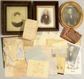 JOHN DAVIS AND FAMILY ARCHIVEArchive of
[more like this]
JOHN DAVIS AND FAMILY ARCHIVEArchive of
[more like this]
-
 A Very Large Collection of Maps, 19th/e
[more like this]
A Very Large Collection of Maps, 19th/e
[more like this]
-
 8 TENNESSEE MILITARY & SURVEY MAPSAssort
[more like this]
8 TENNESSEE MILITARY & SURVEY MAPSAssort
[more like this]
-
 A LATE MEXICAN-AMERICAN WAR ERA MAP, "MA
[more like this]
A LATE MEXICAN-AMERICAN WAR ERA MAP, "MA
[more like this]
-
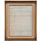 Thomas Jefferson & James Madison Signed
[more like this]
Thomas Jefferson & James Madison Signed
[more like this]
-
 11 PC. MAP COLLECTION: Comprising; 1- La
[more like this]
11 PC. MAP COLLECTION: Comprising; 1- La
[more like this]
-
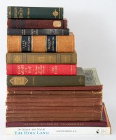
 DAVID ROBERTS BOOKS, "THE HOLY LAND" VOL
[more like this]
DAVID ROBERTS BOOKS, "THE HOLY LAND" VOL
[more like this]
-
 A TOPOGRAPHICAL MAP OF THE ENVIRONS OF L
[more like this]
A TOPOGRAPHICAL MAP OF THE ENVIRONS OF L
[more like this]
-
 16TH / 18TH C. EUROPEAN MAPS OF NEW SPAI
[more like this]
16TH / 18TH C. EUROPEAN MAPS OF NEW SPAI
[more like this]
-
 FORT FAMILY OF NC/TN ARCHIVE, 19 ITEMS I
[more like this]
FORT FAMILY OF NC/TN ARCHIVE, 19 ITEMS I
[more like this]
-
 MAP AND ATLAS LOT, 3 PCS INCL. MELISH DI
[more like this]
MAP AND ATLAS LOT, 3 PCS INCL. MELISH DI
[more like this]
-
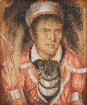 1830 TENNESSEE PORTRAIT MINIATURE OF KIN
[more like this]
1830 TENNESSEE PORTRAIT MINIATURE OF KIN
[more like this]
-
 3 19TH CENT. AL, KY, & TN MAPS1st item:
[more like this]
3 19TH CENT. AL, KY, & TN MAPS1st item:
[more like this]
-
 NATIVE AMERICAN/WESTERN U.S. EXPEDITION
[more like this]
NATIVE AMERICAN/WESTERN U.S. EXPEDITION
[more like this]
-
 5 CIVIL WAR MAPSLot of five Civil War ma
[more like this]
5 CIVIL WAR MAPSLot of five Civil War ma
[more like this]
-
 AN ANTIQUE REPUBLIC OF TEXAS MAP, "MAP O
[more like this]
AN ANTIQUE REPUBLIC OF TEXAS MAP, "MAP O
[more like this]
-
 AN ANTIQUE REPUBLIC OF TEXAS MAP, "MAP O
[more like this]
AN ANTIQUE REPUBLIC OF TEXAS MAP, "MAP O
[more like this]
-
 AN ANTIQUE MAP, "MK & T RAILWAY SECTIONA
[more like this]
AN ANTIQUE MAP, "MK & T RAILWAY SECTIONA
[more like this]
-
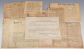 8 DOCS. INC. J. Q. ADAMS SIGNED ALA. LAN
[more like this]
8 DOCS. INC. J. Q. ADAMS SIGNED ALA. LAN
[more like this]
-
 JOSEPH MOXON HOLY LAND COLOR ENGRAVING,
[more like this]
JOSEPH MOXON HOLY LAND COLOR ENGRAVING,
[more like this]
-
 4 EARLY AMERICAN MAPS: OVERTON, THIERRY,
[more like this]
4 EARLY AMERICAN MAPS: OVERTON, THIERRY,
[more like this]
-
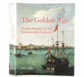 THE GOLDEN AGE: DUTCH PAINTERS OF THE 17
[more like this]
THE GOLDEN AGE: DUTCH PAINTERS OF THE 17
[more like this]
-
 2011 GMC SIERRAVIN:1GTN1TEA3BZ353238 MOT
[more like this]
2011 GMC SIERRAVIN:1GTN1TEA3BZ353238 MOT
[more like this]
-
 AN ANTIQUE EARLY REPUBLIC OF TEXAS MAP,
[more like this]
AN ANTIQUE EARLY REPUBLIC OF TEXAS MAP,
[more like this]
This list is limited to only a few results.
Many more items are available to our members in our
Price Guide!
Ideal research tools for Collectors, Personal Property Appraisers, Antiques & Collectibles
Dealers, Auction Houses, Museums, eBayers or
other online
sellers (Rubylane, Etsy etc) and curious minds interested in appraising & identifying collectibles

EASY. FAST. ACCURATE.
Research at its best

Our research tools include:


