Pricing Guides & Dictionary of Makers Marks for Antiques & Collectibles
Appraise and find values for
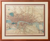
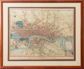
Engraved Cary's Map of the Twelve...
From
marks4antiques.com
- The most updated price guide and makers' marks research online
As a member, you have access to a team of experts
and assistance is always available to you for free
An example from the millions of items in our Price Guide:
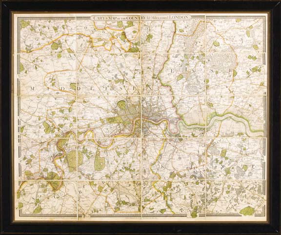
Engraved Cary's Map of the Twelve Miles 'Round London", 1829, presented in a parcel-gilt ebonized barn wood frame and glazed, h. 36", w. 43-1/2"....
This is an example from our
values4antiques price guide
We do not buy or sell any items
See more price guides
Check our other research services:
IDENTIFY WORLDWIDE MAKERS' MARKS & HALLMARKS
marks4ceramics:
Porcelain, Pottery, Chinaware, Figurines, Dolls, Vases...
marks4silver
:
Silver, Jewelry, Pewter, Silverplate, Copper & Bronze...
Explore other items from our
Antiques & Collectibles Price Guide
-
 BRITANNIA, VOL. I & II CAMDEN 1722Camden
[more like this]
BRITANNIA, VOL. I & II CAMDEN 1722Camden
[more like this]
-
 A COMPLETE SYSTEM OF GEOGRAPHY, VOL. I B
[more like this]
A COMPLETE SYSTEM OF GEOGRAPHY, VOL. I B
[more like this]
-
 IMPORTANT ANTIQUE ATLAS DU VOYAGE DE LA
[more like this]
IMPORTANT ANTIQUE ATLAS DU VOYAGE DE LA
[more like this]
-
 A MATCHED PAIR OF REGENCY CARY'S NEW TER
[more like this]
A MATCHED PAIR OF REGENCY CARY'S NEW TER
[more like this]
-
 5 KENTUCKY AND TENNESSEE MAPS1st item: "
[more like this]
5 KENTUCKY AND TENNESSEE MAPS1st item: "
[more like this]
-
 3 KY & TN MAPS: VANCE, TANNER, JOHNSON1s
[more like this]
3 KY & TN MAPS: VANCE, TANNER, JOHNSON1s
[more like this]
-
 A RARE ANTIQUE CIVIL WAR ERA MAP, "PRESS
[more like this]
A RARE ANTIQUE CIVIL WAR ERA MAP, "PRESS
[more like this]
-
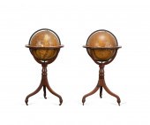
 J&W CARY (LONDON) 1816 CELESTIAL AND TER
[more like this]
J&W CARY (LONDON) 1816 CELESTIAL AND TER
[more like this]
-
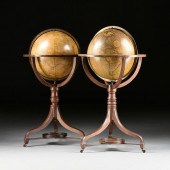
 2 CARY TERRESTRIAL AND CELESTIAL GLOBES,
[more like this]
2 CARY TERRESTRIAL AND CELESTIAL GLOBES,
[more like this]
-
 4 TN & KY MAPS, 3 FRAMED1st item: "Tenne
[more like this]
4 TN & KY MAPS, 3 FRAMED1st item: "Tenne
[more like this]
-
 A TOPOGRAPHICAL MAP OF THE ENVIRONS OF L
[more like this]
A TOPOGRAPHICAL MAP OF THE ENVIRONS OF L
[more like this]
-
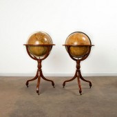
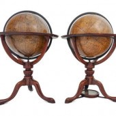 An Associated Pair of Regency Twelve-Inc
[more like this]
An Associated Pair of Regency Twelve-Inc
[more like this]
-
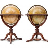 An Associated Pair of English Twelve-Inc
[more like this]
An Associated Pair of English Twelve-Inc
[more like this]
-
 8 TENNESSEE MILITARY & SURVEY MAPSAssort
[more like this]
8 TENNESSEE MILITARY & SURVEY MAPSAssort
[more like this]
-
 A Very Large Collection of Maps, 19th/e
[more like this]
A Very Large Collection of Maps, 19th/e
[more like this]
-
 16TH / 18TH C. EUROPEAN MAPS OF NEW SPAI
[more like this]
16TH / 18TH C. EUROPEAN MAPS OF NEW SPAI
[more like this]
-
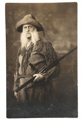 Western Artist William de la Montagne Ca
[more like this]
Western Artist William de la Montagne Ca
[more like this]
-
 3 19TH CENT. AL, KY, & TN MAPS1st item:
[more like this]
3 19TH CENT. AL, KY, & TN MAPS1st item:
[more like this]
-
 11 PC. MAP COLLECTION: Comprising; 1- La
[more like this]
11 PC. MAP COLLECTION: Comprising; 1- La
[more like this]
-
 Large and Opulent Two Hundred Sixty-Nine
[more like this]
Large and Opulent Two Hundred Sixty-Nine
[more like this]
-
 AN IMPORTANT REPUBLIC OF TEXAS MAP, "MAP
[more like this]
AN IMPORTANT REPUBLIC OF TEXAS MAP, "MAP
[more like this]
-
 AN ANTIQUE RECONSTRUCTION ERA MAP, "KOSS
[more like this]
AN ANTIQUE RECONSTRUCTION ERA MAP, "KOSS
[more like this]
-
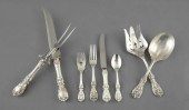
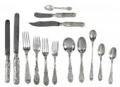 TIFFANY CHRYSANTHEMUM STERLING FLATWARE,
[more like this]
TIFFANY CHRYSANTHEMUM STERLING FLATWARE,
[more like this]
-
 A LATE MEXICAN-AMERICAN WAR ERA MAP, "MA
[more like this]
A LATE MEXICAN-AMERICAN WAR ERA MAP, "MA
[more like this]
-
 MAP AND ATLAS LOT, 3 PCS INCL. MELISH DI
[more like this]
MAP AND ATLAS LOT, 3 PCS INCL. MELISH DI
[more like this]
-
 5 CIVIL WAR MAPSLot of five Civil War ma
[more like this]
5 CIVIL WAR MAPSLot of five Civil War ma
[more like this]
-
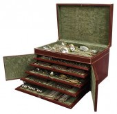
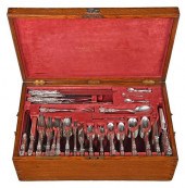 TIFFANY STERLING FLATWARE SET, 214 PIECE
[more like this]
TIFFANY STERLING FLATWARE SET, 214 PIECE
[more like this]
-
 STERLING SILVER FLATWARE SERVICE, S.KIRK
[more like this]
STERLING SILVER FLATWARE SERVICE, S.KIRK
[more like this]
-
 CARY'S NEW MAP OF LONDON & ITS VICINITY,
[more like this]
CARY'S NEW MAP OF LONDON & ITS VICINITY,
[more like this]
-
 CARY'S NEW MAP OF LONDON & ITS
[more like this]
CARY'S NEW MAP OF LONDON & ITS
[more like this]
-
 NATIVE AMERICAN/WESTERN U.S. EXPEDITION
[more like this]
NATIVE AMERICAN/WESTERN U.S. EXPEDITION
[more like this]
-
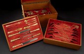
 SERVICE FOR 12 ITALIAN SILVER FLATWARE,
[more like this]
SERVICE FOR 12 ITALIAN SILVER FLATWARE,
[more like this]
-
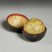 JOHN AND WILLIAM CARY POCKET GLOBE IN CA
[more like this]
JOHN AND WILLIAM CARY POCKET GLOBE IN CA
[more like this]
-
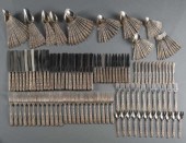
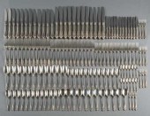
 One Hundred Fifty-Two-Piece Reed and Bar
[more like this]
One Hundred Fifty-Two-Piece Reed and Bar
[more like this]
-
 WALLACE STERLING SILVER CUTLERY SERVICEA
[more like this]
WALLACE STERLING SILVER CUTLERY SERVICEA
[more like this]
-
 RARE 1865 MONTANA TERRITORY MAP BY W.W.
[more like this]
RARE 1865 MONTANA TERRITORY MAP BY W.W.
[more like this]
This list is limited to only a few results.
Many more items are available to our members in our
Price Guide!
Ideal research tools for Collectors, Personal Property Appraisers, Antiques & Collectibles
Dealers, Auction Houses, Museums, eBayers or
other online
sellers (Rubylane, Etsy etc) and curious minds interested in appraising & identifying collectibles

EASY. FAST. ACCURATE.
Research at its best

Our research tools include:


