Pricing Guides & Dictionary of Makers Marks for Antiques & Collectibles
Appraise and find values for
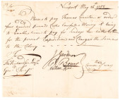
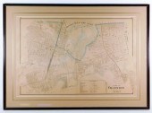
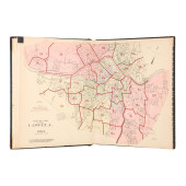
EVERTS & RICHARDS CRANSTON RI MAP...
From
marks4antiques.com
- The most updated price guide and makers' marks research online
As a member, you have access to a team of experts
and assistance is always available to you for free
An example from the millions of items in our Price Guide:
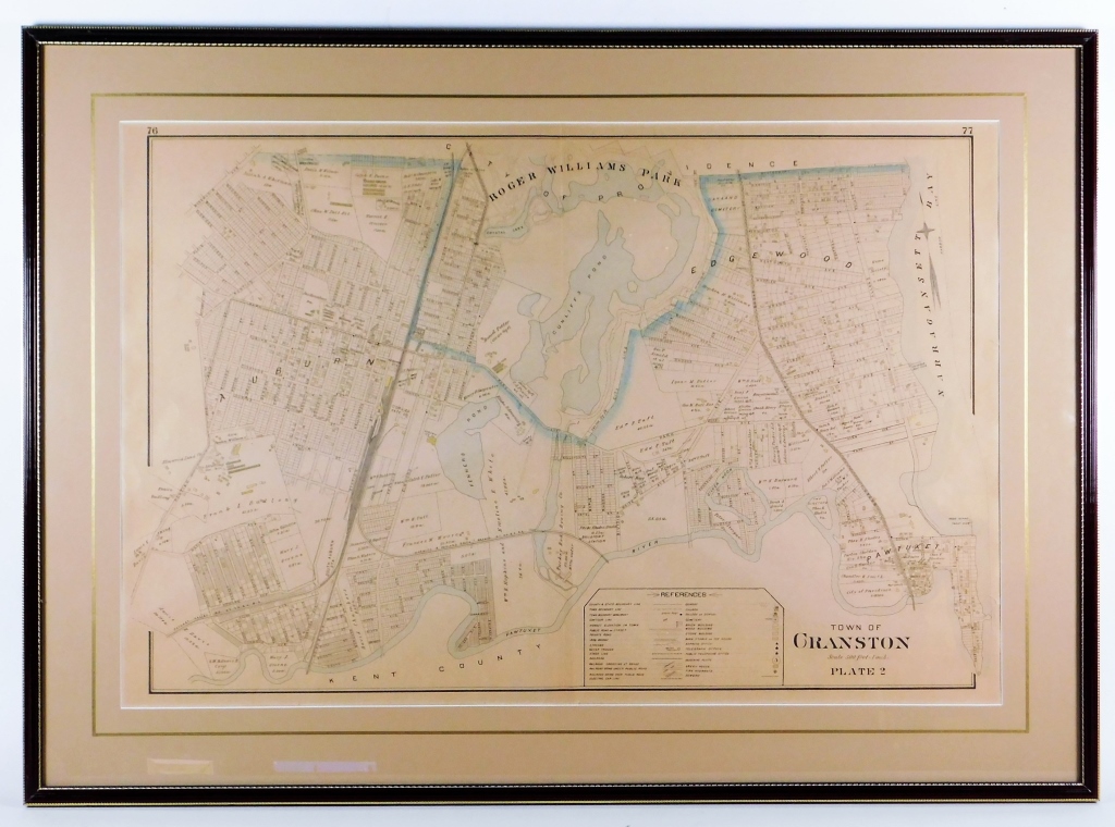
EVERTS & RICHARDS CRANSTON RI MAP Pennsylvania,1895A cadastral map of Cranston, Rhode Island Plate 2 created for the Providence County, Rhode Island 1895...
This is an example from our
values4antiques price guide
We do not buy or sell any items
See more price guides
Check our other research services:
IDENTIFY WORLDWIDE MAKERS' MARKS & HALLMARKS
marks4ceramics:
Porcelain, Pottery, Chinaware, Figurines, Dolls, Vases...
marks4silver
:
Silver, Jewelry, Pewter, Silverplate, Copper & Bronze...
Explore other items from our
Antiques & Collectibles Price Guide
-
 BRITANNIA, VOL. I & II CAMDEN 1722Camden
[more like this]
BRITANNIA, VOL. I & II CAMDEN 1722Camden
[more like this]
-
 A COMPLETE SYSTEM OF GEOGRAPHY, VOL. I B
[more like this]
A COMPLETE SYSTEM OF GEOGRAPHY, VOL. I B
[more like this]
-
 IMPORTANT ANTIQUE ATLAS DU VOYAGE DE LA
[more like this]
IMPORTANT ANTIQUE ATLAS DU VOYAGE DE LA
[more like this]
-
 5 KENTUCKY AND TENNESSEE MAPS1st item: "
[more like this]
5 KENTUCKY AND TENNESSEE MAPS1st item: "
[more like this]
-
 WILLIAM TROST RICHARDS, AMERICAN (1833-1
[more like this]
WILLIAM TROST RICHARDS, AMERICAN (1833-1
[more like this]
-
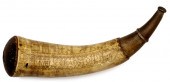 Engraved Powder Horn of Samuel X. Cranst
[more like this]
Engraved Powder Horn of Samuel X. Cranst
[more like this]
-
 CHARLES RENNIE MACKINTOSH (1868-1928) FO
[more like this]
CHARLES RENNIE MACKINTOSH (1868-1928) FO
[more like this]
-
 A RARE ANTIQUE CIVIL WAR ERA MAP, "PRESS
[more like this]
A RARE ANTIQUE CIVIL WAR ERA MAP, "PRESS
[more like this]
-
 3 KY & TN MAPS: VANCE, TANNER, JOHNSON1s
[more like this]
3 KY & TN MAPS: VANCE, TANNER, JOHNSON1s
[more like this]
-
 WESTLEY RICHARDS CONNAUGHT 410 GA SHOTGU
[more like this]
WESTLEY RICHARDS CONNAUGHT 410 GA SHOTGU
[more like this]
-
 4 TN & KY MAPS, 3 FRAMED1st item: "Tenne
[more like this]
4 TN & KY MAPS, 3 FRAMED1st item: "Tenne
[more like this]
-
 THOMAS CRANSTON SIGNED RHODE ISLAND, SEV
[more like this]
THOMAS CRANSTON SIGNED RHODE ISLAND, SEV
[more like this]
-
 THOMAS CRANSTON SIGNED RHODE ISLAND, SEV
[more like this]
THOMAS CRANSTON SIGNED RHODE ISLAND, SEV
[more like this]
-
 Atlas and Cyclopedia of Butler County Oh
[more like this]
Atlas and Cyclopedia of Butler County Oh
[more like this]
-
 A Very Large Collection of Maps, 19th/e
[more like this]
A Very Large Collection of Maps, 19th/e
[more like this]
-
 8 TENNESSEE MILITARY & SURVEY MAPSAssort
[more like this]
8 TENNESSEE MILITARY & SURVEY MAPSAssort
[more like this]
-
 EVERTS & RICHARDS CRANSTON RI MAP Pennsy
[more like this]
EVERTS & RICHARDS CRANSTON RI MAP Pennsy
[more like this]
-
 A SCARCE VICTORIAN NOVELTY SILVER AND PA
[more like this]
A SCARCE VICTORIAN NOVELTY SILVER AND PA
[more like this]
-
 MYRA REYNOLD RICHARDS, AMERICAN (1882-19
[more like this]
MYRA REYNOLD RICHARDS, AMERICAN (1882-19
[more like this]
-
 A TOPOGRAPHICAL MAP OF THE ENVIRONS OF L
[more like this]
A TOPOGRAPHICAL MAP OF THE ENVIRONS OF L
[more like this]
-
 11 PC. MAP COLLECTION: Comprising; 1- La
[more like this]
11 PC. MAP COLLECTION: Comprising; 1- La
[more like this]
-
 16TH / 18TH C. EUROPEAN MAPS OF NEW SPAI
[more like this]
16TH / 18TH C. EUROPEAN MAPS OF NEW SPAI
[more like this]
-
 A LATE MEXICAN-AMERICAN WAR ERA MAP, "MA
[more like this]
A LATE MEXICAN-AMERICAN WAR ERA MAP, "MA
[more like this]
-
 AN IMPORTANT REPUBLIC OF TEXAS MAP, "MAP
[more like this]
AN IMPORTANT REPUBLIC OF TEXAS MAP, "MAP
[more like this]
-
 AN ANTIQUE RECONSTRUCTION ERA MAP, "KOSS
[more like this]
AN ANTIQUE RECONSTRUCTION ERA MAP, "KOSS
[more like this]
-
 3 19TH CENT. AL, KY, & TN MAPS1st item:
[more like this]
3 19TH CENT. AL, KY, & TN MAPS1st item:
[more like this]
-
 MAP AND ATLAS LOT, 3 PCS INCL. MELISH DI
[more like this]
MAP AND ATLAS LOT, 3 PCS INCL. MELISH DI
[more like this]
-
 5 CIVIL WAR MAPSLot of five Civil War ma
[more like this]
5 CIVIL WAR MAPSLot of five Civil War ma
[more like this]
-
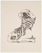 CONNOR EVERTS (1926-2016), "TWO FACES OF
[more like this]
CONNOR EVERTS (1926-2016), "TWO FACES OF
[more like this]
-
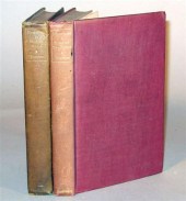 6 vols. Firbank, Ronald: Vainglory. Lon
[more like this]
6 vols. Firbank, Ronald: Vainglory. Lon
[more like this]
-
 WILLIAM TROST RICHARDS (PENNSYLVANIA/RHO
[more like this]
WILLIAM TROST RICHARDS (PENNSYLVANIA/RHO
[more like this]
-
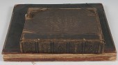
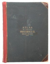 MASSIVE RHODE ISLAND ATLAS 1895The last
[more like this]
MASSIVE RHODE ISLAND ATLAS 1895The last
[more like this]
-
 NATIVE AMERICAN/WESTERN U.S. EXPEDITION
[more like this]
NATIVE AMERICAN/WESTERN U.S. EXPEDITION
[more like this]
-
 RICHARDS STANDARD ATLAS OF THE CITY OF L
[more like this]
RICHARDS STANDARD ATLAS OF THE CITY OF L
[more like this]
-
 RARE 1865 MONTANA TERRITORY MAP BY W.W.
[more like this]
RARE 1865 MONTANA TERRITORY MAP BY W.W.
[more like this]
-
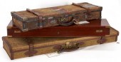 3 ANTIQUE GUN CASES INCL. WESTLEY RICHAR
[more like this]
3 ANTIQUE GUN CASES INCL. WESTLEY RICHAR
[more like this]
This list is limited to only a few results.
Many more items are available to our members in our
Price Guide!
Ideal research tools for Collectors, Personal Property Appraisers, Antiques & Collectibles
Dealers, Auction Houses, Museums, eBayers or
other online
sellers (Rubylane, Etsy etc) and curious minds interested in appraising & identifying collectibles

EASY. FAST. ACCURATE.
Research at its best

Our research tools include:


