Pricing Guides & Dictionary of Makers Marks for Antiques & Collectibles
Appraise and find values for
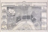
[Map] William Dawson Jr.; ''City of...
From
marks4antiques.com
- The most updated price guide and makers' marks research online
As a member, you have access to a team of experts
and assistance is always available to you for free
An example from the millions of items in our Price Guide:
![[Map] William Dawson Jr.; ''City of](/images/map-william-dawson-jr-city--1395fb-full.jpg)
[Map] William Dawson Jr.; ''City of Baltimore with Its Environs Showing the Lands of the Patapsco Canton and South Baltimore Companies'' (Baltimore: A....
This is an example from our
values4antiques price guide
We do not buy or sell any items
See more price guides
Check our other research services:
IDENTIFY WORLDWIDE MAKERS' MARKS & HALLMARKS
marks4ceramics:
Porcelain, Pottery, Chinaware, Figurines, Dolls, Vases...
marks4silver
:
Silver, Jewelry, Pewter, Silverplate, Copper & Bronze...
Explore other items from our
Antiques & Collectibles Price Guide
-
 BRITANNIA, VOL. I & II CAMDEN 1722Camden
[more like this]
BRITANNIA, VOL. I & II CAMDEN 1722Camden
[more like this]
-
 A COMPLETE SYSTEM OF GEOGRAPHY, VOL. I B
[more like this]
A COMPLETE SYSTEM OF GEOGRAPHY, VOL. I B
[more like this]
-
 IMPORTANT ANTIQUE ATLAS DU VOYAGE DE LA
[more like this]
IMPORTANT ANTIQUE ATLAS DU VOYAGE DE LA
[more like this]
-
 5 KENTUCKY AND TENNESSEE MAPS1st item: "
[more like this]
5 KENTUCKY AND TENNESSEE MAPS1st item: "
[more like this]
-
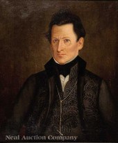 Attributed to C. R. Parker (American/Lou
[more like this]
Attributed to C. R. Parker (American/Lou
[more like this]
-
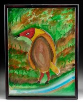 WILLIAM DAWSON PAINTING COLORFUL BIRD OU
[more like this]
WILLIAM DAWSON PAINTING COLORFUL BIRD OU
[more like this]
-
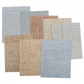 Letters Between the Sturges Brothers Mos
[more like this]
Letters Between the Sturges Brothers Mos
[more like this]
-
 A RARE ANTIQUE CIVIL WAR ERA MAP, "PRESS
[more like this]
A RARE ANTIQUE CIVIL WAR ERA MAP, "PRESS
[more like this]
-
 3 KY & TN MAPS: VANCE, TANNER, JOHNSON1s
[more like this]
3 KY & TN MAPS: VANCE, TANNER, JOHNSON1s
[more like this]
-
 8 TENNESSEE MILITARY & SURVEY MAPSAssort
[more like this]
8 TENNESSEE MILITARY & SURVEY MAPSAssort
[more like this]
-
 4 TN & KY MAPS, 3 FRAMED1st item: "Tenne
[more like this]
4 TN & KY MAPS, 3 FRAMED1st item: "Tenne
[more like this]
-
 AN ANTIQUE RECONSTRUCTION ERA MAP, "KOSS
[more like this]
AN ANTIQUE RECONSTRUCTION ERA MAP, "KOSS
[more like this]
-
 A Very Large Collection of Maps, 19th/e
[more like this]
A Very Large Collection of Maps, 19th/e
[more like this]
-
 A TOPOGRAPHICAL MAP OF THE ENVIRONS OF L
[more like this]
A TOPOGRAPHICAL MAP OF THE ENVIRONS OF L
[more like this]
-
 A LATE MEXICAN-AMERICAN WAR ERA MAP, "MA
[more like this]
A LATE MEXICAN-AMERICAN WAR ERA MAP, "MA
[more like this]
-
 11 PC. MAP COLLECTION: Comprising; 1- La
[more like this]
11 PC. MAP COLLECTION: Comprising; 1- La
[more like this]
-
 16TH / 18TH C. EUROPEAN MAPS OF NEW SPAI
[more like this]
16TH / 18TH C. EUROPEAN MAPS OF NEW SPAI
[more like this]
-
 MONTAGUE DAWSON (BRITISH, 1890-1973) "CL
[more like this]
MONTAGUE DAWSON (BRITISH, 1890-1973) "CL
[more like this]
-
 AN IMPORTANT REPUBLIC OF TEXAS MAP, "MAP
[more like this]
AN IMPORTANT REPUBLIC OF TEXAS MAP, "MAP
[more like this]
-
 3 19TH CENT. AL, KY, & TN MAPS1st item:
[more like this]
3 19TH CENT. AL, KY, & TN MAPS1st item:
[more like this]
-
 MAP AND ATLAS LOT, 3 PCS INCL. MELISH DI
[more like this]
MAP AND ATLAS LOT, 3 PCS INCL. MELISH DI
[more like this]
-
 5 CIVIL WAR MAPSLot of five Civil War ma
[more like this]
5 CIVIL WAR MAPSLot of five Civil War ma
[more like this]
-
 NATIVE AMERICAN/WESTERN U.S. EXPEDITION
[more like this]
NATIVE AMERICAN/WESTERN U.S. EXPEDITION
[more like this]
-
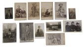 Photographic Archive of Miles City Monta
[more like this]
Photographic Archive of Miles City Monta
[more like this]
-
 Jacques Tanesse (New Orleans) "Plan of t
[more like this]
Jacques Tanesse (New Orleans) "Plan of t
[more like this]
-
 RARE 1865 MONTANA TERRITORY MAP BY W.W.
[more like this]
RARE 1865 MONTANA TERRITORY MAP BY W.W.
[more like this]
-
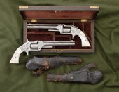 Pair of Nimschke-Style Engraved Smith &
[more like this]
Pair of Nimschke-Style Engraved Smith &
[more like this]
-
 A FACSIMILE CADASTRAL MAP, "MAP OF BEXAR
[more like this]
A FACSIMILE CADASTRAL MAP, "MAP OF BEXAR
[more like this]
-
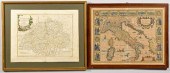 J. SPEED 1626 MAP OF ITALY PLUS SWISS MA
[more like this]
J. SPEED 1626 MAP OF ITALY PLUS SWISS MA
[more like this]
-
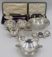 SILVER. ASSORTED GROUPING OF ENGLISH SIL
[more like this]
SILVER. ASSORTED GROUPING OF ENGLISH SIL
[more like this]
-
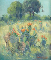
 DAWSON DAWSON-WATSON (1864-1939)Dawson D
[more like this]
DAWSON DAWSON-WATSON (1864-1939)Dawson D
[more like this]
-
 DAWSON DAWSON-WATSON (ENGLISH/TEXAN 1864
[more like this]
DAWSON DAWSON-WATSON (ENGLISH/TEXAN 1864
[more like this]
-
 CIRCLE OF THOMAS POPE STEVENS O/C PAINTI
[more like this]
CIRCLE OF THOMAS POPE STEVENS O/C PAINTI
[more like this]
-
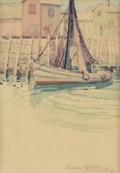
 DAWSON DAWSON-WATSON (1864-1939) PONT D'
[more like this]
DAWSON DAWSON-WATSON (1864-1939) PONT D'
[more like this]
-
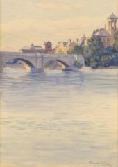
 DAWSON DAWSON-WATSON (1864-1939) PAINTIN
[more like this]
DAWSON DAWSON-WATSON (1864-1939) PAINTIN
[more like this]
-
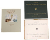 (3) BOOK & EXHIBITION CATALOGS MARIN
[more like this]
(3) BOOK & EXHIBITION CATALOGS MARIN
[more like this]
This list is limited to only a few results.
Many more items are available to our members in our
Price Guide!
Ideal research tools for Collectors, Personal Property Appraisers, Antiques & Collectibles
Dealers, Auction Houses, Museums, eBayers or
other online
sellers (Rubylane, Etsy etc) and curious minds interested in appraising & identifying collectibles

EASY. FAST. ACCURATE.
Research at its best

Our research tools include:


