Pricing Guides & Dictionary of Makers Marks for Antiques & Collectibles
Appraise and find values for
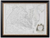
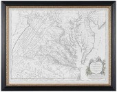
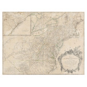
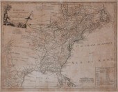
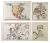
VAUGONDY - FRY & JEFFERSON MAP OF...
From
marks4antiques.com
- The most updated price guide and makers' marks research online
As a member, you have access to a team of experts
and assistance is always available to you for free
An example from the millions of items in our Price Guide:
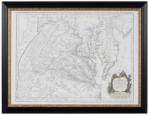
VAUGONDY - FRY & JEFFERSON MAP OF VIRGINIA AND MARYLAND...published by Gilles Robert de Vaugondy, Carte de la Virginie et du Maryland Dress?e sur la Grande...
This is an example from our
values4antiques price guide
We do not buy or sell any items
See more price guides
Check our other research services:
IDENTIFY WORLDWIDE MAKERS' MARKS & HALLMARKS
marks4ceramics:
Porcelain, Pottery, Chinaware, Figurines, Dolls, Vases...
marks4silver
:
Silver, Jewelry, Pewter, Silverplate, Copper & Bronze...
Explore other items from our
Antiques & Collectibles Price Guide
-
 BRITANNIA, VOL. I & II CAMDEN 1722Camden
[more like this]
BRITANNIA, VOL. I & II CAMDEN 1722Camden
[more like this]
-
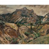 ROGER FRY (BRITISH 1866-1934)
THE RAVINE
[more like this]
ROGER FRY (BRITISH 1866-1934)
THE RAVINE
[more like this]
-
 A COMPLETE SYSTEM OF GEOGRAPHY, VOL. I B
[more like this]
A COMPLETE SYSTEM OF GEOGRAPHY, VOL. I B
[more like this]
-
 IMPORTANT ANTIQUE ATLAS DU VOYAGE DE LA
[more like this]
IMPORTANT ANTIQUE ATLAS DU VOYAGE DE LA
[more like this]
-
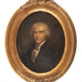
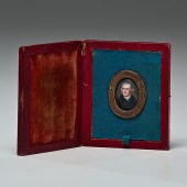 Thomas Jefferson Miniature Portrait by W
[more like this]
Thomas Jefferson Miniature Portrait by W
[more like this]
-
 5 KENTUCKY AND TENNESSEE MAPS1st item: "
[more like this]
5 KENTUCKY AND TENNESSEE MAPS1st item: "
[more like this]
-
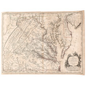
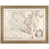
 VAUGONDY - FRY & JEFFERSON MAP OF VIRGIN
[more like this]
VAUGONDY - FRY & JEFFERSON MAP OF VIRGIN
[more like this]
-
 VAUGONDY - FRY & JEFFERSON MAP OF VIRGIN
[more like this]
VAUGONDY - FRY & JEFFERSON MAP OF VIRGIN
[more like this]
-
 1755 ORIGINAL FIRST STATE FRENCH PRINTIN
[more like this]
1755 ORIGINAL FIRST STATE FRENCH PRINTIN
[more like this]
-
 1755 RARE ORIGINAL FIRST STATE FRENCH PR
[more like this]
1755 RARE ORIGINAL FIRST STATE FRENCH PR
[more like this]
-
 American or French School, 19th Century
[more like this]
American or French School, 19th Century
[more like this]
-
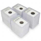
 (22 PC) SLABBED COIN COLLECTIONDESCRIPTI
[more like this]
(22 PC) SLABBED COIN COLLECTIONDESCRIPTI
[more like this]
-
 A RARE ANTIQUE CIVIL WAR ERA MAP, "PRESS
[more like this]
A RARE ANTIQUE CIVIL WAR ERA MAP, "PRESS
[more like this]
-
 3 KY & TN MAPS: VANCE, TANNER, JOHNSON1s
[more like this]
3 KY & TN MAPS: VANCE, TANNER, JOHNSON1s
[more like this]
-
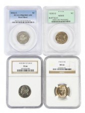 GROUP OF 14 GRADED NICKELS1938-D Buffalo
[more like this]
GROUP OF 14 GRADED NICKELS1938-D Buffalo
[more like this]
-
 FRY FAMILY CIVIL WAR ARCHIVEGeorge Fry,
[more like this]
FRY FAMILY CIVIL WAR ARCHIVEGeorge Fry,
[more like this]
-
 4 TN & KY MAPS, 3 FRAMED1st item: "Tenne
[more like this]
4 TN & KY MAPS, 3 FRAMED1st item: "Tenne
[more like this]
-
 A Very Large Collection of Maps, 19th/e
[more like this]
A Very Large Collection of Maps, 19th/e
[more like this]
-
 8 TENNESSEE MILITARY & SURVEY MAPSAssort
[more like this]
8 TENNESSEE MILITARY & SURVEY MAPSAssort
[more like this]
-
 AN IMPORTANT REPUBLIC OF TEXAS MAP, "MAP
[more like this]
AN IMPORTANT REPUBLIC OF TEXAS MAP, "MAP
[more like this]
-
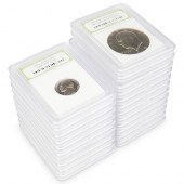
 (37 PC) SLABBED COIN COLLECTIONDESCRIPTI
[more like this]
(37 PC) SLABBED COIN COLLECTIONDESCRIPTI
[more like this]
-
 A TOPOGRAPHICAL MAP OF THE ENVIRONS OF L
[more like this]
A TOPOGRAPHICAL MAP OF THE ENVIRONS OF L
[more like this]
-
 11 PC. MAP COLLECTION: Comprising; 1- La
[more like this]
11 PC. MAP COLLECTION: Comprising; 1- La
[more like this]
-
 16TH / 18TH C. EUROPEAN MAPS OF NEW SPAI
[more like this]
16TH / 18TH C. EUROPEAN MAPS OF NEW SPAI
[more like this]
-
 ROBERT DE VAUGONDY'S 18TH-CENTURY FRENCH
[more like this]
ROBERT DE VAUGONDY'S 18TH-CENTURY FRENCH
[more like this]
-
 A LATE MEXICAN-AMERICAN WAR ERA MAP, "MA
[more like this]
A LATE MEXICAN-AMERICAN WAR ERA MAP, "MA
[more like this]
-
 AN ANTIQUE RECONSTRUCTION ERA MAP, "KOSS
[more like this]
AN ANTIQUE RECONSTRUCTION ERA MAP, "KOSS
[more like this]
-
 3 19TH CENT. AL, KY, & TN MAPS1st item:
[more like this]
3 19TH CENT. AL, KY, & TN MAPS1st item:
[more like this]
-
 MAP AND ATLAS LOT, 3 PCS INCL. MELISH DI
[more like this]
MAP AND ATLAS LOT, 3 PCS INCL. MELISH DI
[more like this]
-
 5 CIVIL WAR MAPSLot of five Civil War ma
[more like this]
5 CIVIL WAR MAPSLot of five Civil War ma
[more like this]
-
 RARE 1865 MONTANA TERRITORY MAP BY W.W.
[more like this]
RARE 1865 MONTANA TERRITORY MAP BY W.W.
[more like this]
-
 MAP: ROBERT DE VAUGONDY "PLAN DE LA VILL
[more like this]
MAP: ROBERT DE VAUGONDY "PLAN DE LA VILL
[more like this]
-
 NATIVE AMERICAN/WESTERN U.S. EXPEDITION
[more like this]
NATIVE AMERICAN/WESTERN U.S. EXPEDITION
[more like this]
-
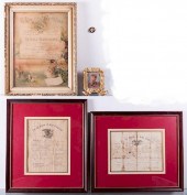
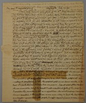 THOMAS JEFFERSON AUTOGRAPH LETTER SIGNED
[more like this]
THOMAS JEFFERSON AUTOGRAPH LETTER SIGNED
[more like this]
-
 ROBERT DE VAUGONDY, FRENCH 18TH CENTURY,
[more like this]
ROBERT DE VAUGONDY, FRENCH 18TH CENTURY,
[more like this]
-
 (4) ANTIQUE MAPS, BONNE & VAUGONDY,
[more like this]
(4) ANTIQUE MAPS, BONNE & VAUGONDY,
[more like this]
This list is limited to only a few results.
Many more items are available to our members in our
Price Guide!
Ideal research tools for Collectors, Personal Property Appraisers, Antiques & Collectibles
Dealers, Auction Houses, Museums, eBayers or
other online
sellers (Rubylane, Etsy etc) and curious minds interested in appraising & identifying collectibles

EASY. FAST. ACCURATE.
Research at its best

Our research tools include:


