Pricing Guides & Dictionary of Makers Marks for Antiques & Collectibles

A few examples of appraisal values for
CITY OF LONDON
Search our price guide for your own treasures
-
 19th Century Engraving of London "A
 Prospect of the City of London" by John Kip, published by John Smith, London, circa 1820, large-scale panoramic view with additional title La Ville de Londres. Prospectus Londinensis in cartouche at top and location key at bottom, two joined sheets, hand-coloring and gum arabic, engraving on laid paper, 19-1/8 x 46-1/8 in. (plate); modern painted wood and composition frame,
19th Century Engraving of London "A
19th Century Engraving of London "A Prospect of the City of London" by John Kip, published by John Smith, London, circa 1820, large-scale panoramic view with additional title La Ville de Londres. Prospectus Londinensis in cartouche at top and location key at bottom, two joined sheets, hand-coloring and gum arabic, engraving on laid paper, 19-1/8 x 46-1/8 in. (plate); modern painted wood and composition frame, -
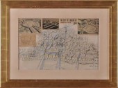 20TH C. SCHOOL: "THE CITY OF LONDON
 IN 1964" Collaged newspaper and architectural photographs on a hand-colored lithographic print 15 x 23 in. (image) signed J.A. Anthony.
20TH C. SCHOOL: "THE CITY OF LONDON
20TH C. SCHOOL: "THE CITY OF LONDON IN 1964" Collaged newspaper and architectural photographs on a hand-colored lithographic print 15 x 23 in. (image) signed J.A. Anthony. -
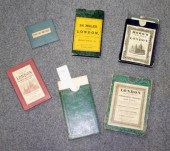 Gardner, Jos. New Plan of the
 Cities of London & Westminster with the Borough of Southwark, 1833. Hand coloured folding map, mounted on linen, green morocco slipcase -Mogg, Edward. London in Miniature With the Surrounding Villages, n.d. Hand coloured folding map, mounted on linen, board slipcase; with another similar by the same, and 3 other maps of London (6)/Provenance: Spetchley Park
Gardner, Jos. New Plan of the
Gardner, Jos. New Plan of the Cities of London & Westminster with the Borough of Southwark, 1833. Hand coloured folding map, mounted on linen, green morocco slipcase -Mogg, Edward. London in Miniature With the Surrounding Villages, n.d. Hand coloured folding map, mounted on linen, board slipcase; with another similar by the same, and 3 other maps of London (6)/Provenance: Spetchley Park -
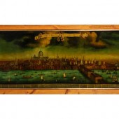 After Johannes Kip, 19th Century La
 Ville de Londres, Prospectus Londinensis (A Prospect of the City of London) reverse painting over engraving on glass 18 3/4 x 45 1/2 inches.
After Johannes Kip, 19th Century La
After Johannes Kip, 19th Century La Ville de Londres, Prospectus Londinensis (A Prospect of the City of London) reverse painting over engraving on glass 18 3/4 x 45 1/2 inches. -
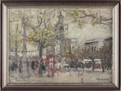 English School (20th c.) London
 Street Sceneoil on canvas illegible signature lower right an impressionist cityscape in which pedestrians scurry by a bright red telephone booth on a gray late autumn day. A large domed building likely St. Paul's Cathedral dominates the background. Presented in a modern wooden frame.SS 17.75 x 25 in.; DOA 22 x 29 in.Estate of the late Arthur H. Danielson of Raleigh NC
English School (20th c.) London
English School (20th c.) London Street Sceneoil on canvas illegible signature lower right an impressionist cityscape in which pedestrians scurry by a bright red telephone booth on a gray late autumn day. A large domed building likely St. Paul's Cathedral dominates the background. Presented in a modern wooden frame.SS 17.75 x 25 in.; DOA 22 x 29 in.Estate of the late Arthur H. Danielson of Raleigh NC -
 Panorama of London and the Thames.,
 circa 1846, Illustrated London News, 4to, coloured wood engraved panorama, printed key on separate tipped in leaf, original green cloth board, with decorative cloth design on upper cover with gilt arms of the City of London/see illustration
Panorama of London and the Thames.,
Panorama of London and the Thames., circa 1846, Illustrated London News, 4to, coloured wood engraved panorama, printed key on separate tipped in leaf, original green cloth board, with decorative cloth design on upper cover with gilt arms of the City of London/see illustration -
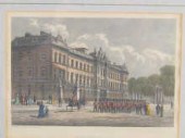 A set of six coloured prints of
 London landmarks each 20 x 13 cm together with a lithograph of a Constable painting of the River Stour.
A set of six coloured prints of
A set of six coloured prints of London landmarks each 20 x 13 cm together with a lithograph of a Constable painting of the River Stour. -
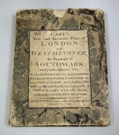 A Cary's ''New and Accurate Plan of
 London and Westminster the Borough of Southwark and Parts Adjacent'' with hand coloured sections laid on to linen with keys to public buildings churches and streets 32ins x 49ins in marbled slip case with printed label
A Cary's ''New and Accurate Plan of
A Cary's ''New and Accurate Plan of London and Westminster the Borough of Southwark and Parts Adjacent'' with hand coloured sections laid on to linen with keys to public buildings churches and streets 32ins x 49ins in marbled slip case with printed label -
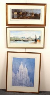 20th Century/St Pauls and City from
 South Bank/watercolour, 24cm x 58cm/J M Halliday/The Thames at Bankside/signed in pencil and dated 1976, limited edition 9/40/print, 19cm x 54cm and/David Gentleman (British, born 1930)/Architectural Study/colour print, 57cm x 44cm [3]
20th Century/St Pauls and City from
20th Century/St Pauls and City from South Bank/watercolour, 24cm x 58cm/J M Halliday/The Thames at Bankside/signed in pencil and dated 1976, limited edition 9/40/print, 19cm x 54cm and/David Gentleman (British, born 1930)/Architectural Study/colour print, 57cm x 44cm [3] -
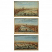 THREE ANTIQUE AERIAL VIEWS OF
 LONDON Each a hand-colored engraving, circa 1750, Thomas Bowles, to include "The South East Prospect of Westminster," "The South West Prospect of London," and "A General View of the City of London, Next to the River Thames," presented in uniform framing.
THREE ANTIQUE AERIAL VIEWS OF
THREE ANTIQUE AERIAL VIEWS OF LONDON Each a hand-colored engraving, circa 1750, Thomas Bowles, to include "The South East Prospect of Westminster," "The South West Prospect of London," and "A General View of the City of London, Next to the River Thames," presented in uniform framing. -
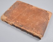 The History and Survey of London
 from its Foundation to the Present Time, by William Maitland and others (London, 1756).
The History and Survey of London
The History and Survey of London from its Foundation to the Present Time, by William Maitland and others (London, 1756). -
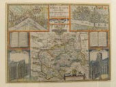 A John Speed map of Middlesex
 with larger scale sections of ''The citties of Westminster and London'' 52 x 38cm.
A John Speed map of Middlesex
A John Speed map of Middlesex with larger scale sections of ''The citties of Westminster and London'' 52 x 38cm. -
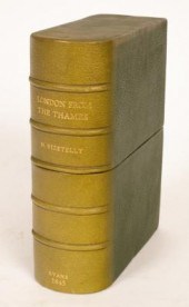 Evans, London from the Thames,
 1845, Vizetelly., plain engraving in a roll backed on linen, 20th Century Morocco box
Evans, London from the Thames,
Evans, London from the Thames, 1845, Vizetelly., plain engraving in a roll backed on linen, 20th Century Morocco box -
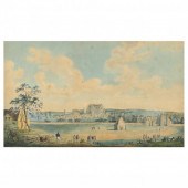 ANTIQUE ENGLISH SCHOOL VIEW OF
 LONDON Ink and watercolor on paper, mounted to support sheet with text beneath image, circa 1800 (Regency Period), retains gallery label to verso, in antique but later period frame.
ANTIQUE ENGLISH SCHOOL VIEW OF
ANTIQUE ENGLISH SCHOOL VIEW OF LONDON Ink and watercolor on paper, mounted to support sheet with text beneath image, circa 1800 (Regency Period), retains gallery label to verso, in antique but later period frame. -
 * British School (18th century) The
 City of Norwich from the South East Prospect oil on canvas 30 x 50 inches.
* British School (18th century) The
* British School (18th century) The City of Norwich from the South East Prospect oil on canvas 30 x 50 inches. -
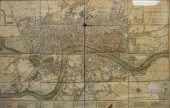 A NEW PLAN OF LONDON, WESTMINSTER
 AND SOUTHWARK, 1805, COLOR ENGRAVED MAP, UNKNOWN CARTOGRAPHER, FRAMED: 18 1/2 X 27 IN. (46.99 X 68.58 CM.)A New Plan of London, Westminster and Southwark, 1805, Color Engraved Map, Unknown Cartographer,, Dimensions: Framed: 18 1/2 x 27 in. (46.99 x 68.58 cm.)
A NEW PLAN OF LONDON, WESTMINSTER
A NEW PLAN OF LONDON, WESTMINSTER AND SOUTHWARK, 1805, COLOR ENGRAVED MAP, UNKNOWN CARTOGRAPHER, FRAMED: 18 1/2 X 27 IN. (46.99 X 68.58 CM.)A New Plan of London, Westminster and Southwark, 1805, Color Engraved Map, Unknown Cartographer,, Dimensions: Framed: 18 1/2 x 27 in. (46.99 x 68.58 cm.) -
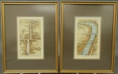 Two hand-colored maps of London
 c.1890 "The Thames" and "St. James Street". 8.5"x4.75" each
Two hand-colored maps of London
Two hand-colored maps of London c.1890 "The Thames" and "St. James Street". 8.5"x4.75" each -
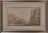 ENGLISH SCHOOL: LONDON STREET SCENE
 Watercolor on paper 11 1/8 x 18 in. (sight) signed Hanslip Fletcher and dated 1922.
ENGLISH SCHOOL: LONDON STREET SCENE
ENGLISH SCHOOL: LONDON STREET SCENE Watercolor on paper 11 1/8 x 18 in. (sight) signed Hanslip Fletcher and dated 1922. -
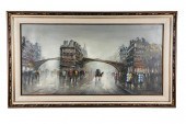 LONDON: OXFORD STREEToil on
 canvas unsigned titled in ink to verso "London: Oxford Street" Provenance: The Estate of Barron Hilton 24 x 48 inches sight; 32 x 56 inches frame Condition:
LONDON: OXFORD STREEToil on
LONDON: OXFORD STREEToil on canvas unsigned titled in ink to verso "London: Oxford Street" Provenance: The Estate of Barron Hilton 24 x 48 inches sight; 32 x 56 inches frame Condition: -
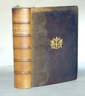 1 vol. The Great Chronicle of
 London. London, 1938. #24/500 printed on hand-made paper at The Sign of The Dolphin. Edited by A.H. Thomas & I.D. Thornley. 4to, orig. full brown morocco, gilt-armorial front cover, gilt-lettered spine, t.e.g., other edges untrimmed, raised bands; spine & edges fading, by Zaehnsdorf. With 10 facsimiles. Internally clean. Guildhall Library MS
1 vol. The Great Chronicle of
1 vol. The Great Chronicle of London. London, 1938. #24/500 printed on hand-made paper at The Sign of The Dolphin. Edited by A.H. Thomas & I.D. Thornley. 4to, orig. full brown morocco, gilt-armorial front cover, gilt-lettered spine, t.e.g., other edges untrimmed, raised bands; spine & edges fading, by Zaehnsdorf. With 10 facsimiles. Internally clean. Guildhall Library MS -
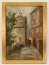 1909 IMPRESSIONIST LONDON STREET
 VIEW PAINTING EnglandDated 1909Depicts tall buildings lining a narrow road comprised of quick brush strokes and muted colors.
1909 IMPRESSIONIST LONDON STREET
1909 IMPRESSIONIST LONDON STREET VIEW PAINTING EnglandDated 1909Depicts tall buildings lining a narrow road comprised of quick brush strokes and muted colors. -
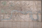 WYLD'S NEW PLAN OF LONDON AND
 WESTMINSTER WITH THE BOROUGH OF SOUTHWARK. 1838. UNFOLDED DIMENSIONS APPROXIMATELY 29 X 43 IN. (73.7 X 109.2 CM.)WYLD'S NEW PLAN OF LONDON AND WESTMINSTER WITH THE BOROUGH OF SOUTHWARK. 1838., [Maps and Atlases] Wyld [James]. New Plan of London and Westminster with the Borough of Southwark: Reduced from the Large Plan in 40 Sheets. 1838. Folding map backed on linen. Contemporary color. With the original rigid slip case with publisher's stamp. The map depicts the area from Regent's Park in the north west to Bethnal Green in the north east, Hyde Park and St. James' Park in the south west to the London docks in the south east. At bottom is a London's streets, courts, inn, theaters, squares, and public buildings, a statistical table noting London's population etc. Dimensions: Unfolded dimensions approximately 29 x 43 in. (73.7 x 109.2 cm.)
WYLD'S NEW PLAN OF LONDON AND
WYLD'S NEW PLAN OF LONDON AND WESTMINSTER WITH THE BOROUGH OF SOUTHWARK. 1838. UNFOLDED DIMENSIONS APPROXIMATELY 29 X 43 IN. (73.7 X 109.2 CM.)WYLD'S NEW PLAN OF LONDON AND WESTMINSTER WITH THE BOROUGH OF SOUTHWARK. 1838., [Maps and Atlases] Wyld [James]. New Plan of London and Westminster with the Borough of Southwark: Reduced from the Large Plan in 40 Sheets. 1838. Folding map backed on linen. Contemporary color. With the original rigid slip case with publisher's stamp. The map depicts the area from Regent's Park in the north west to Bethnal Green in the north east, Hyde Park and St. James' Park in the south west to the London docks in the south east. At bottom is a London's streets, courts, inn, theaters, squares, and public buildings, a statistical table noting London's population etc. Dimensions: Unfolded dimensions approximately 29 x 43 in. (73.7 x 109.2 cm.) -
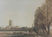 The City of Gloucester a coloured
 engraving and sundry pictures
The City of Gloucester a coloured
The City of Gloucester a coloured engraving and sundry pictures -
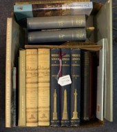 London and Cambridge, a
 collection of volumes to include Adcock, Wonderful London, 3 vols.
London and Cambridge, a
London and Cambridge, a collection of volumes to include Adcock, Wonderful London, 3 vols. -
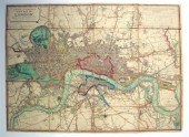 1 piece. Hand-Colored Engraved
 Map. Laurie, Robert; Whittle, James. "New Map of London, with Its Environs,... Including The Recent Improvements." London, 1813. 31 x 23 inches (788 x 584 mm), fold., linen-backed. Generally clean. In custom 1/2 blue morocco fall-down box.
1 piece. Hand-Colored Engraved
1 piece. Hand-Colored Engraved Map. Laurie, Robert; Whittle, James. "New Map of London, with Its Environs,... Including The Recent Improvements." London, 1813. 31 x 23 inches (788 x 584 mm), fold., linen-backed. Generally clean. In custom 1/2 blue morocco fall-down box. -
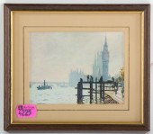 ARTIST UNKNOWN, 20TH C. VIEW OF
 LONDON, WATERCOLOR Watercolor on paper, unsigned, sight size: 3 1/2 x 4 3/4 in., framed.
ARTIST UNKNOWN, 20TH C. VIEW OF
ARTIST UNKNOWN, 20TH C. VIEW OF LONDON, WATERCOLOR Watercolor on paper, unsigned, sight size: 3 1/2 x 4 3/4 in., framed. -
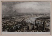 19th Century Engraving of London
 French, 19th century, Aspect Général De Londres, Vue Prise De L'Abbaye De Westminster, by A. Appert, after Chapuis, published by A. Chardon, Paris, circa 1857, panoramic view of London along the Thames River, hand-colored aquatint engraving, 20-1/2 x 32-5/8 in. (image); modern painted wood and composition frame,
19th Century Engraving of London
19th Century Engraving of London French, 19th century, Aspect Général De Londres, Vue Prise De L'Abbaye De Westminster, by A. Appert, after Chapuis, published by A. Chardon, Paris, circa 1857, panoramic view of London along the Thames River, hand-colored aquatint engraving, 20-1/2 x 32-5/8 in. (image); modern painted wood and composition frame, -
 "LONDON, ONTARIO" BY ERIC ATKINSON.
 Canada (b. 1928). Oil on canvas, signed, titled and dated 1988. Modernist landscape. 36.25"h. 50"w., strip frame, 36.75"h. 50.5"w.
"LONDON, ONTARIO" BY ERIC ATKINSON.
"LONDON, ONTARIO" BY ERIC ATKINSON. Canada (b. 1928). Oil on canvas, signed, titled and dated 1988. Modernist landscape. 36.25"h. 50"w., strip frame, 36.75"h. 50.5"w. -
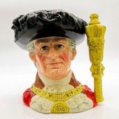 LORD MAYOR OF LONDON D6864 -
 LARGE - ROYAL DOULTON CHAR...Black plume hat, red cloak, yellow chain of office. Condition: Good
LORD MAYOR OF LONDON D6864 -
LORD MAYOR OF LONDON D6864 - LARGE - ROYAL DOULTON CHAR...Black plume hat, red cloak, yellow chain of office. Condition: Good -
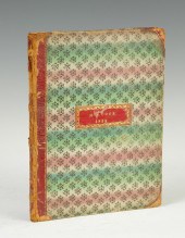 ''Metropolitan Improvements or
 London in the Late 19th Cent'' by James Elms Architect Illustrated by Mr. Thos. H. Shepherd. M.A. Cook 1833.E
''Metropolitan Improvements or
''Metropolitan Improvements or London in the Late 19th Cent'' by James Elms Architect Illustrated by Mr. Thos. H. Shepherd. M.A. Cook 1833.E -
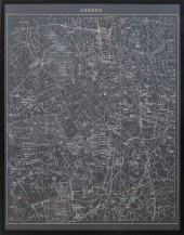 LARGE LONDON MAP BLACK & WHITE
 POSTER Large black and white poster depicting an older map of London city, housed in an ebonized wood frame. Image: 53.5" H x 41.5" W; frame: 55.5" H x 43.5" W.
LARGE LONDON MAP BLACK & WHITE
LARGE LONDON MAP BLACK & WHITE POSTER Large black and white poster depicting an older map of London city, housed in an ebonized wood frame. Image: 53.5" H x 41.5" W; frame: 55.5" H x 43.5" W. -
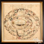 PANORAMA OF LONDON OR A DAY'S
 JOURNEY ROUNDPanorama of London or A Day's Journey Round the Metropolis , ca. 1809 , denoted an amusing and instructive game, John Harris (1756-1846), hand colored aquatint, scarce early board game that takes players on a tour of Georgian London, professionally framed in a deep shadow box frame, 25" x 25". Condition: Game show some expected age wear. A few small areas of paper loss, but overall very good condition.
PANORAMA OF LONDON OR A DAY'S
PANORAMA OF LONDON OR A DAY'S JOURNEY ROUNDPanorama of London or A Day's Journey Round the Metropolis , ca. 1809 , denoted an amusing and instructive game, John Harris (1756-1846), hand colored aquatint, scarce early board game that takes players on a tour of Georgian London, professionally framed in a deep shadow box frame, 25" x 25". Condition: Game show some expected age wear. A few small areas of paper loss, but overall very good condition. -
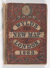 Wyld's New Map of London. 1863
 Wyld's New Map of London 1863.? London: James Wyld 1863.? 4 x 6 in. closed 37.75 x 21.75 open.? Hand-colored.? Condition: Cover worn at edges front cover separated at spine.? Light toning and soiling of map mostly in margins and along folds.
Wyld's New Map of London. 1863
Wyld's New Map of London. 1863 Wyld's New Map of London 1863.? London: James Wyld 1863.? 4 x 6 in. closed 37.75 x 21.75 open.? Hand-colored.? Condition: Cover worn at edges front cover separated at spine.? Light toning and soiling of map mostly in margins and along folds. -
 LONDON AND TOLEDO, TWO COLORED
 MAPSLondon and Toledo, Two Colored Maps
LONDON AND TOLEDO, TWO COLORED
LONDON AND TOLEDO, TWO COLORED MAPSLondon and Toledo, Two Colored Maps -
 Two hand-colored maps of London and
 "View of St. James Gate" all mounted in a walnut frame with overall size of 28"h.x61"l.
Two hand-colored maps of London and
Two hand-colored maps of London and "View of St. James Gate" all mounted in a walnut frame with overall size of 28"h.x61"l. -
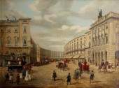 E Pegrum (act. 19th
 Century)/London, a view of Regents Street/signed lower left E J Pegrum and inscribed lower right Regent Street, London/oil on canvas, 91.5cm x 122cm
E Pegrum (act. 19th
E Pegrum (act. 19th Century)/London, a view of Regents Street/signed lower left E J Pegrum and inscribed lower right Regent Street, London/oil on canvas, 91.5cm x 122cm
...many more examples with full details are available to our members - Learn more


