Pricing Guides & Dictionary of Makers Marks for Antiques & Collectibles

A few examples of appraisal values for
HISTORIC AMERICA NEW YORK
Search our price guide for your own treasures
-
 18th century engraving, New York,
 "The South Prospect of the City of New York, in North America", panoramic view by William Burgis, from The London Magazine , August 1761, uncolored, on laid paper, 7-1/2 x 21-1/4 in. (sight); modern wood frame. Folds and creases, light toning, fading, ghost images in water and sky, possible restorations, not examined out of frame; frame with abrasions. The Old Print Shop, New York, 1973
18th century engraving, New York,
18th century engraving, New York, "The South Prospect of the City of New York, in North America", panoramic view by William Burgis, from The London Magazine , August 1761, uncolored, on laid paper, 7-1/2 x 21-1/4 in. (sight); modern wood frame. Folds and creases, light toning, fading, ghost images in water and sky, possible restorations, not examined out of frame; frame with abrasions. The Old Print Shop, New York, 1973 -
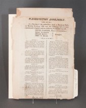 [Americana New York] Group of 10
 items relating to the erection of a statue to George Washington in New York 1822 Descended in family of Philip Hone a major promoter of the project including: Richard Varick ex-mayor of New York ALS to P. Hone March 9 1822 declining to participate; DeWitt Clinton governor of New York ALS to John Pinkard Albany Nov. 22 1822 conveying a letter from Italy regarding the logistics and the costs of the statue; and other items Estimate $ 150-250
[Americana New York] Group of 10
[Americana New York] Group of 10 items relating to the erection of a statue to George Washington in New York 1822 Descended in family of Philip Hone a major promoter of the project including: Richard Varick ex-mayor of New York ALS to P. Hone March 9 1822 declining to participate; DeWitt Clinton governor of New York ALS to John Pinkard Albany Nov. 22 1822 conveying a letter from Italy regarding the logistics and the costs of the statue; and other items Estimate $ 150-250 -
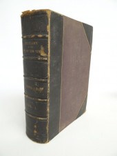 Dated 1877 book ''History Of The
 City Of New York''.
Dated 1877 book ''History Of The
Dated 1877 book ''History Of The City Of New York''. -
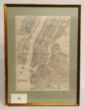 Early New York City map. Sight 23''
 x 16 1/2''.
Early New York City map. Sight 23''
Early New York City map. Sight 23'' x 16 1/2''. -
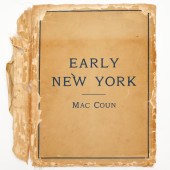 EARLY NEW YORK, MACCOUN, (3)
 MAPS, 1909 Townsend MacCoun, Early New York. (3) color maps (of 5 called for) in a paper covered linen folder, printed by L. L. Poates, "New Amsterdam 1653-1664" and "New York 1730", each 24"h x 17"w, and "1783 Manhattan Island at the Close of the Revolution", 16.25"h x 51.5"w
EARLY NEW YORK, MACCOUN, (3)
EARLY NEW YORK, MACCOUN, (3) MAPS, 1909 Townsend MacCoun, Early New York. (3) color maps (of 5 called for) in a paper covered linen folder, printed by L. L. Poates, "New Amsterdam 1653-1664" and "New York 1730", each 24"h x 17"w, and "1783 Manhattan Island at the Close of the Revolution", 16.25"h x 51.5"w -
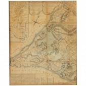 1850S RE-CREATION OF 18TH CENTURY
 MAP SHOWING LOWER MANHATTAN Montresor, John. A Plan of the City of New York & its Environs...To the Hon'ble Tho's. Gage, Esq. Major General and Commander in Chief of his Majesty's Forces in North America... (New York: D. T. Valentine, 1855), the urban tip of late colonial Manhattan soon gives way to a rural landscape about where Chinatown is today.
1850S RE-CREATION OF 18TH CENTURY
1850S RE-CREATION OF 18TH CENTURY MAP SHOWING LOWER MANHATTAN Montresor, John. A Plan of the City of New York & its Environs...To the Hon'ble Tho's. Gage, Esq. Major General and Commander in Chief of his Majesty's Forces in North America... (New York: D. T. Valentine, 1855), the urban tip of late colonial Manhattan soon gives way to a rural landscape about where Chinatown is today. -
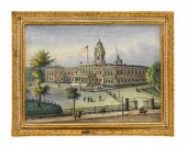 American School 19th century
 miniature portrait of city hall, new york Signed "J. Fritsch" lower left, watercolor on ivory, framed. literature: F.J. Fritsch is listed in The New York Historical Society's Dictionary of Artists in America (1564-1860), Groce, George C. and Wallace, David H., 1957, Yale University Press, Pg. 244, as "Lithographer, especially of military prints, working in NYC 1843-44." Sight size: 3 7/8 x 5 7/8 in. Some very minor scuffs to sky area
American School 19th century
American School 19th century miniature portrait of city hall, new york Signed "J. Fritsch" lower left, watercolor on ivory, framed. literature: F.J. Fritsch is listed in The New York Historical Society's Dictionary of Artists in America (1564-1860), Groce, George C. and Wallace, David H., 1957, Yale University Press, Pg. 244, as "Lithographer, especially of military prints, working in NYC 1843-44." Sight size: 3 7/8 x 5 7/8 in. Some very minor scuffs to sky area -
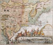 1730 ORIGINAL SEUTTER MAP NEW
 ENGLAND, NYOriginal 1730 hand-colored map in Latin and Dutch "Recens edita totius Novi Belgii in America Septentrionali," by Matthew Sutter (German), illustrating the north-eastern region of what is now the United States and a small part of Canada showing some towns and some poor cartography. A cartouche to the left of the title shows native Americans and gods bringing gifts to the King of England. Underneath the cartouche is a bird's-eye view of New York City ("Neu Jorck five Neu Amsterdam"). Dotted lines delineate some state boundaries. Scattered across the map are named locations of many Indian Tribes, some easily translated (Irocois= Iroquois, Mahikans= Mohicans, Sennecaas=Senecas.) Others are more mysterious: "Sequins, Minquaas, Tockwokhs, Kuscarawaoks,Conitttekocks." There exist current reproductions of this map, but of different size and garishly colored. The map has a band of southern Canada at top, and ends near the Virginia border at the bottom. It is 25-1/2" x 20-1/2" paper size with 21-3/4" x 18-3/4" image size. Unframed. Image shows plate edge depression in paper around perimeter. This is apparently the second state map missing the words "Chalcographie Augustani" at the bottom of the title with that area shaded in with vertical lines. Excellent condition, no foxing. The very edge of the paper shows some age darkening, otherwise it is evenly off-white. The map must have been folded into quarters; fold marks still show, but none are separating and they are barely visible. Hand coloring quite good. shipping info This item will need to be shipped by a packing company of your choice. We maintain a list of reliable shippers, or you may choose your own.
1730 ORIGINAL SEUTTER MAP NEW
1730 ORIGINAL SEUTTER MAP NEW ENGLAND, NYOriginal 1730 hand-colored map in Latin and Dutch "Recens edita totius Novi Belgii in America Septentrionali," by Matthew Sutter (German), illustrating the north-eastern region of what is now the United States and a small part of Canada showing some towns and some poor cartography. A cartouche to the left of the title shows native Americans and gods bringing gifts to the King of England. Underneath the cartouche is a bird's-eye view of New York City ("Neu Jorck five Neu Amsterdam"). Dotted lines delineate some state boundaries. Scattered across the map are named locations of many Indian Tribes, some easily translated (Irocois= Iroquois, Mahikans= Mohicans, Sennecaas=Senecas.) Others are more mysterious: "Sequins, Minquaas, Tockwokhs, Kuscarawaoks,Conitttekocks." There exist current reproductions of this map, but of different size and garishly colored. The map has a band of southern Canada at top, and ends near the Virginia border at the bottom. It is 25-1/2" x 20-1/2" paper size with 21-3/4" x 18-3/4" image size. Unframed. Image shows plate edge depression in paper around perimeter. This is apparently the second state map missing the words "Chalcographie Augustani" at the bottom of the title with that area shaded in with vertical lines. Excellent condition, no foxing. The very edge of the paper shows some age darkening, otherwise it is evenly off-white. The map must have been folded into quarters; fold marks still show, but none are separating and they are barely visible. Hand coloring quite good. shipping info This item will need to be shipped by a packing company of your choice. We maintain a list of reliable shippers, or you may choose your own. -
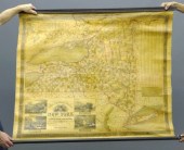 Dated 1845 roll out map ''The
 Empire State New York.....Published by Augustus Mitchell....Philadelphia''. 50'' x 40''.
Dated 1845 roll out map ''The
Dated 1845 roll out map ''The Empire State New York.....Published by Augustus Mitchell....Philadelphia''. 50'' x 40''. -
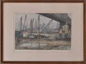 AMERICAN SCHOOL: NEW YORK HARBOR
 SCENE Etching in color 11 1/4 x 16 3/4 in. (plate) titled and dated 1935 in the plate signed in pencil illegibly.
AMERICAN SCHOOL: NEW YORK HARBOR
AMERICAN SCHOOL: NEW YORK HARBOR SCENE Etching in color 11 1/4 x 16 3/4 in. (plate) titled and dated 1935 in the plate signed in pencil illegibly. -
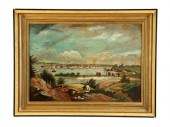 NEW YORK FROM HEIGHTS NEAR BROOKLYN
 AFTER WILLIAM GUY WALL (IRELAND/NEW YORK 1792-AFTER 1864). Oil on canvas unsigned. Landscape with view of Manhattan. Interesting and detailed scene with two gentlemen in the foreground ship in harbor with American flag colonial buildings with church spires and a windmill. 19''h. 27''w. in a gilt frame 24 3/4''h. 32 3/4''w. Ex Jerome Sackheim (California) sold at Garth's April 10 and 11 1981 auction. This view is likely based on John Hill's 1823 aquatint which was based on Wall's painting. Lined several repairs (2 on right 1 lower-center at the figures 1 left at the boat with the US flat more in the sky) some inpainting needs cleaned.
NEW YORK FROM HEIGHTS NEAR BROOKLYN
NEW YORK FROM HEIGHTS NEAR BROOKLYN AFTER WILLIAM GUY WALL (IRELAND/NEW YORK 1792-AFTER 1864). Oil on canvas unsigned. Landscape with view of Manhattan. Interesting and detailed scene with two gentlemen in the foreground ship in harbor with American flag colonial buildings with church spires and a windmill. 19''h. 27''w. in a gilt frame 24 3/4''h. 32 3/4''w. Ex Jerome Sackheim (California) sold at Garth's April 10 and 11 1981 auction. This view is likely based on John Hill's 1823 aquatint which was based on Wall's painting. Lined several repairs (2 on right 1 lower-center at the figures 1 left at the boat with the US flat more in the sky) some inpainting needs cleaned. -
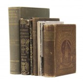 * (AMERICANA NORTHEAST) A group
 of six works. King's Handbook of New York City. Boston: Moses King 1893. Historical Collections of New Jersey. By John Barber. Newark: Justus H. Bradley (1844). The History of Braintree Vermont. By H. Royce Bass. Rutland VT: Tuttle 1883. Brooklyn Flatbush Bushwick Flatlands New Utrecht and Gravesend. New York: The Brooklyn Eagle n.d. Annals of the Town of Keene. By Salma Hale. Keene: J.W. Prentiss 1851. Kegley's Virginia Frontier. By F.B. Kegley. Virginia: Southwest Virginia Historical Society 1938.
* (AMERICANA NORTHEAST) A group
* (AMERICANA NORTHEAST) A group of six works. King's Handbook of New York City. Boston: Moses King 1893. Historical Collections of New Jersey. By John Barber. Newark: Justus H. Bradley (1844). The History of Braintree Vermont. By H. Royce Bass. Rutland VT: Tuttle 1883. Brooklyn Flatbush Bushwick Flatlands New Utrecht and Gravesend. New York: The Brooklyn Eagle n.d. Annals of the Town of Keene. By Salma Hale. Keene: J.W. Prentiss 1851. Kegley's Virginia Frontier. By F.B. Kegley. Virginia: Southwest Virginia Historical Society 1938. -
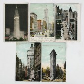 Lot of 45+ postcards from New York,
 most 1905-1915. Views include mostly famous Manhattan landmarks; also included: Ellis Island, Brooklyn, Riverside Dr., Hudson River, Niagara Falls, Albany, Buffalo, Columbia U. Most postmarked.
Lot of 45+ postcards from New York,
Lot of 45+ postcards from New York, most 1905-1915. Views include mostly famous Manhattan landmarks; also included: Ellis Island, Brooklyn, Riverside Dr., Hudson River, Niagara Falls, Albany, Buffalo, Columbia U. Most postmarked. -
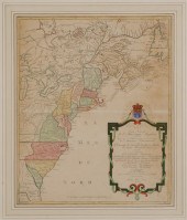 Map of Colonial America Carte
 Nouvelle de L'Amerique Angloise… by Matthieu Albert Lotter, Augsburg, circa 1776, from Lotter's Atlas Geographique, showing the Atlantic seaboard from Canada to Florida with the 13 original colonies filled in and outlined in hand color, on wove paper, 23-3/4 x 19-1/4 in. (sight), modern wood frame,
Map of Colonial America Carte
Map of Colonial America Carte Nouvelle de L'Amerique Angloise… by Matthieu Albert Lotter, Augsburg, circa 1776, from Lotter's Atlas Geographique, showing the Atlantic seaboard from Canada to Florida with the 13 original colonies filled in and outlined in hand color, on wove paper, 23-3/4 x 19-1/4 in. (sight), modern wood frame, -
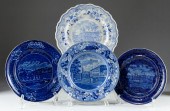 Four New York Historical Transfer
 Platesincluding: ''Park Theater New York'' R. Stephenson & Williams circa 1825 (10 in.); ''City Hall New York '' Jacksons Warranted Ref. Godden p.349 circa 1831 (small chips to underside) (10.5 in.); ''Battle of Plattsburg '' E. Woods & Sons Burslem the lower portion inscribed ''Commodore Mac Donnouche Victory'' (some loss to glaze on raised rim) (9.25 in.); ''Landing of Gen. Lafayette At Castle Garden New York 16th August 1824 '' stamped ''Staffordshire Clews Warranted'' (10 in.).Property of a Charleston SC Collection
Four New York Historical Transfer
Four New York Historical Transfer Platesincluding: ''Park Theater New York'' R. Stephenson & Williams circa 1825 (10 in.); ''City Hall New York '' Jacksons Warranted Ref. Godden p.349 circa 1831 (small chips to underside) (10.5 in.); ''Battle of Plattsburg '' E. Woods & Sons Burslem the lower portion inscribed ''Commodore Mac Donnouche Victory'' (some loss to glaze on raised rim) (9.25 in.); ''Landing of Gen. Lafayette At Castle Garden New York 16th August 1824 '' stamped ''Staffordshire Clews Warranted'' (10 in.).Property of a Charleston SC Collection -
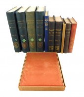 BOOKS: ELEVEN VOLUMES ON NEW YORK
 THEMES, DETAILS INCLUDE SQUIER "ANTIQUITIES OF THE STATE OF NEW YORK" 1851, TWO COPIES; ALONG WITH SAWYER "HISTORY OF CHERRY VALLEY, 1898; O'CALLAGHAN "DOCUMENTARY HISTORY OF THE STAT...BOOKS: Eleven volumes on New York themes, details include Squier "Antiquities of the state of New York" 1851, two copies; along with Sawyer "History of Cherry Valley, 1898; O'Callaghan "Documentary History of the state of New York , four volumes, 1851; Smith "Springs and Wells of Manhattan and the Bronx, 1938; Simms, "Frontiersmen of NY" two volumes, 1882; and lastly "Indian life of a long ago in the city of New York, 1934, limited edition.
BOOKS: ELEVEN VOLUMES ON NEW YORK
BOOKS: ELEVEN VOLUMES ON NEW YORK THEMES, DETAILS INCLUDE SQUIER "ANTIQUITIES OF THE STATE OF NEW YORK" 1851, TWO COPIES; ALONG WITH SAWYER "HISTORY OF CHERRY VALLEY, 1898; O'CALLAGHAN "DOCUMENTARY HISTORY OF THE STAT...BOOKS: Eleven volumes on New York themes, details include Squier "Antiquities of the state of New York" 1851, two copies; along with Sawyer "History of Cherry Valley, 1898; O'Callaghan "Documentary History of the state of New York , four volumes, 1851; Smith "Springs and Wells of Manhattan and the Bronx, 1938; Simms, "Frontiersmen of NY" two volumes, 1882; and lastly "Indian life of a long ago in the city of New York, 1934, limited edition. -
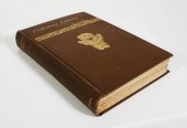 1895 PREHISTORIC AMERICA, GREAT
 ILLUSTRATIONS
1895 PREHISTORIC AMERICA, GREAT
1895 PREHISTORIC AMERICA, GREAT ILLUSTRATIONS -
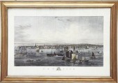 View of New York by Charles Mottram
 handcolored engraving of New York engraved by Charles Mottram (1807-1876) after John William Hill (1812-1879) and published 1855 by Smith Bros. New York ; contained within frame image size: H28'' W50'' Provenance: Charlotte North Carolina private collection. Appears to be in good original condition not examined out of frame.
View of New York by Charles Mottram
View of New York by Charles Mottram handcolored engraving of New York engraved by Charles Mottram (1807-1876) after John William Hill (1812-1879) and published 1855 by Smith Bros. New York ; contained within frame image size: H28'' W50'' Provenance: Charlotte North Carolina private collection. Appears to be in good original condition not examined out of frame. -
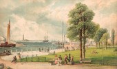 AMERICAN NEW YORK CITY HARBOR
 LITHOGRAPH. Late 19th century. View from Castle Garden with people promenading and background with ships and Statue of Liberty. Original by Andrew Melrose. Some toning. 25"h. 39"w.
AMERICAN NEW YORK CITY HARBOR
AMERICAN NEW YORK CITY HARBOR LITHOGRAPH. Late 19th century. View from Castle Garden with people promenading and background with ships and Statue of Liberty. Original by Andrew Melrose. Some toning. 25"h. 39"w. -
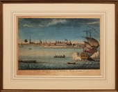 [EARLY NEW YORK VIEW][Early New
 York View], after William Burgis (active 1722-1736), "Fort George with the City of New York from the SW.", c. 1794, hand-colored engraving by John Carwitham, published by Carington Bowles, London, watermark "EDMEADS & PINE" with Strasburg lily over 1794, image 11 1/4 in. x 17 3/8 in., sheet 16 in. x 21 in., framed, overall 25 1/4 in. x 20 in. x 5/8 in.
[EARLY NEW YORK VIEW][Early New
[EARLY NEW YORK VIEW][Early New York View], after William Burgis (active 1722-1736), "Fort George with the City of New York from the SW.", c. 1794, hand-colored engraving by John Carwitham, published by Carington Bowles, London, watermark "EDMEADS & PINE" with Strasburg lily over 1794, image 11 1/4 in. x 17 3/8 in., sheet 16 in. x 21 in., framed, overall 25 1/4 in. x 20 in. x 5/8 in. -
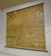 19th c. rolled map of N.Y.S.
 dated 1860. 74'' x 69''.
19th c. rolled map of N.Y.S.
19th c. rolled map of N.Y.S. dated 1860. 74'' x 69''. -
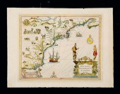 Map of America after Joannis
 Janssonius Amsterdam circa 1630 NOVA ANGLIA NOVVM BELGIUM ET VIRGINIA (Nova Scotia to Virginia) colored engraving framed paper size: H18'' W24'' Back   Inquiry    Previous Item  Next Item © Charlton Hall Auctions. Images descriptions and condition reports used on this site are original copyright material and are not to be reproduced without permission. For further information telephone 803.779.5678   © 2012 CHARLTON HALL GALLERIES INC.
Map of America after Joannis
Map of America after Joannis Janssonius Amsterdam circa 1630 NOVA ANGLIA NOVVM BELGIUM ET VIRGINIA (Nova Scotia to Virginia) colored engraving framed paper size: H18'' W24'' Back   Inquiry    Previous Item  Next Item © Charlton Hall Auctions. Images descriptions and condition reports used on this site are original copyright material and are not to be reproduced without permission. For further information telephone 803.779.5678   © 2012 CHARLTON HALL GALLERIES INC. -
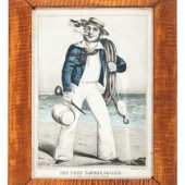 New York, Mid 19th Century A Sarony
 & Major Hand-Colored Lithograph, "The True Yankee Sailor"
New York, Mid 19th Century A Sarony
New York, Mid 19th Century A Sarony & Major Hand-Colored Lithograph, "The True Yankee Sailor" -
 (VIEW) NEW YORK AND NEW JERSEY: 138
 POSTCARDS EARLY TO LATE-20TH CENTURY(VIEW) NEW YORK AND NEW JERSEY: 138 POSTCARDS, Early to Late-20th Century, NY (122 cards): real photo steamer "Adirondack" with passengers and YWCA parade float with flags and signage urging "the vote". Also: ice boating on the Hudson, Race Rock Light at Fisher's Island, Radio City Music Hall cards, aerial view of Times Square, '07 "Making The Monkey Laugh" in Central Park, four-fold of "Barracks, Fort Slocum", Tuck of Rochester, Kropp of Palais D'Or, linen of "Sunrise Village" with good advertising, Max Ettlinger card of the Statue of Liberty, 12 duplicates of George Annand map card and 20 chromes. Together with 16 NJ cards, seven of which are chromes. Provenance: A private New Bedford, Massachusetts collection.
(VIEW) NEW YORK AND NEW JERSEY: 138
(VIEW) NEW YORK AND NEW JERSEY: 138 POSTCARDS EARLY TO LATE-20TH CENTURY(VIEW) NEW YORK AND NEW JERSEY: 138 POSTCARDS, Early to Late-20th Century, NY (122 cards): real photo steamer "Adirondack" with passengers and YWCA parade float with flags and signage urging "the vote". Also: ice boating on the Hudson, Race Rock Light at Fisher's Island, Radio City Music Hall cards, aerial view of Times Square, '07 "Making The Monkey Laugh" in Central Park, four-fold of "Barracks, Fort Slocum", Tuck of Rochester, Kropp of Palais D'Or, linen of "Sunrise Village" with good advertising, Max Ettlinger card of the Statue of Liberty, 12 duplicates of George Annand map card and 20 chromes. Together with 16 NJ cards, seven of which are chromes. Provenance: A private New Bedford, Massachusetts collection. -
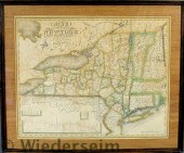 Hand-colored map of New York by
 David H. Burr Engd. By Rawdon Clark & Co. Albany & Rawdon Wright & Co. New York. 20"x25"
Hand-colored map of New York by
Hand-colored map of New York by David H. Burr Engd. By Rawdon Clark & Co. Albany & Rawdon Wright & Co. New York. 20"x25" -
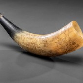 An American Engraved Powder Horn
 18th Century initialed J.S. and dated 1775. depicting cities and forts of New York State, including Albany, Saratoga, Ticondroga, and Skenectedy [sic]. Length 12 inches.
An American Engraved Powder Horn
An American Engraved Powder Horn 18th Century initialed J.S. and dated 1775. depicting cities and forts of New York State, including Albany, Saratoga, Ticondroga, and Skenectedy [sic]. Length 12 inches. -
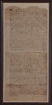 TWO COLONIAL AMERICAN INDENTURES
 - BOTH GERMANTOWN COLUMBIA COUNTY NEW YORK Circa 1750. Framed.
TWO COLONIAL AMERICAN INDENTURES
TWO COLONIAL AMERICAN INDENTURES - BOTH GERMANTOWN COLUMBIA COUNTY NEW YORK Circa 1750. Framed. -
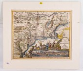 RESTRIKE ANTIQUE MAP "NOVI
 BELGII" Depicting New England, with a view of New Amsterdam, after M. Seutter; engraving, plate size: 19 x 22 3/4 in., unframed.
RESTRIKE ANTIQUE MAP "NOVI
RESTRIKE ANTIQUE MAP "NOVI BELGII" Depicting New England, with a view of New Amsterdam, after M. Seutter; engraving, plate size: 19 x 22 3/4 in., unframed. -
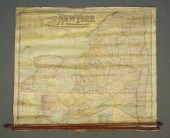 Early ''Scarborough's New York''
 roll-up map. As found. 42'' x 48''.
Early ''Scarborough's New York''
Early ''Scarborough's New York'' roll-up map. As found. 42'' x 48''. -
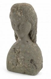 New York State carved bluestone
 bust of a woman mid 19th c. 13" h. 7" w. ?
New York State carved bluestone
New York State carved bluestone bust of a woman mid 19th c. 13" h. 7" w. ? -
 STOKES I.N. & DANIEL HASKELL.
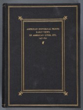
 "AMERICAN HISTORICAL PRINTS - EARLY VIEWS OF AMERICAN CITIES ETC." New York NY Public Library 1932. Thick 4TO. Reproductions of early prints and maps. Black gilt ruled cloth; fine copy in the original box.
STOKES I.N. & DANIEL HASKELL.
STOKES I.N. & DANIEL HASKELL. "AMERICAN HISTORICAL PRINTS - EARLY VIEWS OF AMERICAN CITIES ETC." New York NY Public Library 1932. Thick 4TO. Reproductions of early prints and maps. Black gilt ruled cloth; fine copy in the original box. -
 18th century map, eastern United
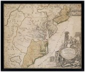
 States, "Virginia Marylandia et Carolina, in America Septentrionali, Brittanorum industria exclutae…" by Johann Baptist Homann, originally published in Homann's Atlas Novus , Nuremberg, Germany, 1714, showing New York southward to the Carolinas, fictional "Apalache Lacus" pictured lower left, ornate title cartouche lower right showing British merchants with trade goods, Native Americans, wild animals, tobacco and drying shed, hand-colored engraving on laid paper, 19-3/4 x 23 in. (page); modern wood frame. Laid down on acidic card, foxing, toning, stains, fading, trimmed including plate marks, ink inscriptions in title cartouche, other pencil and ink inscriptions; frame with abrasions. Estate of the Late Nathan and Mary Anne McCarley, Asheville, North Carolina.
18th century map, eastern United
18th century map, eastern United States, "Virginia Marylandia et Carolina, in America Septentrionali, Brittanorum industria exclutae…" by Johann Baptist Homann, originally published in Homann's Atlas Novus , Nuremberg, Germany, 1714, showing New York southward to the Carolinas, fictional "Apalache Lacus" pictured lower left, ornate title cartouche lower right showing British merchants with trade goods, Native Americans, wild animals, tobacco and drying shed, hand-colored engraving on laid paper, 19-3/4 x 23 in. (page); modern wood frame. Laid down on acidic card, foxing, toning, stains, fading, trimmed including plate marks, ink inscriptions in title cartouche, other pencil and ink inscriptions; frame with abrasions. Estate of the Late Nathan and Mary Anne McCarley, Asheville, North Carolina. -
 Map of states of N.Y. New Hampshire
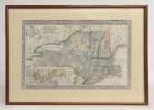
 Vermont Massachusetts Rhode Island And Connecticut. Sight 13 1/2'' x 21''.
Map of states of N.Y. New Hampshire
Map of states of N.Y. New Hampshire Vermont Massachusetts Rhode Island And Connecticut. Sight 13 1/2'' x 21''. -
 3 vols. Americana - History,
 Description & Travel - 19th-Century Imprints: Roux de Rochelle (Jean B.G.). Etats-Unis D'Amerique. Paris: Didot Freres, 1838. 8 vo, contemp. calf-backed marbled bds.; rubbed & worn. With fold. map + 96 plates (views, portraits, plans). Light to moderate foxing, occasional staining. Moderate foxing to fold. map. Howes R-473; Sabin 73516. * Both, Mary L. History of The City of New York. New York: W.R.C. Clark, 1867. Revised ed. 2 vols. 8vo, contemp. sheep; rubbed & worn, rebacked with modern cloth. Frontispieces, wood-engraved illus. Frontispieces & title pages sprung. Internally generally clean. Sabin.
3 vols. Americana - History,
3 vols. Americana - History, Description & Travel - 19th-Century Imprints: Roux de Rochelle (Jean B.G.). Etats-Unis D'Amerique. Paris: Didot Freres, 1838. 8 vo, contemp. calf-backed marbled bds.; rubbed & worn. With fold. map + 96 plates (views, portraits, plans). Light to moderate foxing, occasional staining. Moderate foxing to fold. map. Howes R-473; Sabin 73516. * Both, Mary L. History of The City of New York. New York: W.R.C. Clark, 1867. Revised ed. 2 vols. 8vo, contemp. sheep; rubbed & worn, rebacked with modern cloth. Frontispieces, wood-engraved illus. Frontispieces & title pages sprung. Internally generally clean. Sabin. -
 After F.O.C. Darley A. H. Ritchie
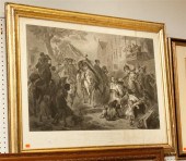
 engraver ''Triumph of Patriotism Washington entering New York ... 1783'' (Ritchie & Co. New York 1858) engraving 28 x 37 3/4 in. framed Estimate $ 100-200 Tide marks and toning in lower margin.
After F.O.C. Darley A. H. Ritchie
After F.O.C. Darley A. H. Ritchie engraver ''Triumph of Patriotism Washington entering New York ... 1783'' (Ritchie & Co. New York 1858) engraving 28 x 37 3/4 in. framed Estimate $ 100-200 Tide marks and toning in lower margin. -
 (VIEW) NEW ENGLAND, NEW JERSEY
 AND NEW YORK: 303 POSTCARDS EARLY TO-MID 20TH CENTURY(VIEW) NEW ENGLAND, NEW JERSEY AND NEW YORK: 303 POSTCARDS, Early to-Mid 20th Century, 11 Vermont, 80 New Hampshire, 70 Maine, 45 Connecticut, 13 New Jersey, 2 Rhode Island and 97 New York. Early: Albany railroad depot, two Volland views of NYC, "Little And Great Diamond Island From Scammel House Island", Port Clyde view, Portland views, Lake Sunapee, Hampton Beach, Keene, White Mountains, Bristol Village and Pemigewasset River from Sugar Hill, Vermont, and more.
(VIEW) NEW ENGLAND, NEW JERSEY
(VIEW) NEW ENGLAND, NEW JERSEY AND NEW YORK: 303 POSTCARDS EARLY TO-MID 20TH CENTURY(VIEW) NEW ENGLAND, NEW JERSEY AND NEW YORK: 303 POSTCARDS, Early to-Mid 20th Century, 11 Vermont, 80 New Hampshire, 70 Maine, 45 Connecticut, 13 New Jersey, 2 Rhode Island and 97 New York. Early: Albany railroad depot, two Volland views of NYC, "Little And Great Diamond Island From Scammel House Island", Port Clyde view, Portland views, Lake Sunapee, Hampton Beach, Keene, White Mountains, Bristol Village and Pemigewasset River from Sugar Hill, Vermont, and more.
...many more examples with full details are available to our members - Learn more


