Pricing Guides & Dictionary of Makers Marks for Antiques & Collectibles

A few examples of appraisal values for
JAPANESE CHEST
Search our price guide for your own treasures
-
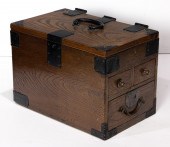 JAPANESE CHEST Japanese chest.
 8.75"h x 8"w x 12.25"d.
JAPANESE CHEST Japanese chest.
JAPANESE CHEST Japanese chest. 8.75"h x 8"w x 12.25"d. -
 JAPANESE CHEST-ON-CHEST ISHO
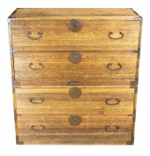
 TANSU Japanese chest-on-chest isho tansu, featuring a set of four drawers and carved copper hardware and fittings, 41"h x 37"w x 16.5"d.
JAPANESE CHEST-ON-CHEST ISHO
JAPANESE CHEST-ON-CHEST ISHO TANSU Japanese chest-on-chest isho tansu, featuring a set of four drawers and carved copper hardware and fittings, 41"h x 37"w x 16.5"d. -
 JAPANESE WOOD & BRONZE
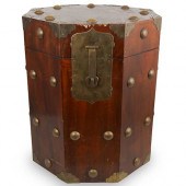
 CHESTDESCRIPTION: A Japanese chest composed of an octagonal wood foundation, embellished with bronze hardware and swiveling handles. Interior is lined with Japanese writing on paper. CIRCA: Late 19th-Early 20th Ct. ORIGIN: Japan DIMENSIONS: H:22.25" L: 18 1/8" CONDITION: Good condition, slight scratches and chipping. See lot description for details on item condition. More detailed condition requests can be obtained via email (info@akibaantiques.com) or SMS (305) 332-9274. Any condition statement given, as a courtesy to a client, is only an opinion and should not be treated as a statement of fact. Akiba Antiques shall have no responsibility for any error or omission.
JAPANESE WOOD & BRONZE
JAPANESE WOOD & BRONZE CHESTDESCRIPTION: A Japanese chest composed of an octagonal wood foundation, embellished with bronze hardware and swiveling handles. Interior is lined with Japanese writing on paper. CIRCA: Late 19th-Early 20th Ct. ORIGIN: Japan DIMENSIONS: H:22.25" L: 18 1/8" CONDITION: Good condition, slight scratches and chipping. See lot description for details on item condition. More detailed condition requests can be obtained via email (info@akibaantiques.com) or SMS (305) 332-9274. Any condition statement given, as a courtesy to a client, is only an opinion and should not be treated as a statement of fact. Akiba Antiques shall have no responsibility for any error or omission. -
 JAPANESE LACQUER & CHINESE
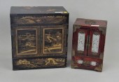
 HARDSTONE/WOOD CHESTfor jewelry, both with several interior drawers. Finish wear, loss, Japanese chest with lacquer loss, age cracks. Largest: 13 1/2" high, 12 3/4" wide. Provenance: Property of a New York Collector. Condition: Any condition information included in our lot descriptions is not the equivalent of a written condition statement, and the absence of condition information does not imply that the lot is free of defects. Our auction lot descriptions reflect our effort to provide accurate, objective and fair information on all lots for sale, and we encourage bidders to request written condition statements and large file images on any lots of interest by emailing condition@woodburyauction.com. We also strongly advise that you or someone on your behalf inspect the lot personally before bidding. All lots are sold "as is" and "where is" and neither we nor any consignor makes any warranties or representation of any kind or nature with respect to the property. There are no returns and no refunds based on condition
JAPANESE LACQUER & CHINESE
JAPANESE LACQUER & CHINESE HARDSTONE/WOOD CHESTfor jewelry, both with several interior drawers. Finish wear, loss, Japanese chest with lacquer loss, age cracks. Largest: 13 1/2" high, 12 3/4" wide. Provenance: Property of a New York Collector. Condition: Any condition information included in our lot descriptions is not the equivalent of a written condition statement, and the absence of condition information does not imply that the lot is free of defects. Our auction lot descriptions reflect our effort to provide accurate, objective and fair information on all lots for sale, and we encourage bidders to request written condition statements and large file images on any lots of interest by emailing condition@woodburyauction.com. We also strongly advise that you or someone on your behalf inspect the lot personally before bidding. All lots are sold "as is" and "where is" and neither we nor any consignor makes any warranties or representation of any kind or nature with respect to the property. There are no returns and no refunds based on condition -
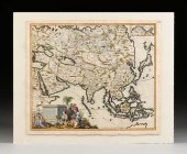 AN ANTIQUE MAP, "EXACTISSIMA ASIæ,"
 CAREL ALLARD, AMSTE...AN ANTIQUE MAP, "Exactissima Asiæ," CAREL ALLARD, AMSTERDAM, CIRCA 1705, hand colored engraving on paper, Carel Allard (Dutch 1648 - 1709), cartographer, Philip Tideman (Dutch 1657-1705), printer, William van der Gouwen (Dutch circa 1640-1720), engraver, with acknowledgment to cartographer Nicolai Witsen (Dutch 1641-1717) for his contribution of information lower center, an inset map upper right titled "Tartariæ Pars," placed above a lower floating rendering of Yedso, Staten Landt and Straet de Vries, warm water access is a focus labeling the Black Sea, Caspian Sea, a part of the Mediterranean Sea, Mare Album, Mare Tartaricum, and lower left a figural cartouche of an unusually modestly ocher robed female personification of the Far East, she wears a conical turban with feather plume, she holds a crescent moon scepter and at her feet a stacking food box holding tasty treats, a thurible incense container, a musical drum, a lacquer plaque, pedestal, an octagonal planter with jeweled hair pins, celadon tea cups and saucers, a zisha tea caddy, the lid held by a curious monkey, a blue and white baluster vase and bottle neck vase with tulips, a lady merchant kneels holding a blanc de chine figurine, a Turkish merchant excitedly opens a gilt mounted Japanese chest filled displaying gilt braids, silks and textiles, enormous south sea pearls, and a tortoise at his feet, behind him an Ottoman blue and red turbaned man holds a triple blade partisan spontoon pole arm, an African merchant holds a gilt bronze jewel casket and bird, a Safavid style camel handler ends the caravan, ropes and crates encourage trade, overlaid with curving latitudinal and longitudinal lines, with one compass rose, margin hand inscribed in ink number 115. Sheet: 21 1/4" x 24 3/4" Plate: 20 1/4" x 23 1/2" Note: NOTE: Nicolai Witsen held the diary of the late explorer Maarten Gerritsz de Vries (1589-1647). He received the diary in 1692 and it has yet to turn up. In 1705 Nicolai Witsen reprinted maps with the most detailed and compiled information spanning from Europe to Japan, covering northern Russian areas and as far south as Australia. A good reference: A Chronological History of the Discoveries in the South Sea Or Pacific Ocean, Volume 3 of 5 Volume Set, Chapter 6, Page 156-157, James Burney, author. Provenance: Property from a Corporate Collection, Houston, Texas. Property from a Corporate Collection, Houston, Texas Condition: Some toning, mild tears and uneven edges, handling creases, mild dents, some overall expected wear, in good to very good condition, wear commensurate with age. Simpson Galleries strongly encourages in-person inspection of items by the bidder. Statements by Simpson Galleries regarding the condition of objects are for guidance only and should not be relied upon as statements of fact and do not constitute a representation, warranty, or assumption of liability by Simpson Galleries. All lots offered are sold "AS IS.” NO REFUNDS will be issued based on condition.
AN ANTIQUE MAP, "EXACTISSIMA ASIæ,"
AN ANTIQUE MAP, "EXACTISSIMA ASIæ," CAREL ALLARD, AMSTE...AN ANTIQUE MAP, "Exactissima Asiæ," CAREL ALLARD, AMSTERDAM, CIRCA 1705, hand colored engraving on paper, Carel Allard (Dutch 1648 - 1709), cartographer, Philip Tideman (Dutch 1657-1705), printer, William van der Gouwen (Dutch circa 1640-1720), engraver, with acknowledgment to cartographer Nicolai Witsen (Dutch 1641-1717) for his contribution of information lower center, an inset map upper right titled "Tartariæ Pars," placed above a lower floating rendering of Yedso, Staten Landt and Straet de Vries, warm water access is a focus labeling the Black Sea, Caspian Sea, a part of the Mediterranean Sea, Mare Album, Mare Tartaricum, and lower left a figural cartouche of an unusually modestly ocher robed female personification of the Far East, she wears a conical turban with feather plume, she holds a crescent moon scepter and at her feet a stacking food box holding tasty treats, a thurible incense container, a musical drum, a lacquer plaque, pedestal, an octagonal planter with jeweled hair pins, celadon tea cups and saucers, a zisha tea caddy, the lid held by a curious monkey, a blue and white baluster vase and bottle neck vase with tulips, a lady merchant kneels holding a blanc de chine figurine, a Turkish merchant excitedly opens a gilt mounted Japanese chest filled displaying gilt braids, silks and textiles, enormous south sea pearls, and a tortoise at his feet, behind him an Ottoman blue and red turbaned man holds a triple blade partisan spontoon pole arm, an African merchant holds a gilt bronze jewel casket and bird, a Safavid style camel handler ends the caravan, ropes and crates encourage trade, overlaid with curving latitudinal and longitudinal lines, with one compass rose, margin hand inscribed in ink number 115. Sheet: 21 1/4" x 24 3/4" Plate: 20 1/4" x 23 1/2" Note: NOTE: Nicolai Witsen held the diary of the late explorer Maarten Gerritsz de Vries (1589-1647). He received the diary in 1692 and it has yet to turn up. In 1705 Nicolai Witsen reprinted maps with the most detailed and compiled information spanning from Europe to Japan, covering northern Russian areas and as far south as Australia. A good reference: A Chronological History of the Discoveries in the South Sea Or Pacific Ocean, Volume 3 of 5 Volume Set, Chapter 6, Page 156-157, James Burney, author. Provenance: Property from a Corporate Collection, Houston, Texas. Property from a Corporate Collection, Houston, Texas Condition: Some toning, mild tears and uneven edges, handling creases, mild dents, some overall expected wear, in good to very good condition, wear commensurate with age. Simpson Galleries strongly encourages in-person inspection of items by the bidder. Statements by Simpson Galleries regarding the condition of objects are for guidance only and should not be relied upon as statements of fact and do not constitute a representation, warranty, or assumption of liability by Simpson Galleries. All lots offered are sold "AS IS.” NO REFUNDS will be issued based on condition.
...many more examples with full details are available to our members - Learn more


