- THE PENNSYLVANIA PACKET AND DAILY ADVERTISER,
THE PENNSYLVANIA PACKET AND DAILY ADVERTISER, 1787 Four-page edition, dated December 29, 1787, and #2777, covers much news of the day, including: the execution of Sarah Kirk, NJ ratification of the constitution, proceeding of the convention, as well as offering the New Government 10 sq miles of land to set aside to form Washington. Printed in this copy as well is much trade and ship news. The complete newspaper is housed in an archival, matted double sided glass with a brown wood frame.
- 11 US MINT COMITIA AMERICANA MEDALS
11 US MINT COMITIA AMERICANA MEDALS Pewter copies of medals given out by Congress during and after the American Revolution. 3- Washington Before Boston, 3- Horatio Gates, 2- Baltimore's John Eager Howard, 3- Lt. Col William Washington. Each has COA with history and reason for the medal.
- Vintage Salt and Pepper Shakers-Souvenir
Vintage Salt and Pepper Shakers-Souvenir 2. Group includes 12 pairs, 2 singles and a set of 4 of Souvenir S&P shakers ranging in size from 1.25"-5". A ceramic tree with orange shakers, marked Sun Japan, chips on one orange. A pair with seashells. Pair of luster wear shakers from FL with applied designs, Sun Japan. Wood hand painted eggs from Atlantic City. Wood bamboo style from Puerto Rico. Wood barrels from Williamsburg Virginia. All have minor scratches. 4 piece set for olive oil, vinegar, salt & pepper, possibly Mexico. Frogs/Coqui's playing instruments possibly Puerto Rico, marked Japan. St. Lawrence milk glass, marked Buffalo. Fort Pitt Special Beer, Pittsburgh PA, marked Buffalo. A pair of pottery tankards from Fullerton PA, made in Japan, small chips. A pair of metal Washington Monument on a stand, has discoloration, label is peeling off, marked Japan. Pair of plastic Jasper wear style shakers with historical Philadelphia imagery from Hong Kong. A metal tray with single shaker teapot from Washington D.C. A porcelain single Liberty Bell shaker missing stopper. All are in good condition with minor crazing, scratches, or color loss & need to be cleaned. If you have any doubt, please ask questions! We will provide extra pictures, or can schedule an in person or video conference preview at your convenience. In house Flat Rate Shipping of $20 is a domestic shipping estimate for first lot and includes insurance. We will gladly combine multiple lots for your convenience and economy. Each additional lot we can pack in the same box is $5 each. Please feel free to contact us with any questions.
- 1820 PENNSYLVANIA FOLK ART ANGEL INKWASH
1820 PENNSYLVANIA FOLK ART ANGEL INKWASH WITH LETTERZachariah Reynolds
(Pennsylvania, 1787-1865)
Angel , 1820
Pen and inkwash on laid paper
11 3/4" x 7 1/2" (sheet)
A folk art pen and ink from Washington County, Pennsylvania, of an angel dancing with a tambourine, as well as the image of an unidentified tree fruit. The painting was executed on the opposite side of an 1820 letter inquiring by Zachariah's father, Benedict Reynolds (1758-1848). The contents of the letter convey the health of various family members, with one somewhat topical aside: "Sally my little girl is now drawing Bonapart in trouble." The piece is housed in a double-sided glazed frame, which measures 15 1/2" x 12 1/2" x 1".
Condition
Creases typical of a letter. Scattered stains and toning.
- 1811 PENNSYLVANIA FOLK ART OWL WATERCOLOR
1811 PENNSYLVANIA FOLK ART OWL WATERCOLOR WITH LETTERZachariah Reynolds
(Pennsylvania, 1787-1865)
The Little Owl (The owl of the woods, the night bird) , 1811
Watercolor and ink on laid paper
12 3/4" x 7 3/4" (sheet)
A folk art watercolor from Washington County, Pennsylvania. Below the title is a verse of "Joy to the World" and a small drawing of a face. The painting was executed on the opposite side of an 1811 letter inquiring about an open teaching position in Uniontown, signed by Reynolds, with another note signed by Joshua Moneyman. The piece is housed in a double-sided glazed frame, which measures 15 1/2" x 12 1/2" x 1".
Condition
Some flaking and pinholes to the top edge of the sheet. Scattered spots, toning, and wrinkling to the sheet.
- WASHINGTON MINT INC REPOUSSE STERLING
WASHINGTON MINT INC REPOUSSE STERLING PLATE DEPICTING UNCLE SAM Washington Mint Inc repousse sterling plate depicting Uncle Sam, after N.C. Wyeth painting, 8"d, 8.8 toz
- EAST TN CIVIL WAR ARCHIVE, SAWYERS FAMILYCivil
EAST TN CIVIL WAR ARCHIVE, SAWYERS FAMILYCivil War era archive relating to the Sawyers family of Corryton, TN. Archive. 1st grouping - Civil War documents relating to Union Lt. Colonel William Sawyers, Tennessee 3rd Infantry Regiment, Company K including a letter dated May 23rd, 1865 to M.C. Hall requesting his oath of allegience to the United States government (Hall refuses in his response). Additional items include two Confederate States receipts (one is blank) with writing on the back stating Sawyers is not indebted to the Confederate States, a 1861 promissory note from Nancy Sawyers to William Sawyers, a 1862 note, and a receipt for a gray draft horse signed by a 1st Lt. 14th Ill Cavalry. Last item - Copper plate negative of William Sawyers, signed verso, 2 1/2" x 3 3/4". 2nd grouping - Medical furlough pass for Confederate private Ganum McBee (Nancy Sawyer's husband), 1st Tennessee Cavalry. Ganum was wounded in the battle of Newtown, VA (November 1864) with a head injury. Ganum's medical furlough pass at Wayside Hospital, Bristol, TN was extended by Confederate physicians several times over the 1864-65 period. Additional item - Handwritten medical home remedies from the 1860s written by Ganum McGee - one titled "The Horse Doctor" and another is a receipt for the "Dropsey". Last item - copper plate negative of Ganum McBee, 2 1/2" x 3 3/4". 3rd grouping - Civil War related archive including a Mexican/Civil War era powder flask (gauge and cap missing) and a total of 10 various Confederate currency notes (most in poor condition). Two of the more unusual notes in very good condition are a pair of one dollar notes from Washington, Tenn. (Rhea County) with a train vignette.
Condition:
1st grouping - overall very good condition. 2nd grouping - Furlough pass folded with separations at the tear. 3rd grouping - flask with cap and gauge missing, dented. 5 Confederate notes in poor condition with the Dixie note with half the note missing.
- WASHINGTON GIRARD TN OIL LANDSCAPEWilliam
WASHINGTON GIRARD TN OIL LANDSCAPEWilliam Washington Girard (Tennessee, 1873-1931), large oil on board landscape painting of a grove of beech trees at water's edge, with pink flowering bush and additional beech trees in the left middle ground and a partly cloudy sky above. Original wide molded Art Nouveau giltwood frame. 23" x 16" sight, 23 1/2" x 31" framed. Signed lower left. Biography: William Washington "Wash" Girard was born on Sycamore Creek in Cheatham County, Tenn. and after high school traveled to New York to study under marine painter Edward Moran. Following the death of his girlfriend, he returned to Nashville, where he continued painting and was a prolific writer. "His paintings of beech trees, his favorite theme, were often small and painted on Sycamore Creek or Brown's Creek in the Nashville area. Not overly sentimental, these paintings were praised for their romanticism while remaining realistic." -Weesner, "William Washington Girard", Tennessee Historical Quarterly, Spring, 1986. (Higher-resolution photos are available at www.caseantiques.com)
Condition:
Excellent condition. Some scattered white paint drips to frame.
- WASHINGTON GIRARD TN OIL LANDSCAPEWilliam
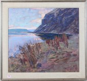
WASHINGTON GIRARD TN OIL LANDSCAPEWilliam Washington Girard (Tennessee, 1873-1931), large oil on board landscape painting of a grove of trees near a field with exposed rock and boulders. Gathering storm clouds in background. Sight - 29 1/2" x 33 1/2". Framed - 34 5/8" x 38 1/2". Signed lower left. Biography: William Washington "Wash" Girard was born on Sycamore Creek in Cheatham County, Tenn. and after high school traveled to New York to study under marine painter Edward Moran. Following the death of his girlfriend, he returned to Nashville, where he continued painting and was a prolific writer. "His paintings of beech trees, his favorite theme, were often small and painted on Sycamore Creek or Brown's Creek in the Nashville area. Not overly sentimental, these paintings were praised for their romanticism while remaining realistic." -Weesner, "William Washington Girard", Tennessee Historical Quarterly, Spring, 1986. Provenance: Collection of the late Edwin and Rebecca Raskin, Nashville, Tennessee. (Higher-resolution photos are available at www.caseantiques.com)
Condition:
Overall very good condition. Blacklighting does not reveal any repairs or restoration. One minor white paint splatter near center. Expected wear and abrasions to frame
- 3 19TH CENT. AL, KY, & TN MAPS1st item:
3 19TH CENT. AL, KY, & TN MAPS1st item: "Map of the States of Kentucky, and Tennessee" by John H. Hinton, engraved and printed by Fenner Sears and Company, published by Issac T. Hinton and Simpkin and Marshall, London, 1832. From "The History and Topography of the United States of America" by John H. Hinton. Steel plate engraving of Kentucky and Tennessee depicting towns and roads, county lines, names of counties, rivers, mountains, and a notation on the location of the "Cherokee Indians", lower right of state of Tennessee. Title and scales of miles, top left. "Longitude West from Washington", centered above map, "Longitude West from Greenwich", centered below map. Map surrounded by scale notations and triple line border. Image - 9 3/4" H x 15 5/8" W. Sheet - 11" H x 17" W. 2nd item: "Kentucky and Tennessee" Map, by Sidney E. Morse, engraved and published by Nathaniel and Simeo Smith Jocelyn, New Haven, 1823. From "An Atlas of the United States" by Sidney E. Morse, A. M. Copper plate engraving with hand colored outlines of Kentucky and Tennessee depicting towns and roads, county lines, names of counties, rivers, and mountains. Title and scale of miles, lower right. Map surrounded by scale notations and triple line border. Image - 7 1/2" H x 9 7/8" W. Sheet - 8 7/8" H x 11" W. 3rd item: Map of Alabama by Anthony Finley, engraved by Young and Delleker, published by Anthony Finley, Philadelphia, 1824. From "A New General Atlas, Comprising a Complete Set of Maps" by Anthony Finley. Copper plate engraving with hand coloring of Alabama depicting towns and roads, county lines, names of counties, rivers, and mountains. Title and scale of miles, lower right. "Longitude West from Washington", centered above map, "Longitude West from Greenwich", centered below map. Map surrounded by scale notations and triple line border. Image - 11 1/4" H x 8 5/8" W. Sheet- 13 3/8" H x 10 1/4" W. All items early 19th century. Provenance: Collection of Charles and Ann Wells, Nashville, Tennessee. (Higher-resolution photos are available at www.caseantiques.com)
Condition:
1st item: Toning impression of map visible on surface of sheet. Slight toning around edge of sheet. 1" piece of sheet missing, lower right corner. Toning impression of text page in cursive script, foxing spots, largest 1/4" top center, visible en verso. 2nd item: Foxing spots, largest 3/8" top left, on surface of sheet. Foxing spots visible en verso. 3rd item: Toning around edges of sheet. Foxing spots, largest 1/8" top right, on surface of sheet. Toning, foxing spots, visible en verso.
- 3 KY & TN MAPS: VANCE, TANNER, JOHNSON1st
3 KY & TN MAPS: VANCE, TANNER, JOHNSON1st item: "Map of Kentucky and Tennessee Compiled from the Latest Authorities", drawn by D. H. Vance, engraved by J. H. Young, published by Anthony Finley, Philadelphia, 1826. From "A New American Atlas" by Anthony Finley. Copper plate engraving with hand coloring of Kentucky and Tennessee depicting towns and roads, county lines, names of counties, rivers, and mountains. Title, statistical table, and scale of miles, top left. Statistical table for each state is organized by status of population, white, free black, slave, etc., and provides information for 1790, 1800, 1810, and 1820. Occupational status, agriculture, manufactures, commerce, etc., shown for 1820. "Longitude West from Greenwich", centered above map, "Longitude West from Washington", centered below map. Map surrounded by scale notations and triple line border. Image - 17" H x 21 1/2" W. Sheet - 19" H x 24 1/4" W. 2nd item: "Kentucky and Tennessee" Map, engraved by Henry S. Tanner and Assistants, published by Henry S. Tanner, Philadelphia, 1823. From "A New American Atlas" by Henry S. Tanner. Copper plate engraving with hand coloring of Kentucky and Tennessee depicting towns, roads, county lines, names of counties, rivers, mountains, and railroads. Title, top center of map, scales of miles and explanation, lower center of map. "Longitude West from Washington", centered above map, "Longitude West from Greenwich", centered below map. Map surrounded by scale notations and triple line border. Image - 20 5/8" H x 28 5/8" W. Sheet - 22 1/8" H x 29" W. 3rd item: "Johnson's Tennessee and Kentucky" Map, compiled, drawn, and engraved under the supervision of Joseph H. Colton and Alvin J. Johnson, published by Alvin J. Johnson, New York, 1866. From "Johnson's New Illustrated (Steel Plate) Family Atlas, With Physical Geography, And With Descriptions Geographical, Statistical, And Historicalò" by Richard S. Fisher, M.D. Steel plate engraving with hand coloring of Tennessee and Kentucky depicting towns, roads, county lines, names of counties, rivers, mountains, and railroads. Features two uncolored vignettes, one titled "State House Nashville", top left, and one titled "Entrance to Mammoth Cave", bottom right. Title and scale of miles, top left corner. "Longitude West from Greenwich", centered above map, "Longitude West from Washington", centered below map. Map surrounded by scale notations and fretwork border. "Historical and Statistical View of the United States" text pages en verso. Image - 16 6/8" H x 23" W. Sheet - 18 1/4" H x 26 1/2" W. All items early/mid 19th century. Provenance: Collection of Charles and Ann Wells, Nashville, Tennessee. (Higher-resolution photos are available at www.caseantiques.com)
Condition:
1st item: Sheet completely separated along center fold. Toning impression of Ohio map visible on surface of sheet. Tears, largest 3/4", middle right, on edges of sheet. Slight toning around edges. Toning spots, largest 1/4", top center, visible en verso. 2nd item: Sheet mostly separated along center crease. Toning impression of map visible on surface of sheet. Tears, largest 1 1/2" lower left corner, on edges of sheet. Tape, top left corner. Toning spots, largest 1/4", top right, visible en verso. 3rd item: Water damage along top, left, right edges, and crease of sheet. 1 1/4" tear, bottom edge of sheet crease. Slight toning on edges of sheet. Water damage, toning spots, largest 1 /4", lower left, visible en verso.
- 4 TN & KY MAPS, 3 FRAMED1st item: "Tennessee"
4 TN & KY MAPS, 3 FRAMED1st item: "Tennessee" Map, by Anthony Finley, engraved by Young and Delleker, published by Anthony Finley, Philadelphia, 1824. From "A New General Atlas, Comprising a Complete Set of Maps" by Anthony Finley. Copper plate engraving with hand coloring of Tennessee depicting towns and roads, county lines, names of counties, rivers, mountains, and railroads. Title, top center, scale of miles, bottom center. "Longitude West from Washington", centered above map, "Longitude West from Greenwich", centered below map. Map surrounded by scale notations and triple line border. Housed in a wooden frame with matte. Image - 8 3/8" H x 11 1/2" W. Sight - 8 3/4" H x 11 3/4" W. Framed - 14 1/8" H x 17 1/4" W. 2nd item: "Kentucky and Tennessee" Map, by Thomas Illman after David Burr, published by William Hall and Company, New York, 1836. From "A New Universal Atlas" by David Burr. Copper plate engraving with hand colored outlines of Kentucky and Tennessee depicting towns and roads, county lines, names of counties, rivers, mountains, and railroads. Title and scale of miles, top left. "Longitude West from Greenwich", centered above map, "Longitude West from Washington", centered below map. Map surrounded by scale notations and triple line border. Housed in a black wooden frame with matte. Image - 10 1/2" H x 12 1/8" W. Sight - 11 1/2" H x 13 1/8" W. Framed - 17 3/4" H x 19 1/4" W. 3rd item: "Kentucky and Tennessee" Map, by George W. Colton, published by Joseph H. Colton and Company, New York, c. 1857. From "Colton's General Atlas" by Joseph H. Colton. Steel plate engraving with hand coloring of Kentucky and Tennessee depicting towns and roads, county lines, names of counties, rivers, mountains, and railroads. "The State of Ohio" text page en verso. Title, scale of miles, and explanations, top left. "Longitude West from Greenwich", centered above map, "Longitude West from Washington", centered below map. Map surrounded by scale notations and triple line border. Housed in sealed plastic sleeve. Image - 11 3/4" H x 16 1/2" W. Sheet - 14" H x 17" W. Sleeve - 16" H x 19" W. 4th item: "J. H. Colton's Map of Kentucky and Tennessee", by Joseph H. Colton, published by Johnson and Ward, New York, 1863. From "A Chronological History of the Civil War in America" by Richard S. Fisher. Steel plate engraving with hand coloring of Kentucky and Tennessee depicting towns and roads, county lines, names of counties, rivers, mountains, and railroads. Title and scale of miles, top left. Map surrounded by scale notations and double line border. Housed in a black wooden frame with matte. Image - 7 5/8" H x 10 1/8" W. Sight - 8 1/8" H x 10 5/8" W. Framed - 13 3/8" H x 16" W. All items early/mid 19th century. Provenance: Collection of Charles and Ann Wells, Nashville, Tennessee. (Higher-resolution photos are available at www.caseantiques.com)
Condition:
1st item: Foxing spots, largest 14" lower right, on surface of sheet. Not examined outside of frame. 2nd item: Two minute foxing spots, top left and right on surface of sheet. Wrinkling on surface of sheet. Not examined outside of frame. 3rd item: Toning around edges of sheet. Minute foxing spots on surface of sheet. Paper tears, largest 1/4" top left, on top edge of sheet. Toning and foxing spots visible en verso. 4th item: Two minute foxing spots, top and bottom right on surface of sheet. Not examined outside of frame.
- NATIVE AMERICAN/WESTERN U.S. EXPEDITION
NATIVE AMERICAN/WESTERN U.S. EXPEDITION EPHEMERA1st item: "Map Showing the Location of the Indian Reservations Within the Limits of the United States and Territories" compiled from the Official and other Authentic Sources, under the Direction of the Honorable John H. Oberly, Commissioner of Indian Affairs. William H. Rowe, Draughtsman, photo lithographed with printed color by Norris Peters, published by Office of Indian Affairs, Washington, D.C., 1888. Issued with the Annual Report of the Department of the Interior. Map depicting the United States, detailing the locations in color of Native American reservations such as the "Indian Territory" of the Cherokee, Creek, Chotaw, etc. in what would become the state of Oklahoma. Includes inset maps of "Indian Territory" lower center, "Mission Ind. Res. in California" and "Alaska", lower left. Title and scale of statue miles, lower right, references, left center. "West from Greenwich", centered above map, "West from Washington", centered below map. Map surrounded by scale notations and triple line border. Image - 20 3/4" H x 32 3/4" W. Sheet - 22 1/2" H x 34" W. 2nd item: "U. States Indian Frontier in 1840" Map, by George Catlin, lithographed with printed color by Tosswill and Company, published for the Domestic Committee of the Board of Missions by Daniel Dana, Jr., New York, 1844. From "Journal of a Tour in the "Indian Territory"." by Nathaniel Sayre Harris; Episcopal Church . Board of Missions. Domestic Committee. Map depicting the locations in color of the Native American tribes that had been moved west of the Mississippi River as of 1840 including the Sacs and Foxes, Kickapoo, Delawares, etc., and the surrounding states. Uncolored territories of the Chippeways, Sioux, Crows, etc., Texas and Mexico surround colored areas. Map surrounded by notations and line border. Image - 8 1/2" H x 5 1/8" W. Sheet - 9 3/4" H x 6" W. 3rd-29th items: 27 lithographs, most with hand coloring, from the "Report of the United States Pacific Railroad Expedition and Surveys (USPRR) CAL (Senate Document: Reports of Explorations and Surveys to Ascertain the Most Practicable and Economical Route for a Railroad from the Mississippi River to the Pacific Ocean)", circa 1855. The prints feature scenic views from the American West including "The Great Basin from the Canada de Las Uvas with Lost Mountains in the Distance", drawn by Charles Koppel, lithographed by August Hoen and Company, Baltimore, images of Native Americans such as "Distribution of Goods to the Assiniboines", drawn by John M. Stanley, lithographed by Sarony, Major and Knapp, New York, and U.S. Military bases including "U. S. Military Post Benicia". "Near Mouse River" print housed in plastic sleeve. Images approximately - 6 1/8" H x 9 1/4" W. Sheets approximately - 8 1/2" H x 11 1/2" W. 30th-34th items: 4 tinted lithographs from "Report of an Expedition Down the Zuni and Colorado Rivers", by Captain Lorenzo Sitgreaves, Corps of Topographical Engineers, circa 1854. Titles include "Zuni Indian [Buffalo Dance]" and "Canon Peak from Camp 7", both drawn by Richard H. Kern, lithographed by the Ackerman Firm, New York, "View Near Gypsum Bluffs on Red-River" and "Mount Webster", both lithographed by Henry Lawrence, New York. Images approximately - 3 7/8" H x 7" W. Sheets approximately - 5 7/8" H x 8 3/4" W. 35th-38th items: 3 tinted lithographs from United States Geological Surveys (USGS), including "Mt. Agassiz - Unita Range - Utah" and "Eocene Bluffs -Green River - Wyoming" from the "Geological Exploration of the Fortieth Parallel", circa 1870-1880, and "Bullion Ravine Looking East. Diorite. Mt. Kate in the Middle Distance" from "Geology of the Comstock Lode and the Washoe District, with Atlas, USGS Monograph", by G. F. Becker, 1882. Images approximately - 9" H x 6 1/4" W. Sheets approximately - 12" H x 9 1/4" W. 39th-46th items: Assorted grouping of Native American colored lithographs, including "Hos-ta, (The Lightning.) Governor of the Pueblo of Jemez. Aug. 20", illustrated for United States Executive Documents. 31rst Cong., 1st sess., 1849-1850, drawn by Richard H. Kern, lithographed by Peter S. Duval, Philadelphia, circa 1894, "PL. CXVII" from the Bureau of Ethnology Eigth Annual Report, 1892, "Sioux War Shirt, Apache Caps, Pouches, Moccasins, Totems, &c." with "Description and Explanation of Plate II" text page, published by A. D. Worthington and Company, Hartford, "Lamina XCIII T. IX. 24. Tejidos.", and "91", "286", and "291", by George Caitlin. "Hosta" housed in plastic sleeve. "PL. CXVIII" mounted to matte. Images range in size from 6 3/4" H x 4" W to 5 1/2" H x 8" W. Sheets range in size from 8 7/8" H x 5 3/8" W to 7 1/2" H x 11 1/8" W. All items mid/late 19th century. Provenance: Collection of Charles and Ann Wells, Nashville, Tennessee. (Higher-resolution photos are available at www.caseantiques.com)
Condition:
1st item: Toning impressions from colored areas on surface of map. Minute black scuffs along lower right paper crease. 15" section of left edge of map cut away, paper tears, top left edge of sheet. Toning impressions visible en verso. 2nd item: Minute toning spots across top of sheet. Toning spots visible en verso. 3rd-29th items: Light overall toning, foxing spots, and water damage. Several sheets with rough edges from book removal. Two pieces of white tape, top left and right of "Butte de Morale" print. 30th-34th items: Light overall toning and foxing spots. "Canon Peak" with rough top edge from book removal. "Zuni Indian" with piece of scotch tape, top left corner, and paper tear, top right corner. 35th-38th items: Light overall toning. 39th-46th items: Light overall toning. Foxing spots, largest 1/4", top left of "298".
- 5 KENTUCKY AND TENNESSEE MAPS1st item:
5 KENTUCKY AND TENNESSEE MAPS1st item: "Tennessee & Kentucky" Map, by Thomas G. Bradford, engraved by George W. Boynton, published by William D. Ticknor, Boston, 1835. From "A Comprehensive Atlas, Geographical, Historical & Commercial" by Thomas G. Bradford. Copper plate engraving with hand colored outlines of Tennessee and Kentucky depicting towns and roads, county lines, names of counties, rivers, mountains, and a notation on the location of the "Cherokee Indians", lower right of state of Tennessee. Title and explanation, top left. Scale of miles, lower right. "Longitude West from Washington", centered below map, "Longitude West from London", centered below map. Map surrounded by scale notations and triple line border. Mounted to matte. Image - 7 3/4" H x 10" W. Sheet - 9 7/8" H x 13" W. Matte - 12" H x 14 1/4" W. 2nd item: "County Map of Kentucky and Tennessee", by Samuel Augustus Mitchell, Jr., 1865. From "Mitchell's New General Atlas" by Samuel Augustus Mitchell, Jr. Steel plate engraving with hand coloring of Kentucky and Tennessee depicting towns and roads, county lines, names of counties, rivers, and mountains. Title and scale of miles, top left. "Longitude West from Greenwich", centered above map, "Longitude West from Washington", centered below map. Map surrounded by scale notations and decorative border. Image - 10 5/8" H x 13 3/8" W. Sheet - 12 1/4" H x 15 1/4" W. 3rd item: "Ohio, Indiana, Kentucky, and Tennessee" Map, by George W. Colton, published by Joseph H. Colton, New York, 1859. From "Colton's Illustrated Cabinet Atlas and Descriptive Geography Maps" by Richard S. Fisher. Steel plate engraving with hand coloring of Ohio, Indiana, Kentucky, and Tennessee depicting towns and roads, county lines, names of counties, rivers, and mountains. Includes inset map of the "Vicinity of Cincinnati", top left. Title, top center, explanation and scale of miles, lower right. Map surrounded by scale notations and decorative border. Mounted to matte. Image - 12 5/8" H x 10 5/8" W. Sheet - 14 5/8" H x 11 7/8" W. Matte - 19 3/8" H x 17" W. 4th item: "County Map of Kentucky and Tennessee" by Samuel Augustus Mitchell, Jr., drawn and engraved by William H. Gamble, published by William M. Bradley and Brother, Philadelphia, 1886. From "Mitchell's New General Atlas" by Samuel Augustus Mitchell, Jr. Steel plate engraving with hand coloring of Kentucky and Tennessee depicting towns and roads, county lines, names of counties, rivers, and mountains. Title and scale of miles, top left. "Longitude West from Greenwich", centered above map, "Longitude West from Washington", centered below map. Map surrounded by scale notations and double line border. Mounted to matte. Image ì 14 1/2" H x 21 3/8" W. Sheet ì 15 1/4" H x 23 1/8" W. Matte - 20" H x 27" W. 5th item: "County Map of Kentucky and Tennessee" by Samuel Augustus Mitchell, Jr., drawn and engraved by William H. Gamble, published by S. Mitchell, Philadelphia, 1882. From "Mitchell's New General Atlas" by Samuel Augustus Mitchell, Jr. Steel plate engraving with hand coloring of Kentucky and Tennessee depicting towns and roads, county lines, names of counties, rivers, and mountains. Title and scale of miles, top left. "Longitude West from Greenwich", centered above map, "Longitude West from Washington", centered below map. Map surrounded by scale notations and grape vine border. Mounted to matte. Image ì 14 1/4" H x 21 1/4" W. Sheet ì 15 1/4" H x 23 1/4" W. Matte - 20" H x 27" W. All items mid/late 19th century. Provenance: Collection of Charles and Ann Wells, Nashville, Tennessee. (Higher-resolution photos are available at www.caseantiques.com)
Condition:
1st item: Green coloring on border extends onto sheet, lower right. Slight toning on edges of sheet. 2nd item: Blue coloring on outline extends onto sheet, lower right. Two tears on lower edge, largest 3/4" lower right. Scattered scuffs and marks on surface of sheet. Scattered scuffs and marks visible en verso. 3rd item: Foxing spots, largest 1/4", left edge of sheet. Slight toning around edges of sheet. Pinprick hole, centered below map. Foxing spots, pinprick hole visible en verso. 4th item: Pink coloring on outline extends onto sheet, lower left. Slight toning around edges of sheet. 5th item: Slight toning around edges of sheet. Paper torn, lower left corner. Black scuffs visible en verso.
- KY AND TN 1823 MAP, H.S. TANNERMap of
KY AND TN 1823 MAP, H.S. TANNERMap of Kentucky and Tennessee, engraved by Henry S. Tanner and Assistants, published by Henry S. Tanner, Philadelphia, 1823. From "A New American Atlas " by Henry S. Tanner. Copper plate engraving with hand coloring of Kentucky and Tennessee depicting towns, roads, county lines, names of counties, rivers, mountains, and railroads. Points of interest include a notation on the location of the Cherokee, lower right of Tennessee, and the boundaries of the yet to be founded Fayette County, lower left of Tennessee. Title, top center of map, scales of miles and explanation, lower center of map. "Longitude West from Washington", centered above map, "Longitude West from Greenwich", centered below map. Map surrounded by scale notations and triple line border. Housed in a contemporary wooden frame. Image - 21 1/4" H x 28 1/8" W. Sight - 22 3/4" H x 29 1/2" W. Framed - 29 1/2" H x 37" W. American, early 19th century. Provenance: Collection of Charles and Ann Wells, Nashville, Tennessee. (Higher-resolution photos are available at www.caseantiques.com)
Condition:
Toning impression of map, visible on surface of sheet. Minute foxing spots, scattered on surface of sheet. Not examined out of frame.
- ITALIAN RENAISSANCE STYLE INLAID EBONY
ITALIAN RENAISSANCE STYLE INLAID EBONY CABINET, POSS. J...Milanese Renaissance style ebony cupboard, possibly made by Jackson and Graham of London, mid to late 19th century, with profuse inlay decoration; constructed in three sections. Removable Cornice features a double domed pediment, each pediment topped with a classical bracketed plinth and inlaid with mask and classical figures, above an upper shelved section with two doors, flanked and divided by fully turned columns with carved and inlaid capitals, and inlaid with portraits of a young man and young woman (suggesting this cabinet may have been made as a wedding gift). Lower, stepped cupboard section has a molded edge over a frieze with panoramic, silhouetted scenes of putti in landscapes, over two inlaid doors inlaid with circular putti scenes, flanked by inlaid pilasters, atop a plinth base with square ogee molded feet. Heavily inlaid throughout with bone and ivory veneers including foliate and geometric patterns, angels, urns, winged lions, griffins, and other classical motifs. 91 1/2" H x 51 1/2" W x 19 3/4" D. Milanese or English, circa 1870. Note: the underside of the top section retains a Railway Express Agency shipping label dated 1958 (or 1938) showing the piece was shipped from Washington, DC to Chattanooga, Tennessee. A copy of a portion of a 1993 appraisal, dating this piece to the Victorian era with possible attribution to Jackson & Graham, is available to winning bidder.
Property of a Tennessee Religious Institution, acquired 1958 from an antiques store in Washington, DC. Copies of accession documentation available to the winning bidder.
Condition:
Overall good condition. Original finials are not present. Left corner section of base top molding loose but present. Scattered minor losses, age cracks, and wear to inlay and cabinet due to general use wear.
- WASHINGTON GIRARD O/C LANDSCAPE PAINTING,
WASHINGTON GIRARD O/C LANDSCAPE PAINTING, BEECHES AT DU...Washington Girard (Tennessee, 1873-1931) oil on canvas landscape painting depicting late autumn beech trees along a still creek at dusk. Signed "Washington Girard" in red lower left. Housed in a wooden frame. Sight: 16" H x 11 1/2" W. Framed: 23 1/4" H x 18 3/4" W. Biography: "William Washington "Wash" Girard was born on Sycamore Creek in Cheatham County, TN and after high school traveled to New York to study under marine painter Edward Moran. Following the death of his girlfriend, he returned to Nashville, where he continued painting and was a prolific writer. His paintings of beech trees, his favorite theme, were often small and painted on Sycamore Creek or Brown's Creek in the Nashville area. Not overly sentimental, these paintings were praised for their romanticism while remaining realistic." (source: Weesner, "William Washington Girard", Tennessee Historical Quarterly, Spring, 1986).
Condition:
Some inpainting noted to a couple of tree trunks, a few to the body of water and the lower right corner, all visible under UV light examination.
- “LUMINESCENT II” TEXTURED LITHOGRAPH1985
“LUMINESCENT II” TEXTURED LITHOGRAPH1985 “Luminescent II” lithograph from unknown artist; from Washington Post Graham family collection; double matted and framed under glass; labeled to back; titled, dated "85", and signed illegibly to bottom; measures approximately 24-5/16" x 20-3/8" with frame and has a sight image of approximately 16-7/8" x 12-7/8"; in Good overall condition.
- A LATE MEXICAN-AMERICAN WAR ERA MAP,
A LATE MEXICAN-AMERICAN WAR ERA MAP, "MAPA DE LOS ESTAD...A LATE MEXICAN-AMERICAN WAR ERA MAP, "Mapa de los Estados Unidos de Mejico, Revised Edition," JOHN DISTURNELL, NEW YORK,1848-1850, hand colored copper plate engraving on paper, the Gulf of Mexico with four inset maps, "Map Showing the Battlegrounds of (Palo Alto) the 8th and 9th, May 1846, by J.H. Eaton," "Plan of Monterrey and its Environs," "Chart of the Bay of Veracruz," and "Tampico and its Environs," at far right, "Diagram of the Battleground (of Buena Vista) February 22nd and 23rd 1847," in the lower left, "Table de Distancias.," "Tabla Estadistica.," and "Carta de los Caminos & Desde Vera Cruz Y Alvarado a Méjico," accompanied by two profiles of the routes "...between Mexico and Veracruz," and "...between Mexico and Acapulco," the upper right with engraving of Mexican eagle with snake in its beak, perched on cactus with names of Mexican states lettered on pads, above a bow and arrow; the hand coloring ordered as follows: Green-Spanish Boundary 1786, Blue-Boundary Proposed by Mexican Commissioners, Yellow-Boundary Claimed by the United States," with quotation, "Prior to the Revolution Texas and Coahuila were united to form one of the Federal States of the Mexican Republic," Red- Route of Gen. Taylor in south Texas and north Mexico, and Gen. Kearny's Route in the north tracking his "March of the 1st Dragoons" from Fort Leavenworth, Kansas, Pink-Boundary Proposed by Mr. Trist U.S. Commissioner, presented with a gilt embossed green cloth cover board, "Map of the Republic of Mexico, Published by J. Disturnell, New York." 30" x 42" Note: The particular map noted for numerous editions with notable mistakes; this map is a rare example of a map that both has gross inaccuracies and served as an important tool for the United States and Mexican governments during land disputes and negotiations at the end of the Mexican American War. The present map includes detailed hand-drawn routes and boundaries that formed the face of the modern American landscape.The red route indicated in the Southern Texas/Northern Mexico area tracks future President Zachary Taylor's military expeditions during the Mexican-American War. "In the summer of 1845, Taylor, now sixty years old and stationed again at Fort Jesup, was ordered by the Polk administration to defend the recently annexed Texas republic. Commanding what would now be called the "Army of Occupation," Taylor moved his troops to Corpus Christi, at the mouth of the Nueces River, where he awaited reinforcements. By March 1846, with an army that now numbered 4,000, he moved further south, to the Rio Grande. When Mexican troops attacked U.S. forces in late April, President James K. Polk used the attack to ask Congress for a declaration of war. On May 18, though heavily outnumbered, Taylor defeated Mexican forces at Palo Alto; the following day he engaged the Mexican army again at Resaca de la Palma, driving it back to Matamoros. With the United States and Mexico now at war, Taylor established a base of operations at Camargo, on the Rio Grande, while he awaited reinforcements from the War Department, which had issued a call for volunteers. In September 1846, his army now numbering 6,500, Taylor marched south to lay siege to Monterey, Mexico's largest northern city, which was garrisoned by the 5,000-man Army of the North, commanded by General Pedro Ampudia. After three days of fighting, Taylor took the city, signing an eight-week armistice with Ampudia, who was allowed to withdraw. The news of the victory was offset in Washington by President Polk's belief that Taylor had missed an opportunity to end the war by allowing Ampudia to evacuate the city. The War Department ordered Taylor to terminate the armistice immediately, and pointedly refrained from congratulating the general on his victory. This brought an immediate chill to relations between Taylor and the Polk administration, which was undoubtedly aggravated by reports that the general was being courted by the Whig Party as a possible candidate for the presidency in 1848. The rift between Polk and Taylor became even wider when Washington decided at year's end to open up a new theater of operations in the south, under the command of Winfield Scott. Ordered to assume a defensive position and place a large portion of his army under Scott's command in anticipation of an amphibious landing at Vera Cruz, Taylor refused to be relegated to a secondary role. In defiance of orders from both Scott and the War Department, Taylor pushed south, encountering the Mexican army at Buena Vista, below Saltillo. Taylor's army repulsed several Mexican assaults on February 22 and 23. Although both sides claimed victory, the battle ended in a stalemate. Nonetheless, Taylor's Army of Occupation remained firmly in control of northern Mexico, and the battle was hailed as a great victory by the American press. The Battle of Buena Vista added further luster to Taylor's political fortunes. Known as 'Old Rough and Ready' for his simple manner and modest appearance, Taylor was now the most celebrated hero of the war. Still bristling at his treatment by the Polk administration, Taylor agreed to accept the nomination of the Whig party, despite the fact that he had not been active in politics, nor did he appear to hold particularly strong political convictions. Indeed, Taylor did not share many of the core Whig beliefs, such as support for a protective tariff, the national bank, and internal improvements. Nonetheless, the war hero easily defeated the Democratic candidate, Lewis Cass, whose support in the North was undercut by the Free Soil party, headed by long-time Democratic standard-bearer Martin Van Buren." - an excerpt from UT Arlington Library's Special Collections, A Continent Divided: The U.S. Mexico War, and with special thanks. The route of General Stephen W. Kearny in the north indicated, also in red in the north, established for the first time the United State's military control of the lands spanning from Fort Leavenworth, Kansas westward to Los Angeles. "The start of the U.S.-Mexico War found Kearny at Fort Leavenworth, where in May 1846 he gathered troops charged with conquering New Mexico and California. Kearny's forces left Fort Leavenworth in June 1846. Numbering 1,558 men, the "Army of the West" consisted of a battalion of Missouri Volunteers, two companies of regular infantry, five squadrons of the First Dragoons, Doniphan's Regiment of Missouri Mounted Volunteers, an interpreter, about fifty Indian guides, and a small body of Army Topographical Engineers. On July 22, the army reached Bent's Fort. Soon afterward, Kearny sent word to New Mexico Governor Manuel Armijo that the Americans intended to take possession of New Mexico. On August 15 the Americans entered Las Vegas, New Mexico, and three days later entered Santa Fe without opposition, Armijo having fled. Promising to respect New Mexican property and religion, Kearny established a legal code for New Mexico and installed Charles Bent, an American trader, as territorial governor. Kearny now received new orders from Washington, promoting him to the rank of brigadier general and instructing him to aid in the conquest of California...As Kearny headed west, resistance to U.S. rule flared in California. As his small force approached San Diego, where it planned to link up with Commodore Robert F. Stockton's marines, Kearny's weary dragoons encountered a force of 150 Californios. At the Battle of San Pascual on December 6, Kearny was seriously wounded and 18 of his men killed. The force was rescued the following day by the timely arrival of a relief column led by Stockton. While the dragoons rested, Stockton prepared to retake Los Angeles. In late December he and Kearny led a joint Army-Navy force of about 600 men out of San Diego. Defeating Mexican and California troops at the battles of Rio San Gabriel and La Mesa, Stockton and Kearny's troops entered Los Angeles. Signing the Treaty of Cahuenga, which ended Californian resistance to U.S. occupation, Stockton turned over military command to Kearny and appointed John C. Fremont governor."- an excerpt from UT Arlington Library's Special Collections, A Continent Divided: The U.S. Mexico War, and with special thanks. Layering each territory boundary by color gives the viewer an instant look at the intense negotiations that took place between Nicholas Trist in pink and the Mexican government in blue. The University of Texas at Arlington writes, "Nicholas P. Trist, the American diplomat who negotiated the treaty that ended the U.S.-Mexico War...Just as he was beginning to enter into negotiations with the provisional Mexican government that had been hastily organized at the town of Querétaro under a new President, Manuel Peña y Peña, Trist received word from Secretary of State James Buchanan that he (Trist) had been recalled by an impatient President Polk. Buchanan's dispatch stated further that if the Mexicans wanted peace, they would have to send an emissary to the United States. Realizing that to abandon his work and leave Mexico at that crucial juncture would almost certainly have negative consequences for both countries, Trist decided to ignore the recall, which General Scott and all three Mexican negotiators, Luis G. Cuevas, Bernardo Couto, and Miguel Atristain, encouraged him to do. On February 2, 1848, Trist signed the Treaty of Guadalupe Hidalgo on behalf of the United States while Cuevas, Couto, and Atristain signed for Mexico. The treaty's most far-reaching provisions included recognition by Mexico of the Rio Grande as the boundary of Texas, the United States government's assumption of $3 million Mexico owed to private U.S. citizens, and Mexico's agreement to sell Upper California and New Mexico, a vast expanse that makes up the present-day states of California, Arizona, Nevada, Utah, New Mexico, and part of Colorado, for $15 million. When the treaty reached Washington, Polk was outraged that Trist, who technically had no authority to make an agreement with Mexico on account of his recall, had ignored the President's order. At first, Polk considered discarding the agreement but realizing that all his principal war goals had been accomplished and that the country was in no mood to prolong the conflict, he sent it to the Senate, which ratified the treaty on March 10, 1848. Both houses of the Mexican Congress ratified it on May 19." -an excerpt from UT Arlington Library's Special Collections, A Continent Divided: The U.S. Mexico War, and with special thanks.Attributed as an eighth edition or later, with special consideration to the appearance of the inset maps in the Gulf of Mexico. This revision containing the inset maps in the Gulf coinciding with the Presidential term of Zachary Taylor and the end of the Mexican-American War. The inset maps celebrate Zachary Taylor's many military achievements. The present map with special hand coloring notes the fundamentally transformative time for the United States at the end of the Mexican-American War, which effectively established the United States of America from coast to coast, fulfilling Manifest Destiny. No longer would the United States boundary ever change or waver as much as this map with hand color indicates it once did. An invaluable and education addition to any American map collection.
Condition:
Some stains, losses, creases, joined neat line, tears at edges, float mounted with repairs and indrawing, waving, Simpson Galleries strongly encourages in-person inspection of items by the bidder. Statements by Simpson Galleries regarding the condition of objects are for guidance only and should not be relied upon as statements of fact and do not constitute a representation, warranty, or assumption of liability by Simpson Galleries. All lots offered are sold "AS IS." NO REFUNDS will be issued based on condition.
- GROUP OF 15 STERLING & SILVER SOUVENIR
GROUP OF 15 STERLING & SILVER SOUVENIR SPOONSGroup of 15 sterling and silver souvenir spoons; 11 marked sterling, one marked 825, and three silverplate. Including spoons from Washington, Vassar College, Maine, Lake Mohawk, Seattle, Philadelphia, Ireland, and Minnesota.
Length ranges from 4 3/4 in to 5 3/4 in. Gross weight of sterling: 6.42 Troy oz.
Condition:
Please contact us for a detailed condition report. Please note that the lack of a condition statement does not imply perfect condition. Email condition@revereauctions.com with any condition questions.
- HE DOG OGLALA - CA. 1878 WINCHESTER
HE DOG OGLALA - CA. 1878 WINCHESTER MODEL 1873 SRCThis is a rare Winchester Model 1873 Saddle Ring Carbine serial number 16399 ordered by He Dog, marked “Crazy Horse rode with He Dog” and B.F. Flower 1879. The piece comes accompanied by a signed document from Wendell Grangaard from The Guns of History, Inc. Sioux Falls, South Dakota. The firearm was examined by Wendell Grangaard, author and historian on Custer, the Battle of the Little Bighorn as well as the Togia language. Wendell noted the firearm being marked as such in Togia and English: On the left side of the receiver cover is marked He Dog with an illustration of a dog, below this is “B.F. Flower 1879” and in front of the dog, Crazy Horse rode with He Dog (illustration 1); On the left side of the stock is marked son of He Dog – Eagle Hawk (illustration 2); On the right side of the stock is the signature mark of Standing Bear (illustration 3). It is noted in the signed document that in July 1877, General Crook told Crazy Horse he could have one last buffalo hunt, with the date set for August 15, 1877. Crooks notified the trading post and traders that they were permitted to sell weapons to anyone participating in the buffalo hunt. He Dog ordered and purchased a Winchester from Long Joe Larrabee a French trader from St. Cloud on the Missouri River who had a trading post at Fort Robinson. The hunt was delayed when Crazy Horse was arrested and killed at the Fort on September 5, 1877. After returning from Washington in October 1877, He Dog formed a breakout of Soreback band members and they fled into Canada to join Sitting Bull. He Dog brought his first wife, and left behind his 13-year old son Joseph Eagle Hawk with his second wife, Rock mother to He Dog’s daughter They Keep Her Horse. She stayed with her people the Soreback Hunkpapa Lakota Sioux in the White Clay District on the Pine Ridge Reservation. The gun was delivered to Long Joe Larrabee at his trading post Fort Robinson in the spring of 1878 to He Dog’s wife, Rock. Rock knew the way of the Togia and that “lemita” (my possession) must be placed on the new Winchester carbine, so she asked Standing Bear to inscribe the rifle with her husbands name. The winter of 1878-1879 was long, cold and turbulent causing Rock to need to sell the firearm for necessary supplies for her family. She sold it to a teamster who was hailing supplies to the new Pine Ridge Agency. As part of trading the Winchester , Rock told B.F. Flowers, the teamster, to put his name below her husbands in the tradition of Togia. So he marked the gun B.F. Flowers 1879 below He Dog’s name. B.F. Flowers or B. Franklin Flowers was born on August 2, 1819, and was employed by the Department of the Platte for General Crooks. Flowers hauled supplies out of Fort Omaha, Nebraska. He died on December 21, 1889, and is buried on Lot 079 Pacific Cemetery, Pacific Township, Columbia County, Wisconsin. It is believe He Dog’s son, Joseph Eagle Hawk used the carbine before it was sold to Flowers, as his name is written on the stock in Togia. The Winchester is accompanied with a Winchester Factory Letter noting that this firearm, serial number 16399 as a Carbine shipped May 2, 1878 in Order Number 11740. The firearm is accompanied by the Cody Letter, Signed Provenance Document from Guns of History, and illustrations. The carbine exhibits the saddle ring on the left side, marked on the bottom of the straight grip, “16399”, on the top of the barrel in a two line address “WINCHESTER’S – REPEATING - ARMS. NEW HAVEN, CT / KING’S – IMPROVED – PATENTED – MARCH 29, 1866, OCTOBER 16, 1866” and on the back of the frame tang “MODEL 1873”. Has a tilt up site on the barrel and front barrel band site. Hammer exhibits some case hardening and the receiver some original color. Has a 20 inch long round barrel with full length loading tube. Butte plate is a crescent metal with sliding brass window exposing the metal and brass three piece cleaning rod. The lever lock tab functions. The lever works correctly, rolling down pushing the brass ejector up which loads the next round while also cocking back the hammer. The hammer independently will also click back twice holding into place. The trigger releases the hammer appearing to work correctly. The dust cover is present with oblong oval checkered thumb spot. This is an Antique Firearm that does not require an FFL.
- CENTENNIAL LITHOGRAPH, GEORGE STINSON
CENTENNIAL LITHOGRAPH, GEORGE STINSON & CO., PUBLISHER(18th century)
Centennial Exhibition, Philadelphia, In Remembrance of the One Hundredth Anniversary of the Independence of the United States , George Stinson & Co., Portland, Maine circa 1876, color lithograph, sheet without extension at bottom, 27-1/2 x 19-3/4 in.; modern black print frame, 35-1/4 x 27-1/4 in.
Note: This print was thought to have been commissioned by the United States Congress for the official celebration of the US Centennial. It depicts the central figure of Liberty/Columbia figure in center, full length seated holding a wreath of laurel leaves and wearing a Phrygian cap, surrounded by flags and stars, and at her feet is a large eagle holding a shield in its claws. The figure is surrounded by a border of 18 oval bust portraits of presidents of the United States from Washington to Grant. Below the eagle in the center bottom of the image are oval bust portraits of the following six Revolutionary War heroes: Israel Putnam, Philip Schuyler, Horatio Gates, Nathaniel Greene, Benjamin Lincoln, and John Sullivan. Above is a birds-eye view of the exposition grounds and small oval vignettes of Independence Hall, Philadelphia (top left), Bunker Hill Monument, Boston (top center) and Faneuil Hall, Boston (top right). Below the center image is text and in the lower left below the date 1776, is a scene of a Revolutionary War battle labeled "The Struggle for Liberty." Below the 1876 date in the lower right are side by side farm and city scenes labeled "Peace and Prosperity."
Provenance: W. Graham Arader III, King of Prussia, Pennsylvania (label verso); A du Pont Family Collection
Condition:
hinged in, restorations to paper, addition paper at bottom 7/8 x 19-3/4, light toning and fading; frame with minor abrasions
- FIVE 19TH CENTURY VIRGINIA POSTAL COVERS
FIVE 19TH CENTURY VIRGINIA POSTAL COVERS WITH HISTORICAL ASSOCIATIONS All from the estate of the notorious Alexandria bookseller Fitzhugh Lee Opie, as follows: three with Alexandria cancellations, 1857, 1886, 1887, one from Woodstock, Virginia, and one from Washington with a Congressional circular date stamp.
- FULL PLATE POSTWAR TINTYPE OF AN IDENTIFIED
FULL PLATE POSTWAR TINTYPE OF AN IDENTIFIED CONFEDERATE SOLDIER Behind mat in mahogany shadowbox frame, the portrait being heavily touched up as is typical for these large images; the sitter here wears a kepi, uniform coat, and carries a spur trigger revolver tucked in his belt; below the image is a strip of lined paper inscribed "William C. Burdette Co. I. 4th Va V. I.. This Confederate infantry company served under Stonewall Jackson and was best known as "The Liberty Hall Volunteers," being initially composed of students from Washington College in Lexington. The paper with Burdette's name and military unit appears to be a later 19th century addition to the overall presentation.
- LARGE GROUP OF PRESIDENTIAL BIOGRAPHY
LARGE GROUP OF PRESIDENTIAL BIOGRAPHY AND HISTORYLARGE GROUP OF PRESIDENTIAL BIOGRAPHY AND HISTORY, Recollections of Reagan: A Portrait of Ronald Reagan (signed); The Ike I Knew (signed); Roosevelt's Secret War: FDR and World War II Espionage; Poems of Abraham Lincoln; Public Papers of the Presidents: George W. Bush 2001; The Civil Rights Legacy of Harry S. Truman; Famous Statements Speeches and Stories of Abraham Lincoln; Yes U Can: 44th President Inauguration Day; Barack Obama: The Official Inaugural Book (2009); George Washington's Rules of Civility; Dead Certain: The Presidency of George W. Bush; Founding Father: Rediscovering George Washington; Saving Freedom: Truman, The Cold War, and the Fight for Western Civilization (signed); The United States and Africa Relations: The Obama Presidency; The Presidency in Translation (signed); Reagan in His Own Hand: The Writings of Ronald Reagan That Reveal His Revolutionary Vision for America; Roosevelt's Centurions: FDR and the Commanders He Led to Victory in World War II (signed); Arrival: Barack Obama 44th President of the United States; Reagan Remembered; Presidents of War (signed); Nixon's Piano: Presidents and Racial Politics from Washington to Clinton (21) Provenance: Estate of General Colin L. Powell, to benefit America's Promise Alliance and the Colin Powell School at City College of New York.
- EIGHT BOOKS OF MILITARY AUTOBIOGRAPHIES,
EIGHT BOOKS OF MILITARY AUTOBIOGRAPHIES, SOME SIGNED AND INSCRIBEDEIGHT BOOKS OF MILITARY AUTOBIOGRAPHIES, SOME SIGNED AND INSCRIBED, titles include: American Soldier: General Tommy Franks (signed); We Were Soldiers Once... and Young: Ia Drang-The Battle That Changed the War in Vietnam (signed); The Line of Fire: From Washington to the Gulf, the Politics and Battles of the New Military; Battleground: The Fight to Defend the Free World; It Doesn't Take A Hero: The Autobiography; Storm Command: A Personal Account of the Gulf War; A General's Life: An Autobiography by General of the Army (signed); Damn the Alligators: Full Speed Ahead! (signed) (8) Provenance: Estate of General Colin L. Powell, to benefit America's Promise Alliance and the Colin Powell School at City College of New York.
- 14 "AMERICA'S FIRST MEDALS" COMITIA
14 "AMERICA'S FIRST MEDALS" COMITIA AMERICANA COPY Pewter copies of the Comitia Americana medals awarded by Congress to heroes of the American Revolution: two Washington Before Boston, two General Horatio Gates, two General Anthony Wayne/Stoney Point, one Lt. Col William Washington, one Lt. Col.John Eager Howard (of Baltimore), two General Daniel Morgan/Cowpens, two Major Henry Lee, two Colonel De Fleury.
- GEORGE HENRY ROSE ALS, 1808, CHESAPEAKE
GEORGE HENRY ROSE ALS, 1808, CHESAPEAKE AFFAIR Sir George Henry Rose (1770-1855) to Vice Admiral Sir Thomas Duckworth (1st Baronet, officer in the British Royal Navy, 1748-1817), dated March 19, 1808; 3 pp.folio; conveys valuable information from Washington noting, "There is no immediate prospect either of this country engaging in war on the one hand, or of the embargo she has imposed, being removed on the other."
- AFTER WILLIAM HENRY BARTLETT (1809 -
AFTER WILLIAM HENRY BARTLETT (1809 - 1854): EIGHT WORKSeach: engraving; each: unsigned; each depicting an American historical landmark; comprising "The President's House, from Washington"; "View of the Capitol at Washington"; "Broadway, New York"; "The Exchange, Philadelphia"; "Schuylkill Bridge, Philadelphia"; "Faneuil Hall, from the Water"; "City Hall, New York"; and "Faneuil Hall, Boston"; each 17 1/2 x 24 inches sight; 20 1/4 x 26 1/4 inches frame Condition:
- JOHN C. CALHOUN MANUSCRIPT LETTERVice-President
JOHN C. CALHOUN MANUSCRIPT LETTERVice-President John C. Calhoun Manuscript Letter Signed, five pages, from an autograph album of L.A.E. Wickliffe, daughter of the Postmaster General, dated from Washington, May 18, 1832, giving advice and observations of life and society, 9 1/2 in. x 7 3/4 in
- JUDAH P. BENJAMIN AUTOGRAPH LETTER SIGNEDJudah
JUDAH P. BENJAMIN AUTOGRAPH LETTER SIGNEDJudah P. Benjamin Autograph Letter Signed, two pages, dated from Washington, Feb. 5, 1861, to an unknown man, relaying, in part, "...I must go home this evening..." and "I will write you from N.O as I may be ordered to Montgomery", 7 in. x 4 in., together with Butler, Pierce. Judah P. Benjamin, Philadelphia, George Jacobs & Company, 1906.
- THE WHITE HOUSE GALLERY OF OFFICIAL
THE WHITE HOUSE GALLERY OF OFFICIAL PORTRAITS OF THE PRESIDENTS, TWO BOUND VOLUMES, 1901 & 1907THE WHITE HOUSE GALLERY OF OFFICIAL PORTRAITS OF THE PRESIDENTS, TWO BOUND VOLUMES, 1901 & 1907, the first being numbered 467 in The McKinley Memorial Edition, allotted to Chas. Tierney, printed by The Gravure Company of America, December 18, 1901, with portraits of the presidents from Washington to McKinley; the second being numbered 3731, printed by The Gravure Company of America (New York and Washington), 1907, with portraits of the presidents from Washington to McKinley (as indicated by the table of contents), but also including an additional portrait of President Theodore Roosevelt (2)
- PRESIDENT THEODORE ROOSEVELT 1902 DOCUMENT
PRESIDENT THEODORE ROOSEVELT 1902 DOCUMENT - ISAAC W. DYER OF MAINE Appointment as Attorney of the United States for the District of Maine for four years (1902-1906) Isaac Watson Dyer (1855-1937), signed by Theodore Roosevelt as President, countersigned by US Attorney General Philander C. Knox (1901?1904). Dated 13th Jan, 1902. 16" x 19 1/2" vellum with red paper seal, rolled in the original Department of Justice mailing tube, having postal cancel of Jan 22 from Washington DC, soiled, vertical bends, Knox autograph has faded, TR is still bold.
- (11) BOOKS: ROBERTSON 'HISTORY OF AMERICA'
(11) BOOKS: ROBERTSON 'HISTORY OF AMERICA' & OTHER(lot of 11) Library shelf books: literature, history, and Americana subjects, all with leather spine, gilt embossed lettering, some with gilt page ends, including: (3 vols) "The History of America," by William Robertson (Scottish, 1721-1793), Fifth Edition, published by A. Strahan, T. Cadell, and J. Balfour, in 1788, all with coat of arms and monogram plate to interior front cover, (two) with fold-out maps, (1) "Webster's New Collegiate Dictionary," Second Edition, published by G. & C. Merriam Company, in 1959, (1) "The Presidency: A Pictorial History of Presidential Elections from Washington to Truman," by Stefan Lorant, published by MacMillan Company, in 1952, numbered 60/250, (1) "The Scarlet Letter," by Nathaniel Hawthorne, with lithographs by Henry Varnum Poor, published by The Limited Editions Club, in 1941, accompanied by slip cover, (1) "Gunner's Dawn," by Roland Clark, published by Premier Press, in 1983, numbered 180/3000, (4) published by Premier Press, in 1984, numbered 180/3000, "My Health is Better in November," by Havilah Babcock, "A Book of Trout Flies," by Preston J. Jennings, "Wildfowling in the Mississippi Flyway," edited by Eugene V. Connett, "De Shootinest Gent'man," by Nash Buckingham, largest: approx 10.25"h, 7.75"w, 1.5"d, 26lbs total **Provenance: A prominent Houstonian's River Oaks Estate**
- LARGE CLEVELAND-HENDRICKS BROADSIDE
LARGE CLEVELAND-HENDRICKS BROADSIDE FROM 1884 PRESIDENTIAL CAMPAIGN Published in color by H.C. Tunison, the poster depicts the candidates surrounded by portraits of every president from Washington to Arthur, this elaborate work also gives the candidates' biographies, outlines the Democratic platform, and gives statistics for each state, presented in gilt wooden frame.
- PATHA, Camille, (American, b. 1938):
PATHA, Camille, (American, b. 1938): ''Mark-One'', Abstract Mid Century Modern, Oil/Canvas, 62'' x 54'', signed lower left, thin edge modern frame, 63'' x 55'', 2 labels affixed verso, one from 1965 Annual Exhibition of Northwest Artists. Female Artist from Washington State, one from The Collector's Gallery, Bellevue, Washington.