Pricing Guides & Dictionary of Makers Marks for Antiques & Collectibles

A few examples of appraisal values for
NEW ENGLAND
Search our price guide for your own treasures
-
 (VIEW) NEW ENGLAND, NEW JERSEY
 AND NEW YORK: 303 POSTCARDS EARLY TO-MID 20TH CENTURY(VIEW) NEW ENGLAND, NEW JERSEY AND NEW YORK: 303 POSTCARDS, Early to-Mid 20th Century, 11 Vermont, 80 New Hampshire, 70 Maine, 45 Connecticut, 13 New Jersey, 2 Rhode Island and 97 New York. Early: Albany railroad depot, two Volland views of NYC, "Little And Great Diamond Island From Scammel House Island", Port Clyde view, Portland views, Lake Sunapee, Hampton Beach, Keene, White Mountains, Bristol Village and Pemigewasset River from Sugar Hill, Vermont, and more.
(VIEW) NEW ENGLAND, NEW JERSEY
(VIEW) NEW ENGLAND, NEW JERSEY AND NEW YORK: 303 POSTCARDS EARLY TO-MID 20TH CENTURY(VIEW) NEW ENGLAND, NEW JERSEY AND NEW YORK: 303 POSTCARDS, Early to-Mid 20th Century, 11 Vermont, 80 New Hampshire, 70 Maine, 45 Connecticut, 13 New Jersey, 2 Rhode Island and 97 New York. Early: Albany railroad depot, two Volland views of NYC, "Little And Great Diamond Island From Scammel House Island", Port Clyde view, Portland views, Lake Sunapee, Hampton Beach, Keene, White Mountains, Bristol Village and Pemigewasset River from Sugar Hill, Vermont, and more. -
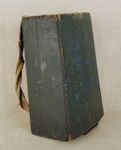 New England painted pine backpack
 19th c. 21" h. ?
New England painted pine backpack
New England painted pine backpack 19th c. 21" h. ? -
 E. D. WARD NEW ENGLAND LANDSCAPE
 PASTEL DRAWING MassachusettsEarly 20th CenturyDepicts a winding river surrounded by trees bathed in the warm light of dawn.
E. D. WARD NEW ENGLAND LANDSCAPE
E. D. WARD NEW ENGLAND LANDSCAPE PASTEL DRAWING MassachusettsEarly 20th CenturyDepicts a winding river surrounded by trees bathed in the warm light of dawn. -
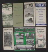 NEW ENGLAND AND CANADA TRAVEL
 EPHEMERA
NEW ENGLAND AND CANADA TRAVEL
NEW ENGLAND AND CANADA TRAVEL EPHEMERA -
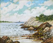 NEW ENGLAND COASTAL LANDSCAPE
 PAINTING America,20th CenturyImpressionistic scene of gentle waves rippling against a sandy alcove surrounded by rock formations and trees.
NEW ENGLAND COASTAL LANDSCAPE
NEW ENGLAND COASTAL LANDSCAPE PAINTING America,20th CenturyImpressionistic scene of gentle waves rippling against a sandy alcove surrounded by rock formations and trees. -
 [New England] Collection of over 35
 titles with emphasis on Massachusetts including: Coffin Old Times in the Colonies; Abbott Old Paths and Legends of New England; Thwing The Crooked and Narrow Streets of Boston Estimate $ 200-300
[New England] Collection of over 35
[New England] Collection of over 35 titles with emphasis on Massachusetts including: Coffin Old Times in the Colonies; Abbott Old Paths and Legends of New England; Thwing The Crooked and Narrow Streets of Boston Estimate $ 200-300 -
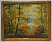 NEW ENGLAND ILLUMINATED O/C
 LANDSCAPE PAINTING New England,19th CenturyPlein air work of an Autumn forest with small clearing exposing a lake and mountain in the background illuminated by sunlight through the foliage, housed in its period Arts & Crafts gilt wood frame.
NEW ENGLAND ILLUMINATED O/C
NEW ENGLAND ILLUMINATED O/C LANDSCAPE PAINTING New England,19th CenturyPlein air work of an Autumn forest with small clearing exposing a lake and mountain in the background illuminated by sunlight through the foliage, housed in its period Arts & Crafts gilt wood frame. -
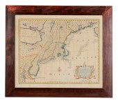 Middle Atlantic, New England Map
 London, England, 18th century, \"A New and Accurate Map of New Jersey, Pensilvania [sic], New York and New England, with the adjacent Countri
Middle Atlantic, New England Map
Middle Atlantic, New England Map London, England, 18th century, \"A New and Accurate Map of New Jersey, Pensilvania [sic], New York and New England, with the adjacent Countri -
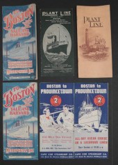 NEW ENGLAND STEAMSHIP TRAVEL
 EPHEMERA
NEW ENGLAND STEAMSHIP TRAVEL
NEW ENGLAND STEAMSHIP TRAVEL EPHEMERA -
 New England painted swift ca.
 1830 with green floral decoration on a yellow ground 24" l. ?
New England painted swift ca.
New England painted swift ca. 1830 with green floral decoration on a yellow ground 24" l. ? -
 PR BEN JOHNSON NEW ENGLAND
 WATERCOLOR PAINTINGS United States,20th CenturyIncludes two works, one depicting domed sand dunes with low shrubbery beneath a setting sun, most likely Cape Cod. The other depicting a rocky coastline with evergreen trees and a sailboat in the distant background.
PR BEN JOHNSON NEW ENGLAND
PR BEN JOHNSON NEW ENGLAND WATERCOLOR PAINTINGS United States,20th CenturyIncludes two works, one depicting domed sand dunes with low shrubbery beneath a setting sun, most likely Cape Cod. The other depicting a rocky coastline with evergreen trees and a sailboat in the distant background. -
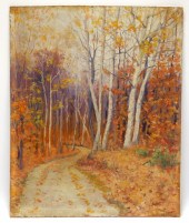 NEW ENGLAND IMPRESSIONIST
 AUTUMNAL LANDSCAPE United States,20th CenturyDepicts a winding dirt path between fallen leaves and bare trees.
NEW ENGLAND IMPRESSIONIST
NEW ENGLAND IMPRESSIONIST AUTUMNAL LANDSCAPE United States,20th CenturyDepicts a winding dirt path between fallen leaves and bare trees. -
 New England burlwood bowl and cover
 early 19th c. 7 1/2" x 9". ?
New England burlwood bowl and cover
New England burlwood bowl and cover early 19th c. 7 1/2" x 9". ? -
 KAY KELLOGG NEW ENGLAND LANDSCAPE
 PAINTING New England,20th CenturyImpressionist depiction of a winding dirt path between trees and white houses leading down to the ocean. Kellogg was a member of the Providence Art Club.
KAY KELLOGG NEW ENGLAND LANDSCAPE
KAY KELLOGG NEW ENGLAND LANDSCAPE PAINTING New England,20th CenturyImpressionist depiction of a winding dirt path between trees and white houses leading down to the ocean. Kellogg was a member of the Providence Art Club. -
 New England carved frame late
 19th/early 20th c. with heart and arrow appliqués the sides terminating in lollipop ends overall -... ?
New England carved frame late
New England carved frame late 19th/early 20th c. with heart and arrow appliqués the sides terminating in lollipop ends overall -... ? -
 NEW ENGLAND PINE WINDOW PORCH
 BUCKET BENCH New England,19th CenturyPine wood, shellacked surface, many old cut nails can be seen throughout.
NEW ENGLAND PINE WINDOW PORCH
NEW ENGLAND PINE WINDOW PORCH BUCKET BENCH New England,19th CenturyPine wood, shellacked surface, many old cut nails can be seen throughout. -
 19C. NEW ENGLAND 3 TIER GREEN
 BUCKET CROCK SHELF New England,19th CenturyOriginal green paint on pine wood with old nail construction.
19C. NEW ENGLAND 3 TIER GREEN
19C. NEW ENGLAND 3 TIER GREEN BUCKET CROCK SHELF New England,19th CenturyOriginal green paint on pine wood with old nail construction. -
 D. A. FISHER NEW ENGLAND SUMMER
 MOUNTAIN LANDSCAPE California, Maine,1867-1940Depicting a tranquil river with a forested embankment beginning to show Fall foliage with a mountainous background beneath a blue sky with Stratus clouds.
D. A. FISHER NEW ENGLAND SUMMER
D. A. FISHER NEW ENGLAND SUMMER MOUNTAIN LANDSCAPE California, Maine,1867-1940Depicting a tranquil river with a forested embankment beginning to show Fall foliage with a mountainous background beneath a blue sky with Stratus clouds. -
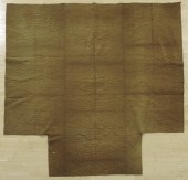 New England tan linsey woolsey
 coverlet ca. 1800. ?
New England tan linsey woolsey
New England tan linsey woolsey coverlet ca. 1800. ? -
 SEA CHART OF NEW ENGLAND Edmund
 Blunt, "THE NORTH EASTERN COAST OF NORTH AMERICA FROM NEW YORK TO CAPE CANSO INCLUDING SABLE ISLAND" (NY: Blunt, 1848) Laid down on blue cartridge paper with glazed linen binding.
SEA CHART OF NEW ENGLAND Edmund
SEA CHART OF NEW ENGLAND Edmund Blunt, "THE NORTH EASTERN COAST OF NORTH AMERICA FROM NEW YORK TO CAPE CANSO INCLUDING SABLE ISLAND" (NY: Blunt, 1848) Laid down on blue cartridge paper with glazed linen binding. -
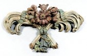 New England Federal architectural
 carving, finely carved white pine (tested) depicting floral and ribbon tied trophy in original brick red, blue/green and pale green paint, possibly Coastal Massachusetts, early 19th century, 20-1/2 x 35 x 8 in. In as-found condition with original painted surface with wear and losses, several breaks and losses including one section of ribbon and several flower petals. A Memphis, Tennessee Collection
New England Federal architectural
New England Federal architectural carving, finely carved white pine (tested) depicting floral and ribbon tied trophy in original brick red, blue/green and pale green paint, possibly Coastal Massachusetts, early 19th century, 20-1/2 x 35 x 8 in. In as-found condition with original painted surface with wear and losses, several breaks and losses including one section of ribbon and several flower petals. A Memphis, Tennessee Collection -
 RUTH WAITE NEW ENGLAND WINTER
 LANDSCAPE PAINTING Massachusetts,20th CenturyImpressionist depiction of a bridge leading to a small neighborhood blanketed by snow and bathed in early morning light.
RUTH WAITE NEW ENGLAND WINTER
RUTH WAITE NEW ENGLAND WINTER LANDSCAPE PAINTING Massachusetts,20th CenturyImpressionist depiction of a bridge leading to a small neighborhood blanketed by snow and bathed in early morning light. -
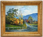 NEW ENGLAND AUTUMNAL LANDSCAPE
 PAINTING United States,20th CenturyDepicts a walking path in the forest lined with tall trees in the beginning of their autumnal transition.
NEW ENGLAND AUTUMNAL LANDSCAPE
NEW ENGLAND AUTUMNAL LANDSCAPE PAINTING United States,20th CenturyDepicts a walking path in the forest lined with tall trees in the beginning of their autumnal transition. -
 PETER TYSVER NEW ENGLAND AUTUMN
 LANDSCAPE PAINTING Massachusetts, Maine,b.1948Depicting a rolling meadow with trees showing Fall foliage and a small creek with a vast mountain range in the background.
PETER TYSVER NEW ENGLAND AUTUMN
PETER TYSVER NEW ENGLAND AUTUMN LANDSCAPE PAINTING Massachusetts, Maine,b.1948Depicting a rolling meadow with trees showing Fall foliage and a small creek with a vast mountain range in the background. -
 JUDITH FULMER NEW ENGLAND LANDSCAPE
 PAINTING Maryland, Massachusetts,b.1962Illuminated landscape comprised of vibrant yellows, greens, purples, and blues depicting picturesque moorlands of Provincetown, Massachusetts.
JUDITH FULMER NEW ENGLAND LANDSCAPE
JUDITH FULMER NEW ENGLAND LANDSCAPE PAINTING Maryland, Massachusetts,b.1962Illuminated landscape comprised of vibrant yellows, greens, purples, and blues depicting picturesque moorlands of Provincetown, Massachusetts. -
 New England watercolor folk art
 interior scene mid 19th c. depicting a mother three children and a cat 7 1/2" x 5 3/4". ?
New England watercolor folk art
New England watercolor folk art interior scene mid 19th c. depicting a mother three children and a cat 7 1/2" x 5 3/4". ? -
 AMERICAN NATURALIST NEW ENGLAND
 LANDSCAPE PAINTING United States,Late 18th-Early 19th CenturyFinally executed work capturing a river bend with small island during Fall. Notice the vibrant white caps of the water crashing on rockery in the foreground and layered depth of the background. Signature is illegible but certainly done by a highly skilled artist. The painting exhibits influence from the work of Russell Smith (1812-1896), Worthington Whittredge (1820-1910), and their contemporaries.
AMERICAN NATURALIST NEW ENGLAND
AMERICAN NATURALIST NEW ENGLAND LANDSCAPE PAINTING United States,Late 18th-Early 19th CenturyFinally executed work capturing a river bend with small island during Fall. Notice the vibrant white caps of the water crashing on rockery in the foreground and layered depth of the background. Signature is illegible but certainly done by a highly skilled artist. The painting exhibits influence from the work of Russell Smith (1812-1896), Worthington Whittredge (1820-1910), and their contemporaries. -
 New England oil on velvet theorem
 19th c. of fruit on a slab table 17" x 22 1/2". ?
New England oil on velvet theorem
New England oil on velvet theorem 19th c. of fruit on a slab table 17" x 22 1/2". ? -
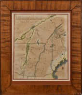 EARLY PRINT OF HISTORICAL MAP,
 NEW ENGLAND. English map of late 18th C. New England with description and scale key in upper left. Image 10.5”H x 8.75”W, in a tiger maple frame 14.75”h x 12.75”W. Sussman Collection.
EARLY PRINT OF HISTORICAL MAP,
EARLY PRINT OF HISTORICAL MAP, NEW ENGLAND. English map of late 18th C. New England with description and scale key in upper left. Image 10.5”H x 8.75”W, in a tiger maple frame 14.75”h x 12.75”W. Sussman Collection. -
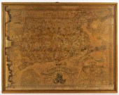 1836 A.F WILCOX NEW ENGLAND
 TRI-STATE ENGRAVED MAP United States,1836Highly detailed map of Massachusetts, Rhode Island, and Connecticut. Engraved by J. Wells, New York, published by A.F. Wilcox Middletown, Connecticut; Light & Stearns, Boston; C. Shepard, New York & Providence. Prime meridian: Washington [D.C.] and Greenwich. Shows roads, railroads, mills, factories and churches. Includes illustrations. Insets: Norwich, Conn. and factories; Fall River, Mass. and factories; New-Haven; Salem; City of Lowell; New Britain, Conn. manufactories; New-York; North Adams, Mass. manufactories, Boston; Canton factories, Mass.; Warwick & Coventry factories, R.I.; Pawtucket and Central Falls manufactories; Hartford; Woonsocket Falls, R.I. & factories; Providence. Scale ca 1:464,000
1836 A.F WILCOX NEW ENGLAND
1836 A.F WILCOX NEW ENGLAND TRI-STATE ENGRAVED MAP United States,1836Highly detailed map of Massachusetts, Rhode Island, and Connecticut. Engraved by J. Wells, New York, published by A.F. Wilcox Middletown, Connecticut; Light & Stearns, Boston; C. Shepard, New York & Providence. Prime meridian: Washington [D.C.] and Greenwich. Shows roads, railroads, mills, factories and churches. Includes illustrations. Insets: Norwich, Conn. and factories; Fall River, Mass. and factories; New-Haven; Salem; City of Lowell; New Britain, Conn. manufactories; New-York; North Adams, Mass. manufactories, Boston; Canton factories, Mass.; Warwick & Coventry factories, R.I.; Pawtucket and Central Falls manufactories; Hartford; Woonsocket Falls, R.I. & factories; Providence. Scale ca 1:464,000 -
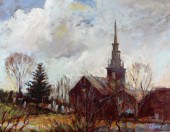 CURTIS ROSSER IMPRESSIONIST NEW
 ENGLAND PAINTING Massachusetts,1927-2005Fall landscape depicting a New England, most likely Massachusetts church with trees in the foreground.
CURTIS ROSSER IMPRESSIONIST NEW
CURTIS ROSSER IMPRESSIONIST NEW ENGLAND PAINTING Massachusetts,1927-2005Fall landscape depicting a New England, most likely Massachusetts church with trees in the foreground. -
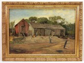 GEORGE WHITAKER NEW ENGLAND
 FARMYARD PAINTING Rhode Island, New York, Massachusetts1841-1916Depicts an old farmer carrying a pitchfork across a dirt patch speckled with chickens in front of an old dilapidated shed.
GEORGE WHITAKER NEW ENGLAND
GEORGE WHITAKER NEW ENGLAND FARMYARD PAINTING Rhode Island, New York, Massachusetts1841-1916Depicts an old farmer carrying a pitchfork across a dirt patch speckled with chickens in front of an old dilapidated shed. -
 DOROTHY TARR NEW ENGLAND O/C
 SEASCAPE PAINTING United States,20th CenturyDepicts crashing waves upon a rocky New England seashore.
DOROTHY TARR NEW ENGLAND O/C
DOROTHY TARR NEW ENGLAND O/C SEASCAPE PAINTING United States,20th CenturyDepicts crashing waves upon a rocky New England seashore. -
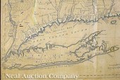 Braddock Mead (British 1688-1757)
 and Thomas Jefferys/Publisher "A Map of the most Inhabited part of New England containing the Provinces of Massachusets Bay and New Hampshire with the Colonies of Conecticut and Rhode Island Divided into Counties and Townships..." published November 29 1774 Thomas Jefferys London hand-colored copper-engraved four sheet map featuring an inset city map of Boston another of Boston Harbor also with a delightful cartouche depicting the Pilgrims arriving at Plymouth Rock 42 in. x 39 1/2 in. Note: This was the largest and most detailed map of New England published during the Revolutionary period. It was used by both sides for tactical planning and was used after the war to settle boundary disputes.
Braddock Mead (British 1688-1757)
Braddock Mead (British 1688-1757) and Thomas Jefferys/Publisher "A Map of the most Inhabited part of New England containing the Provinces of Massachusets Bay and New Hampshire with the Colonies of Conecticut and Rhode Island Divided into Counties and Townships..." published November 29 1774 Thomas Jefferys London hand-colored copper-engraved four sheet map featuring an inset city map of Boston another of Boston Harbor also with a delightful cartouche depicting the Pilgrims arriving at Plymouth Rock 42 in. x 39 1/2 in. Note: This was the largest and most detailed map of New England published during the Revolutionary period. It was used by both sides for tactical planning and was used after the war to settle boundary disputes. -
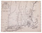 "AN EXACT MAPP OF NEW ENGLAND AND
 NEW YORK", COTTON MATHER, 1702 [London: Printed for Thomas Parkhurst, 1702], engraved map, slight wear and repaired closed tears to outer margins. Recogniced as the first 18th century map of New England (Schwartz & Ehrenberg), this map was used to illustrate Cotton Mather's famous history of the Bay Colony, "Magnalia Christi Americana: or the Ecclesiastical History of New England from Its First Planting". The map provided little new geographic information, since it was based on an earlier printed map -- Thornton, Morden, and Lea's 1685 map of New England. Mather's history of the settlement of New England is one of the most interesting and valuable sources for the study of life in early colonial New England. It is generally considered to be America's most famous 18th-century book. 11" x 14" on laid paper, thread margins, losing scale edge at top asnd bottom, toned edges, discolored vertical center fold.
"AN EXACT MAPP OF NEW ENGLAND AND
"AN EXACT MAPP OF NEW ENGLAND AND NEW YORK", COTTON MATHER, 1702 [London: Printed for Thomas Parkhurst, 1702], engraved map, slight wear and repaired closed tears to outer margins. Recogniced as the first 18th century map of New England (Schwartz & Ehrenberg), this map was used to illustrate Cotton Mather's famous history of the Bay Colony, "Magnalia Christi Americana: or the Ecclesiastical History of New England from Its First Planting". The map provided little new geographic information, since it was based on an earlier printed map -- Thornton, Morden, and Lea's 1685 map of New England. Mather's history of the settlement of New England is one of the most interesting and valuable sources for the study of life in early colonial New England. It is generally considered to be America's most famous 18th-century book. 11" x 14" on laid paper, thread margins, losing scale edge at top asnd bottom, toned edges, discolored vertical center fold. -
 New England watercolor and ink on
 paper record for the Hart family dated 1880 with grapes roses hearts peacocks and American... ?
New England watercolor and ink on
New England watercolor and ink on paper record for the Hart family dated 1880 with grapes roses hearts peacocks and American... ?
...many more examples with full details are available to our members - Learn more


