Pricing Guides & Dictionary of Makers Marks for Antiques & Collectibles

A few examples of appraisal values for
NORTHER
Search our price guide for your own treasures
-
 Northw
Northw
Northw -
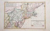 Carte de la partie nord, des
 Etats Unis, de l'Amerique Septentrionale, map of the northern part of the United States of North America, from the Atlas de toutes les Parties Connues du Globe Terrestre by Guillaume Thomas Francois Raynal, c 1780, 9-3/4" x 15-1/4", creases down center, On laid paper, no repairs or damage apparent
Carte de la partie nord, des
Carte de la partie nord, des Etats Unis, de l'Amerique Septentrionale, map of the northern part of the United States of North America, from the Atlas de toutes les Parties Connues du Globe Terrestre by Guillaume Thomas Francois Raynal, c 1780, 9-3/4" x 15-1/4", creases down center, On laid paper, no repairs or damage apparent -
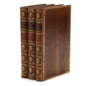 NORTH, ROGER. THE LIVES OF THE
 NORTHS (London: Henry Colburn, 1826), three volumes, 8vo (8-3/4 x 5-3/4 in.), tree calf boards, raised bands and gilt, marbled page edges and endpapers, the gentlemen described within are Francis North, Sir Dudley North, and the Hon. and Rev. Dr. John North.
NORTH, ROGER. THE LIVES OF THE
NORTH, ROGER. THE LIVES OF THE NORTHS (London: Henry Colburn, 1826), three volumes, 8vo (8-3/4 x 5-3/4 in.), tree calf boards, raised bands and gilt, marbled page edges and endpapers, the gentlemen described within are Francis North, Sir Dudley North, and the Hon. and Rev. Dr. John North. -
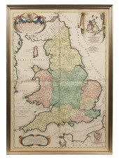 RARE 17TH C MAP OF ENGLAND -
 Coronelli Vincenzo;'Parte Settentrionale del Regno d'Inghilterra' & 'Parte Meridionale del Regno d'Ingelterra'; (Northern part of England. Southern part of England); Publisher: Corso Geografico Universale circa 1695; origina
RARE 17TH C MAP OF ENGLAND -
RARE 17TH C MAP OF ENGLAND - Coronelli Vincenzo;'Parte Settentrionale del Regno d'Inghilterra' & 'Parte Meridionale del Regno d'Ingelterra'; (Northern part of England. Southern part of England); Publisher: Corso Geografico Universale circa 1695; origina -
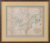 MAP OF THE NORTHERN AND
 MID-ATLANTIC STATESMAP OF THE NORTHERN AND MID-ATLANTIC STATES, "A Map of the Northern and Middle States: Comprehending the Western Territory and the British Dominions in North America from the best Authorities", G. Allen Sadlers for Morse's Geography. Published by J. Stockdale, London, 1792. Provenance: Showing land grants of the Western Territory including Ohio, Tennessee and the Old Northwest Territory. The grants include Illinois Company, Army Lands, Wagbash Company, New Jersey Company, Ohio Company, and the 7 Ranges, along with the Donation Lands from the Commonwealth of Virginia and General Clark's Grant 1500 acres.
MAP OF THE NORTHERN AND
MAP OF THE NORTHERN AND MID-ATLANTIC STATESMAP OF THE NORTHERN AND MID-ATLANTIC STATES, "A Map of the Northern and Middle States: Comprehending the Western Territory and the British Dominions in North America from the best Authorities", G. Allen Sadlers for Morse's Geography. Published by J. Stockdale, London, 1792. Provenance: Showing land grants of the Western Territory including Ohio, Tennessee and the Old Northwest Territory. The grants include Illinois Company, Army Lands, Wagbash Company, New Jersey Company, Ohio Company, and the 7 Ranges, along with the Donation Lands from the Commonwealth of Virginia and General Clark's Grant 1500 acres. -
 Fine Southern D
Fine Southern D
Fine Southern D -
 NORTHERN CIRCUMPOLAR MAP AND TWO
 ASTROLOGICAL MAPS, THREE REPRODUCTION COLOR ENGRAVINGSNorthern Circumpolar Map and Two Astrological Maps, Three Reproduction Color Engravings,
NORTHERN CIRCUMPOLAR MAP AND TWO
NORTHERN CIRCUMPOLAR MAP AND TWO ASTROLOGICAL MAPS, THREE REPRODUCTION COLOR ENGRAVINGSNorthern Circumpolar Map and Two Astrological Maps, Three Reproduction Color Engravings, -
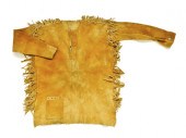 Northern Plains scout's jacket. ?
Northern Plains scout's jacket. ?
Northern Plains scout's jacket. ? -
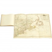 Robert Sayer and John Bennett,
 British A GENERAL MAP OF THE NORTHERN BRITISH COLONIES IN AMERICA, WHICH COMPREHENDS THE PROVINCE OF QUEBEC, THE GOVERNMENT OF NEWFOUNDLAND, NOVA-SCOTIA, NEW-ENGLAND AND NEW-YORK A GENERAL MAP OF THE NORTHERN BRITISH COLONIES IN AMERICA, WHICH COMPREHENDS THE PROVINCE OF QUEBEC, THE GOVERNMENT OF NEWFOUNDLAND, NOVA-SCOTIA, NEW-ENGLAND AND NEW-YORK
Robert Sayer and John Bennett,
Robert Sayer and John Bennett, British A GENERAL MAP OF THE NORTHERN BRITISH COLONIES IN AMERICA, WHICH COMPREHENDS THE PROVINCE OF QUEBEC, THE GOVERNMENT OF NEWFOUNDLAND, NOVA-SCOTIA, NEW-ENGLAND AND NEW-YORK A GENERAL MAP OF THE NORTHERN BRITISH COLONIES IN AMERICA, WHICH COMPREHENDS THE PROVINCE OF QUEBEC, THE GOVERNMENT OF NEWFOUNDLAND, NOVA-SCOTIA, NEW-ENGLAND AND NEW-YORK -
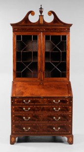 Very Fine Southern D
Very Fine Southern D
Very Fine Southern D -
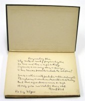 ''North of Boston'' N.Y. 1917 6th
 printing of the Second Edition with poem ''Fragmentary Blue'' on the free end paper in Frost's hand signed. Provenance: Aunt (Caroline Gay Wilgus) of current owner became a friend of Frost's daughter during the Frost family's stays in Ann Arbor Michigan c. 1910 and received this book from Frost.
''North of Boston'' N.Y. 1917 6th
''North of Boston'' N.Y. 1917 6th printing of the Second Edition with poem ''Fragmentary Blue'' on the free end paper in Frost's hand signed. Provenance: Aunt (Caroline Gay Wilgus) of current owner became a friend of Frost's daughter during the Frost family's stays in Ann Arbor Michigan c. 1910 and received this book from Frost. -
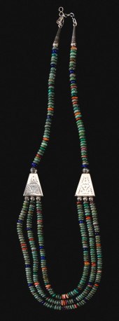 Southw
Southw
Southw -
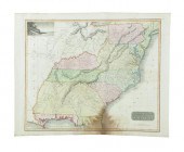 TWO MAPS FROM THOMSON'S NEW GENERAL
 ATLAS. ''Northern Provinces of the United States'' and ''Southern Provinces of the United States '' 1817 handcolored engravings. Unframed 21 1/2''h. 26 1/2''w. Even toning fold lines both with minor marginal damage both with dampstaining at lower center. Outlining is later.
TWO MAPS FROM THOMSON'S NEW GENERAL
TWO MAPS FROM THOMSON'S NEW GENERAL ATLAS. ''Northern Provinces of the United States'' and ''Southern Provinces of the United States '' 1817 handcolored engravings. Unframed 21 1/2''h. 26 1/2''w. Even toning fold lines both with minor marginal damage both with dampstaining at lower center. Outlining is later. -
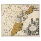 HOMANN, JOHANN BAPTIST. VIRGINIA
 MARYLANDIA ET CAROLINA... ...in America Septentrionali Britannorum industria excultar reprasentatae a Ioh. Bap. Homann S. C. M. Geog. Norimbergae (Nuremburg, fist half 18th century), being a German copperplate engraving with hand color, the map depicts the southern coastal region of British North America and has an attractive cartouche that promotes settlement by illustrating friendly natives being dazzled by European trade goods. Presented in a wooden frame with beaded gilt.
HOMANN, JOHANN BAPTIST. VIRGINIA
HOMANN, JOHANN BAPTIST. VIRGINIA MARYLANDIA ET CAROLINA... ...in America Septentrionali Britannorum industria excultar reprasentatae a Ioh. Bap. Homann S. C. M. Geog. Norimbergae (Nuremburg, fist half 18th century), being a German copperplate engraving with hand color, the map depicts the southern coastal region of British North America and has an attractive cartouche that promotes settlement by illustrating friendly natives being dazzled by European trade goods. Presented in a wooden frame with beaded gilt. -
 Two Southw
Two Southw
Two Southw -
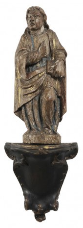 Northern European School
 (possibly 17th century) Relief of a Gospel Writer, possibly Saint John, carved, polychromed and gilt wood with painted plaster shelf, figure 15-1/4 in., shelf 9 in.,
Northern European School
Northern European School (possibly 17th century) Relief of a Gospel Writer, possibly Saint John, carved, polychromed and gilt wood with painted plaster shelf, figure 15-1/4 in., shelf 9 in., -
 Two Southw
Two Southw
Two Southw -
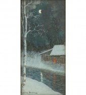 Gulbrand Sether (Norwegian/American
 1869-1941) evening winter landscape with cabin watercolor signed lower left After studying art in Norway with the Norwegian city and landscape painter, Fritz Thaulow, Sether emigrated to the US in 1893. Around 1900 he settled in Chicago’s Humboldt Park where he had his own studio. 11 1/4" x 5 1/4"
Gulbrand Sether (Norwegian/American
Gulbrand Sether (Norwegian/American 1869-1941) evening winter landscape with cabin watercolor signed lower left After studying art in Norway with the Norwegian city and landscape painter, Fritz Thaulow, Sether emigrated to the US in 1893. Around 1900 he settled in Chicago’s Humboldt Park where he had his own studio. 11 1/4" x 5 1/4" -
 Two Southw
Two Southw
Two Southw -
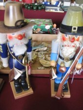 2 Christmas Nutcrackers in Civil
 War Univorm North & South.
2 Christmas Nutcrackers in Civil
2 Christmas Nutcrackers in Civil War Univorm North & South. -
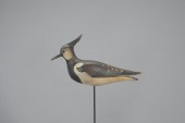 NORTHERN LAPWINGMark S. McNair
 (b. 1950) Craddockville, VA, 2006 12 in. long This striking plover is a rare visitor to North America yet is easily recognizable by its regal crest which is represented here with a leather inlay. This is the first of only two or three by the artist. The maker's incised signature is on the underside along with a "1." Original paint with light wear. Provenance: Harry and Judy Bextel Collection
NORTHERN LAPWINGMark S. McNair
NORTHERN LAPWINGMark S. McNair (b. 1950) Craddockville, VA, 2006 12 in. long This striking plover is a rare visitor to North America yet is easily recognizable by its regal crest which is represented here with a leather inlay. This is the first of only two or three by the artist. The maker's incised signature is on the underside along with a "1." Original paint with light wear. Provenance: Harry and Judy Bextel Collection -
 Southw
Southw
Southw -
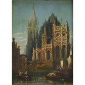 Northern European School, 19th c
 - A Riverside Cathedral, oil on panel, 36.5 x 27cm More Information Varnish slightly yellowed, requiring a clean
Northern European School, 19th c
Northern European School, 19th c - A Riverside Cathedral, oil on panel, 36.5 x 27cm More Information Varnish slightly yellowed, requiring a clean -
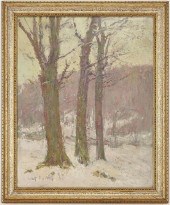 SOUTHERN O/B IMPRESSIONIST WINTER
 LANDSCAPE PAINTINGSouthern oil on board impressionist winter landscape snow scene, titled "View at Sweetbriar, VA", depicting a stand of trees in the foreground with hills or mountains in the background, rendered in an impasto manner using soft pastel colors. Signed illegibly lower left "E H *** P/F***". Pencil inscription with title, en verso. Housed in a modern gilt wood frame. Sight: 19 5/8" H x 15 1/2" W. Framed: 23" H x 19" W. 20th century. Provenance: The collection of Gary Glesser of Loudon, Tennessee, by descent from his grandparents, Captain Hoyt and Rachel Holton of Toledo, Ohio. See description for provenance information. Condition: Overall very good condition with minute scattered craquelure and possible a few paint flakes around signature.
SOUTHERN O/B IMPRESSIONIST WINTER
SOUTHERN O/B IMPRESSIONIST WINTER LANDSCAPE PAINTINGSouthern oil on board impressionist winter landscape snow scene, titled "View at Sweetbriar, VA", depicting a stand of trees in the foreground with hills or mountains in the background, rendered in an impasto manner using soft pastel colors. Signed illegibly lower left "E H *** P/F***". Pencil inscription with title, en verso. Housed in a modern gilt wood frame. Sight: 19 5/8" H x 15 1/2" W. Framed: 23" H x 19" W. 20th century. Provenance: The collection of Gary Glesser of Loudon, Tennessee, by descent from his grandparents, Captain Hoyt and Rachel Holton of Toledo, Ohio. See description for provenance information. Condition: Overall very good condition with minute scattered craquelure and possible a few paint flakes around signature. -
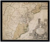 18th century map, eastern United
 States, "Virginia Marylandia et Carolina, in America Septentrionali, Brittanorum industria exclutae…" by Johann Baptist Homann, originally published in Homann's Atlas Novus , Nuremberg, Germany, 1714, showing New York southward to the Carolinas, fictional "Apalache Lacus" pictured lower left, ornate title cartouche lower right showing British merchants with trade goods, Native Americans, wild animals, tobacco and drying shed, hand-colored engraving on laid paper, 19-3/4 x 23 in. (page); modern wood frame. Laid down on acidic card, foxing, toning, stains, fading, trimmed including plate marks, ink inscriptions in title cartouche, other pencil and ink inscriptions; frame with abrasions. Estate of the Late Nathan and Mary Anne McCarley, Asheville, North Carolina.
18th century map, eastern United
18th century map, eastern United States, "Virginia Marylandia et Carolina, in America Septentrionali, Brittanorum industria exclutae…" by Johann Baptist Homann, originally published in Homann's Atlas Novus , Nuremberg, Germany, 1714, showing New York southward to the Carolinas, fictional "Apalache Lacus" pictured lower left, ornate title cartouche lower right showing British merchants with trade goods, Native Americans, wild animals, tobacco and drying shed, hand-colored engraving on laid paper, 19-3/4 x 23 in. (page); modern wood frame. Laid down on acidic card, foxing, toning, stains, fading, trimmed including plate marks, ink inscriptions in title cartouche, other pencil and ink inscriptions; frame with abrasions. Estate of the Late Nathan and Mary Anne McCarley, Asheville, North Carolina. -
 TWELVE BOOKS MOSTLY ON SOUTHERN
 PEOPLE, PLACES, AND PASTIMES Largest 4to (over 9 in. spine), to include: The Poetical Works of Elizabeth Barret Browning (1897);Journal and Letters of Philip Vickers Fithian (1943); Parker: America's Finest Shotgun (1961); Pennsy Power (1962); Architecture of the Old South: South Carolina (1984); L.L. Bean (1987), a company history; Slavery Time When I was Chillun Down on Marster's Plantation (1990); Architecture of the Old South: Maryland (1991); The Sporting Life (1992); Through the Heart of the South: The Seaboard Airline Railroad Story (1995); Confederate Faces in Color (2013);
TWELVE BOOKS MOSTLY ON SOUTHERN
TWELVE BOOKS MOSTLY ON SOUTHERN PEOPLE, PLACES, AND PASTIMES Largest 4to (over 9 in. spine), to include: The Poetical Works of Elizabeth Barret Browning (1897);Journal and Letters of Philip Vickers Fithian (1943); Parker: America's Finest Shotgun (1961); Pennsy Power (1962); Architecture of the Old South: South Carolina (1984); L.L. Bean (1987), a company history; Slavery Time When I was Chillun Down on Marster's Plantation (1990); Architecture of the Old South: Maryland (1991); The Sporting Life (1992); Through the Heart of the South: The Seaboard Airline Railroad Story (1995); Confederate Faces in Color (2013); -
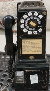 NORTHERN ELECTRIC BLACK PAINTED
 METAL PAY PHONENorthern Electric Black Painted Metal Pay Phone
NORTHERN ELECTRIC BLACK PAINTED
NORTHERN ELECTRIC BLACK PAINTED METAL PAY PHONENorthern Electric Black Painted Metal Pay Phone -
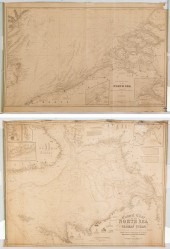 TWO NAUTICAL CHARTS Comprising:
 1) "General chart of the North Sea or German Ocean" (London: J. Imray 1853) With a tear and some damp damage; and 2) "Southern Part of the North Sea" (London: Wilson 1862) With considerable tearing. Each laid down at the time of production on partridge paper and marked with makers mark.
TWO NAUTICAL CHARTS Comprising:
TWO NAUTICAL CHARTS Comprising: 1) "General chart of the North Sea or German Ocean" (London: J. Imray 1853) With a tear and some damp damage; and 2) "Southern Part of the North Sea" (London: Wilson 1862) With considerable tearing. Each laid down at the time of production on partridge paper and marked with makers mark. -
 A NORTHERN PLAINS FUR LINED
 FETISH AND A NORTHERN CALIFORNIA BEADWORK NECKLACE (lot of 2) Native American beaded articles, the first Northern Plains beaded fur lined fetish, 9.75"l and Northern California beadwork necklace. Provenance: Lew Sarett (1888 - 1954), American poet and professor
A NORTHERN PLAINS FUR LINED
A NORTHERN PLAINS FUR LINED FETISH AND A NORTHERN CALIFORNIA BEADWORK NECKLACE (lot of 2) Native American beaded articles, the first Northern Plains beaded fur lined fetish, 9.75"l and Northern California beadwork necklace. Provenance: Lew Sarett (1888 - 1954), American poet and professor -
 SIGNED AND DATED SCRIMSHAW
 WHALE'S TOOTH PERTAINING TO THE SHIP "NORTHERN LIGHT" DATED 1861 LENGTH 6.75".SIGNED AND DATED SCRIMSHAW WHALE'S TOOTH PERTAINING TO THE SHIP "NORTHERN LIGHT", Dated 1861, Obverse depicts a full-rigged ship flying an American flag and another distant ship coming head-on. In the foreground, mostly depicted on the edge of the tooth, is a whaling scene of a pod of whales, one of which is waifed, two whaleboats in pursuit, and an overturned whaleboat, with her six men and assorted gear in the water. Reverse depicts a coastal scene of a large lighthouse, buildings, and several vessels of different rigs, some of which are flying American flags. Other edge depicts a sperm whale inscribed "Ship Northern Light N.B." at center, signed "J.T." on upper fluke and dated "1861" on lower fluke. Whale executed in a unique parquet patchwork pattern, and the water on both the obverse and reverse scenes has a rope-like pattern. Dimensions: Length 6.75". Provenance: Rafael Osona Auctions, Nantucket, Massachusetts, August 7, 2004, Lot #186G.The Collection of Michael Gill.Notes:According to the WhalingHistory.org database, the ship Northern Light was built in Mattapoisett, Massachusetts in 1851. She made several voyages out of New Bedford from 1851 to 1881 and was lost in 1898. On an 1861 to 1862 voyage, her master was Jacob Taber, possibly the "J.T." signature seen here. Taber made another voyage aboard the Northern Light from 1863 to 1864, as well as seven other voyages on other vessels.
SIGNED AND DATED SCRIMSHAW
SIGNED AND DATED SCRIMSHAW WHALE'S TOOTH PERTAINING TO THE SHIP "NORTHERN LIGHT" DATED 1861 LENGTH 6.75".SIGNED AND DATED SCRIMSHAW WHALE'S TOOTH PERTAINING TO THE SHIP "NORTHERN LIGHT", Dated 1861, Obverse depicts a full-rigged ship flying an American flag and another distant ship coming head-on. In the foreground, mostly depicted on the edge of the tooth, is a whaling scene of a pod of whales, one of which is waifed, two whaleboats in pursuit, and an overturned whaleboat, with her six men and assorted gear in the water. Reverse depicts a coastal scene of a large lighthouse, buildings, and several vessels of different rigs, some of which are flying American flags. Other edge depicts a sperm whale inscribed "Ship Northern Light N.B." at center, signed "J.T." on upper fluke and dated "1861" on lower fluke. Whale executed in a unique parquet patchwork pattern, and the water on both the obverse and reverse scenes has a rope-like pattern. Dimensions: Length 6.75". Provenance: Rafael Osona Auctions, Nantucket, Massachusetts, August 7, 2004, Lot #186G.The Collection of Michael Gill.Notes:According to the WhalingHistory.org database, the ship Northern Light was built in Mattapoisett, Massachusetts in 1851. She made several voyages out of New Bedford from 1851 to 1881 and was lost in 1898. On an 1861 to 1862 voyage, her master was Jacob Taber, possibly the "J.T." signature seen here. Taber made another voyage aboard the Northern Light from 1863 to 1864, as well as seven other voyages on other vessels. -
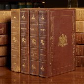 (14) VOLS., NORROENA ANGLO SAXON
 CLASSICS, 1906 The History and Romance of Northern Europe, Norroena Society, Saxo Edition, #14 of 350 sets, with color frontispieces, the limitation page of Saxo Grammaticus I signed "A.B. Anderson", fine full leather binding stamped with Viking ships and swords, top edges gilt, ribbon markers, 9.25"h x 6.5"w
(14) VOLS., NORROENA ANGLO SAXON
(14) VOLS., NORROENA ANGLO SAXON CLASSICS, 1906 The History and Romance of Northern Europe, Norroena Society, Saxo Edition, #14 of 350 sets, with color frontispieces, the limitation page of Saxo Grammaticus I signed "A.B. Anderson", fine full leather binding stamped with Viking ships and swords, top edges gilt, ribbon markers, 9.25"h x 6.5"w -
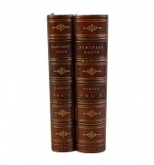 TWO VOLUMES: "FRIDTJOF NANSEN'S
 FARTHEST NORTH"Nanse, Fridtjof "Farthest North" Westminster: Archibald Constable & Company, 1897 [2 volumes] Condition: with discoloration to some pages Condition:
TWO VOLUMES: "FRIDTJOF NANSEN'S
TWO VOLUMES: "FRIDTJOF NANSEN'S FARTHEST NORTH"Nanse, Fridtjof "Farthest North" Westminster: Archibald Constable & Company, 1897 [2 volumes] Condition: with discoloration to some pages Condition: -
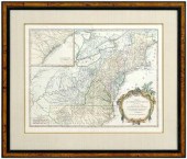 18th century map of North
 America, "Partie De L'Amerique Septentrionale, qui comprend Le Cours De L'Ohio, La Nlle. Angleterre, La Nlle. York, Le New Jersey, La Pensylvanie, Le Maryland, La Virginie, La Caroline " by Gilles and Didier Robert de Vaugondy, Eastern Seaboard with an inset map of Carolina, published by the Robert de Vaugondy family in Atlas Universel , Paris, 1755, copper engraving on laid paper with watermarks, 18-3/4 x 21-1/4 in.; modern wood frame. Hinged with archival tape, moderate foxing, light toning, stains, creases, reinforced center crease, ink stamp verso (possibly period); frame with abrasions, Village Smith Galleries label on backing. Private Collection, Winston-Salem, North Carolina
18th century map of North
18th century map of North America, "Partie De L'Amerique Septentrionale, qui comprend Le Cours De L'Ohio, La Nlle. Angleterre, La Nlle. York, Le New Jersey, La Pensylvanie, Le Maryland, La Virginie, La Caroline " by Gilles and Didier Robert de Vaugondy, Eastern Seaboard with an inset map of Carolina, published by the Robert de Vaugondy family in Atlas Universel , Paris, 1755, copper engraving on laid paper with watermarks, 18-3/4 x 21-1/4 in.; modern wood frame. Hinged with archival tape, moderate foxing, light toning, stains, creases, reinforced center crease, ink stamp verso (possibly period); frame with abrasions, Village Smith Galleries label on backing. Private Collection, Winston-Salem, North Carolina -
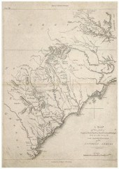 19th century map of the
 Southeast, "A Map of those parts of Virginia, North Carolina, South Carolina, and Georgia, which were the scenes of the most important Operations of the Southern Armies", by Francis Shallus, plate VIII of The Life of Washington: Maps and Subscribers Names, published circa 1807 by C.P. Wayne, Philadelphia, copper engraving on laid paper, 16-1/4 x 11 in. (page). Loose, trimmed including plate marks, creases, light foxing, toning, fading, smudges.
19th century map of the
19th century map of the Southeast, "A Map of those parts of Virginia, North Carolina, South Carolina, and Georgia, which were the scenes of the most important Operations of the Southern Armies", by Francis Shallus, plate VIII of The Life of Washington: Maps and Subscribers Names, published circa 1807 by C.P. Wayne, Philadelphia, copper engraving on laid paper, 16-1/4 x 11 in. (page). Loose, trimmed including plate marks, creases, light foxing, toning, fading, smudges. -
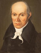 North European School, early 19th
 Century/Portrait of a Gentleman/bust length, wearing a black coat and a white neck tie/oil on canvas, 22cm x 17.5cm
North European School, early 19th
North European School, early 19th Century/Portrait of a Gentleman/bust length, wearing a black coat and a white neck tie/oil on canvas, 22cm x 17.5cm -
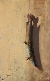 BRUCE KURLAND (AMERICAN, 1938-2013)
 "NORTHERN PIKE" oil on board. signed BK (lower left). Exhibited: New York: National Academy of Design, 1975.
BRUCE KURLAND (AMERICAN, 1938-2013)
BRUCE KURLAND (AMERICAN, 1938-2013) "NORTHERN PIKE" oil on board. signed BK (lower left). Exhibited: New York: National Academy of Design, 1975.
...many more examples with full details are available to our members - Learn more


