Pricing Guides & Dictionary of Makers Marks for Antiques & Collectibles

A few examples of appraisal values for
TEXAS
Search our price guide for your own treasures
-
 William A. Slaughter Texas painting
 (Texas, born 1923), barn and bluebonnets, signed lower left "W.A. Slaughter", oil on canvas, 14 x 10-7/8 in.; original distressed wood frame. Original stretcher and tacking edge, good condition; frame with abrasions. Southwest Gallery (original receipt verso); Jim Harmon, Dallas, Texas.
William A. Slaughter Texas painting
William A. Slaughter Texas painting (Texas, born 1923), barn and bluebonnets, signed lower left "W.A. Slaughter", oil on canvas, 14 x 10-7/8 in.; original distressed wood frame. Original stretcher and tacking edge, good condition; frame with abrasions. Southwest Gallery (original receipt verso); Jim Harmon, Dallas, Texas. -
 Texas bluebonnet landscape oil on
 canvasboard. 3.75'' H x 4.75'' W.
Texas bluebonnet landscape oil on
Texas bluebonnet landscape oil on canvasboard. 3.75'' H x 4.75'' W. -
 Oil on canvas laid down on board of
 a summer landscape with Texas bluebonnets, signed lower right "C.E. Clenney", sight 11"h x 17 1/2"w
Oil on canvas laid down on board of
Oil on canvas laid down on board of a summer landscape with Texas bluebonnets, signed lower right "C.E. Clenney", sight 11"h x 17 1/2"w -
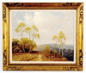 A. D. Greer New York/Texas
 (1904-1998) NATURE'S SENTINELLES oil on canvas framed signed: lower right A.D. Greer H24'' W30'' Provenance: Estate of Governor John Connally Texas. Viola Collectibles Inc. Houston Texas Upstate South Carolina private collection. Other Notes: Aubrey Dale Greer lived much of his life in Austin Texas. He was active from 1938 to 1986 and was a painter muralist and commercial artist. This painting depicts the Texas ''Hill Country'' in the fall. Back   Inquiry    Previous Item  Next Item © Charlton Hall Auctions. Images descriptions and condition reports used on this site are original copyright material and are not to be reproduced without permission. For further information telephone 803.779.5678   © 2012 CHARLTON HALL GALLERIES INC.
A. D. Greer New York/Texas
A. D. Greer New York/Texas (1904-1998) NATURE'S SENTINELLES oil on canvas framed signed: lower right A.D. Greer H24'' W30'' Provenance: Estate of Governor John Connally Texas. Viola Collectibles Inc. Houston Texas Upstate South Carolina private collection. Other Notes: Aubrey Dale Greer lived much of his life in Austin Texas. He was active from 1938 to 1986 and was a painter muralist and commercial artist. This painting depicts the Texas ''Hill Country'' in the fall. Back   Inquiry    Previous Item  Next Item © Charlton Hall Auctions. Images descriptions and condition reports used on this site are original copyright material and are not to be reproduced without permission. For further information telephone 803.779.5678   © 2012 CHARLTON HALL GALLERIES INC. -
 TEXAS SCHOOL, A PHOTOGRAPH,
 "ABSTRACT SUNSET LANDSCAPE ...TEXAS SCHOOL, A PHOTOGRAPH, "Abstract Sunset Landscape (Untitled)," photograph in color mounted to acrylic, 47 1/2" x 66". Condition: Some surface wear, glue on lower areas, and overall in good condition. Unsigned. Simpson Galleries strongly encourages in-person inspection of items by the bidder. Statements by Simpson Galleries regarding the condition of objects are for guidance only and should not be relied upon as statements of fact and do not constitute a representation, warranty, or assumption of liability by Simpson Galleries. All lots offered are sold "AS IS."
TEXAS SCHOOL, A PHOTOGRAPH,
TEXAS SCHOOL, A PHOTOGRAPH, "ABSTRACT SUNSET LANDSCAPE ...TEXAS SCHOOL, A PHOTOGRAPH, "Abstract Sunset Landscape (Untitled)," photograph in color mounted to acrylic, 47 1/2" x 66". Condition: Some surface wear, glue on lower areas, and overall in good condition. Unsigned. Simpson Galleries strongly encourages in-person inspection of items by the bidder. Statements by Simpson Galleries regarding the condition of objects are for guidance only and should not be relied upon as statements of fact and do not constitute a representation, warranty, or assumption of liability by Simpson Galleries. All lots offered are sold "AS IS." -
 PAINTING, TEXAS BLUEBONNETS, 1926
 American School (20th century), Texas Bluebonnets, 1926, oil on panel, signed indistinctly "G. Flury (?)" and dated lower right, panel: 9"h x 12"w, overall (with frame): 13.5"h x 16.5"w
PAINTING, TEXAS BLUEBONNETS, 1926
PAINTING, TEXAS BLUEBONNETS, 1926 American School (20th century), Texas Bluebonnets, 1926, oil on panel, signed indistinctly "G. Flury (?)" and dated lower right, panel: 9"h x 12"w, overall (with frame): 13.5"h x 16.5"w -
 IRENE KLEIN "TEXAS BLUEBONNET"
 OIL ON CANVAS BOARDIrene Klein (Austin, TX, ? - 2013), . Irene Klein is a recognized artist whose paintings are hung in homes, businesses, and private & public collections all over the world. This example is a beautiful oil painting on canvas art board depicting a Texas Landscape with Bluebonnet flowers in bloom, signed Irene Klein lower right; canvas board measures approximately 11-7/8" x 15-7/8".
IRENE KLEIN "TEXAS BLUEBONNET"
IRENE KLEIN "TEXAS BLUEBONNET" OIL ON CANVAS BOARDIrene Klein (Austin, TX, ? - 2013), . Irene Klein is a recognized artist whose paintings are hung in homes, businesses, and private & public collections all over the world. This example is a beautiful oil painting on canvas art board depicting a Texas Landscape with Bluebonnet flowers in bloom, signed Irene Klein lower right; canvas board measures approximately 11-7/8" x 15-7/8". -
 FREDERICK CARTER ABSTRACT LANDSCAPE
 OIL PAINTING Texas,1925-2010Semi-abstract fauvist landscape of Texas depicting rocky terrain overlooking farmland with a river and town in the background.
FREDERICK CARTER ABSTRACT LANDSCAPE
FREDERICK CARTER ABSTRACT LANDSCAPE OIL PAINTING Texas,1925-2010Semi-abstract fauvist landscape of Texas depicting rocky terrain overlooking farmland with a river and town in the background. -
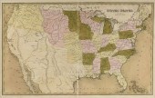 AN ANTIQUE MAP, "UNITED STATES,"
 BOSTON, CIRCA 1838,AN ANTIQUE MAP, "United States," BOSTON, CIRCA 1838, hand colored engraving on paper, showing Texas as an independent nation, a page fragment from an atlas, Thomas Gamaliel Bradford (1802-1887) cartographer. 15" x 23 1/2" Note: The present map is a good example of early American state formation and attributed as a page fragment from An Illustrated Atlas Geographical, Statistical and Historical of the United States and Adjacent Countries published by T.G. Bradford in 1838. T.G. Bradford is among the first cartographers to record Texas as an independent nation. The Republic of Texas existed from 1836-1846. Provenance: Property from a Fortune 500 Energy Company, Houston, Texas. Condition: Some fading of hand coloring, some acid bleed of text, some foxing spots, apparent tears, mostly at crease, but overall in good to very good condition, wear commensurate with age and use. Simpson Galleries strongly encourages in-person inspection of items by the bidder. Statements by Simpson Galleries regarding the condition of objects are for guidance only and should not be relied upon as statements of fact and do not constitute a representation, warranty, or assumption of liability by Simpson Galleries. All lots offered are sold "AS IS."
AN ANTIQUE MAP, "UNITED STATES,"
AN ANTIQUE MAP, "UNITED STATES," BOSTON, CIRCA 1838,AN ANTIQUE MAP, "United States," BOSTON, CIRCA 1838, hand colored engraving on paper, showing Texas as an independent nation, a page fragment from an atlas, Thomas Gamaliel Bradford (1802-1887) cartographer. 15" x 23 1/2" Note: The present map is a good example of early American state formation and attributed as a page fragment from An Illustrated Atlas Geographical, Statistical and Historical of the United States and Adjacent Countries published by T.G. Bradford in 1838. T.G. Bradford is among the first cartographers to record Texas as an independent nation. The Republic of Texas existed from 1836-1846. Provenance: Property from a Fortune 500 Energy Company, Houston, Texas. Condition: Some fading of hand coloring, some acid bleed of text, some foxing spots, apparent tears, mostly at crease, but overall in good to very good condition, wear commensurate with age and use. Simpson Galleries strongly encourages in-person inspection of items by the bidder. Statements by Simpson Galleries regarding the condition of objects are for guidance only and should not be relied upon as statements of fact and do not constitute a representation, warranty, or assumption of liability by Simpson Galleries. All lots offered are sold "AS IS." -
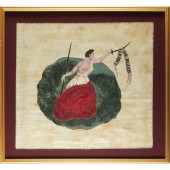 LARGE FRAMED SAN JACINTO "LIBERTY
 OR DEATH" FLAG 20th c., hand-made replica of the flag carried by Texans in the 1836 battle with Santa Ana's army, which was soundly defeated by the outnumbered Texan force, setting the stage for an independent Texas, pigment on cotton, mounted in a shadowbox frame, gallery label verso, 29.5"h x 32"w (flag), 37.25"h x 40.25"w x 2"d (frame)
LARGE FRAMED SAN JACINTO "LIBERTY
LARGE FRAMED SAN JACINTO "LIBERTY OR DEATH" FLAG 20th c., hand-made replica of the flag carried by Texans in the 1836 battle with Santa Ana's army, which was soundly defeated by the outnumbered Texan force, setting the stage for an independent Texas, pigment on cotton, mounted in a shadowbox frame, gallery label verso, 29.5"h x 32"w (flag), 37.25"h x 40.25"w x 2"d (frame) -
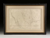 A REPUBLIC OF TEXAS MAP, "MAP OF
 TEXAS AND THE COUNTRIE...A REPUBLIC OF TEXAS MAP, "Map of Texas and the Countries Adjacent," W.H. EMORY, WASHINGTON D.C., CIRCA 1844, lithograph on paper, printed by William J. Stone, "Compiled in the Bureau of the Corps of Topographical Engineers for the State Department. Under the direction of J.J. Abert, Chief of the Corps, by W.H. Emory 1st Leuit. T.E., War Department, 1844.," "Published by order of the U.S. Senate.," recognizing Austin as the Capital of Texas, established for only five years at the time of printing, with note confirming the accuracy of the Arkansas River, an excerpt, "The present boundaries of Texas are defined by an act of the Texian Congress, approved on December 19th, 1836 to be as follows, "Beginning at the mouth of the Rio Grande thence up the principal stream of said river to its source, thence due North to the 42º North latitude; thence along the boundary line as defined in the treaty between the United States and Spain, to the beginning," estimated number of Free Whites 140,000 and Slaves 22,410, Galveston population 5,000, Houston population 4,500, Austin population 200, a note on the arguable accuracy of the Presidio de Rio Grande and San Antonio de Bexar. 22" x 33 1/2" Note: William Hemsley Emory (1811-1887), Surveyor. Provenance: Property from a Corporate Collection, Houston, Texas. Property from a Corporate Collection, Houston, Texas Condition: Some handling creases, a buckle in foreground, some stains, fading of hand color, some loss at neatline, overall in good to very good condition, wear commensurate with age and use. Simpson Galleries strongly encourages in-person inspection of items by the bidder. Statements by Simpson Galleries regarding the condition of objects are for guidance only and should not be relied upon as statements of fact and do not constitute a representation, warranty, or assumption of liability by Simpson Galleries. All lots offered are sold "AS IS.” NO REFUNDS will be issued based on condition.
A REPUBLIC OF TEXAS MAP, "MAP OF
A REPUBLIC OF TEXAS MAP, "MAP OF TEXAS AND THE COUNTRIE...A REPUBLIC OF TEXAS MAP, "Map of Texas and the Countries Adjacent," W.H. EMORY, WASHINGTON D.C., CIRCA 1844, lithograph on paper, printed by William J. Stone, "Compiled in the Bureau of the Corps of Topographical Engineers for the State Department. Under the direction of J.J. Abert, Chief of the Corps, by W.H. Emory 1st Leuit. T.E., War Department, 1844.," "Published by order of the U.S. Senate.," recognizing Austin as the Capital of Texas, established for only five years at the time of printing, with note confirming the accuracy of the Arkansas River, an excerpt, "The present boundaries of Texas are defined by an act of the Texian Congress, approved on December 19th, 1836 to be as follows, "Beginning at the mouth of the Rio Grande thence up the principal stream of said river to its source, thence due North to the 42º North latitude; thence along the boundary line as defined in the treaty between the United States and Spain, to the beginning," estimated number of Free Whites 140,000 and Slaves 22,410, Galveston population 5,000, Houston population 4,500, Austin population 200, a note on the arguable accuracy of the Presidio de Rio Grande and San Antonio de Bexar. 22" x 33 1/2" Note: William Hemsley Emory (1811-1887), Surveyor. Provenance: Property from a Corporate Collection, Houston, Texas. Property from a Corporate Collection, Houston, Texas Condition: Some handling creases, a buckle in foreground, some stains, fading of hand color, some loss at neatline, overall in good to very good condition, wear commensurate with age and use. Simpson Galleries strongly encourages in-person inspection of items by the bidder. Statements by Simpson Galleries regarding the condition of objects are for guidance only and should not be relied upon as statements of fact and do not constitute a representation, warranty, or assumption of liability by Simpson Galleries. All lots offered are sold "AS IS.” NO REFUNDS will be issued based on condition. -
 TEXAS 2005 NATIONAL CHAMPIONS
 PHOTO, COACH SIGNEDFramed panoramic photographic color copy of the 2005 BCS National Championship Rose Bowl football game between the University of Texas Longhorns and the University of Southern California Trojans, the Longhorns with head coach Mack Brown and quarterback Vince Young winning the game 41 to 37, the photo copy signed by Mack Brown the Texas head coach, photo from the Rob Arra collection, approx. 41.5"h, 15.75"w, 5.25lbs
TEXAS 2005 NATIONAL CHAMPIONS
TEXAS 2005 NATIONAL CHAMPIONS PHOTO, COACH SIGNEDFramed panoramic photographic color copy of the 2005 BCS National Championship Rose Bowl football game between the University of Texas Longhorns and the University of Southern California Trojans, the Longhorns with head coach Mack Brown and quarterback Vince Young winning the game 41 to 37, the photo copy signed by Mack Brown the Texas head coach, photo from the Rob Arra collection, approx. 41.5"h, 15.75"w, 5.25lbs -
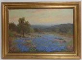 PORFIRIO SALINAS 1910-73 TEXAS
 BLUEBONNETS O/CPorfirio Salinas American-Texan, 1910-1973 Texas Hills with Bluebonnets, oil on canvas, signed lower left. estate and market fresh. Dimensions: 20x30, framed 26x36 Property from a Washington Connecticut Estate (PERR6247)(TC) Condition: faint vertical craquelure visible in the sky, drying crackle in the impasto of leaves on the some of the trees, would probably benefit from a cleaning
PORFIRIO SALINAS 1910-73 TEXAS
PORFIRIO SALINAS 1910-73 TEXAS BLUEBONNETS O/CPorfirio Salinas American-Texan, 1910-1973 Texas Hills with Bluebonnets, oil on canvas, signed lower left. estate and market fresh. Dimensions: 20x30, framed 26x36 Property from a Washington Connecticut Estate (PERR6247)(TC) Condition: faint vertical craquelure visible in the sky, drying crackle in the impasto of leaves on the some of the trees, would probably benefit from a cleaning -
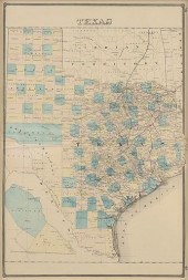 AN ANTIQUE MAP, "TEXAS AND INDIAN
 TERRITORY," 1880-1901...AN ANTIQUE MAP, "Texas and Indian Territory," 1880-1901, hand colored engraving on paper, a page fragment from an atlas, pages 66-67, unusually a portion of West Texas is inverted in the L/L of the map; the vertical map of Texas showing railroads, Indian territories, counties, and the yet organized Bexar Territory of West Texas, within a repeating box chain and line border joined by rosettes. 25 1/2" x 17" Provenance: Property from a Fortune 500 Energy Company, Houston, Texas. Condition: Some creases, fading, joined paper, minor buckling at center, but overall in very good condition, wear commensurate with age. Simpson Galleries strongly encourages in-person inspection of items by the bidder. Statements by Simpson Galleries regarding the condition of objects are for guidance only and should not be relied upon as statements of fact and do not constitute a representation, warranty, or assumption of liability by Simpson Galleries. All lots offered are sold "AS IS."
AN ANTIQUE MAP, "TEXAS AND INDIAN
AN ANTIQUE MAP, "TEXAS AND INDIAN TERRITORY," 1880-1901...AN ANTIQUE MAP, "Texas and Indian Territory," 1880-1901, hand colored engraving on paper, a page fragment from an atlas, pages 66-67, unusually a portion of West Texas is inverted in the L/L of the map; the vertical map of Texas showing railroads, Indian territories, counties, and the yet organized Bexar Territory of West Texas, within a repeating box chain and line border joined by rosettes. 25 1/2" x 17" Provenance: Property from a Fortune 500 Energy Company, Houston, Texas. Condition: Some creases, fading, joined paper, minor buckling at center, but overall in very good condition, wear commensurate with age. Simpson Galleries strongly encourages in-person inspection of items by the bidder. Statements by Simpson Galleries regarding the condition of objects are for guidance only and should not be relied upon as statements of fact and do not constitute a representation, warranty, or assumption of liability by Simpson Galleries. All lots offered are sold "AS IS." -
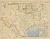 A GROUP OF TWO ANTIQUE MAPS OF
 THE STATE OF TEXAS, AMER...A GROUP OF TWO ANTIQUE MAPS OF THE STATE OF TEXAS, AMERICAN, EARLY 20TH CENTURY, "No. 13 Map of the State of Texas," Philadelphia, circa 1912, hand colored engraving on paper, a page fragment from Mitchell's School and Family Geography, publishing attributed to the son of Samuel Augustus Mitchell, showing the newly formed state of New Mexico, 11" x 8 1/2"; and "Southern States Western Section," New York, four color linotype print on paper, published by Mathews, Northup & Co., with view of New Orleans and Vicinity, a pedagogical map, the margins including notable geographic laying on the same latitudinal line, and times of day in Greenwich and Washington, the Gulf of Mexico depths expressed, 9" x 11". Provenance: Property from a Fortune 500 Energy Company, Houston, Texas. Condition: Mild yellowing, occasional stains, but overall in good to very good condition, wear commensurate with age. Simpson Galleries strongly encourages in-person inspection of items by the bidder. Statements by Simpson Galleries regarding the condition of objects are for guidance only and should not be relied upon as statements of fact and do not constitute a representation, warranty, or assumption of liability by Simpson Galleries. All lots offered are sold "AS IS."
A GROUP OF TWO ANTIQUE MAPS OF
A GROUP OF TWO ANTIQUE MAPS OF THE STATE OF TEXAS, AMER...A GROUP OF TWO ANTIQUE MAPS OF THE STATE OF TEXAS, AMERICAN, EARLY 20TH CENTURY, "No. 13 Map of the State of Texas," Philadelphia, circa 1912, hand colored engraving on paper, a page fragment from Mitchell's School and Family Geography, publishing attributed to the son of Samuel Augustus Mitchell, showing the newly formed state of New Mexico, 11" x 8 1/2"; and "Southern States Western Section," New York, four color linotype print on paper, published by Mathews, Northup & Co., with view of New Orleans and Vicinity, a pedagogical map, the margins including notable geographic laying on the same latitudinal line, and times of day in Greenwich and Washington, the Gulf of Mexico depths expressed, 9" x 11". Provenance: Property from a Fortune 500 Energy Company, Houston, Texas. Condition: Mild yellowing, occasional stains, but overall in good to very good condition, wear commensurate with age. Simpson Galleries strongly encourages in-person inspection of items by the bidder. Statements by Simpson Galleries regarding the condition of objects are for guidance only and should not be relied upon as statements of fact and do not constitute a representation, warranty, or assumption of liability by Simpson Galleries. All lots offered are sold "AS IS." -
 CAL GASPARD (AMERICAN,
 1934-2020), TEXAS BLUEBONNETS Oil on Masonite, signed at lower right, framed.
CAL GASPARD (AMERICAN,
CAL GASPARD (AMERICAN, 1934-2020), TEXAS BLUEBONNETS Oil on Masonite, signed at lower right, framed. -
 MANUEL GARZA (TX, B.1940)
 BLUEBONNETS, 30" X 40"Framed oil on canvas painting, Texas Bluebonnets, signed lower left Manuel Garza (Texas, b.1940), sight: 29.5"h, 39.5"w, overall: 41.5"h, 51.5"w, 30lbs
MANUEL GARZA (TX, B.1940)
MANUEL GARZA (TX, B.1940) BLUEBONNETS, 30" X 40"Framed oil on canvas painting, Texas Bluebonnets, signed lower left Manuel Garza (Texas, b.1940), sight: 29.5"h, 39.5"w, overall: 41.5"h, 51.5"w, 30lbs -
 AN IMPORTANT REPUBLIC OF TEXAS MAP,
 "MAP OF TEXAS," NEW...AN IMPORTANT REPUBLIC OF TEXAS MAP, "Map of Texas," NEW YORK, 1839, hand colored engraving on paper, "Compiled from surveys on record in the General Land Office of the Republic, to the year 1839," by Richard S. Hunt and Jess F. Randel, published by J.H. Colton, engraved by Stiles, Sherman & Smith, with original cloth covered gilt tooled front board, "Guide to Texas with a Map, Published by J.H. Colton, 1839," a lower view, "Map of the Rio Grande and the Country west to the Pacific," signed in plate by James Web (1792–1856), Secretary of State, John Woodward, Consul General of Texas in New York from 1836-1840, Francis Moore (1808–1864), Editor Telegraph Houston, and John Petit Borden (1812–1891), Commissioner, General Land Office, with General Land Office seal used 1838-1842. 31 1/2" x 24" Note: The map showing early Texas Colonies divided by red hand colored lines: McMullen & McGloin's Colony, Power's Colony, Dewitt's Colony, Austin's Small Colony, Robertson's Colony, Milam's Colony, Leon's Colony, and an unnamed colony between Austin's Colony and Zavala Colony in the east. Counties are hand colored respectively in yellow, orange, green and blue, and include Fannin, Red River, Nacogdoches, Robertson, Harrisburg, Milam, Harrison, Shelby, San Augustine, Houston, Liberty, Jefferson, Galveston, Brazoria, Fort Bend, Bastrop, Austin, Washington, Fayette, Matagorda, Victoria, Refugio, Goliad San Patricio, and Bexar Counties. The map details major waterways, mentioning Comanche Ranches, Herds of Buffaloes, Cado villages burned by Gen. Rush in January 1839, Enchanted Rock and other topographical elevations expressed in hachur, the Old Spanish road from Santa Fe to Bexar, and telegraph lines. In plate signers serving the Republic of Texas acknowledge, "We, the undersigned, have inspected the above map and give it our approval as being a compilation from the best and most recent authorities...I hereby Certify that the compiler of this map has had access to the records of this office and that the map was compiled from them." The Sabine and portions of the Red River serve as an eastern border to the United States. Condition: Creasing as issued, waving, some buckling, mild shifting within frame, yellowing, foxing, crinkles, surface debris, but overall in good to very good condition, wear commensurate with age. Simpson Galleries strongly encourages in-person inspection of items by the bidder. Statements by Simpson Galleries regarding the condition of objects are for guidance only and should not be relied upon as statements of fact and do not constitute a representation, warranty, or assumption of liability by Simpson Galleries. All lots offered are sold "AS IS."
AN IMPORTANT REPUBLIC OF TEXAS MAP,
AN IMPORTANT REPUBLIC OF TEXAS MAP, "MAP OF TEXAS," NEW...AN IMPORTANT REPUBLIC OF TEXAS MAP, "Map of Texas," NEW YORK, 1839, hand colored engraving on paper, "Compiled from surveys on record in the General Land Office of the Republic, to the year 1839," by Richard S. Hunt and Jess F. Randel, published by J.H. Colton, engraved by Stiles, Sherman & Smith, with original cloth covered gilt tooled front board, "Guide to Texas with a Map, Published by J.H. Colton, 1839," a lower view, "Map of the Rio Grande and the Country west to the Pacific," signed in plate by James Web (1792–1856), Secretary of State, John Woodward, Consul General of Texas in New York from 1836-1840, Francis Moore (1808–1864), Editor Telegraph Houston, and John Petit Borden (1812–1891), Commissioner, General Land Office, with General Land Office seal used 1838-1842. 31 1/2" x 24" Note: The map showing early Texas Colonies divided by red hand colored lines: McMullen & McGloin's Colony, Power's Colony, Dewitt's Colony, Austin's Small Colony, Robertson's Colony, Milam's Colony, Leon's Colony, and an unnamed colony between Austin's Colony and Zavala Colony in the east. Counties are hand colored respectively in yellow, orange, green and blue, and include Fannin, Red River, Nacogdoches, Robertson, Harrisburg, Milam, Harrison, Shelby, San Augustine, Houston, Liberty, Jefferson, Galveston, Brazoria, Fort Bend, Bastrop, Austin, Washington, Fayette, Matagorda, Victoria, Refugio, Goliad San Patricio, and Bexar Counties. The map details major waterways, mentioning Comanche Ranches, Herds of Buffaloes, Cado villages burned by Gen. Rush in January 1839, Enchanted Rock and other topographical elevations expressed in hachur, the Old Spanish road from Santa Fe to Bexar, and telegraph lines. In plate signers serving the Republic of Texas acknowledge, "We, the undersigned, have inspected the above map and give it our approval as being a compilation from the best and most recent authorities...I hereby Certify that the compiler of this map has had access to the records of this office and that the map was compiled from them." The Sabine and portions of the Red River serve as an eastern border to the United States. Condition: Creasing as issued, waving, some buckling, mild shifting within frame, yellowing, foxing, crinkles, surface debris, but overall in good to very good condition, wear commensurate with age. Simpson Galleries strongly encourages in-person inspection of items by the bidder. Statements by Simpson Galleries regarding the condition of objects are for guidance only and should not be relied upon as statements of fact and do not constitute a representation, warranty, or assumption of liability by Simpson Galleries. All lots offered are sold "AS IS." -
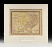 AN ANTIQUE ANTEBELLUM MAP, "MAP
 OF THE STATE OF TEXAS,"...AN ANTIQUE ANTEBELLUM MAP, "Map of the State of Texas," PHILADELPHIA, CIRCA 1852, hand colored lithograph on paper, a page fragment from an atlas, no. 25, by J.H. Young, published by Thomas Cowperthwait & Co., J.L. Hazzard, engraver, "Entered according to act of Congress in the year 1852 by Thomas, Cowperthwait & Co., in the Clerk's office of the District court of of the Eastern District of Pennsylvania," inset U/L, "Northern Texas," and L/L inset, "Map of the Vicinity of Galveston City," including a population chart organized by race and freed status. 13 5/8" x 17" Note: The map is a good example of Texas in early statehood, showing old indigenous roads, waterways, elevation by hachures, some lands identified by natural abundances and were yet undetermined territory. Short notes about water depths, "The Grand Indian Crossing is a shallow place in the Rio Grande 1,000 miles from its mouth with 4 feet water. Here the Apaches and Comanches cross in their annual predatory incursions into Mexico." Provenance: Property from a Corporate Collection, Houston, Texas. Property from a Corporate Collection, Houston, Texas Condition: Some foxing spots, toning of paper, some fading of hand color, tears and creases at edges, overall in good to very good condition, wear commensurate with age. Simpson Galleries strongly encourages in-person inspection of items by the bidder. Statements by Simpson Galleries regarding the condition of objects are for guidance only and should not be relied upon as statements of fact and do not constitute a representation, warranty, or assumption of liability by Simpson Galleries. All lots offered are sold "AS IS.” NO REFUNDS will be issued based on condition.
AN ANTIQUE ANTEBELLUM MAP, "MAP
AN ANTIQUE ANTEBELLUM MAP, "MAP OF THE STATE OF TEXAS,"...AN ANTIQUE ANTEBELLUM MAP, "Map of the State of Texas," PHILADELPHIA, CIRCA 1852, hand colored lithograph on paper, a page fragment from an atlas, no. 25, by J.H. Young, published by Thomas Cowperthwait & Co., J.L. Hazzard, engraver, "Entered according to act of Congress in the year 1852 by Thomas, Cowperthwait & Co., in the Clerk's office of the District court of of the Eastern District of Pennsylvania," inset U/L, "Northern Texas," and L/L inset, "Map of the Vicinity of Galveston City," including a population chart organized by race and freed status. 13 5/8" x 17" Note: The map is a good example of Texas in early statehood, showing old indigenous roads, waterways, elevation by hachures, some lands identified by natural abundances and were yet undetermined territory. Short notes about water depths, "The Grand Indian Crossing is a shallow place in the Rio Grande 1,000 miles from its mouth with 4 feet water. Here the Apaches and Comanches cross in their annual predatory incursions into Mexico." Provenance: Property from a Corporate Collection, Houston, Texas. Property from a Corporate Collection, Houston, Texas Condition: Some foxing spots, toning of paper, some fading of hand color, tears and creases at edges, overall in good to very good condition, wear commensurate with age. Simpson Galleries strongly encourages in-person inspection of items by the bidder. Statements by Simpson Galleries regarding the condition of objects are for guidance only and should not be relied upon as statements of fact and do not constitute a representation, warranty, or assumption of liability by Simpson Galleries. All lots offered are sold "AS IS.” NO REFUNDS will be issued based on condition. -
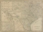 A VINTAGE MAP, "TEXAS," CIRCA
 1890,A VINTAGE MAP, "Texas," CIRCA 1890, engraving on paper, a page fragment from an atlas, plate 68, with view of the Panhandle, lacking Jeff Davis County, within a geometric border, attributed to Mast, Crowell, and Kirkpatrick publishers. 17" x 22 3/4" Provenance: Property from a Fortune 500 Energy Company, Houston, Texas. Condition: Some waving, joined paper, a tear upper left, fading of hand coloring, but overall in fair to good condition, wear commensurate with age and use. Simpson Galleries strongly encourages in-person inspection of items by the bidder. Statements by Simpson Galleries regarding the condition of objects are for guidance only and should not be relied upon as statements of fact and do not constitute a representation, warranty, or assumption of liability by Simpson Galleries. All lots offered are sold "AS IS."
A VINTAGE MAP, "TEXAS," CIRCA
A VINTAGE MAP, "TEXAS," CIRCA 1890,A VINTAGE MAP, "Texas," CIRCA 1890, engraving on paper, a page fragment from an atlas, plate 68, with view of the Panhandle, lacking Jeff Davis County, within a geometric border, attributed to Mast, Crowell, and Kirkpatrick publishers. 17" x 22 3/4" Provenance: Property from a Fortune 500 Energy Company, Houston, Texas. Condition: Some waving, joined paper, a tear upper left, fading of hand coloring, but overall in fair to good condition, wear commensurate with age and use. Simpson Galleries strongly encourages in-person inspection of items by the bidder. Statements by Simpson Galleries regarding the condition of objects are for guidance only and should not be relied upon as statements of fact and do not constitute a representation, warranty, or assumption of liability by Simpson Galleries. All lots offered are sold "AS IS." -
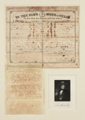 A STATE OF TEXAS LAND GRANT, SIGNED
 BY GOVERNOR SAM HOU...A STATE OF TEXAS LAND GRANT, SIGNED BY GOVERNOR SAM HOUSTON, AUSTIN, 1860, State of Texas printed and hand manuscript completed land grant, Austin, Texas, September 3, 1860, granting to Frederick Liebensan 320 acres in Jones County west side of ... (illegible), lower right Houston's bold signature, 14 3/4" x 11 1/2"; above a docket manuscript document written by Irving Moore, Clerk for the District Court, Brown County, Texas. Framed and matted, enclosing an engraved portrait of Houston with printed signature. Note: Sam Houston (1793-1863), a respected statesman, congressman, a politician trusted by many including some Native Americans, a soldier in the War of 1812 against Britain and a victorious General leading the Texians at the Battle of San Jacinto during the Texas Revolution, served two separate terms as President of the Republic of Texas, had been governor of Tennessee and was the last governor of the State of Texas and only United States southern governor before the Civil War began who opposed joining the Confederacy. Just over six months of signing this document on September 3rd 1860, Sam Houston was pushed out of the Texas governor's seat on March 16, 1861 for his steadfast refusal to swear a loyalty oath to the Confederate States of America. Provenance: Property from a Corporate Collection, Houston, Texas. Condition: Good condition for Texas documents of this age and use including but not limited to ink blooming and bleeding of written text, creases, folds, age darkening of paper, discolorations and some normal small tears along edges. Simpson Galleries strongly encourages in-person inspection of items by the bidder. Statements by Simpson Galleries regarding the condition of objects are for guidance only and should not be relied upon as statements of fact and do not constitute a representation, warranty, or assumption of liability by Simpson Galleries. All lots offered are sold "AS IS."
A STATE OF TEXAS LAND GRANT, SIGNED
A STATE OF TEXAS LAND GRANT, SIGNED BY GOVERNOR SAM HOU...A STATE OF TEXAS LAND GRANT, SIGNED BY GOVERNOR SAM HOUSTON, AUSTIN, 1860, State of Texas printed and hand manuscript completed land grant, Austin, Texas, September 3, 1860, granting to Frederick Liebensan 320 acres in Jones County west side of ... (illegible), lower right Houston's bold signature, 14 3/4" x 11 1/2"; above a docket manuscript document written by Irving Moore, Clerk for the District Court, Brown County, Texas. Framed and matted, enclosing an engraved portrait of Houston with printed signature. Note: Sam Houston (1793-1863), a respected statesman, congressman, a politician trusted by many including some Native Americans, a soldier in the War of 1812 against Britain and a victorious General leading the Texians at the Battle of San Jacinto during the Texas Revolution, served two separate terms as President of the Republic of Texas, had been governor of Tennessee and was the last governor of the State of Texas and only United States southern governor before the Civil War began who opposed joining the Confederacy. Just over six months of signing this document on September 3rd 1860, Sam Houston was pushed out of the Texas governor's seat on March 16, 1861 for his steadfast refusal to swear a loyalty oath to the Confederate States of America. Provenance: Property from a Corporate Collection, Houston, Texas. Condition: Good condition for Texas documents of this age and use including but not limited to ink blooming and bleeding of written text, creases, folds, age darkening of paper, discolorations and some normal small tears along edges. Simpson Galleries strongly encourages in-person inspection of items by the bidder. Statements by Simpson Galleries regarding the condition of objects are for guidance only and should not be relied upon as statements of fact and do not constitute a representation, warranty, or assumption of liability by Simpson Galleries. All lots offered are sold "AS IS." -
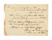 A REPUBLIC OF TEXAS HANDWRITTEN
 MANUSCRIPT, THOMAS MASO...A REPUBLIC OF TEXAS HANDWRITTEN MANUSCRIPT, THOMAS MASON DENNIS (1807-1877) SIGNED AND DATED MATAGORDA, JULY 23, 1834, served as a soldier and legislator, settled in Bastrop and joined Captain Robert M. Coleman's company of volunteers that marched from Bastrop to the relief of Gonzales. On December 20, 1835, signed the Goliad Declaration of Independence, enlisted in the Texas Army on February 28, 1836 and at San Jacinto served in Captain Jesse Billingsley's Company also known as the "Mina Volunteers" of Col. Edward Burleson's First Regiment, Texas Volunteers. According to his obituary he was promoted to lieutenant, but no documentary evidence of this promotion has been located. 7 3/4" x 5 3/4" Condition: Some ink smudges, toning, trimmed and torn edges, ink bleed, all wear expected, overall in very good condition, wear commensurate with age. Simpson Galleries strongly encourages in-person inspection of items by the bidder. Statements by Simpson Galleries regarding the condition of objects are for guidance only and should not be relied upon as statements of fact and do not constitute a representation, warranty, or assumption of liability by Simpson Galleries. All lots offered are sold "AS IS."
A REPUBLIC OF TEXAS HANDWRITTEN
A REPUBLIC OF TEXAS HANDWRITTEN MANUSCRIPT, THOMAS MASO...A REPUBLIC OF TEXAS HANDWRITTEN MANUSCRIPT, THOMAS MASON DENNIS (1807-1877) SIGNED AND DATED MATAGORDA, JULY 23, 1834, served as a soldier and legislator, settled in Bastrop and joined Captain Robert M. Coleman's company of volunteers that marched from Bastrop to the relief of Gonzales. On December 20, 1835, signed the Goliad Declaration of Independence, enlisted in the Texas Army on February 28, 1836 and at San Jacinto served in Captain Jesse Billingsley's Company also known as the "Mina Volunteers" of Col. Edward Burleson's First Regiment, Texas Volunteers. According to his obituary he was promoted to lieutenant, but no documentary evidence of this promotion has been located. 7 3/4" x 5 3/4" Condition: Some ink smudges, toning, trimmed and torn edges, ink bleed, all wear expected, overall in very good condition, wear commensurate with age. Simpson Galleries strongly encourages in-person inspection of items by the bidder. Statements by Simpson Galleries regarding the condition of objects are for guidance only and should not be relied upon as statements of fact and do not constitute a representation, warranty, or assumption of liability by Simpson Galleries. All lots offered are sold "AS IS." -
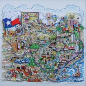 CHARLES FAZZINO (American b. 1955).
 A TASTE OF TEXAS signed and numbered 74/200DX and titled in pencil lower margin. Color lithograph in 3D construction - Framed image: 22 in. x 23 in.
CHARLES FAZZINO (American b. 1955).
CHARLES FAZZINO (American b. 1955). A TASTE OF TEXAS signed and numbered 74/200DX and titled in pencil lower margin. Color lithograph in 3D construction - Framed image: 22 in. x 23 in. -
 WILLIAM ROBERT THRASHER, TEXAS
 BLUEBONNET, FRAMED William Robert Thrasher (American/Texas, 1908-1997). "Texas, Bluebonnets", oil on canvas. Initialed lower left. Approx. 13.5" x 15.5" (frame), 8" x 10" (canvas)
WILLIAM ROBERT THRASHER, TEXAS
WILLIAM ROBERT THRASHER, TEXAS BLUEBONNET, FRAMED William Robert Thrasher (American/Texas, 1908-1997). "Texas, Bluebonnets", oil on canvas. Initialed lower left. Approx. 13.5" x 15.5" (frame), 8" x 10" (canvas) -
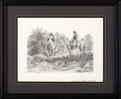 Charles Shaw (American/Texas,
 1941-2005) "Michener's Texas, Chapter 8", pencil on paper, sheet size 9-1/2" x 13-1/4", signed lower right, titled lower right margin. Glazed, matted and framed. Provenance: The estates of David and Eula Wintermann.
Charles Shaw (American/Texas,
Charles Shaw (American/Texas, 1941-2005) "Michener's Texas, Chapter 8", pencil on paper, sheet size 9-1/2" x 13-1/4", signed lower right, titled lower right margin. Glazed, matted and framed. Provenance: The estates of David and Eula Wintermann. -
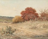 ''Spanish Red Oak Texas'' oil on
 canvas. 16'' H x 20'' W.
''Spanish Red Oak Texas'' oil on
''Spanish Red Oak Texas'' oil on canvas. 16'' H x 20'' W. -
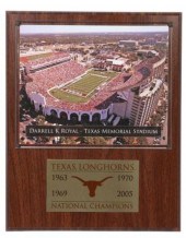 UNIVERSITY OF TEXAS FOOTBALL
 STADIUM PLAQUEFramed plaque with panoramic photo of the University of Texas at Austin DKR stadium, below the plaque a plate "Texas Longhorns National Champions, 1963, 1969, 1970, 2005, the stadium now expanded with a seating capacity of 100,119 making it the seventh largest football stadium in the United States, approx. 15"h, 12"w, 3.75lbs
UNIVERSITY OF TEXAS FOOTBALL
UNIVERSITY OF TEXAS FOOTBALL STADIUM PLAQUEFramed plaque with panoramic photo of the University of Texas at Austin DKR stadium, below the plaque a plate "Texas Longhorns National Champions, 1963, 1969, 1970, 2005, the stadium now expanded with a seating capacity of 100,119 making it the seventh largest football stadium in the United States, approx. 15"h, 12"w, 3.75lbs -
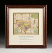 AN ANTIQUE EARLY REPUBLIC OF
 TEXAS MAP, "NEW MAP OF TEX...AN ANTIQUE EARLY REPUBLIC OF TEXAS MAP, "New Map of Texas with the Contiguous American & Mexican States," PHILADELPHIA, 1836, hand-colored lithograph on paper, first edition-second issue, engraved by J.H. Young, published by S. Augustus Mitchell, "Sold by Mitchell & Hinman No. 6 North Fifth Street," three inset paragraphs, "Remarks on Texas," "Land Grants," and "Rivers of Texas," "Entered according to Act of Congress in the year 1835 by S. Augustus Mitchell in the Clerk's office of the district court of the eastern district of Pennsylvania," the whole within a geometric and piano key motif border. 13" x 15 1/2" Note: The second printing of this map from the 1835 version, showing Texas divided into land grants and colonies. The Red River is the boundary in the north; the Panhandle still entirely Indian Territory. Harrisburg, Anahuaca, Matagorda, and Galveston are prominent coastal areas. The River San Antonio noted with "Goliad, formerly La Bahia," and "San Antonio de Bexar, usually called Bexar." Neighboring Guadalupe River noted with Gonzales and Victoria. This rare map of early Texas is a well colored and an invaluable addition to any Texana collection. Provenance: Property from a Corporate Collection, Houston, Texas. Property from a Corporate Collection, Houston, Texas Condition: Creasing, buckles, pleasing bright hand color extends west Texas borders into Comanche Indian territory, old tears, overall in good to very good condition, wear commensurate with age. Simpson Galleries strongly encourages in-person inspection of items by the bidder. Statements by Simpson Galleries regarding the condition of objects are for guidance only and should not be relied upon as statements of fact and do not constitute a representation, warranty, or assumption of liability by Simpson Galleries. All lots offered are sold "AS IS.” NO REFUNDS will be issued based on condition.
AN ANTIQUE EARLY REPUBLIC OF
AN ANTIQUE EARLY REPUBLIC OF TEXAS MAP, "NEW MAP OF TEX...AN ANTIQUE EARLY REPUBLIC OF TEXAS MAP, "New Map of Texas with the Contiguous American & Mexican States," PHILADELPHIA, 1836, hand-colored lithograph on paper, first edition-second issue, engraved by J.H. Young, published by S. Augustus Mitchell, "Sold by Mitchell & Hinman No. 6 North Fifth Street," three inset paragraphs, "Remarks on Texas," "Land Grants," and "Rivers of Texas," "Entered according to Act of Congress in the year 1835 by S. Augustus Mitchell in the Clerk's office of the district court of the eastern district of Pennsylvania," the whole within a geometric and piano key motif border. 13" x 15 1/2" Note: The second printing of this map from the 1835 version, showing Texas divided into land grants and colonies. The Red River is the boundary in the north; the Panhandle still entirely Indian Territory. Harrisburg, Anahuaca, Matagorda, and Galveston are prominent coastal areas. The River San Antonio noted with "Goliad, formerly La Bahia," and "San Antonio de Bexar, usually called Bexar." Neighboring Guadalupe River noted with Gonzales and Victoria. This rare map of early Texas is a well colored and an invaluable addition to any Texana collection. Provenance: Property from a Corporate Collection, Houston, Texas. Property from a Corporate Collection, Houston, Texas Condition: Creasing, buckles, pleasing bright hand color extends west Texas borders into Comanche Indian territory, old tears, overall in good to very good condition, wear commensurate with age. Simpson Galleries strongly encourages in-person inspection of items by the bidder. Statements by Simpson Galleries regarding the condition of objects are for guidance only and should not be relied upon as statements of fact and do not constitute a representation, warranty, or assumption of liability by Simpson Galleries. All lots offered are sold "AS IS.” NO REFUNDS will be issued based on condition. -
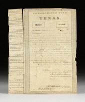 A REPUBLIC OF TEXAS $1,000
 CONSOLIDATED FUND OF TEXAS B...A REPUBLIC OF TEXAS $1,000 CONSOLIDATED FUND OF TEXAS BOND, HENRY H. WILLIAMS, AUSTIN, JANUARY 23, 1841, lithograph and ink manuscript on thin wove paper, no. 1201, canceled signature for James B. Shaw, comptroller, and Charles Demorse as Stock Commissioner, with coupons endorsed by Charles Demorse, Clerk Stock Office, verso endorsed. 13 1/2" x 10 3/4" Provenance: Condition: Unframed, cancel marks, some coupons detached, creases, white spots, tattered edges. Simpson Galleries strongly encourages in-person inspection of items by the bidder. Statements by Simpson Galleries regarding the condition of objects are for guidance only and should not be relied upon as statements of fact and do not constitute a representation, warranty, or assumption of liability by Simpson Galleries. All lots offered are sold "AS IS.”
A REPUBLIC OF TEXAS $1,000
A REPUBLIC OF TEXAS $1,000 CONSOLIDATED FUND OF TEXAS B...A REPUBLIC OF TEXAS $1,000 CONSOLIDATED FUND OF TEXAS BOND, HENRY H. WILLIAMS, AUSTIN, JANUARY 23, 1841, lithograph and ink manuscript on thin wove paper, no. 1201, canceled signature for James B. Shaw, comptroller, and Charles Demorse as Stock Commissioner, with coupons endorsed by Charles Demorse, Clerk Stock Office, verso endorsed. 13 1/2" x 10 3/4" Provenance: Condition: Unframed, cancel marks, some coupons detached, creases, white spots, tattered edges. Simpson Galleries strongly encourages in-person inspection of items by the bidder. Statements by Simpson Galleries regarding the condition of objects are for guidance only and should not be relied upon as statements of fact and do not constitute a representation, warranty, or assumption of liability by Simpson Galleries. All lots offered are sold "AS IS.” -
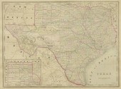 TEXAS MAP ENGRAVING PANHANDLE
 COUNTIES INSETFramed Texas map, hand-colored engraving on paper, a page from an atlas, plate 68, published by William Bradley, c.1880, an inset with Panhandle counties, within a geometric border, sight: approx 17.5"h, 23.5"w, overall: approx 23"h, 29"w, 7lbs
TEXAS MAP ENGRAVING PANHANDLE
TEXAS MAP ENGRAVING PANHANDLE COUNTIES INSETFramed Texas map, hand-colored engraving on paper, a page from an atlas, plate 68, published by William Bradley, c.1880, an inset with Panhandle counties, within a geometric border, sight: approx 17.5"h, 23.5"w, overall: approx 23"h, 29"w, 7lbs -
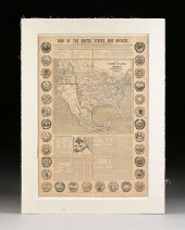 A REPUBLIC OF TEXAS MAP, "MAP OF
 THE UNITED STATES AND ...A REPUBLIC OF TEXAS MAP, "Map of the United States and Mexico, Including Oregon, Texas and the Californias," NEW YORK, CIRCA 1846, hand colored lithograph on paper, "Showing the route and importance of the contemplated Great Oregon Railroad, the boundary as agreed upon, the only two routes by which an army can reach the city of Mexico, an account of the battles of the American and Texian revolutions, Army & Navy of the United States; Route of the Santa Fe Traders, Description of Mexico, its gold and silver mines, seals of different states...," published by John Haven, a broadside map promoting Manifest Destiny and produced on the eve of the Mexican-American War, "The Texians claim as their boundary the Rio del Norte from its mouth to its source. Mexico recognizes their claim only as far as the Nueces." 31" x 20 3/8" Provenance: Property from a Corporate Collection, Houston, Texas. Property from a Corporate Collection, Houston, Texas Condition: Some tears, creases, losses, mild fading, stains, toning, and expected wear, overall in fair to good condition, wear commensurate with age. Simpson Galleries strongly encourages in-person inspection of items by the bidder. Statements by Simpson Galleries regarding the condition of objects are for guidance only and should not be relied upon as statements of fact and do not constitute a representation, warranty, or assumption of liability by Simpson Galleries. All lots offered are sold "AS IS.” NO REFUNDS will be issued based on condition.
A REPUBLIC OF TEXAS MAP, "MAP OF
A REPUBLIC OF TEXAS MAP, "MAP OF THE UNITED STATES AND ...A REPUBLIC OF TEXAS MAP, "Map of the United States and Mexico, Including Oregon, Texas and the Californias," NEW YORK, CIRCA 1846, hand colored lithograph on paper, "Showing the route and importance of the contemplated Great Oregon Railroad, the boundary as agreed upon, the only two routes by which an army can reach the city of Mexico, an account of the battles of the American and Texian revolutions, Army & Navy of the United States; Route of the Santa Fe Traders, Description of Mexico, its gold and silver mines, seals of different states...," published by John Haven, a broadside map promoting Manifest Destiny and produced on the eve of the Mexican-American War, "The Texians claim as their boundary the Rio del Norte from its mouth to its source. Mexico recognizes their claim only as far as the Nueces." 31" x 20 3/8" Provenance: Property from a Corporate Collection, Houston, Texas. Property from a Corporate Collection, Houston, Texas Condition: Some tears, creases, losses, mild fading, stains, toning, and expected wear, overall in fair to good condition, wear commensurate with age. Simpson Galleries strongly encourages in-person inspection of items by the bidder. Statements by Simpson Galleries regarding the condition of objects are for guidance only and should not be relied upon as statements of fact and do not constitute a representation, warranty, or assumption of liability by Simpson Galleries. All lots offered are sold "AS IS.” NO REFUNDS will be issued based on condition. -
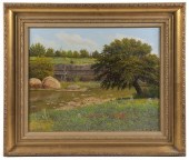 MANUEL GARZA (TX, 1940- ) Texas
 Bluebonnets, oil on canvas, signed lower left, also signed verso, a springtime riverside landscape with wildflowers and butterflies, in a gilded wooden frame with velvet liner, OS: 23 1/4" x 27 3/8", SS: 15 3/4" x 19 1/2". Good condition.
MANUEL GARZA (TX, 1940- ) Texas
MANUEL GARZA (TX, 1940- ) Texas Bluebonnets, oil on canvas, signed lower left, also signed verso, a springtime riverside landscape with wildflowers and butterflies, in a gilded wooden frame with velvet liner, OS: 23 1/4" x 27 3/8", SS: 15 3/4" x 19 1/2". Good condition. -
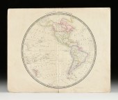 HENRY TEESDALE (1776-1855) A
 REPUBLIC OF TEXAS PERIOD M...HENRY TEESDALE (1776-1855) A REPUBLIC OF TEXAS PERIOD MAP, "Western Hemisphere," LONDON, SEPTEMBER 4, 1843-DECEMBER 1845, hand-colored engraving on wove paper, showing the Republic of Texas with territory extending to 40° latitude, published by Henry Teesdale, engraver obscured below Antarctica, also showing Land Discovered by Capts. Ross & Crozier 10th Jany. 1840; 15 1/4" x 18 1/2". Condition: Unframed, some tears, smudges, handling wear, creases, and losses. Simpson Galleries strongly encourages in-person inspection of items by the bidder. Statements by Simpson Galleries regarding the condition of objects are for guidance only and should not be relied upon as statements of fact and do not constitute a representation, warranty, or assumption of liability by Simpson Galleries. All lots offered are sold "AS IS."
HENRY TEESDALE (1776-1855) A
HENRY TEESDALE (1776-1855) A REPUBLIC OF TEXAS PERIOD M...HENRY TEESDALE (1776-1855) A REPUBLIC OF TEXAS PERIOD MAP, "Western Hemisphere," LONDON, SEPTEMBER 4, 1843-DECEMBER 1845, hand-colored engraving on wove paper, showing the Republic of Texas with territory extending to 40° latitude, published by Henry Teesdale, engraver obscured below Antarctica, also showing Land Discovered by Capts. Ross & Crozier 10th Jany. 1840; 15 1/4" x 18 1/2". Condition: Unframed, some tears, smudges, handling wear, creases, and losses. Simpson Galleries strongly encourages in-person inspection of items by the bidder. Statements by Simpson Galleries regarding the condition of objects are for guidance only and should not be relied upon as statements of fact and do not constitute a representation, warranty, or assumption of liability by Simpson Galleries. All lots offered are sold "AS IS." -
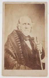 SAM HOUSTON (TEXAS) C1860
 CARTE-DE-VISITECDV of Sam Houston, the general who led Texans to victory in the decisive Battle of San Jacinto, and later served as president of the Republic of Texas (twice), as Texas governor and as the first U.S. senator from Texas. (He also served earlier asthe governor of Tennessee, the only person in the history of the country to serve as governor of two different states.) Uncredited, but other examples of this image have the backstamp for C.D. Fredericks. Measures 4" x 2-1/2". See images. Fine condition. Small toning spot along right border, not affecting photo. Pencil identification on verso. shipping info This item can be shipped in-house.
SAM HOUSTON (TEXAS) C1860
SAM HOUSTON (TEXAS) C1860 CARTE-DE-VISITECDV of Sam Houston, the general who led Texans to victory in the decisive Battle of San Jacinto, and later served as president of the Republic of Texas (twice), as Texas governor and as the first U.S. senator from Texas. (He also served earlier asthe governor of Tennessee, the only person in the history of the country to serve as governor of two different states.) Uncredited, but other examples of this image have the backstamp for C.D. Fredericks. Measures 4" x 2-1/2". See images. Fine condition. Small toning spot along right border, not affecting photo. Pencil identification on verso. shipping info This item can be shipped in-house. -
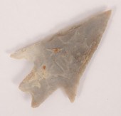 Pedernales Texas point. 2 3/4".
Pedernales Texas point. 2 3/4".
Pedernales Texas point. 2 3/4". -
 MANUEL GARZA (TX, 1940- )
 Bluebonnet Field, oil on canvas, signed lower left, also signed verso, depicting a springtime rolling field of Texas wildflowers, in a gilded wooden frame with velvet liner and gilded inner lip, OS: 25 1/2" x 31 1/2", SS: 17 3/4" x 23 3/4". Indentation in canvas lower left.
MANUEL GARZA (TX, 1940- )
MANUEL GARZA (TX, 1940- ) Bluebonnet Field, oil on canvas, signed lower left, also signed verso, depicting a springtime rolling field of Texas wildflowers, in a gilded wooden frame with velvet liner and gilded inner lip, OS: 25 1/2" x 31 1/2", SS: 17 3/4" x 23 3/4". Indentation in canvas lower left.
...many more examples with full details are available to our members - Learn more


