Pricing Guides & Dictionary of Makers Marks for Antiques & Collectibles
Appraise and find values for
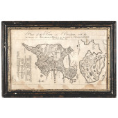
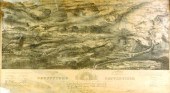
1774 MAP TITLED: A PLAN OF THE TOWN...
From
marks4antiques.com
- The most updated price guide and makers' marks research online
As a member, you have access to a team of experts
and assistance is always available to you for free
An example from the millions of items in our Price Guide:
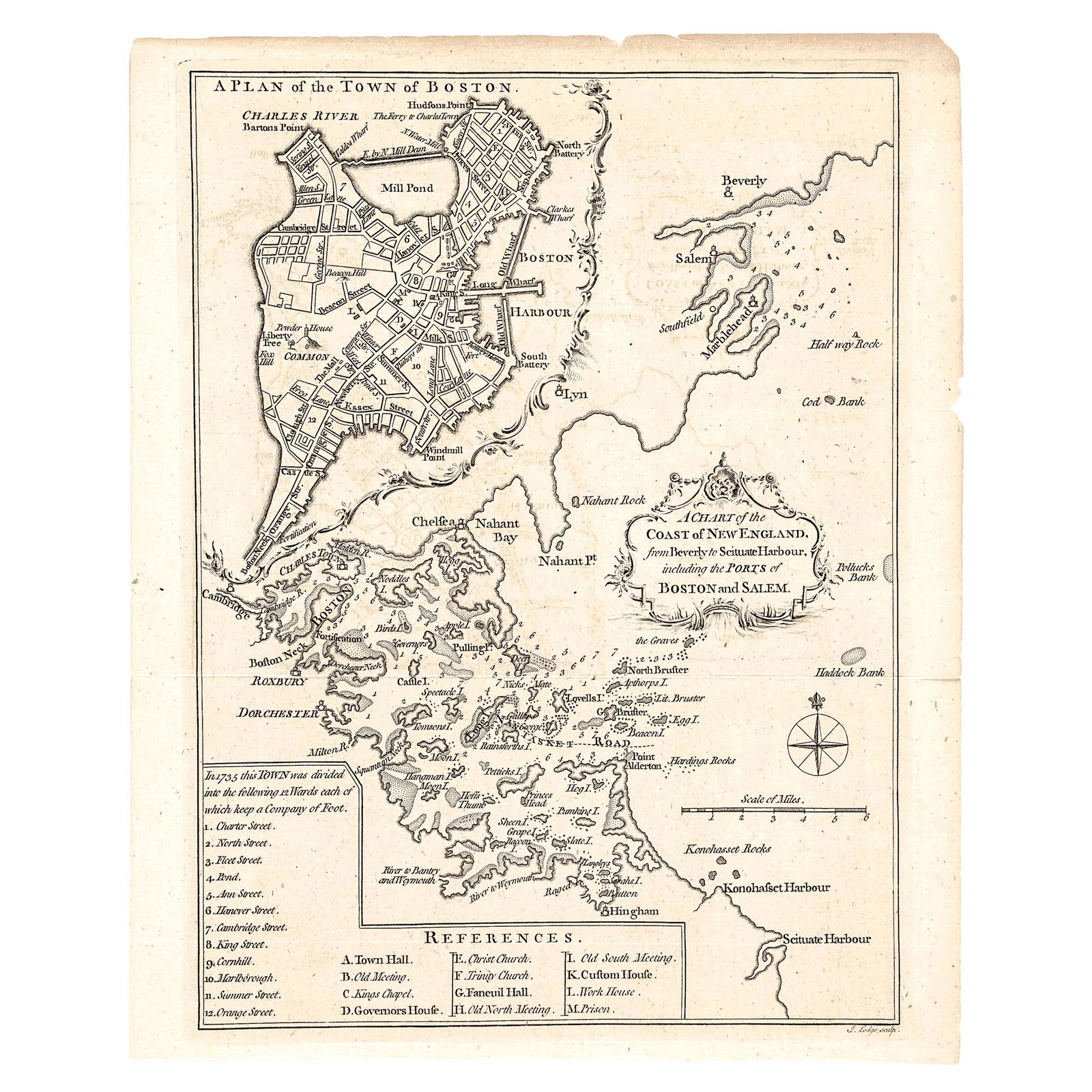
1774 MAP TITLED: A PLAN OF THE TOWN OF BOSTONAmerican Revolution 1774 "A PLAN of the TOWN of BOSTON" Engraved Map April 1774, Engraved Printed Map...
This is an example from our
values4antiques price guide
We do not buy or sell any items
See more price guides
Check our other research services:
IDENTIFY WORLDWIDE MAKERS' MARKS & HALLMARKS
marks4ceramics:
Porcelain, Pottery, Chinaware, Figurines, Dolls, Vases...
marks4silver
:
Silver, Jewelry, Pewter, Silverplate, Copper & Bronze...
Explore other items from our
Antiques & Collectibles Price Guide
-
 BRITANNIA, VOL. I & II CAMDEN 1722Camden
[more like this]
BRITANNIA, VOL. I & II CAMDEN 1722Camden
[more like this]
-
 A COMPLETE SYSTEM OF GEOGRAPHY, VOL. I B
[more like this]
A COMPLETE SYSTEM OF GEOGRAPHY, VOL. I B
[more like this]
-
 IMPORTANT ANTIQUE ATLAS DU VOYAGE DE LA
[more like this]
IMPORTANT ANTIQUE ATLAS DU VOYAGE DE LA
[more like this]
-
 5 KENTUCKY AND TENNESSEE MAPS1st item: "
[more like this]
5 KENTUCKY AND TENNESSEE MAPS1st item: "
[more like this]
-
 8 TENNESSEE MILITARY & SURVEY MAPSAssort
[more like this]
8 TENNESSEE MILITARY & SURVEY MAPSAssort
[more like this]
-
 3 KY & TN MAPS: VANCE, TANNER, JOHNSON1s
[more like this]
3 KY & TN MAPS: VANCE, TANNER, JOHNSON1s
[more like this]
-
 1774 MAP TITLED: A PLAN OF THE TOWN OF B
[more like this]
1774 MAP TITLED: A PLAN OF THE TOWN OF B
[more like this]
-
 A RARE ANTIQUE CIVIL WAR ERA MAP, "PRESS
[more like this]
A RARE ANTIQUE CIVIL WAR ERA MAP, "PRESS
[more like this]
-
 4 TN & KY MAPS, 3 FRAMED1st item: "Tenne
[more like this]
4 TN & KY MAPS, 3 FRAMED1st item: "Tenne
[more like this]
-
 A LATE MEXICAN-AMERICAN WAR ERA MAP, "MA
[more like this]
A LATE MEXICAN-AMERICAN WAR ERA MAP, "MA
[more like this]
-
 A Very Large Collection of Maps, 19th/e
[more like this]
A Very Large Collection of Maps, 19th/e
[more like this]
-
 A TOPOGRAPHICAL MAP OF THE ENVIRONS OF L
[more like this]
A TOPOGRAPHICAL MAP OF THE ENVIRONS OF L
[more like this]
-
 11 PC. MAP COLLECTION: Comprising; 1- La
[more like this]
11 PC. MAP COLLECTION: Comprising; 1- La
[more like this]
-
 16TH / 18TH C. EUROPEAN MAPS OF NEW SPAI
[more like this]
16TH / 18TH C. EUROPEAN MAPS OF NEW SPAI
[more like this]
-
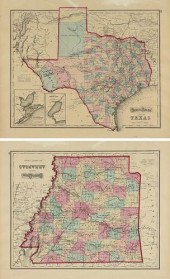
 AN IMPORTANT REPUBLIC OF TEXAS MAP, "MAP
[more like this]
AN IMPORTANT REPUBLIC OF TEXAS MAP, "MAP
[more like this]
-
 AN ANTIQUE RECONSTRUCTION ERA MAP, "KOSS
[more like this]
AN ANTIQUE RECONSTRUCTION ERA MAP, "KOSS
[more like this]
-
 3 19TH CENT. AL, KY, & TN MAPS1st item:
[more like this]
3 19TH CENT. AL, KY, & TN MAPS1st item:
[more like this]
-
 MAP AND ATLAS LOT, 3 PCS INCL. MELISH DI
[more like this]
MAP AND ATLAS LOT, 3 PCS INCL. MELISH DI
[more like this]
-
 5 CIVIL WAR MAPSLot of five Civil War ma
[more like this]
5 CIVIL WAR MAPSLot of five Civil War ma
[more like this]
-
 Four RI and CT town Atlas Maps: Map of t
[more like this]
Four RI and CT town Atlas Maps: Map of t
[more like this]
-
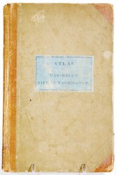 Rare Book: Atlas to Marshall's Life of W
[more like this]
Rare Book: Atlas to Marshall's Life of W
[more like this]
-
 JOHN NORMAN, ENGRAVED MAP TITLED, PLAN O
[more like this]
JOHN NORMAN, ENGRAVED MAP TITLED, PLAN O
[more like this]
-
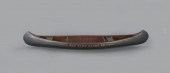 OUTSTANDING SALESMAN’S SAMPLE CANOEOld T
[more like this]
OUTSTANDING SALESMAN’S SAMPLE CANOEOld T
[more like this]
-
 J.H. COLTON (1800-1893) A MAP, "NEW MAP
[more like this]
J.H. COLTON (1800-1893) A MAP, "NEW MAP
[more like this]
-
 NATIVE AMERICAN/WESTERN U.S. EXPEDITION
[more like this]
NATIVE AMERICAN/WESTERN U.S. EXPEDITION
[more like this]
-
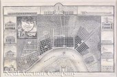 Jacques Tanesse (New Orleans) "Plan of t
[more like this]
Jacques Tanesse (New Orleans) "Plan of t
[more like this]
-
 MAP: "GETTYSBURG BATTLE-FIELD", BY JOHN
[more like this]
MAP: "GETTYSBURG BATTLE-FIELD", BY JOHN
[more like this]
-
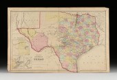
 AN ANTIQUE REPUBLIC OF TEXAS MAP, "MAP O
[more like this]
AN ANTIQUE REPUBLIC OF TEXAS MAP, "MAP O
[more like this]
-
 AN ANTIQUE REPUBLIC OF TEXAS MAP, "MAP O
[more like this]
AN ANTIQUE REPUBLIC OF TEXAS MAP, "MAP O
[more like this]
-
 MAPS: JOHN SPEED (ENGLAND, 1552-1629), T
[more like this]
MAPS: JOHN SPEED (ENGLAND, 1552-1629), T
[more like this]
-
 M... (20TH CENTURY) SIX ''MAP'' SERIES P
[more like this]
M... (20TH CENTURY) SIX ''MAP'' SERIES P
[more like this]
-
 RARE 1865 MONTANA TERRITORY MAP BY W.W.
[more like this]
RARE 1865 MONTANA TERRITORY MAP BY W.W.
[more like this]
-
 AN ANTIQUE TWO SIDED MAP, "GRAY'S ATLAS
[more like this]
AN ANTIQUE TWO SIDED MAP, "GRAY'S ATLAS
[more like this]
-
 A FACSIMILE CADASTRAL MAP, "MAP OF BEXAR
[more like this]
A FACSIMILE CADASTRAL MAP, "MAP OF BEXAR
[more like this]
-
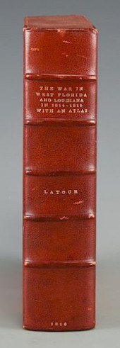 LATOUR WAR IN WEST FLORIDA LA 1814-1815,
[more like this]
LATOUR WAR IN WEST FLORIDA LA 1814-1815,
[more like this]
-
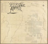 AN ANTIQUE MAP, "MAP OF ABILENE," GALVES
[more like this]
AN ANTIQUE MAP, "MAP OF ABILENE," GALVES
[more like this]
This list is limited to only a few results.
Many more items are available to our members in our
Price Guide!
Ideal research tools for Collectors, Personal Property Appraisers, Antiques & Collectibles
Dealers, Auction Houses, Museums, eBayers or
other online
sellers (Rubylane, Etsy etc) and curious minds interested in appraising & identifying collectibles

EASY. FAST. ACCURATE.
Research at its best

Our research tools include:


