Pricing Guides & Dictionary of Makers Marks for Antiques & Collectibles
Appraise and find values for
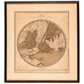
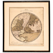
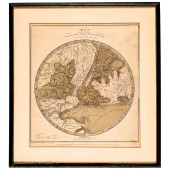
1836 TANNER MAP OF WASHINGTON D.C.:...
From
marks4antiques.com
- The most updated price guide and makers' marks research online
As a member, you have access to a team of experts
and assistance is always available to you for free
An example from the millions of items in our Price Guide:
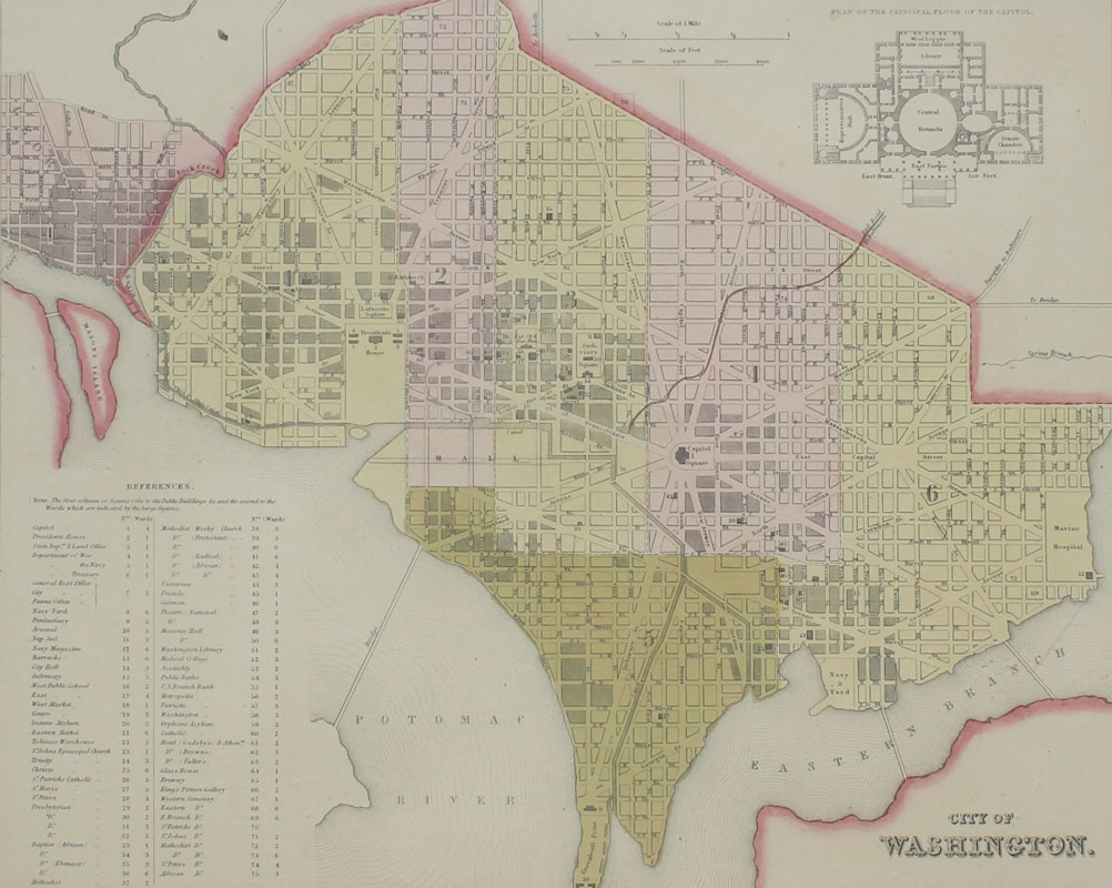
1836 TANNER MAP OF WASHINGTON D.C.: Hand colored copper engraving of Washington D. C. published 1836 by H. S. (Henry Schenck) Tanner. Sight size 12'' x...
This is an example from our
values4antiques price guide
We do not buy or sell any items
See more price guides
Check our other research services:
IDENTIFY WORLDWIDE MAKERS' MARKS & HALLMARKS
marks4ceramics:
Porcelain, Pottery, Chinaware, Figurines, Dolls, Vases...
marks4silver
:
Silver, Jewelry, Pewter, Silverplate, Copper & Bronze...
Explore other items from our
Antiques & Collectibles Price Guide
-
 BRITANNIA, VOL. I & II CAMDEN 1722Camden
[more like this]
BRITANNIA, VOL. I & II CAMDEN 1722Camden
[more like this]
-
 A COMPLETE SYSTEM OF GEOGRAPHY, VOL. I B
[more like this]
A COMPLETE SYSTEM OF GEOGRAPHY, VOL. I B
[more like this]
-
 IMPORTANT ANTIQUE ATLAS DU VOYAGE DE LA
[more like this]
IMPORTANT ANTIQUE ATLAS DU VOYAGE DE LA
[more like this]
-
 3 KY & TN MAPS: VANCE, TANNER, JOHNSON1s
[more like this]
3 KY & TN MAPS: VANCE, TANNER, JOHNSON1s
[more like this]
-
 5 KENTUCKY AND TENNESSEE MAPS1st item: "
[more like this]
5 KENTUCKY AND TENNESSEE MAPS1st item: "
[more like this]
-
 4 TN & KY MAPS, 3 FRAMED1st item: "Tenne
[more like this]
4 TN & KY MAPS, 3 FRAMED1st item: "Tenne
[more like this]
-
 A RARE ANTIQUE CIVIL WAR ERA MAP, "PRESS
[more like this]
A RARE ANTIQUE CIVIL WAR ERA MAP, "PRESS
[more like this]
-
 8 TENNESSEE MILITARY & SURVEY MAPSAssort
[more like this]
8 TENNESSEE MILITARY & SURVEY MAPSAssort
[more like this]
-
 KY AND TN 1823 MAP, H.S. TANNERMap of Ke
[more like this]
KY AND TN 1823 MAP, H.S. TANNERMap of Ke
[more like this]
-
 A LATE MEXICAN-AMERICAN WAR ERA MAP, "MA
[more like this]
A LATE MEXICAN-AMERICAN WAR ERA MAP, "MA
[more like this]
-
 AN IMPORTANT REPUBLIC OF TEXAS MAP, "MAP
[more like this]
AN IMPORTANT REPUBLIC OF TEXAS MAP, "MAP
[more like this]
-
 A Very Large Collection of Maps, 19th/e
[more like this]
A Very Large Collection of Maps, 19th/e
[more like this]
-
 3 19TH CENT. AL, KY, & TN MAPS1st item:
[more like this]
3 19TH CENT. AL, KY, & TN MAPS1st item:
[more like this]
-
 SITTING BEAR BY C. TANNER & OTHER (BITTE
[more like this]
SITTING BEAR BY C. TANNER & OTHER (BITTE
[more like this]
-
 A TOPOGRAPHICAL MAP OF THE ENVIRONS OF L
[more like this]
A TOPOGRAPHICAL MAP OF THE ENVIRONS OF L
[more like this]
-
 11 PC. MAP COLLECTION: Comprising; 1- La
[more like this]
11 PC. MAP COLLECTION: Comprising; 1- La
[more like this]
-
 16TH / 18TH C. EUROPEAN MAPS OF NEW SPAI
[more like this]
16TH / 18TH C. EUROPEAN MAPS OF NEW SPAI
[more like this]
-
 TWO 1830S SOUHEASTERN MAPS BY H. S. TANN
[more like this]
TWO 1830S SOUHEASTERN MAPS BY H. S. TANN
[more like this]
-
 NATIVE AMERICAN/WESTERN U.S. EXPEDITION
[more like this]
NATIVE AMERICAN/WESTERN U.S. EXPEDITION
[more like this]
-
 AN ANTIQUE RECONSTRUCTION ERA MAP, "KOSS
[more like this]
AN ANTIQUE RECONSTRUCTION ERA MAP, "KOSS
[more like this]
-
 MAP AND ATLAS LOT, 3 PCS INCL. MELISH DI
[more like this]
MAP AND ATLAS LOT, 3 PCS INCL. MELISH DI
[more like this]
-
 5 CIVIL WAR MAPSLot of five Civil War ma
[more like this]
5 CIVIL WAR MAPSLot of five Civil War ma
[more like this]
-
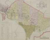 1836 TANNER MAP OF WASHINGTON D.C.: Hand
[more like this]
1836 TANNER MAP OF WASHINGTON D.C.: Hand
[more like this]
-
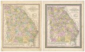 Two 19th century Georgia maps, two versi
[more like this]
Two 19th century Georgia maps, two versi
[more like this]
-
 RARE 1865 MONTANA TERRITORY MAP BY W.W.
[more like this]
RARE 1865 MONTANA TERRITORY MAP BY W.W.
[more like this]
-
 NASHVILLE BATTLEFIELDS AND TN MAPTwo Ten
[more like this]
NASHVILLE BATTLEFIELDS AND TN MAPTwo Ten
[more like this]
-
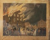
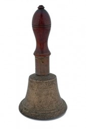 Bell Belonging to George Washington Engr
[more like this]
Bell Belonging to George Washington Engr
[more like this]
-
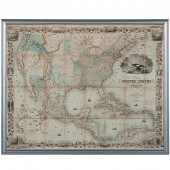 Colton's 1849 Map of the U.S. Showing Ca
[more like this]
Colton's 1849 Map of the U.S. Showing Ca
[more like this]
-
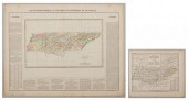 2 EUROPEAN MAPS OF TN1st item: "Carte Ge
[more like this]
2 EUROPEAN MAPS OF TN1st item: "Carte Ge
[more like this]
-
 BENJAMIN TANNER (AMERICAN, 1775-1848) TH
[more like this]
BENJAMIN TANNER (AMERICAN, 1775-1848) TH
[more like this]
-
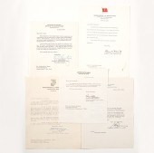 Autographs of World War II Generals Eigh
[more like this]
Autographs of World War II Generals Eigh
[more like this]
-
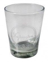 RARE ENGRAVED GLASS PRESENTATION TUMBLER
[more like this]
RARE ENGRAVED GLASS PRESENTATION TUMBLER
[more like this]
-
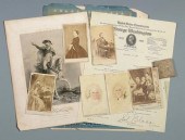 LINCOLN AND WASHINGTON CDVS, EPHEMERA7 p
[more like this]
LINCOLN AND WASHINGTON CDVS, EPHEMERA7 p
[more like this]
-
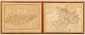
 1836 HAND-COLORED MAP, COUNTRY TWENTY FI
[more like this]
1836 HAND-COLORED MAP, COUNTRY TWENTY FI
[more like this]
-
 1836 HAND-COLORED MAP, COUNTRY TWENTY FI
[more like this]
1836 HAND-COLORED MAP, COUNTRY TWENTY FI
[more like this]
-
 1836 HAND-COLORED MAP, COUNTRY TWENTY FI
[more like this]
1836 HAND-COLORED MAP, COUNTRY TWENTY FI
[more like this]
This list is limited to only a few results.
Many more items are available to our members in our
Price Guide!
Ideal research tools for Collectors, Personal Property Appraisers, Antiques & Collectibles
Dealers, Auction Houses, Museums, eBayers or
other online
sellers (Rubylane, Etsy etc) and curious minds interested in appraising & identifying collectibles

EASY. FAST. ACCURATE.
Research at its best

Our research tools include:


