Pricing Guides & Dictionary of Makers Marks for Antiques & Collectibles
Appraise and find values for
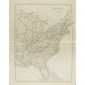
ATLASES - BLACK, A. & C.: PUBLISHER...
From
marks4antiques.com
- The most updated price guide and makers' marks research online
As a member, you have access to a team of experts
and assistance is always available to you for free
An example from the millions of items in our Price Guide:

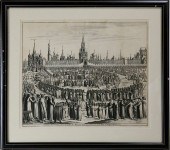
ATLASES - BLACK, A. & C.: PUBLISHER BLACK'S GENERAL ATLAS comprising sixty one maps. Edinburgh, 1850. Folio, 61 maps partly coloured, maroon half...
This is an example from our
values4antiques price guide
We do not buy or sell any items
See more price guides
Check our other research services:
IDENTIFY WORLDWIDE MAKERS' MARKS & HALLMARKS
marks4ceramics:
Porcelain, Pottery, Chinaware, Figurines, Dolls, Vases...
marks4silver
:
Silver, Jewelry, Pewter, Silverplate, Copper & Bronze...
Explore other items from our
Antiques & Collectibles Price Guide
-
 AN ANTIQUE MAP, "CARTE DES VARIATIONS DE
[more like this]
AN ANTIQUE MAP, "CARTE DES VARIATIONS DE
[more like this]
-
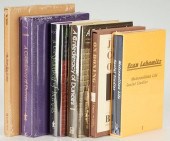
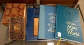
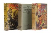
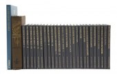
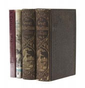
![THREE ANTIQUE ATLASES[Atlases]](/images/three-antique-atlasesatlases-three-antique--386cba-medium.jpg) THREE ANTIQUE ATLASES[Atlases] Three Ant
[more like this]
THREE ANTIQUE ATLASES[Atlases] Three Ant
[more like this]
-
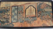 YOSHITORA UTAGAWA japanese (active ca.
[more like this]
YOSHITORA UTAGAWA japanese (active ca.
[more like this]
-
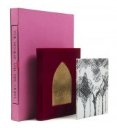
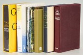 GROUPING OF 6 SIGNED LIMITED EDITION BOO
[more like this]
GROUPING OF 6 SIGNED LIMITED EDITION BOO
[more like this]
-
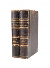 2VOL OVERLAND MONTHLY MAGAZINES PRESENTA
[more like this]
2VOL OVERLAND MONTHLY MAGAZINES PRESENTA
[more like this]
-
 * (AMERICANA NATIVE AMERICANA) A group o
[more like this]
* (AMERICANA NATIVE AMERICANA) A group o
[more like this]
-
 GROUPING OF 6 BOOKS, LIMITED EDITION, DR
[more like this]
GROUPING OF 6 BOOKS, LIMITED EDITION, DR
[more like this]
-
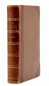 CLARKE, SIDNEY W. THE ANNALS OF CONJURIN
[more like this]
CLARKE, SIDNEY W. THE ANNALS OF CONJURIN
[more like this]
-
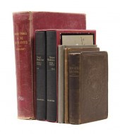
 5 CIVIL WAR RELATED BOOKS1st item: Hopki
[more like this]
5 CIVIL WAR RELATED BOOKS1st item: Hopki
[more like this]
-
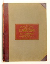 2 vols. (Property Atlases.) Franklin Su
[more like this]
2 vols. (Property Atlases.) Franklin Su
[more like this]
-
 2 BOUND ATLASES FOR THE TOWN OF FALMOUTH
[more like this]
2 BOUND ATLASES FOR THE TOWN OF FALMOUTH
[more like this]
-
 THE POETIC WORK OF LORD BYRON, PUBLISHED
[more like this]
THE POETIC WORK OF LORD BYRON, PUBLISHED
[more like this]
-
 TWO LARGE ATLASES IN SLIPCASES, EMBOSSED
[more like this]
TWO LARGE ATLASES IN SLIPCASES, EMBOSSED
[more like this]
-
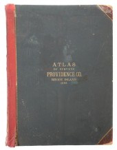 MASSIVE RHODE ISLAND ATLAS 1895The last
[more like this]
MASSIVE RHODE ISLAND ATLAS 1895The last
[more like this]
-
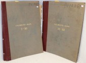
 COLLECTION OF PROPERTY ATLASES<br>Collec
[more like this]
COLLECTION OF PROPERTY ATLASES<br>Collec
[more like this]
-
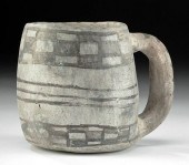 ANCESTRAL PUEBLOAN MANCOS BLACK ON WHITE
[more like this]
ANCESTRAL PUEBLOAN MANCOS BLACK ON WHITE
[more like this]
-
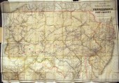
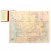 EDWARD STANFORD'S MAP OF CENTRAL AFRICA
[more like this]
EDWARD STANFORD'S MAP OF CENTRAL AFRICA
[more like this]
-
 ATLASES - BLACK, A. & C.: PUBLISHER
BLAC
[more like this]
ATLASES - BLACK, A. & C.: PUBLISHER
BLAC
[more like this]
-
 KUNICHIKA TOYOHARA (japanese 1835-1900)
[more like this]
KUNICHIKA TOYOHARA (japanese 1835-1900)
[more like this]
-
 Four fore edge painted books: Songs and
[more like this]
Four fore edge painted books: Songs and
[more like this]
-
 * (BOOK ARTS. D'AMBROSIO JOSEPH) JOYCE J
[more like this]
* (BOOK ARTS. D'AMBROSIO JOSEPH) JOYCE J
[more like this]
-
 * BURROUGHS EDGAR RICE A group of three
[more like this]
* BURROUGHS EDGAR RICE A group of three
[more like this]
-
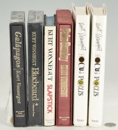 6 KURT VONNEGUT HARDCOVER BOOKS, INCL. A
[more like this]
6 KURT VONNEGUT HARDCOVER BOOKS, INCL. A
[more like this]
-
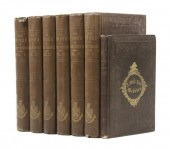
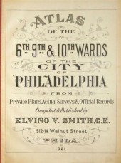 4 vols. Philadelphia Ward Atlases. Elvi
[more like this]
4 vols. Philadelphia Ward Atlases. Elvi
[more like this]
-
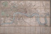 WYLD'S NEW PLAN OF LONDON AND WESTMINSTE
[more like this]
WYLD'S NEW PLAN OF LONDON AND WESTMINSTE
[more like this]
-
 ENGRAVING: "CHATEAU KREMELIN, DANS LA VI
[more like this]
ENGRAVING: "CHATEAU KREMELIN, DANS LA VI
[more like this]
-
 * (ANGLING) KREH LEFTY The complete set
[more like this]
* (ANGLING) KREH LEFTY The complete set
[more like this]
-
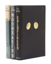 FLEMING IAN A group of two first U.K. ed
[more like this]
FLEMING IAN A group of two first U.K. ed
[more like this]
-
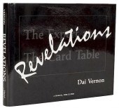 REVELATIONS.Vernon, Dai. Revelations. Pa
[more like this]
REVELATIONS.Vernon, Dai. Revelations. Pa
[more like this]
-
 3 pieces. Fold Maps: Colton, G.W.G. & C
[more like this]
3 pieces. Fold Maps: Colton, G.W.G. & C
[more like this]
-
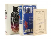 * HELLER JOSEPH A group of three works s
[more like this]
* HELLER JOSEPH A group of three works s
[more like this]
-
 * (AMERICANA CIVIL WAR) HEADLEY J.T. The
[more like this]
* (AMERICANA CIVIL WAR) HEADLEY J.T. The
[more like this]
-
 (FILLMORE MILLARD) WEBSTER DANIEL The Wo
[more like this]
(FILLMORE MILLARD) WEBSTER DANIEL The Wo
[more like this]
-
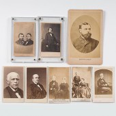 CDVs of Lincoln-Era Political Figures Lo
[more like this]
CDVs of Lincoln-Era Political Figures Lo
[more like this]
-
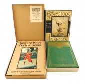 BOOKS: PYLE, HOWARD. HOWARD PYLE’S BOOK
[more like this]
BOOKS: PYLE, HOWARD. HOWARD PYLE’S BOOK
[more like this]
-
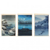 HASUI KAWASE (JAPANESE, 1883-1957), THRE
[more like this]
HASUI KAWASE (JAPANESE, 1883-1957), THRE
[more like this]
This list is limited to only a few results.
Many more items are available to our members in our
Price Guide!
Ideal research tools for Collectors, Personal Property Appraisers, Antiques & Collectibles
Dealers, Auction Houses, Museums, eBayers or
other online
sellers (Rubylane, Etsy etc) and curious minds interested in appraising & identifying collectibles

EASY. FAST. ACCURATE.
Research at its best

Our research tools include:


