Pricing Guides & Dictionary of Makers Marks for Antiques & Collectibles
Appraise and find values for
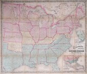
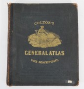
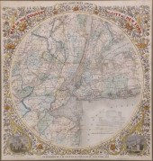
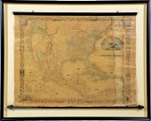
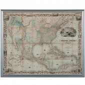
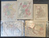
3 pieces. Fold Maps: Colton,...
From
marks4antiques.com
- The most updated price guide and makers' marks research online
As a member, you have access to a team of experts
and assistance is always available to you for free
An example from the millions of items in our Price Guide:
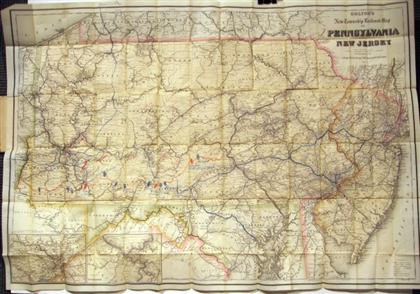
3 pieces. Fold Maps: Colton, G.W.G. & C.B., publisher. "Colton's New Township Map of Pennsylvania & The Southern Counties of New York." New York, 1871....
This is an example from our
values4antiques price guide
We do not buy or sell any items
See more price guides
Check our other research services:
IDENTIFY WORLDWIDE MAKERS' MARKS & HALLMARKS
marks4ceramics:
Porcelain, Pottery, Chinaware, Figurines, Dolls, Vases...
marks4silver
:
Silver, Jewelry, Pewter, Silverplate, Copper & Bronze...
Explore other items from our
Antiques & Collectibles Price Guide
-
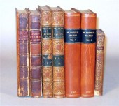
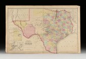
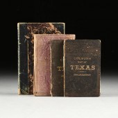 A GROUP OF FOUR BOOKS WITH MAPS OF TEXAS
[more like this]
A GROUP OF FOUR BOOKS WITH MAPS OF TEXAS
[more like this]
-
 4 TN & KY MAPS, 3 FRAMED1st item: "Tenne
[more like this]
4 TN & KY MAPS, 3 FRAMED1st item: "Tenne
[more like this]
-
 6 MISSISSIPPI AND TENNESSEE RIVER MAPSSi
[more like this]
6 MISSISSIPPI AND TENNESSEE RIVER MAPSSi
[more like this]
-
 A Very Large Collection of Maps, 19th/e
[more like this]
A Very Large Collection of Maps, 19th/e
[more like this]
-
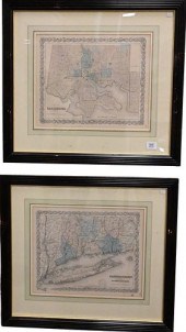
 3 pieces. Fold Maps: Colton, G.W.G. & C
[more like this]
3 pieces. Fold Maps: Colton, G.W.G. & C
[more like this]
-
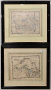
 2 vols. American 19th-Century Atlases:
[more like this]
2 vols. American 19th-Century Atlases:
[more like this]
-
 JOSEPH H. COLTON HAND COLORED ENGRAVED M
[more like this]
JOSEPH H. COLTON HAND COLORED ENGRAVED M
[more like this]
-
 COLTON'S MAP OF THE UNITED STATES SHOWIN
[more like this]
COLTON'S MAP OF THE UNITED STATES SHOWIN
[more like this]
-
 1874 COLTON'S GENERAL ATLAS New York,187
[more like this]
1874 COLTON'S GENERAL ATLAS New York,187
[more like this]
-
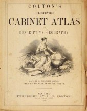
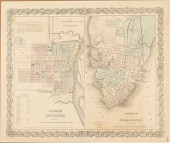
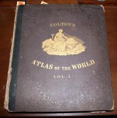
![COLTON G[EORGE] WOOLWORTH Colt](/images/colton-george-woolworth-coltons-general--154768-medium.jpg) COLTON G[EORGE] WOOLWORTH Colton's Gener
[more like this]
COLTON G[EORGE] WOOLWORTH Colton's Gener
[more like this]
-
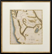
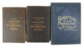 (3) EARLY FLORIDA MAPS, BLOOMFIELD, COLT
[more like this]
(3) EARLY FLORIDA MAPS, BLOOMFIELD, COLT
[more like this]
-
 COLTON'S MAPS OF SAVANNAH AND CHARL
[more like this]
COLTON'S MAPS OF SAVANNAH AND CHARL
[more like this]
-
 1 vol. (Philadelphia Atlas.) Smedley, S
[more like this]
1 vol. (Philadelphia Atlas.) Smedley, S
[more like this]
-
 G.W. & J.H. COLTON "MAP OF THE COUNTRY T
[more like this]
G.W. & J.H. COLTON "MAP OF THE COUNTRY T
[more like this]
-
 EIGHT JOSEPH H. COLTON HAND COLORED ENGR
[more like this]
EIGHT JOSEPH H. COLTON HAND COLORED ENGR
[more like this]
-
 2 19TH CENTURY NEW YORK MAPS GAMBLE & CO
[more like this]
2 19TH CENTURY NEW YORK MAPS GAMBLE & CO
[more like this]
-
 (MAPS) George W. Colton and R. S. Fishe
[more like this]
(MAPS) George W. Colton and R. S. Fishe
[more like this]
-
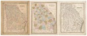 Three 19th century maps of Georgia: &quo
[more like this]
Three 19th century maps of Georgia: &quo
[more like this]
-
 5 KENTUCKY AND TENNESSEE MAPS1st item: "
[more like this]
5 KENTUCKY AND TENNESSEE MAPS1st item: "
[more like this]
-
 WILLIAM WINTERBOTHAM. AN HISTORICAL, GEO
[more like this]
WILLIAM WINTERBOTHAM. AN HISTORICAL, GEO
[more like this]
-
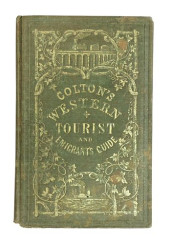 BOOK: COLTON'S WESTERN TOURIST GUID
[more like this]
BOOK: COLTON'S WESTERN TOURIST GUID
[more like this]
-
 7 vols. French & British Travelers in A
[more like this]
7 vols. French & British Travelers in A
[more like this]
-
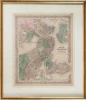 "COLTON'S BOSTON AND ADJACENT CITIES." M
[more like this]
"COLTON'S BOSTON AND ADJACENT CITIES." M
[more like this]
-
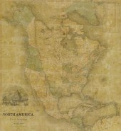 FRAMED J.H. COLTON MAP OF NORTH AMERICA
[more like this]
FRAMED J.H. COLTON MAP OF NORTH AMERICA
[more like this]
-
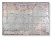
 COLTON NORTHWESTERN U.S. HAND-COLORED EN
[more like this]
COLTON NORTHWESTERN U.S. HAND-COLORED EN
[more like this]
-
 J.H. COLTON (1800-1893) A MAP, "NEW MAP
[more like this]
J.H. COLTON (1800-1893) A MAP, "NEW MAP
[more like this]
-
 AN ANTIQUE CIVIL WAR MAP, "COLTON'S MAP
[more like this]
AN ANTIQUE CIVIL WAR MAP, "COLTON'S MAP
[more like this]
-
 J.H. COLTON MAP OF THE UNITED STATES OF
[more like this]
J.H. COLTON MAP OF THE UNITED STATES OF
[more like this]
-
 Colton's 1849 Map of the U.S. Showing Ca
[more like this]
Colton's 1849 Map of the U.S. Showing Ca
[more like this]
-
 J. H. COLTON & CO. AND OTHER PUBLISHERS,
[more like this]
J. H. COLTON & CO. AND OTHER PUBLISHERS,
[more like this]
-
 4 vols. (Pennsylvania Property Atlases
[more like this]
4 vols. (Pennsylvania Property Atlases
[more like this]
-
 DU HALDE, Jean-Baptiste, (French, 1674-1
[more like this]
DU HALDE, Jean-Baptiste, (French, 1674-1
[more like this]
-
 MITCHELL. A NEW UNIVERSAL ATLAS CONTAINI
[more like this]
MITCHELL. A NEW UNIVERSAL ATLAS CONTAINI
[more like this]
-
 2 FRAMED 18TH C. FADEN MAPS - GREECE & D
[more like this]
2 FRAMED 18TH C. FADEN MAPS - GREECE & D
[more like this]
-
 HENRY MOUZON - MAP OF NORTH AND SOUTH CA
[more like this]
HENRY MOUZON - MAP OF NORTH AND SOUTH CA
[more like this]
-
 AN ANTIQUE MAP, "CARTE DES VARIATIONS DE
[more like this]
AN ANTIQUE MAP, "CARTE DES VARIATIONS DE
[more like this]
This list is limited to only a few results.
Many more items are available to our members in our
Price Guide!
Ideal research tools for Collectors, Personal Property Appraisers, Antiques & Collectibles
Dealers, Auction Houses, Museums, eBayers or
other online
sellers (Rubylane, Etsy etc) and curious minds interested in appraising & identifying collectibles

EASY. FAST. ACCURATE.
Research at its best

Our research tools include:


