Pricing Guides & Dictionary of Makers Marks for Antiques & Collectibles

Appraise and find values for
MARTIN WALDSEEMüLLER - MAP OF THE...
From
marks4antiques.com
- The most updated price guide and makers' marks research online
As a member, you have access to a team of experts
and assistance is always available to you for free
An example from the millions of items in our Price Guide:
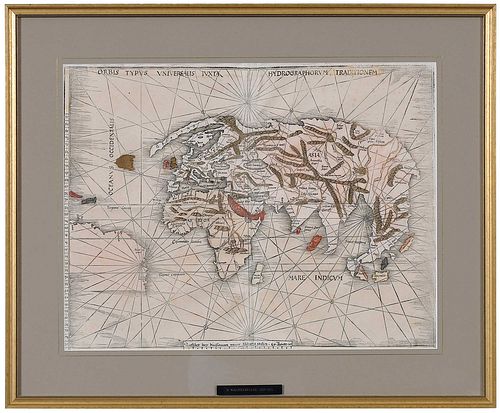
MARTIN WALDSEEMüLLER - MAP OF THE WORLD, 1513Martin Waldseemüller (c. 1475-1520), Orbis Typus Universalis Luxta Hydrographorum Traditionem , Strasbourg,...
This is an example from our
values4antiques price guide
We do not buy or sell any items
See more price guides
Check our other research services:
IDENTIFY WORLDWIDE MAKERS' MARKS & HALLMARKS
marks4ceramics:
Porcelain, Pottery, Chinaware, Figurines, Dolls, Vases...
marks4silver
:
Silver, Jewelry, Pewter, Silverplate, Copper & Bronze...
Explore other items from our
Antiques & Collectibles Price Guide
-
 BRITANNIA, VOL. I & II CAMDEN 1722Camden
[more like this]
-
 A COMPLETE SYSTEM OF GEOGRAPHY, VOL. I B
[more like this]
-
 IMPORTANT ANTIQUE ATLAS DU VOYAGE DE LA
[more like this]
-
 5 KENTUCKY AND TENNESSEE MAPS1st item: "
[more like this]
-
 A RARE ANTIQUE CIVIL WAR ERA MAP, "PRESS
[more like this]
-
 3 KY & TN MAPS: VANCE, TANNER, JOHNSON1s
[more like this]
-
 4 TN & KY MAPS, 3 FRAMED1st item: "Tenne
[more like this]
-
 A Very Large Collection of Maps, 19th/e
[more like this]
-
 8 TENNESSEE MILITARY & SURVEY MAPSAssort
[more like this]
-
 A TOPOGRAPHICAL MAP OF THE ENVIRONS OF L
[more like this]
-
 11 PC. MAP COLLECTION: Comprising; 1- La
[more like this]
-
 16TH / 18TH C. EUROPEAN MAPS OF NEW SPAI
[more like this]
-
 A LATE MEXICAN-AMERICAN WAR ERA MAP, "MA
[more like this]
-
 C. 1557 WALDSEEMULLER / FRIES UNCOLORED
[more like this]
-
 ARCHIVE OF ALSS AND DIRECTIONS FROM JON
[more like this]
-
 AN IMPORTANT REPUBLIC OF TEXAS MAP, "MAP
[more like this]
-
 AN ANTIQUE RECONSTRUCTION ERA MAP, "KOSS
[more like this]
-
 3 19TH CENT. AL, KY, & TN MAPS1st item:
[more like this]
-
 MAP AND ATLAS LOT, 3 PCS INCL. MELISH DI
[more like this]
-
 5 CIVIL WAR MAPSLot of five Civil War ma
[more like this]
-
 MARTIN WALDSEEMüLLER - MAP OF THE WORLD,
[more like this]
-
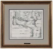 MARTIN WALDSEEMüLLER - “THE ADMIRAL’S MA
[more like this]
-
 NATIVE AMERICAN/WESTERN U.S. EXPEDITION
[more like this]
-
 Rare and Important American Rococo Reviv
[more like this]
-
 RARE 1865 MONTANA TERRITORY MAP BY W.W.
[more like this]
-
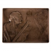 AMERIGO VESPUCCI PLAQUE IN BRONZE By VD
[more like this]
-
 AN ANTIQUE REPUBLIC OF TEXAS MAP, "MAP O
[more like this]
-
 AN ANTIQUE REPUBLIC OF TEXAS MAP, "MAP O
[more like this]
-
 AN ANTIQUE RECONSTRUCTION ERA MAP, "TRAV
[more like this]
-
 A RENAISSANCE MAP, "PTOLEMY MAP OF THE W
[more like this]
-
 AN ANTIQUE POCKET MAP, "MAP OF MEXICO AN
[more like this]
-
 AN ANTEBELLUM MAP, "J. DE CORDOVA'S MAP
[more like this]
-
 4 EARLY AMERICAN MAPS: OVERTON, THIERRY,
[more like this]
-
 KENTUCKY MAP, 1800 PAYNE"The State of Ke
[more like this]
-
 2 MAPS, LA/FL AND US, LATE 18TH AND EARL
[more like this]
-
 FIVE 18TH CENTURY NC/TN LAND GRANTSGroup
[more like this]
This list is limited to only a few results.
Many more items are available to our members in our
Price Guide!


