Pricing Guides & Dictionary of Makers Marks for Antiques & Collectibles
Appraise and find values for
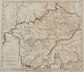
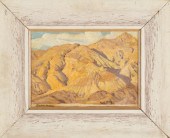
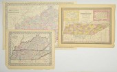
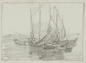
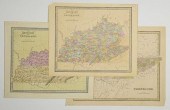
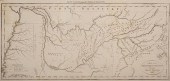
KENTUCKY MAP, 1800 PAYNE"The...
From
marks4antiques.com
- The most updated price guide and makers' marks research online
As a member, you have access to a team of experts
and assistance is always available to you for free
An example from the millions of items in our Price Guide:
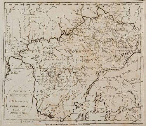
KENTUCKY MAP, 1800 PAYNE"The State of Kentucky with Adjoining Territories" Map, by John Payne, engraved by John Scoles, published by John Low, New York,...
This is an example from our
values4antiques price guide
We do not buy or sell any items
See more price guides
Check our other research services:
IDENTIFY WORLDWIDE MAKERS' MARKS & HALLMARKS
marks4ceramics:
Porcelain, Pottery, Chinaware, Figurines, Dolls, Vases...
marks4silver
:
Silver, Jewelry, Pewter, Silverplate, Copper & Bronze...
Explore other items from our
Antiques & Collectibles Price Guide
-
 BRITANNIA, VOL. I & II CAMDEN 1722Camden
[more like this]
BRITANNIA, VOL. I & II CAMDEN 1722Camden
[more like this]
-
 A COMPLETE SYSTEM OF GEOGRAPHY, VOL. I B
[more like this]
A COMPLETE SYSTEM OF GEOGRAPHY, VOL. I B
[more like this]
-
 5 KENTUCKY AND TENNESSEE MAPS1st item: "
[more like this]
5 KENTUCKY AND TENNESSEE MAPS1st item: "
[more like this]
-
 IMPORTANT ANTIQUE ATLAS DU VOYAGE DE LA
[more like this]
IMPORTANT ANTIQUE ATLAS DU VOYAGE DE LA
[more like this]
-
 3 KY & TN MAPS: VANCE, TANNER, JOHNSON1s
[more like this]
3 KY & TN MAPS: VANCE, TANNER, JOHNSON1s
[more like this]
-
 4 TN & KY MAPS, 3 FRAMED1st item: "Tenne
[more like this]
4 TN & KY MAPS, 3 FRAMED1st item: "Tenne
[more like this]
-
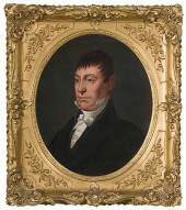 Asa Park (Kentucky 1790-1827) Portrait o
[more like this]
Asa Park (Kentucky 1790-1827) Portrait o
[more like this]
-
 KENTUCKY MAP, 1800 PAYNE"The State of Ke
[more like this]
KENTUCKY MAP, 1800 PAYNE"The State of Ke
[more like this]
-
 8 TENNESSEE MILITARY & SURVEY MAPSAssort
[more like this]
8 TENNESSEE MILITARY & SURVEY MAPSAssort
[more like this]
-
 A RARE ANTIQUE CIVIL WAR ERA MAP, "PRESS
[more like this]
A RARE ANTIQUE CIVIL WAR ERA MAP, "PRESS
[more like this]
-
 9 KY RELATED ANTIQUES BOOKS AND EXHIBITI
[more like this]
9 KY RELATED ANTIQUES BOOKS AND EXHIBITI
[more like this]
-
 EDGAR PAYNE (CALIFORNIA, 1883-1947) MOUN
[more like this]
EDGAR PAYNE (CALIFORNIA, 1883-1947) MOUN
[more like this]
-
 3 19TH CENT. AL, KY, & TN MAPS1st item:
[more like this]
3 19TH CENT. AL, KY, & TN MAPS1st item:
[more like this]
-
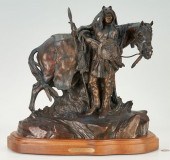 KEN PAYNE BRONZE SCULPTURE, SILHOUETTES
[more like this]
KEN PAYNE BRONZE SCULPTURE, SILHOUETTES
[more like this]
-
 KEN PAYNE BRONZE SCULPTURE, WALKS AMONG
[more like this]
KEN PAYNE BRONZE SCULPTURE, WALKS AMONG
[more like this]
-
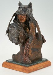
 KEN PAYNE BRONZE SCULPTURE, CANYON SHADO
[more like this]
KEN PAYNE BRONZE SCULPTURE, CANYON SHADO
[more like this]
-
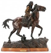 KEN PAYNE BRONZE SCULPTURE, WHERE SMOKE
[more like this]
KEN PAYNE BRONZE SCULPTURE, WHERE SMOKE
[more like this]
-
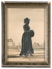 Silhouette of Kentucky First Lady Mrs. I
[more like this]
Silhouette of Kentucky First Lady Mrs. I
[more like this]
-
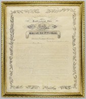 KY CAPITOL PRESENTATION DOCUMENT & PLATE
[more like this]
KY CAPITOL PRESENTATION DOCUMENT & PLATE
[more like this]
-
 A Very Large Collection of Maps, 19th/e
[more like this]
A Very Large Collection of Maps, 19th/e
[more like this]
-
 3 MAPS TOTAL , 1 OF TENNESSEE, 2 OF KENT
[more like this]
3 MAPS TOTAL , 1 OF TENNESSEE, 2 OF KENT
[more like this]
-
 A TOPOGRAPHICAL MAP OF THE ENVIRONS OF L
[more like this]
A TOPOGRAPHICAL MAP OF THE ENVIRONS OF L
[more like this]
-
 11 PC. MAP COLLECTION: Comprising; 1- La
[more like this]
11 PC. MAP COLLECTION: Comprising; 1- La
[more like this]
-
 16TH / 18TH C. EUROPEAN MAPS OF NEW SPAI
[more like this]
16TH / 18TH C. EUROPEAN MAPS OF NEW SPAI
[more like this]
-
 EDGAR PAYNE (1883-1947), "STUDY FOR BRET
[more like this]
EDGAR PAYNE (1883-1947), "STUDY FOR BRET
[more like this]
-
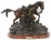
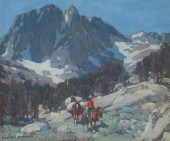 EDGAR ALWIN PAYNE (1883-1947), RIDER ON
[more like this]
EDGAR ALWIN PAYNE (1883-1947), RIDER ON
[more like this]
-
 3 TN AND KY MAPS INC. BRADFORD, GREENLEA
[more like this]
3 TN AND KY MAPS INC. BRADFORD, GREENLEA
[more like this]
-
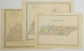 3 TN AND KY MAPS INC. FINLEY AND 2 GREEN
[more like this]
3 TN AND KY MAPS INC. FINLEY AND 2 GREEN
[more like this]
-
 A LATE MEXICAN-AMERICAN WAR ERA MAP, "MA
[more like this]
A LATE MEXICAN-AMERICAN WAR ERA MAP, "MA
[more like this]
-
 AN IMPORTANT REPUBLIC OF TEXAS MAP, "MAP
[more like this]
AN IMPORTANT REPUBLIC OF TEXAS MAP, "MAP
[more like this]
-
 AN ANTIQUE RECONSTRUCTION ERA MAP, "KOSS
[more like this]
AN ANTIQUE RECONSTRUCTION ERA MAP, "KOSS
[more like this]
-
 MAP AND ATLAS LOT, 3 PCS INCL. MELISH DI
[more like this]
MAP AND ATLAS LOT, 3 PCS INCL. MELISH DI
[more like this]
-
 5 CIVIL WAR MAPSLot of five Civil War ma
[more like this]
5 CIVIL WAR MAPSLot of five Civil War ma
[more like this]
-
 JIM CANTRELL, AMERICAN (B.1935), SEMI NU
[more like this]
JIM CANTRELL, AMERICAN (B.1935), SEMI NU
[more like this]
-
 NATIVE AMERICAN/WESTERN U.S. EXPEDITION
[more like this]
NATIVE AMERICAN/WESTERN U.S. EXPEDITION
[more like this]
-
 TENN. MAP 1811, PAYNE/LOW"A Map of the T
[more like this]
TENN. MAP 1811, PAYNE/LOW"A Map of the T
[more like this]
This list is limited to only a few results.
Many more items are available to our members in our
Price Guide!
Ideal research tools for Collectors, Personal Property Appraisers, Antiques & Collectibles
Dealers, Auction Houses, Museums, eBayers or
other online
sellers (Rubylane, Etsy etc) and curious minds interested in appraising & identifying collectibles

EASY. FAST. ACCURATE.
Research at its best

Our research tools include:


