Pricing Guides & Dictionary of Makers Marks for Antiques & Collectibles
Appraise and find values for
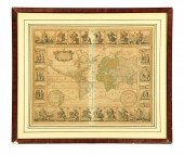
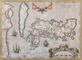
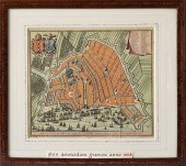
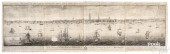
NICHOLAS VISSCHER, INSULAE...
From
marks4antiques.com
- The most updated price guide and makers' marks research online
As a member, you have access to a team of experts
and assistance is always available to you for free
An example from the millions of items in our Price Guide:
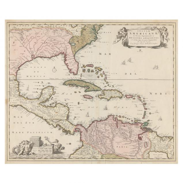
NICHOLAS VISSCHER, INSULAE AMERICANAE IN OCEANO SEPTENTRIONALI... ...ac Regiones Adjacentes, late 17th century, copperplate engraving with hand color,...
This is an example from our
values4antiques price guide
We do not buy or sell any items
See more price guides
Check our other research services:
IDENTIFY WORLDWIDE MAKERS' MARKS & HALLMARKS
marks4ceramics:
Porcelain, Pottery, Chinaware, Figurines, Dolls, Vases...
marks4silver
:
Silver, Jewelry, Pewter, Silverplate, Copper & Bronze...
Explore other items from our
Antiques & Collectibles Price Guide
-
 NICHOLAES VISSCHER (1618-1679)Nicholaes
[more like this]
NICHOLAES VISSCHER (1618-1679)Nicholaes
[more like this]
-
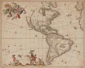
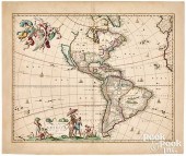 NICHOLAS VISSCHER MAP OF THE AMERICAS, C
[more like this]
NICHOLAS VISSCHER MAP OF THE AMERICAS, C
[more like this]
-
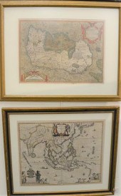 WILLEM BLAEU "INDIA QUAE ORIENTALIS DICT
[more like this]
WILLEM BLAEU "INDIA QUAE ORIENTALIS DICT
[more like this]
-
 RUSSIAN ENAMEL 1896 CORONATION BLOOD CUP
[more like this]
RUSSIAN ENAMEL 1896 CORONATION BLOOD CUP
[more like this]
-
 MAP OF THE WORLD BY CLAES JANSZOON VISSC
[more like this]
MAP OF THE WORLD BY CLAES JANSZOON VISSC
[more like this]
-
 BLAEU, MORTIER, VISSCHER - THREE MAPS OF
[more like this]
BLAEU, MORTIER, VISSCHER - THREE MAPS OF
[more like this]
-
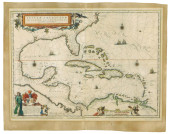
 NICHOLAS VISSCHER, INSULAE AMERICANAE IN
[more like this]
NICHOLAS VISSCHER, INSULAE AMERICANAE IN
[more like this]
-
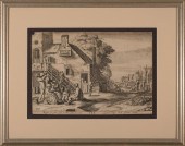 AFTER JAN VAN DE VELDE II (DUTCH, C. 159
[more like this]
AFTER JAN VAN DE VELDE II (DUTCH, C. 159
[more like this]
-
 An Impressive Masterwork Andrew Clemens
[more like this]
An Impressive Masterwork Andrew Clemens
[more like this]
-
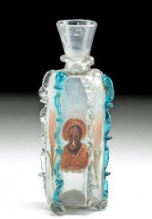 16TH C. FACON DE VENISE GLASS BOTTLE W/
[more like this]
16TH C. FACON DE VENISE GLASS BOTTLE W/
[more like this]
-
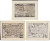
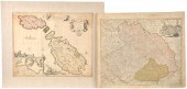
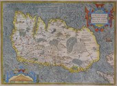 MAP: MAP OF IRELAND, 16TH C., BY ABRAHAM
[more like this]
MAP: MAP OF IRELAND, 16TH C., BY ABRAHAM
[more like this]
-
 ABRAHAM ORTELIUS, FLEMISH 1527-1598, JAP
[more like this]
ABRAHAM ORTELIUS, FLEMISH 1527-1598, JAP
[more like this]
-
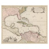
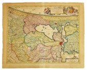
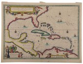 BLAEU - INSULAE AMERICANAE IN OCEANO SEP
[more like this]
BLAEU - INSULAE AMERICANAE IN OCEANO SEP
[more like this]
-
 MAP: BLAEU, JOAN (1596-1673), "INSULAE A
[more like this]
MAP: BLAEU, JOAN (1596-1673), "INSULAE A
[more like this]
-
 Two Antique Maps The lot consisting of:
[more like this]
Two Antique Maps The lot consisting of:
[more like this]
-
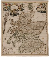 17th Century Map of Scotland "Exactissim
[more like this]
17th Century Map of Scotland "Exactissim
[more like this]
-
 S. VISSCHER OIL ON CANVASS. VISSCHER (Ne
[more like this]
S. VISSCHER OIL ON CANVASS. VISSCHER (Ne
[more like this]
-
 NICOLAES VISSCHER ENGRAVING MAP OF AMSTE
[more like this]
NICOLAES VISSCHER ENGRAVING MAP OF AMSTE
[more like this]
-
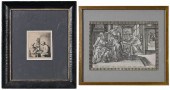 TWO DUTCH ENGRAVINGS(17th century)
Adri
[more like this]
TWO DUTCH ENGRAVINGS(17th century)
Adri
[more like this]
-
 NICOLAS VISSCHER HAND COLORED ENGRAVING
[more like this]
NICOLAS VISSCHER HAND COLORED ENGRAVING
[more like this]
-
 NICOLAES VISSCHER WORLD MAP 1657Nicolaes
[more like this]
NICOLAES VISSCHER WORLD MAP 1657Nicolaes
[more like this]
-
 CLAES JANSZ VISSCHER (1586-1652), "VIEWS
[more like this]
CLAES JANSZ VISSCHER (1586-1652), "VIEWS
[more like this]
-
 (4) VISSCHER FAMILY PUBLISHED BIBLICAL O
[more like this]
(4) VISSCHER FAMILY PUBLISHED BIBLICAL O
[more like this]
-
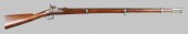 The Nicholas Wolf Springfield Rifle/ Mus
[more like this]
The Nicholas Wolf Springfield Rifle/ Mus
[more like this]
-
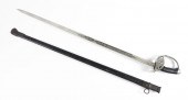 NICHOLAS II IMPERIAL GERMAN CAVALRY SWOR
[more like this]
NICHOLAS II IMPERIAL GERMAN CAVALRY SWOR
[more like this]
-
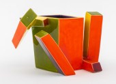 KEN PRICE 'CUBIST CUP' MODERN ART CERAMI
[more like this]
KEN PRICE 'CUBIST CUP' MODERN ART CERAMI
[more like this]
-
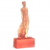 NICHOLAS AFRICANO, AMERICAN (B. 1948), U
[more like this]
NICHOLAS AFRICANO, AMERICAN (B. 1948), U
[more like this]
-
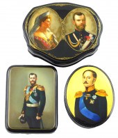 RUSSIAN HAND-PAINTED LACQUER BOXES, GROU
[more like this]
RUSSIAN HAND-PAINTED LACQUER BOXES, GROU
[more like this]
-
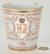
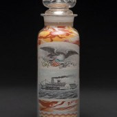
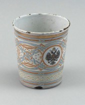
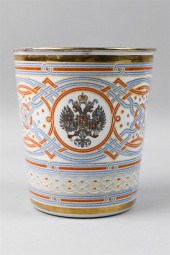 RUSSIAN KHODYNKA 'CUP OF SORROWS', 1896R
[more like this]
RUSSIAN KHODYNKA 'CUP OF SORROWS', 1896R
[more like this]
-
 GABRIEL VIGIL, NICHOLAS OTERO, ROBERTO G
[more like this]
GABRIEL VIGIL, NICHOLAS OTERO, ROBERTO G
[more like this]
-
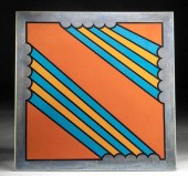 SIGNED NICHOLAS KRUSHENICK SCREENPRINT O
[more like this]
SIGNED NICHOLAS KRUSHENICK SCREENPRINT O
[more like this]
-
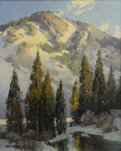 TOM NICHOLAS (B. 1934) "IN HIGH SIERRAS,
[more like this]
TOM NICHOLAS (B. 1934) "IN HIGH SIERRAS,
[more like this]
-
 A RUSSIAN FAUX JEWELED AND CLOISONNE ENA
[more like this]
A RUSSIAN FAUX JEWELED AND CLOISONNE ENA
[more like this]
-
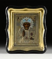
 CZAR NICHOLAS II CORONATION COMMEMORATIV
[more like this]
CZAR NICHOLAS II CORONATION COMMEMORATIV
[more like this]
-
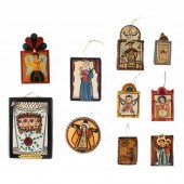
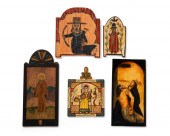 A GROUP OF CONTEMPORARY RETABLOSA group
[more like this]
A GROUP OF CONTEMPORARY RETABLOSA group
[more like this]
-
 GEORGE HEAP AND NICHOLAS SCULL PROSPECT
[more like this]
GEORGE HEAP AND NICHOLAS SCULL PROSPECT
[more like this]
This list is limited to only a few results.
Many more items are available to our members in our
Price Guide!
Ideal research tools for Collectors, Personal Property Appraisers, Antiques & Collectibles
Dealers, Auction Houses, Museums, eBayers or
other online
sellers (Rubylane, Etsy etc) and curious minds interested in appraising & identifying collectibles

EASY. FAST. ACCURATE.
Research at its best

Our research tools include:


