Pricing Guides & Dictionary of Makers Marks for Antiques & Collectibles
Appraise and find values for
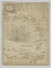
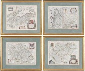
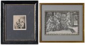
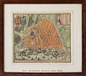
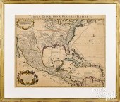
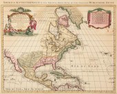
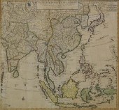
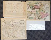
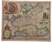
BLAEU, MORTIER, VISSCHER - THREE...
From
marks4antiques.com
- The most updated price guide and makers' marks research online
As a member, you have access to a team of experts
and assistance is always available to you for free
An example from the millions of items in our Price Guide:
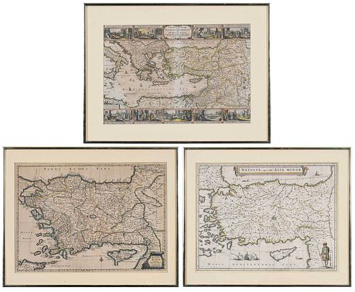
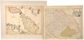
BLAEU, MORTIER, VISSCHER - THREE MAPS OF ASIA MINORcomprising: Willem Janszoon Blaeu (1571-1638), Natolia, quae olim Asia Minor , published by Joan...
This is an example from our
values4antiques price guide
We do not buy or sell any items
See more price guides
Check our other research services:
IDENTIFY WORLDWIDE MAKERS' MARKS & HALLMARKS
marks4ceramics:
Porcelain, Pottery, Chinaware, Figurines, Dolls, Vases...
marks4silver
:
Silver, Jewelry, Pewter, Silverplate, Copper & Bronze...
Explore other items from our
Antiques & Collectibles Price Guide
-
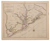
 BLAEU, MORTIER, VISSCHER - THREE MAPS OF
[more like this]
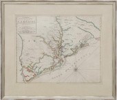
BLAEU, MORTIER, VISSCHER - THREE MAPS OF
[more like this]
-
 NICHOLAES VISSCHER (1618-1679)Nicholaes
[more like this]
NICHOLAES VISSCHER (1618-1679)Nicholaes
[more like this]
-
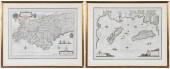
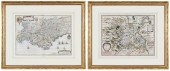
 17TH C. DUTCH MAP - REGNO DI NAPOLI - BY
[more like this]
17TH C. DUTCH MAP - REGNO DI NAPOLI - BY
[more like this]
-
 GRP: 5 MAPS OF BRAZIL BLAEU BELLIN KITCH
[more like this]
GRP: 5 MAPS OF BRAZIL BLAEU BELLIN KITCH
[more like this]
-
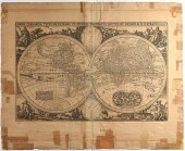
 MAP OF THE WORLD BY CLAES JANSZOON VISSC
[more like this]
MAP OF THE WORLD BY CLAES JANSZOON VISSC
[more like this]
-
 NICHOLAS VISSCHER MAP OF THE AMERICAS, C
[more like this]
NICHOLAS VISSCHER MAP OF THE AMERICAS, C
[more like this]
-
 JOHANNES L. VAN LUCHTENBURG (1685-1711)
[more like this]
JOHANNES L. VAN LUCHTENBURG (1685-1711)
[more like this]
-
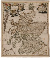 17th Century Map of Scotland "Exactissim
[more like this]
17th Century Map of Scotland "Exactissim
[more like this]
-
 BLAEU, LE ROUGE - THREE MAPS OF FRANCE,
[more like this]
BLAEU, LE ROUGE - THREE MAPS OF FRANCE,
[more like this]
-
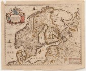 Maps of Scandanavia by Joan Blaeu Anders
[more like this]
Maps of Scandanavia by Joan Blaeu Anders
[more like this]
-
 BLAEU - TWO FRAMED FRENCH REGIONAL MAPSW
[more like this]
BLAEU - TWO FRAMED FRENCH REGIONAL MAPSW
[more like this]
-
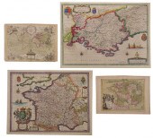
 BLAEU - FOUR FRENCH REGIONAL MAPSWillem
[more like this]
BLAEU - FOUR FRENCH REGIONAL MAPSWillem
[more like this]
-
 HONDIUS AND BLAEU - TWO FRENCH REGIONAL
[more like this]
HONDIUS AND BLAEU - TWO FRENCH REGIONAL
[more like this]
-
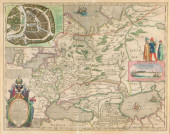 MAP: BLAEU, WILLEM & JOAN. "TABULA RUSSI
[more like this]
MAP: BLAEU, WILLEM & JOAN. "TABULA RUSSI
[more like this]
-
 NICOLAES VISSCHER WORLD MAP 1657Nicolaes
[more like this]
NICOLAES VISSCHER WORLD MAP 1657Nicolaes
[more like this]
-
 Two Antique Maps The lot consisting of:
[more like this]
Two Antique Maps The lot consisting of:
[more like this]
-
 AFTER JAN VAN DE VELDE II (DUTCH, C. 159
[more like this]
AFTER JAN VAN DE VELDE II (DUTCH, C. 159
[more like this]
-
 S. VISSCHER OIL ON CANVASS. VISSCHER (Ne
[more like this]
S. VISSCHER OIL ON CANVASS. VISSCHER (Ne
[more like this]
-
 NICOLAES VISSCHER ENGRAVING MAP OF AMSTE
[more like this]
NICOLAES VISSCHER ENGRAVING MAP OF AMSTE
[more like this]
-
 TWO DUTCH ENGRAVINGS(17th century)
Adri
[more like this]
TWO DUTCH ENGRAVINGS(17th century)
Adri
[more like this]
-
 NICOLAS VISSCHER HAND COLORED ENGRAVING
[more like this]
NICOLAS VISSCHER HAND COLORED ENGRAVING
[more like this]
-
 CLAES JANSZ VISSCHER (1586-1652), "VIEWS
[more like this]
CLAES JANSZ VISSCHER (1586-1652), "VIEWS
[more like this]
-
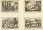 (4) VISSCHER FAMILY PUBLISHED BIBLICAL O
[more like this]
(4) VISSCHER FAMILY PUBLISHED BIBLICAL O
[more like this]
-
 MORTIER - CARTE PARTICULIERE DE LA CAROL
[more like this]
MORTIER - CARTE PARTICULIERE DE LA CAROL
[more like this]
-
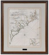
 Rare early map of South Carolina by Pier
[more like this]
Rare early map of South Carolina by Pier
[more like this]
-
 PIETER MORTIER (AFTER), PAIR LARGE ENGRA
[more like this]
PIETER MORTIER (AFTER), PAIR LARGE ENGRA
[more like this]
-
 COVENS & MORTIER COLOR ENGRAVED MAPCoven
[more like this]
COVENS & MORTIER COLOR ENGRAVED MAPCoven
[more like this]
-
 PIETER COVENS AND CORNELIU MORTIER, C. 1
[more like this]
PIETER COVENS AND CORNELIU MORTIER, C. 1
[more like this]
-
 COVENS AND MORTIER, CARTE DES INDES ET D
[more like this]
COVENS AND MORTIER, CARTE DES INDES ET D
[more like this]
-
 MAPS OF THE OTTOMAN EMPIRE BY DE WITT AN
[more like this]
MAPS OF THE OTTOMAN EMPIRE BY DE WITT AN
[more like this]
-
 PIERRE MORTIER, CARTOGRAPHER, AVENIO VUL
[more like this]
PIERRE MORTIER, CARTOGRAPHER, AVENIO VUL
[more like this]
-
 DRESDEN CARL THIEME, EDOUARD MORTIER (NA
[more like this]
DRESDEN CARL THIEME, EDOUARD MORTIER (NA
[more like this]
-
 PIERRE MORTIER - MAP OF THE CAROLINAS, 1
[more like this]
PIERRE MORTIER - MAP OF THE CAROLINAS, 1
[more like this]
-
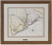 PIERRE MORTIER - MAP OF SOUTH CAROLINAPi
[more like this]
PIERRE MORTIER - MAP OF SOUTH CAROLINAPi
[more like this]
-
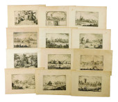
 SIXTEEN ANTIQUE MAPSSixteen Antique Maps
[more like this]
SIXTEEN ANTIQUE MAPSSixteen Antique Maps
[more like this]
-
 BLAEU - TABULA RUSSIAE EX AUTOGRAPHO...,
[more like this]
BLAEU - TABULA RUSSIAE EX AUTOGRAPHO...,
[more like this]
This list is limited to only a few results.
Many more items are available to our members in our
Price Guide!
Ideal research tools for Collectors, Personal Property Appraisers, Antiques & Collectibles
Dealers, Auction Houses, Museums, eBayers or
other online
sellers (Rubylane, Etsy etc) and curious minds interested in appraising & identifying collectibles

EASY. FAST. ACCURATE.
Research at its best

Our research tools include:


