Pricing Guides & Dictionary of Makers Marks for Antiques & Collectibles
Appraise and find values for
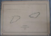
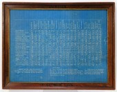
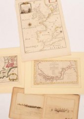
A Correct Chart of the Baltick or...
From
marks4antiques.com
- The most updated price guide and makers' marks research online
As a member, you have access to a team of experts
and assistance is always available to you for free
An example from the millions of items in our Price Guide:
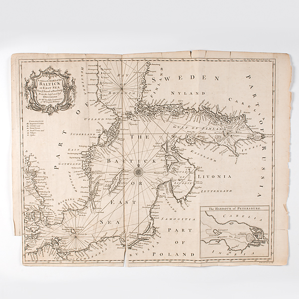
A Correct Chart of the Baltick or East Sea Seale Richard William. A Correct Chart of the Baltick or East Sea from ye Sound to Petersburg from the latest...
This is an example from our
values4antiques price guide
We do not buy or sell any items
See more price guides
Check our other research services:
IDENTIFY WORLDWIDE MAKERS' MARKS & HALLMARKS
marks4ceramics:
Porcelain, Pottery, Chinaware, Figurines, Dolls, Vases...
marks4silver
:
Silver, Jewelry, Pewter, Silverplate, Copper & Bronze...
Explore other items from our
Antiques & Collectibles Price Guide
-
 A Correct Chart of the Baltick or East S
[more like this]
A Correct Chart of the Baltick or East S
[more like this]
-
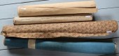
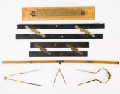
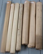 LOT OF SEVEN ROLL UP CHARTS, TO INCLUDE:
[more like this]
LOT OF SEVEN ROLL UP CHARTS, TO INCLUDE:
[more like this]
-
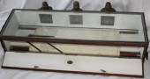 LIGHTED NAUTICAL CHART HOLDER & COURSE I
[more like this]
LIGHTED NAUTICAL CHART HOLDER & COURSE I
[more like this]
-
 LOT OF FOUR 19TH CENTURY NAUTICAL ROLL U
[more like this]
LOT OF FOUR 19TH CENTURY NAUTICAL ROLL U
[more like this]
-
 LOT OF FOUR ROLL UP CHARTS TO INCLUDE: 1
[more like this]
LOT OF FOUR ROLL UP CHARTS TO INCLUDE: 1
[more like this]
-
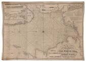 BLUEBACK CHART "A NEW CHART OF THE NORTH
[more like this]
BLUEBACK CHART "A NEW CHART OF THE NORTH
[more like this]
-
 HAND DRAWN SHIP'S CHART OF A WHALING VOY
[more like this]
HAND DRAWN SHIP'S CHART OF A WHALING VOY
[more like this]
-
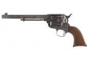 BOSTON CUSTER'S COLT CARRIED AT LITTLE B
[more like this]
BOSTON CUSTER'S COLT CARRIED AT LITTLE B
[more like this]
-
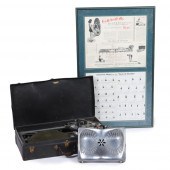 EARLY 1930S "THE SEAT OF HEALTH" PORTABL
[more like this]
EARLY 1930S "THE SEAT OF HEALTH" PORTABL
[more like this]
-
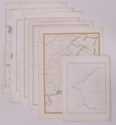 6pc John Barrow China Maps. All maps pub
[more like this]
6pc John Barrow China Maps. All maps pub
[more like this]
-
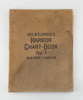 "GEO. W. ELDRIDGE'S HARBOR CHART-BOOK NO
[more like this]
"GEO. W. ELDRIDGE'S HARBOR CHART-BOOK NO
[more like this]
-
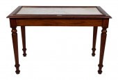 CHART TABLE 19TH CENTURY HEIGHT 33”. WID
[more like this]
CHART TABLE 19TH CENTURY HEIGHT 33”. WID
[more like this]
-
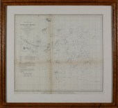
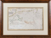 CHART OF NANTUCKET SHOALS SURVEYED BY CA
[more like this]
CHART OF NANTUCKET SHOALS SURVEYED BY CA
[more like this]
-
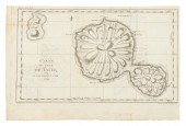 CHART "CARTE DE L'ISLE DE TAITI, PAR LE
[more like this]
CHART "CARTE DE L'ISLE DE TAITI, PAR LE
[more like this]
-
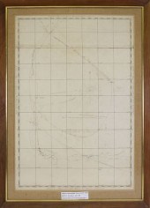
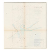
 PRELIMINARY CHART OF NANTUCKET SHOALS TO
[more like this]
PRELIMINARY CHART OF NANTUCKET SHOALS TO
[more like this]
-
 TWO ANTIQUE ANTEBELLUM MAPS, "MAP OF TEX
[more like this]
TWO ANTIQUE ANTEBELLUM MAPS, "MAP OF TEX
[more like this]
-
 ANTIQUE & VINTAGE MARINE MAP CHART ACCES
[more like this]
ANTIQUE & VINTAGE MARINE MAP CHART ACCES
[more like this]
-
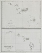 A CHART OF THE SANDWICH ISLANDSA chart o
[more like this]
A CHART OF THE SANDWICH ISLANDSA chart o
[more like this]
-
 CIVIL WAR ERA U.S. COAST SURVEY CHART OF
[more like this]
CIVIL WAR ERA U.S. COAST SURVEY CHART OF
[more like this]
-
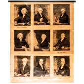 C 1842 FIRST NINE U.S. PRESIDENTS CURRIE
[more like this]
C 1842 FIRST NINE U.S. PRESIDENTS CURRIE
[more like this]
-
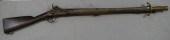 Sappers: 1847, muzzle loading percussion
[more like this]
Sappers: 1847, muzzle loading percussion
[more like this]
-
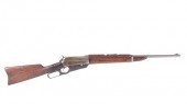 WINCHESTER M1895 .35-40 KRAG SADDLE RING
[more like this]
WINCHESTER M1895 .35-40 KRAG SADDLE RING
[more like this]
-
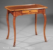 A Provincial Louis XV Walnut Table á Thé
[more like this]
A Provincial Louis XV Walnut Table á Thé
[more like this]
-
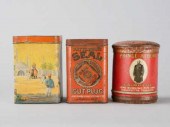 LOT OF AMERICAN TINSLot of three vintage
[more like this]
LOT OF AMERICAN TINSLot of three vintage
[more like this]
-
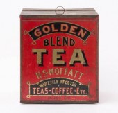 LITHOGRAPHED LIDDED TIN TEA BOX, JASPER,
[more like this]
LITHOGRAPHED LIDDED TIN TEA BOX, JASPER,
[more like this]
-
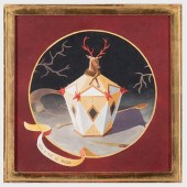 LAURENT DE COMMINES (B. 1960): BOITE à T
[more like this]
LAURENT DE COMMINES (B. 1960): BOITE à T
[more like this]
-
 After Marie Adrien Persac (French/Louisi
[more like this]
After Marie Adrien Persac (French/Louisi
[more like this]
-
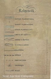
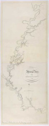 Joseph Frederick Wallet des Barres (Engl
[more like this]
Joseph Frederick Wallet des Barres (Engl
[more like this]
-
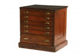 CHART CABINET - Mid 19th c Six-Drawer Ch
[more like this]
CHART CABINET - Mid 19th c Six-Drawer Ch
[more like this]
-
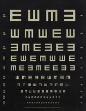
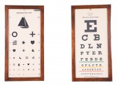 (2) Framed Eye charts, c/o Kindergarten
[more like this]
(2) Framed Eye charts, c/o Kindergarten
[more like this]
-
 FALL RIVER LINE PURITAN SHIP DISTANCE CH
[more like this]
FALL RIVER LINE PURITAN SHIP DISTANCE CH
[more like this]
-
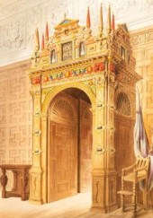 Richardson, Charles James. Studies from
[more like this]
Richardson, Charles James. Studies from
[more like this]
-
 Harrison & Co after James Cook (1728-177
[more like this]
Harrison & Co after James Cook (1728-177
[more like this]
-
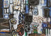 WARRINGTON COLESCOTT, AMERICAN (1921-201
[more like this]
WARRINGTON COLESCOTT, AMERICAN (1921-201
[more like this]
-
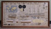 TRE TRYCKARE MARINER'S CHART, COLOR PRIN
[more like this]
TRE TRYCKARE MARINER'S CHART, COLOR PRIN
[more like this]
-
 20TH CENTURY AMERICAN SCHOOL, "TUMBLING
[more like this]
20TH CENTURY AMERICAN SCHOOL, "TUMBLING
[more like this]
This list is limited to only a few results.
Many more items are available to our members in our
Price Guide!
Ideal research tools for Collectors, Personal Property Appraisers, Antiques & Collectibles
Dealers, Auction Houses, Museums, eBayers or
other online
sellers (Rubylane, Etsy etc) and curious minds interested in appraising & identifying collectibles

EASY. FAST. ACCURATE.
Research at its best

Our research tools include:


