Pricing Guides & Dictionary of Makers Marks for Antiques & Collectibles
Appraise and find values for
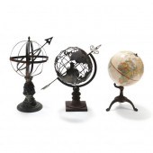
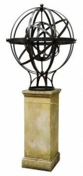
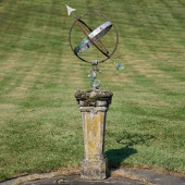
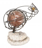
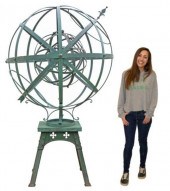
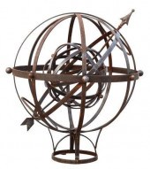
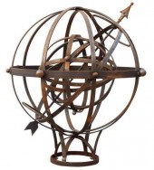
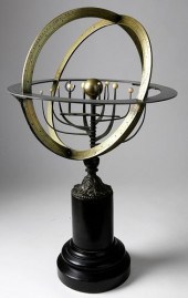
ATLAS ARMILLARY SPHERE Late...
From
marks4antiques.com
- The most updated price guide and makers' marks research online
As a member, you have access to a team of experts
and assistance is always available to you for free
An example from the millions of items in our Price Guide:
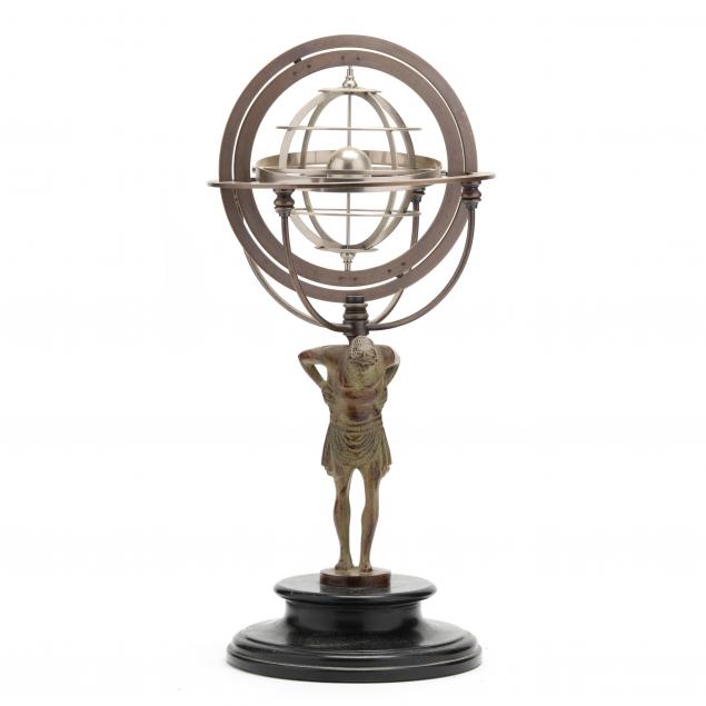
ATLAS ARMILLARY SPHERE Late 20th-early 21st century, cast metal Atlas figure of a standing Titan with antiqued patina, supporting a full brass meridian...
This is an example from our
values4antiques price guide
We do not buy or sell any items
See more price guides
Check our other research services:
IDENTIFY WORLDWIDE MAKERS' MARKS & HALLMARKS
marks4ceramics:
Porcelain, Pottery, Chinaware, Figurines, Dolls, Vases...
marks4silver
:
Silver, Jewelry, Pewter, Silverplate, Copper & Bronze...
Explore other items from our
Antiques & Collectibles Price Guide
-
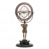
 BRONZE FIGURE OF ATLAS HOLDING ARMILLARY
[more like this]
BRONZE FIGURE OF ATLAS HOLDING ARMILLARY
[more like this]
-
 ATLAS ARMILLARY SPHERE BRONZE SCULPTURED
[more like this]
ATLAS ARMILLARY SPHERE BRONZE SCULPTURED
[more like this]
-
 ARCHITECTURAL ARMILLARY SPHERE ATLAS SUN
[more like this]
ARCHITECTURAL ARMILLARY SPHERE ATLAS SUN
[more like this]
-
 ARCHITECTURAL ARMILLARY SPHERE ATLAS SUN
[more like this]
ARCHITECTURAL ARMILLARY SPHERE ATLAS SUN
[more like this]
-
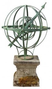
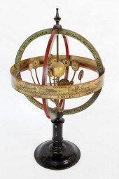
 GLOBE AND ARMILLARY SPHERES Second half
[more like this]
GLOBE AND ARMILLARY SPHERES Second half
[more like this]
-
 ATLAS ARMILLARY SPHERE Late 20th-early
[more like this]
ATLAS ARMILLARY SPHERE Late 20th-early
[more like this]
-
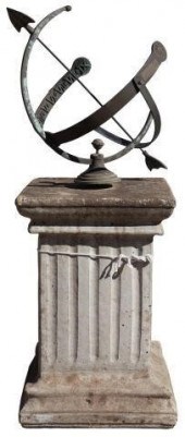
 IRON ARMILLARY SPHERE ON STONE PEDESTAL,
[more like this]
IRON ARMILLARY SPHERE ON STONE PEDESTAL,
[more like this]
-
 IRON ARMILLARY SPHERE ON STONE PEDESTAL,
[more like this]
IRON ARMILLARY SPHERE ON STONE PEDESTAL,
[more like this]
-
 LARGE IRON ARMILLARY SPHERE ON STONE PED
[more like this]
LARGE IRON ARMILLARY SPHERE ON STONE PED
[more like this]
-
 LARGE IRON ARMILLARY SPHERE ON STONE PED
[more like this]
LARGE IRON ARMILLARY SPHERE ON STONE PED
[more like this]
-
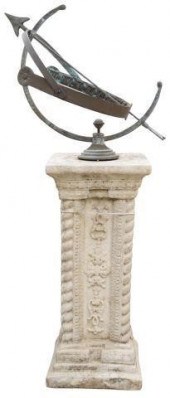
 ARMILLARY SPHERE ON MARBLE PEDESTAL20th
[more like this]
ARMILLARY SPHERE ON MARBLE PEDESTAL20th
[more like this]
-
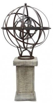
 LARGE ARCHITECTURAL IRON ARMILLARY SPHER
[more like this]
LARGE ARCHITECTURAL IRON ARMILLARY SPHER
[more like this]
-
 STONE PEDESTAL WITH SEAHORSE MOUNTED MET
[more like this]
STONE PEDESTAL WITH SEAHORSE MOUNTED MET
[more like this]
-
 6PC ASSORTED ANTIQUE 1870'S ATLASES Unit
[more like this]
6PC ASSORTED ANTIQUE 1870'S ATLASES Unit
[more like this]
-
 JUDAICA. FRANK MEISLER JERUSALEM SPHERE
[more like this]
JUDAICA. FRANK MEISLER JERUSALEM SPHERE
[more like this]
-
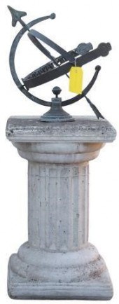 IRON ARMILLARY SPHERE ON STONE PEDESTAL,
[more like this]
IRON ARMILLARY SPHERE ON STONE PEDESTAL,
[more like this]
-
 "ARMILLARY SPHERE" MODERN ABSTRACT SCULP
[more like this]
"ARMILLARY SPHERE" MODERN ABSTRACT SCULP
[more like this]
-
 ARCHITECTURAL BRASS ARMILLARY SPHERE TAB
[more like this]
ARCHITECTURAL BRASS ARMILLARY SPHERE TAB
[more like this]
-
 BRONZE ARMILLARY SPHERE HEIGHT: 14 IN. (
[more like this]
BRONZE ARMILLARY SPHERE HEIGHT: 14 IN. (
[more like this]
-
 "ARMILLARY SPHERE" MODERN ABSTRACT SCULP
[more like this]
"ARMILLARY SPHERE" MODERN ABSTRACT SCULP
[more like this]
-
 CONCRETE AND VERDIGRIS PATINATED WROUGHT
[more like this]
CONCRETE AND VERDIGRIS PATINATED WROUGHT
[more like this]
-
 MIDDLE EASTERN BRASS ARMILLARY SPHERE WI
[more like this]
MIDDLE EASTERN BRASS ARMILLARY SPHERE WI
[more like this]
-
 WOODEN PTOLEMAIC ARMILLARY SPHERE HEIGHT
[more like this]
WOODEN PTOLEMAIC ARMILLARY SPHERE HEIGHT
[more like this]
-
 (LOT) IRON ARMILLARY SPHERE ON ARCHITECT
[more like this]
(LOT) IRON ARMILLARY SPHERE ON ARCHITECT
[more like this]
-
 LOT) LARGE ARMILLARY SPHERE ON GOTHIC ST
[more like this]
LOT) LARGE ARMILLARY SPHERE ON GOTHIC ST
[more like this]
-
 LOT) LARGE ARMILLARY SPHERE ON CAST STON
[more like this]
LOT) LARGE ARMILLARY SPHERE ON CAST STON
[more like this]
-
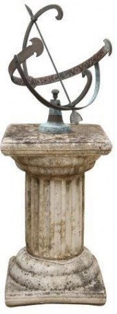 ARMILLARY SPHERE ON CAST STONE PEDESTAL,
[more like this]
ARMILLARY SPHERE ON CAST STONE PEDESTAL,
[more like this]
-
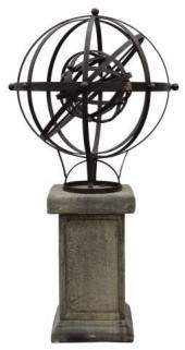
 ARMILLARY SPHERE ON STONE PEDESTAL, 32.5
[more like this]
ARMILLARY SPHERE ON STONE PEDESTAL, 32.5
[more like this]
-
 LARGE ARCHITECTURAL IRON ARMILLARY SPHER
[more like this]
LARGE ARCHITECTURAL IRON ARMILLARY SPHER
[more like this]
-
 ARMILLARY SPHERE ON CAST STONE PEDESTAL,
[more like this]
ARMILLARY SPHERE ON CAST STONE PEDESTAL,
[more like this]
-
 LARGE ARCHITECTURAL IRON ARMILLARY SPHER
[more like this]
LARGE ARCHITECTURAL IRON ARMILLARY SPHER
[more like this]
-
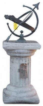
 ARMILLARY SPHERE ON STONE PEDESTAL, 40"H
[more like this]
ARMILLARY SPHERE ON STONE PEDESTAL, 40"H
[more like this]
-
 FRENCH BRASS AND IVORY ARMILLARY SPHERE,
[more like this]
FRENCH BRASS AND IVORY ARMILLARY SPHERE,
[more like this]
-
 FRENCH BRASS ARMILLARY SPHERE, 19TH CENT
[more like this]
FRENCH BRASS ARMILLARY SPHERE, 19TH CENT
[more like this]
-
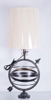 ARMILLARY SPHERE TABLE LAMPPottery Barn
[more like this]
ARMILLARY SPHERE TABLE LAMPPottery Barn
[more like this]
-
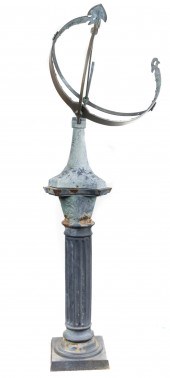 A LARGE IRON GARDEN ARMILLARY SPHERE A l
[more like this]
A LARGE IRON GARDEN ARMILLARY SPHERE A l
[more like this]
This list is limited to only a few results.
Many more items are available to our members in our
Price Guide!
Ideal research tools for Collectors, Personal Property Appraisers, Antiques & Collectibles
Dealers, Auction Houses, Museums, eBayers or
other online
sellers (Rubylane, Etsy etc) and curious minds interested in appraising & identifying collectibles

EASY. FAST. ACCURATE.
Research at its best

Our research tools include:


