Pricing Guides & Dictionary of Makers Marks for Antiques & Collectibles
Appraise and find values for
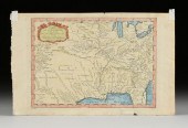
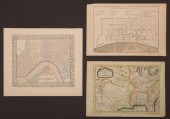
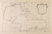
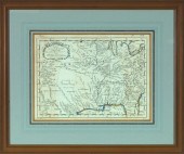
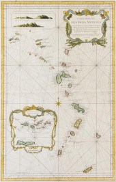
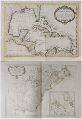
BELLIN, JACQUES-NICOLAS. CARTE...
From
marks4antiques.com
- The most updated price guide and makers' marks research online
As a member, you have access to a team of experts
and assistance is always available to you for free
An example from the millions of items in our Price Guide:
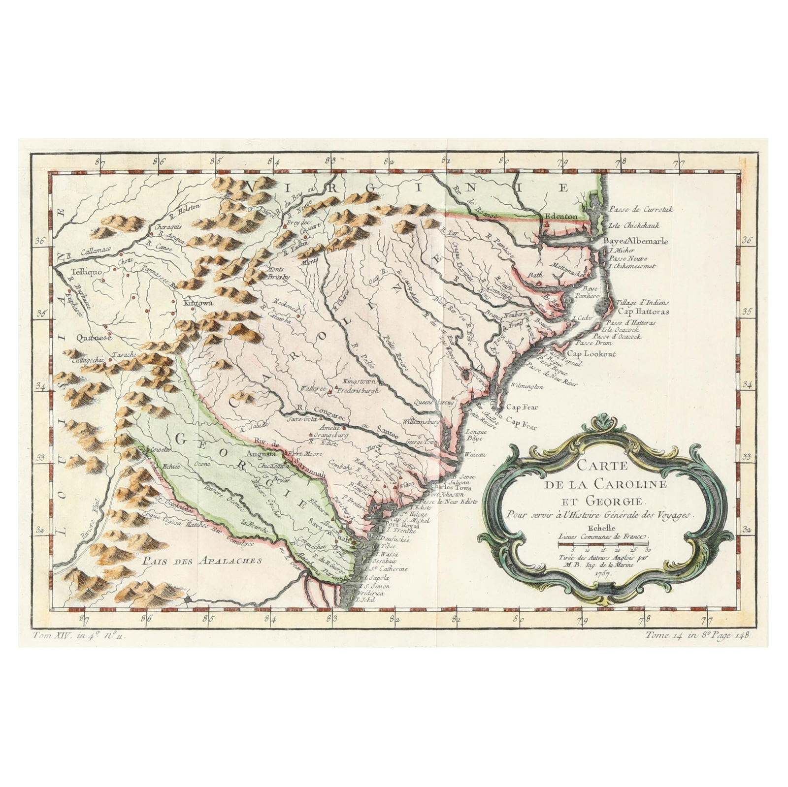
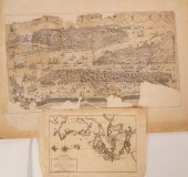
BELLIN, JACQUES-NICOLAS. CARTE DE LA CAROLINE ET GEORGIE )Bellin, Jacques-Nicolas. Carte De La Caroline et Georgie) from Histoire Generale des Voyages...
This is an example from our
values4antiques price guide
We do not buy or sell any items
See more price guides
Check our other research services:
IDENTIFY WORLDWIDE MAKERS' MARKS & HALLMARKS
marks4ceramics:
Porcelain, Pottery, Chinaware, Figurines, Dolls, Vases...
marks4silver
:
Silver, Jewelry, Pewter, Silverplate, Copper & Bronze...
Explore other items from our
Antiques & Collectibles Price Guide
-
 JACQUES NICOLAS BELLIN (18TH CENTURY) CA
[more like this]
JACQUES NICOLAS BELLIN (18TH CENTURY) CA
[more like this]
-
 BELLIN, JACQUES-NICOLAS. CARTE DE LA CA
[more like this]
BELLIN, JACQUES-NICOLAS. CARTE DE LA CA
[more like this]
-
 BELLIN'S 18TH-CENTURY MAP OF KOREA<br>Be
[more like this]
BELLIN'S 18TH-CENTURY MAP OF KOREA<br>Be
[more like this]
-
 JACQUES-NICOLAS BELLIN (1703-1772) A FRE
[more like this]
JACQUES-NICOLAS BELLIN (1703-1772) A FRE
[more like this]
-
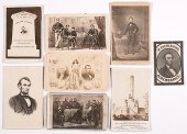 [Political Americana - Lincolniana] Abra
[more like this]
[Political Americana - Lincolniana] Abra
[more like this]
-
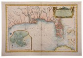 BELLIN - CARTE REDUITE DES COSTES DE LA
[more like this]
BELLIN - CARTE REDUITE DES COSTES DE LA
[more like this]
-
 JACQUES NICOLAS BELLIN MAP, DATED 1757Ja
[more like this]
JACQUES NICOLAS BELLIN MAP, DATED 1757Ja
[more like this]
-
 JACQUES NICOLAS BELLIN (FRENCH, 1703-177
[more like this]
JACQUES NICOLAS BELLIN (FRENCH, 1703-177
[more like this]
-
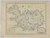 JACQUES-NICOLAS BELLIN MAP OF ICELAND CA
[more like this]
JACQUES-NICOLAS BELLIN MAP OF ICELAND CA
[more like this]
-
 GRP: 5 MAPS OF BRAZIL BLAEU BELLIN KITCH
[more like this]
GRP: 5 MAPS OF BRAZIL BLAEU BELLIN KITCH
[more like this]
-
 JACQUES NICOLAS BELLIN (1703 - 1772): IL
[more like this]
JACQUES NICOLAS BELLIN (1703 - 1772): IL
[more like this]
-
 A Large Collection of Maps from Around t
[more like this]
A Large Collection of Maps from Around t
[more like this]
-
 AN ANTIQUE MAP, "CARTE DES VARIATIONS DE
[more like this]
AN ANTIQUE MAP, "CARTE DES VARIATIONS DE
[more like this]
-
 AN ANTIQUE MAP, "CARTE REDUITE DU GOLPHE
[more like this]
AN ANTIQUE MAP, "CARTE REDUITE DU GOLPHE
[more like this]
-
 MAP: "CARTE DU KATAY OU EMPIRE DE KIN",
[more like this]
MAP: "CARTE DU KATAY OU EMPIRE DE KIN",
[more like this]
-
 BELLIN - MAP OF THE NORTHWEST PASSAGE, 1
[more like this]
BELLIN - MAP OF THE NORTHWEST PASSAGE, 1
[more like this]
-
 BELLIN, DEPOT DE LA MARINE - MAP OF THE
[more like this]
BELLIN, DEPOT DE LA MARINE - MAP OF THE
[more like this]
-
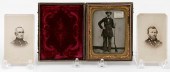 CASED TIN TYPE AND TWO CARTE DE VISITES
[more like this]
CASED TIN TYPE AND TWO CARTE DE VISITES
[more like this]
-
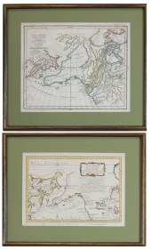 TWO COLLECTIBLE MAPS: DISCOVERIES OF RUS
[more like this]
TWO COLLECTIBLE MAPS: DISCOVERIES OF RUS
[more like this]
-
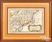
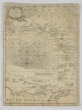
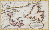
 Carte De La Louisiana et Pays Voisins, P
[more like this]
Carte De La Louisiana et Pays Voisins, P
[more like this]
-
 * (MAP) BELLIN JACQUES NICOLAS Carte du
[more like this]
* (MAP) BELLIN JACQUES NICOLAS Carte du
[more like this]
-
 * (MAP) BELLIN JACQUES NICOLAS Carte Red
[more like this]
* (MAP) BELLIN JACQUES NICOLAS Carte Red
[more like this]
-
 Jacques Nicolas Bellin (1703-1772) - Col
[more like this]
Jacques Nicolas Bellin (1703-1772) - Col
[more like this]
-
 Jacques Nicolas Bellin (1703-1772)/Carte
[more like this]
Jacques Nicolas Bellin (1703-1772)/Carte
[more like this]
-
 Harrison & Co after James Cook (1728-177
[more like this]
Harrison & Co after James Cook (1728-177
[more like this]
-
 Jacques-Nicolas Bellin (1703-1772)/Carte
[more like this]
Jacques-Nicolas Bellin (1703-1772)/Carte
[more like this]
-
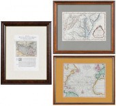 THREE FRAMED MAPS, ATLANTIC, CHESAPEAKE,
[more like this]
THREE FRAMED MAPS, ATLANTIC, CHESAPEAKE,
[more like this]
-
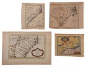 FOUR 17TH AND 18TH CENTURY MAPS OF THE S
[more like this]
FOUR 17TH AND 18TH CENTURY MAPS OF THE S
[more like this]
-
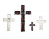 FOUR DEVOTIONAL TIN WALL CROSSESFour dev
[more like this]
FOUR DEVOTIONAL TIN WALL CROSSESFour dev
[more like this]
-
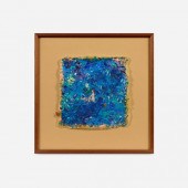
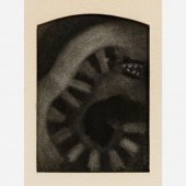 NICOLAS AFRICANO / THE SERPENT (1971 CHA
[more like this]
NICOLAS AFRICANO / THE SERPENT (1971 CHA
[more like this]
-
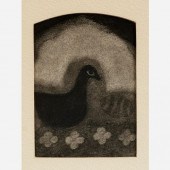 NICOLAS AFRICANO / BLACK GOOSE (1971 CHA
[more like this]
NICOLAS AFRICANO / BLACK GOOSE (1971 CHA
[more like this]
-
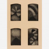 NICOLAS AFRICANO / ELEMENTAL FORCES (197
[more like this]
NICOLAS AFRICANO / ELEMENTAL FORCES (197
[more like this]
-
 NICOLAS AFRICANO / THE MEANING (1974)Nic
[more like this]
NICOLAS AFRICANO / THE MEANING (1974)Nic
[more like this]
-
 NICOLAS AFRICANO / THE REFLECTION (1974
[more like this]
NICOLAS AFRICANO / THE REFLECTION (1974
[more like this]
-
 Two French Maps of the Americas 18th cen
[more like this]
Two French Maps of the Americas 18th cen
[more like this]
-
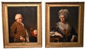 PAIR OF STUDIO OF JACQUES-LOUIS DAVID FR
[more like this]
PAIR OF STUDIO OF JACQUES-LOUIS DAVID FR
[more like this]
This list is limited to only a few results.
Many more items are available to our members in our
Price Guide!
Ideal research tools for Collectors, Personal Property Appraisers, Antiques & Collectibles
Dealers, Auction Houses, Museums, eBayers or
other online
sellers (Rubylane, Etsy etc) and curious minds interested in appraising & identifying collectibles

EASY. FAST. ACCURATE.
Research at its best

Our research tools include:


