Pricing Guides & Dictionary of Makers Marks for Antiques & Collectibles
Appraise and find values for
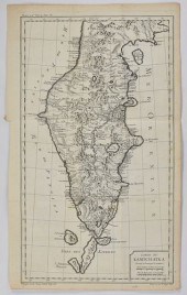
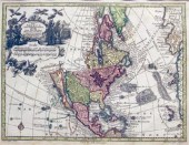
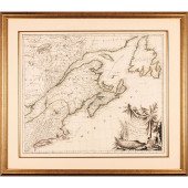
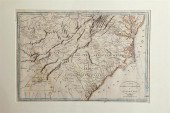
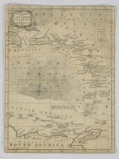
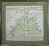
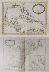
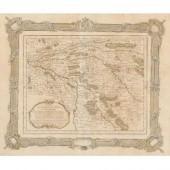
Carte de la partie nord, des...
From
marks4antiques.com
- The most updated price guide and makers' marks research online
As a member, you have access to a team of experts
and assistance is always available to you for free
An example from the millions of items in our Price Guide:
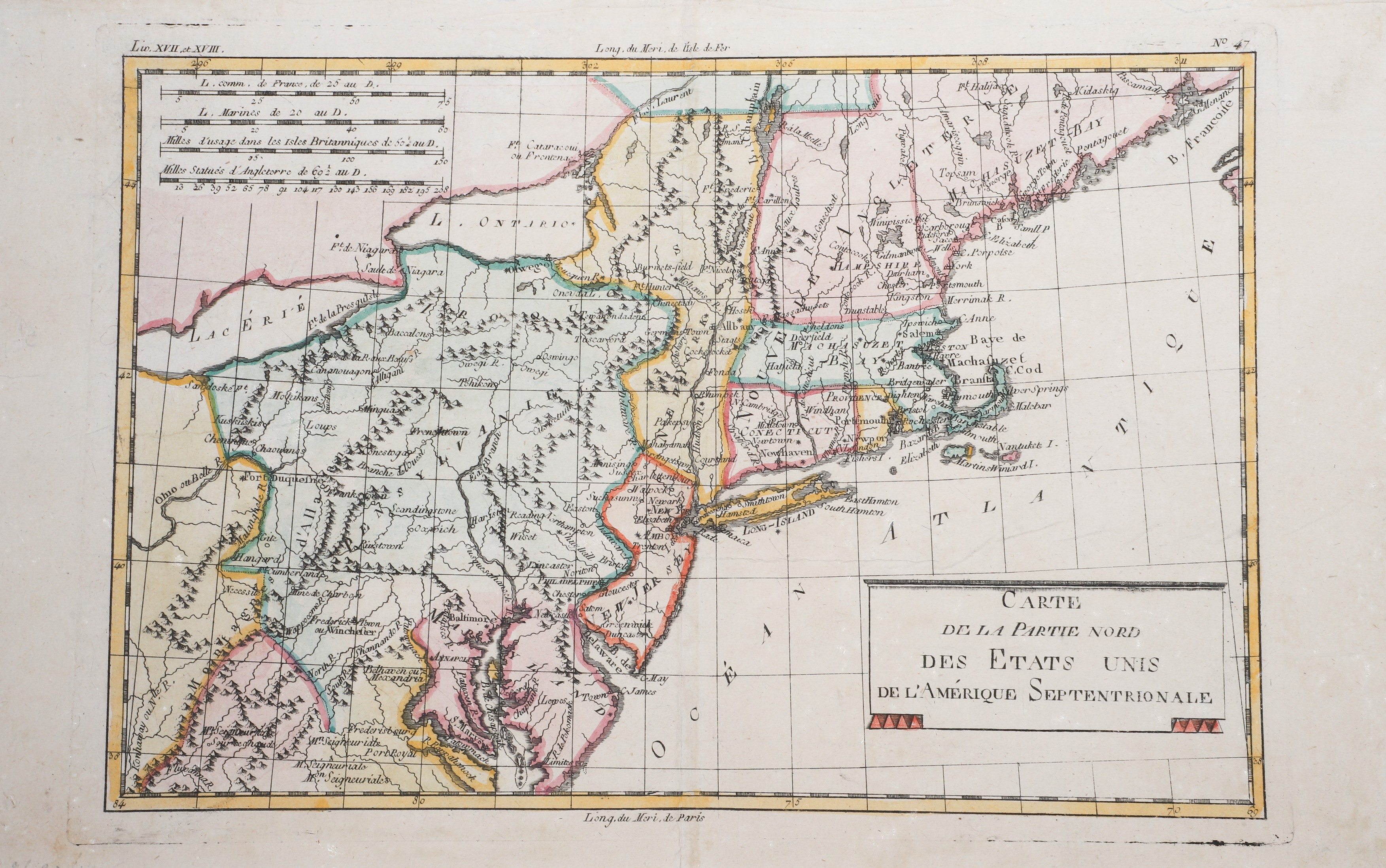
Carte de la partie nord, des Etats Unis, de l'Amerique Septentrionale, map of the northern part of the United States of North America, from the Atlas de...
This is an example from our
values4antiques price guide
We do not buy or sell any items
See more price guides
Check our other research services:
IDENTIFY WORLDWIDE MAKERS' MARKS & HALLMARKS
marks4ceramics:
Porcelain, Pottery, Chinaware, Figurines, Dolls, Vases...
marks4silver
:
Silver, Jewelry, Pewter, Silverplate, Copper & Bronze...
Explore other items from our
Antiques & Collectibles Price Guide
-
 [Political Americana - Lincolniana] Abra
[more like this]
[Political Americana - Lincolniana] Abra
[more like this]
-
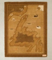
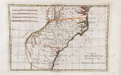 Early maps of South Carolina and the sou
[more like this]
Early maps of South Carolina and the sou
[more like this]
-
 HENRI CHATELAIN, CARTE DES ESTATS D LA C
[more like this]
HENRI CHATELAIN, CARTE DES ESTATS D LA C
[more like this]
-
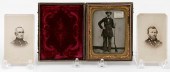 CASED TIN TYPE AND TWO CARTE DE VISITES
[more like this]
CASED TIN TYPE AND TWO CARTE DE VISITES
[more like this]
-
 AN ANTIQUE MAP, "CARTE DES VARIATIONS DE
[more like this]
AN ANTIQUE MAP, "CARTE DES VARIATIONS DE
[more like this]
-
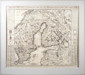
 GRP: 7 MAPS OF RUSSIA AND EUROPEGroup of
[more like this]
GRP: 7 MAPS OF RUSSIA AND EUROPEGroup of
[more like this]
-
 3 pieces. Hand-Colored Engraved 18th-Ce
[more like this]
3 pieces. Hand-Colored Engraved 18th-Ce
[more like this]
-
 AN ANTIQUE MAP, "CARTE DE LA CôTE DE L'A
[more like this]
AN ANTIQUE MAP, "CARTE DE LA CôTE DE L'A
[more like this]
-
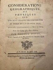 BUACHE, PHILIPPE. CONSIDERATIONS GEOGRAP
[more like this]
BUACHE, PHILIPPE. CONSIDERATIONS GEOGRAP
[more like this]
-
 2 pieces. Hand-Colored Engraved Maps: B
[more like this]
2 pieces. Hand-Colored Engraved Maps: B
[more like this]
-
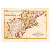
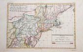 Carte de la partie nord, des Etats Unis,
[more like this]
Carte de la partie nord, des Etats Unis,
[more like this]
-
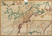
 C 1760 NORTHERN COLONIES FRENCH + INDIAN
[more like this]
C 1760 NORTHERN COLONIES FRENCH + INDIAN
[more like this]
-
 1776 MAP, PARTIE ORIENTALE DU CANADA, AV
[more like this]
1776 MAP, PARTIE ORIENTALE DU CANADA, AV
[more like this]
-
 1776 MAP, PARTIE ORIENTALE DU CANADA, AV
[more like this]
1776 MAP, PARTIE ORIENTALE DU CANADA, AV
[more like this]
-
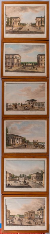
 BOOKS ON CONTINENTAL CASTLES, GROUP OF 8
[more like this]
BOOKS ON CONTINENTAL CASTLES, GROUP OF 8
[more like this]
-
 GROUP OF SIX COMME DES GARçONS AND YOHJI
[more like this]
GROUP OF SIX COMME DES GARçONS AND YOHJI
[more like this]
-
 LARGE & EARLY GRENFELL HOOKED MAT, CA. 1
[more like this]
LARGE & EARLY GRENFELL HOOKED MAT, CA. 1
[more like this]
-
 AN ELC DU NORD MID-CENTURY MODERN STUDIO
[more like this]
AN ELC DU NORD MID-CENTURY MODERN STUDIO
[more like this]
-
 Rare early map: Southeastern United Stat
[more like this]
Rare early map: Southeastern United Stat
[more like this]
-
 TWO COLLECTIBLE MAPS: DISCOVERIES OF RUS
[more like this]
TWO COLLECTIBLE MAPS: DISCOVERIES OF RUS
[more like this]
-
 GRP: 5 MAPS OF BRAZIL BLAEU BELLIN KITCH
[more like this]
GRP: 5 MAPS OF BRAZIL BLAEU BELLIN KITCH
[more like this]
-
 EARLY ZOOLOGICAL BOOKS INCLUDING ALLETZ.
[more like this]
EARLY ZOOLOGICAL BOOKS INCLUDING ALLETZ.
[more like this]
-
 FRENCH CASTLE HISTORICAL REFERENCE BOOK,
[more like this]
FRENCH CASTLE HISTORICAL REFERENCE BOOK,
[more like this]
-
 GROUP WITH LOOSE PRINTS (FROM 'DU TABLEA
[more like this]
GROUP WITH LOOSE PRINTS (FROM 'DU TABLEA
[more like this]
-
 JOHANN GEORG REINHEIMER (GERMAN, 1777-18
[more like this]
JOHANN GEORG REINHEIMER (GERMAN, 1777-18
[more like this]
-
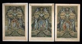 THREE 18TH C. FRENCH ETCHINGS AFTER CHAR
[more like this]
THREE 18TH C. FRENCH ETCHINGS AFTER CHAR
[more like this]
-
 FRENCH CASTLE HISTORICAL REFERENCE BOOK,
[more like this]
FRENCH CASTLE HISTORICAL REFERENCE BOOK,
[more like this]
-
 A Large Collection of Maps from Around t
[more like this]
A Large Collection of Maps from Around t
[more like this]
-
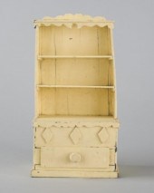 MINIATURE DISH DRESSERA naïve miniature
[more like this]
MINIATURE DISH DRESSERA naïve miniature
[more like this]
-
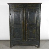 SMALL ARMOIRE, QUEBEC, LATE 18TH CENTURY
[more like this]
SMALL ARMOIRE, QUEBEC, LATE 18TH CENTURY
[more like this]
-
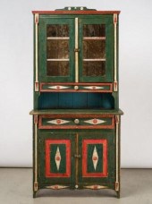 MANITOBA UKRAINIAN TWO-PIECE CUPBOARD, 1
[more like this]
MANITOBA UKRAINIAN TWO-PIECE CUPBOARD, 1
[more like this]
-
 COLLECTIBLE MAP: TOBIAS CONRAD LOTTER, "
[more like this]
COLLECTIBLE MAP: TOBIAS CONRAD LOTTER, "
[more like this]
-
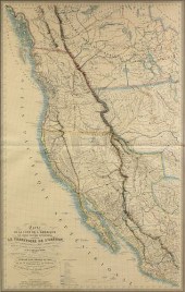
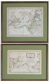
 Two French Maps of the Americas 18th cen
[more like this]
Two French Maps of the Americas 18th cen
[more like this]
-
 RIZZI-ZANNONI ANTIQUE MAP OF 1766 PARIS
[more like this]
RIZZI-ZANNONI ANTIQUE MAP OF 1766 PARIS
[more like this]
-
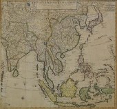 COVENS AND MORTIER, CARTE DES INDES ET D
[more like this]
COVENS AND MORTIER, CARTE DES INDES ET D
[more like this]
-
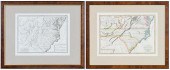 TWO FRAMED MAPS OF THE CAROLINAScomprisi
[more like this]
TWO FRAMED MAPS OF THE CAROLINAScomprisi
[more like this]
This list is limited to only a few results.
Many more items are available to our members in our
Price Guide!
Ideal research tools for Collectors, Personal Property Appraisers, Antiques & Collectibles
Dealers, Auction Houses, Museums, eBayers or
other online
sellers (Rubylane, Etsy etc) and curious minds interested in appraising & identifying collectibles

EASY. FAST. ACCURATE.
Research at its best

Our research tools include:


