Pricing Guides & Dictionary of Makers Marks for Antiques & Collectibles
Appraise and find values for
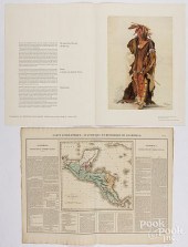
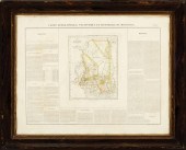
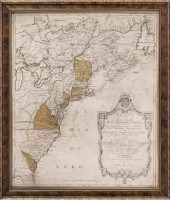
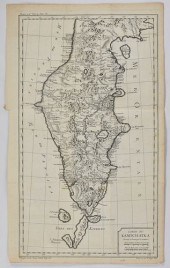
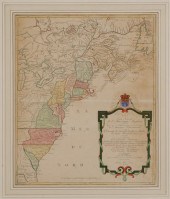
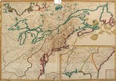
CARTE GEOGRAPHIQUE, STATISTIQUE...
From
marks4antiques.com
- The most updated price guide and makers' marks research online
As a member, you have access to a team of experts
and assistance is always available to you for free
An example from the millions of items in our Price Guide:
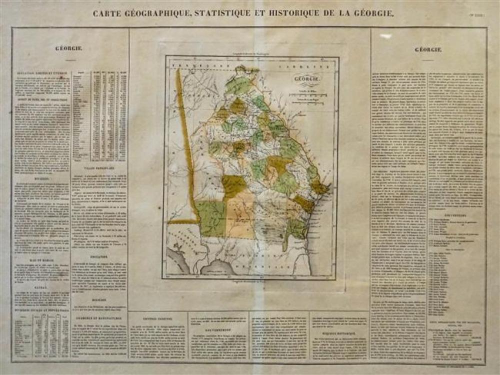
CARTE GEOGRAPHIQUE, STATISTIQUE ET HISTORIQUE DE LA GEORGIE, COLOR ENGRAVED MAP, FRAME: 22-1/2 X 28 INCarte Geographique, Statistique et Historique de La...
This is an example from our
values4antiques price guide
We do not buy or sell any items
See more price guides
Check our other research services:
IDENTIFY WORLDWIDE MAKERS' MARKS & HALLMARKS
marks4ceramics:
Porcelain, Pottery, Chinaware, Figurines, Dolls, Vases...
marks4silver
:
Silver, Jewelry, Pewter, Silverplate, Copper & Bronze...
Explore other items from our
Antiques & Collectibles Price Guide
-
 CARTE GEOGRAPHIQUE, STATISTIQUE ET HISTO
[more like this]
CARTE GEOGRAPHIQUE, STATISTIQUE ET HISTO
[more like this]
-
 2 EUROPEAN MAPS OF TN1st item: "Carte Ge
[more like this]
2 EUROPEAN MAPS OF TN1st item: "Carte Ge
[more like this]
-
 CARTE GEOGRAPHIQUE, CIRCA 1825<br>Carte
[more like this]
CARTE GEOGRAPHIQUE, CIRCA 1825<br>Carte
[more like this]
-
 CARTE GEOGRAPHIQUE, CIRCA 1825Carte Geog
[more like this]
CARTE GEOGRAPHIQUE, CIRCA 1825Carte Geog
[more like this]
-
 [Political Americana - Lincolniana] Abra
[more like this]
[Political Americana - Lincolniana] Abra
[more like this]
-
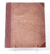 Mills's Atlas of South Carolina and Caro
[more like this]
Mills's Atlas of South Carolina and Caro
[more like this]
-
 ANTIQUE FRENCH MAP OF MISSISSIPPIAntique
[more like this]
ANTIQUE FRENCH MAP OF MISSISSIPPIAntique
[more like this]
-
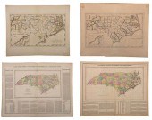 GROUP OF FOUR 19TH CENTURY NORTH CAROLIN
[more like this]
GROUP OF FOUR 19TH CENTURY NORTH CAROLIN
[more like this]
-
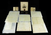
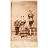
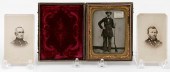 CASED TIN TYPE AND TWO CARTE DE VISITES
[more like this]
CASED TIN TYPE AND TWO CARTE DE VISITES
[more like this]
-
 Five Richard Kidder Meade, Jr. Confedera
[more like this]
Five Richard Kidder Meade, Jr. Confedera
[more like this]
-
 [Political Americana - Lincolniana] Mary
[more like this]
[Political Americana - Lincolniana] Mary
[more like this]
-
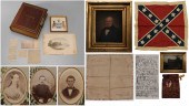
 CIVIL WAR: MANUSCRIPTS, PHOTOGRAPHS, AND
[more like this]
CIVIL WAR: MANUSCRIPTS, PHOTOGRAPHS, AND
[more like this]
-
 EMANCIPATION AND PEACE CARTE-DE-VISITE,
[more like this]
EMANCIPATION AND PEACE CARTE-DE-VISITE,
[more like this]
-
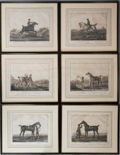 CARLE VERNET AND CHARLES LEVACHEX (FRENC
[more like this]
CARLE VERNET AND CHARLES LEVACHEX (FRENC
[more like this]
-
 HAND-COLORED MAP OF NORTH AMERICA "CARTE
[more like this]
HAND-COLORED MAP OF NORTH AMERICA "CARTE
[more like this]
-
 FOUR GUILLAUME DELISLE ENGRAVED MAPS 18T
[more like this]
FOUR GUILLAUME DELISLE ENGRAVED MAPS 18T
[more like this]
-
 GRP: 7 MAPS OF RUSSIA AND EUROPEGroup of
[more like this]
GRP: 7 MAPS OF RUSSIA AND EUROPEGroup of
[more like this]
-
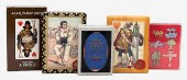 FIVE PACKS OF PLAYING CARDS.Five Packs o
[more like this]
FIVE PACKS OF PLAYING CARDS.Five Packs o
[more like this]
-
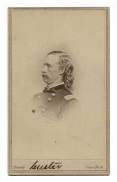 AUTOGRAPHED CARTE-DE-VISITE OF GEORGE AR
[more like this]
AUTOGRAPHED CARTE-DE-VISITE OF GEORGE AR
[more like this]
-
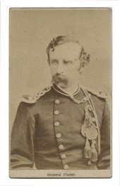 CARTE DE VISITE OF GEORGE ARMSTRONG CUST
[more like this]
CARTE DE VISITE OF GEORGE ARMSTRONG CUST
[more like this]
-
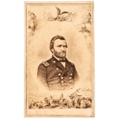
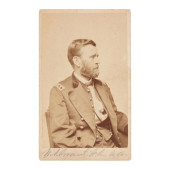 SIGNED ULYSSES S. GRANT CARTE DE VISITE<
[more like this]
SIGNED ULYSSES S. GRANT CARTE DE VISITE<
[more like this]
-
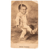
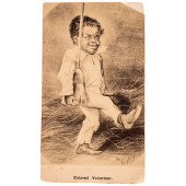
 C 1878 CARTE DE VISITE WITH P.T. BARNUMS
[more like this]
C 1878 CARTE DE VISITE WITH P.T. BARNUMS
[more like this]
-
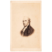
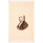 C. 1850 ALEXANDER HAMILTON PORTRAIT ENGR
[more like this]
C. 1850 ALEXANDER HAMILTON PORTRAIT ENGR
[more like this]
-
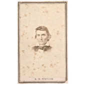
 C. 1863 PATRIOTIC CIVIL WAR CARTE DE VIS
[more like this]
C. 1863 PATRIOTIC CIVIL WAR CARTE DE VIS
[more like this]
-
 1860S CIVIL WAR PERIOD, CARTE DE VISITE
[more like this]
1860S CIVIL WAR PERIOD, CARTE DE VISITE
[more like this]
-
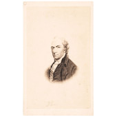 C. 1850 RARE ALEXANDER HAMILTON CARTE DE
[more like this]
C. 1850 RARE ALEXANDER HAMILTON CARTE DE
[more like this]
-
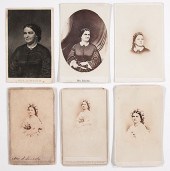
 LOT OF TWO, CARTE DE VISITE PHOTOGRAPHS
[more like this]
LOT OF TWO, CARTE DE VISITE PHOTOGRAPHS
[more like this]
-
 C. 1850 RARE ALEXANDER HAMILTON CARTE DE
[more like this]
C. 1850 RARE ALEXANDER HAMILTON CARTE DE
[more like this]
-
 1860S CIVIL WAR PERIOD, CARTE DE VISITE
[more like this]
1860S CIVIL WAR PERIOD, CARTE DE VISITE
[more like this]
-
 Map of Colonial America Carte Nouvelle d
[more like this]
Map of Colonial America Carte Nouvelle d
[more like this]
-
 Fine and rare books: various topics rela
[more like this]
Fine and rare books: various topics rela
[more like this]
-
 A Group of 120 Antique French Prints inc
[more like this]
A Group of 120 Antique French Prints inc
[more like this]
-
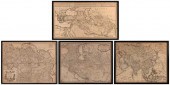
 A Large Collection of Maps from Around t
[more like this]
A Large Collection of Maps from Around t
[more like this]
-
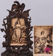
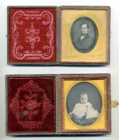 8 pieces. Cased Daguerreotype & other 1
[more like this]
8 pieces. Cased Daguerreotype & other 1
[more like this]
-
 3 pieces. Hand-Colored Engraved 18th-Ce
[more like this]
3 pieces. Hand-Colored Engraved 18th-Ce
[more like this]
-
 1 vol. (American Civil War.) Carte-de-V
[more like this]
1 vol. (American Civil War.) Carte-de-V
[more like this]
This list is limited to only a few results.
Many more items are available to our members in our
Price Guide!
Ideal research tools for Collectors, Personal Property Appraisers, Antiques & Collectibles
Dealers, Auction Houses, Museums, eBayers or
other online
sellers (Rubylane, Etsy etc) and curious minds interested in appraising & identifying collectibles

EASY. FAST. ACCURATE.
Research at its best

Our research tools include:


