Pricing Guides & Dictionary of Makers Marks for Antiques & Collectibles
Appraise and find values for
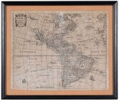
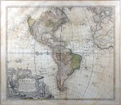
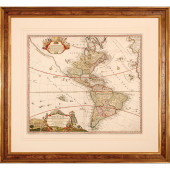
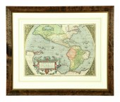
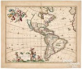
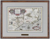
CHETWIND - AMERICAE DESCRIPTIO...
From
marks4antiques.com
- The most updated price guide and makers' marks research online
As a member, you have access to a team of experts
and assistance is always available to you for free
An example from the millions of items in our Price Guide:

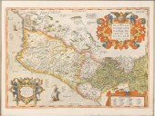
CHETWIND - AMERICAE DESCRIPTIO NOVA, MAPAmericae Descriptio Nova , published by Philip Chetwind, London, 1666, in two sheets, engraving on laid paper,...
This is an example from our
values4antiques price guide
We do not buy or sell any items
See more price guides
Check our other research services:
IDENTIFY WORLDWIDE MAKERS' MARKS & HALLMARKS
marks4ceramics:
Porcelain, Pottery, Chinaware, Figurines, Dolls, Vases...
marks4silver
:
Silver, Jewelry, Pewter, Silverplate, Copper & Bronze...
Explore other items from our
Antiques & Collectibles Price Guide
-
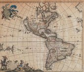
 CHETWIND - AMERICAE DESCRIPTIO NOVA, MAP
[more like this]
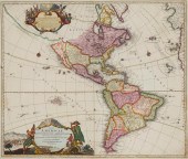
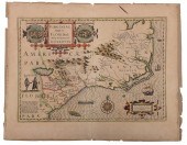
CHETWIND - AMERICAE DESCRIPTIO NOVA, MAP
[more like this]
-
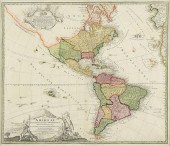
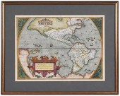
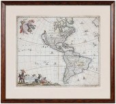
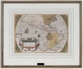
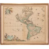 FREDERICK DE WIT, TOTIUS AMERICAE DESCRI
[more like this]
FREDERICK DE WIT, TOTIUS AMERICAE DESCRI
[more like this]
-
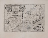
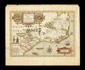
 16TH / 18TH C. EUROPEAN MAPS OF NEW SPAI
[more like this]
16TH / 18TH C. EUROPEAN MAPS OF NEW SPAI
[more like this]
-
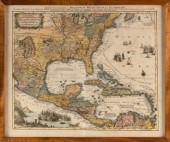
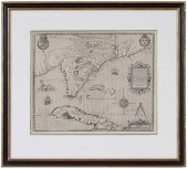
 Map of the Southeast After John White 17
[more like this]
Map of the Southeast After John White 17
[more like this]
-
 JOHANNES BAPTIST HOMANN, (1663-1724), "T
[more like this]
JOHANNES BAPTIST HOMANN, (1663-1724), "T
[more like this]
-
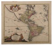
 HOMANN HEIRS , AMERICAE: MAPPA GENERALIS
[more like this]
HOMANN HEIRS , AMERICAE: MAPPA GENERALIS
[more like this]
-
 FREDERICK DE WITT (DUTCH, 1610-1698) AME
[more like this]
FREDERICK DE WITT (DUTCH, 1610-1698) AME
[more like this]
-
 "MAPPA GEOGRAPHICA, REGIONEM MEXICANAM E
[more like this]
"MAPPA GEOGRAPHICA, REGIONEM MEXICANAM E
[more like this]
-
 HOMANN - TOTIUS AMERICAE SEPTENTRIONALIS
[more like this]
HOMANN - TOTIUS AMERICAE SEPTENTRIONALIS
[more like this]
-
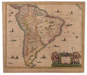 HONDIUS - AMERICAE PARS MERIDIONALIS, MA
[more like this]
HONDIUS - AMERICAE PARS MERIDIONALIS, MA
[more like this]
-
 AN ANTIQUE MAP, "TOTIUS AMERICAE SEPTENT
[more like this]
AN ANTIQUE MAP, "TOTIUS AMERICAE SEPTENT
[more like this]
-
 1720 HANDCOLORED HOMANN MAP TOTIUS AMERI
[more like this]
1720 HANDCOLORED HOMANN MAP TOTIUS AMERI
[more like this]
-
 1 piece. Hand-Colored Engraved Map. (Ho
[more like this]
1 piece. Hand-Colored Engraved Map. (Ho
[more like this]
-
 EARLY MAP OF THE AMERICAS. Abraham Orte
[more like this]
EARLY MAP OF THE AMERICAS. Abraham Orte
[more like this]
-
 Rare Mercator-Hondius map of the Southea
[more like this]
Rare Mercator-Hondius map of the Southea
[more like this]
-
 Abraham Ortelius 16th Cent. ''Americae S
[more like this]
Abraham Ortelius 16th Cent. ''Americae S
[more like this]
-
 NICHOLAES VISSCHER (1618-1679)Nicholaes
[more like this]
NICHOLAES VISSCHER (1618-1679)Nicholaes
[more like this]
-
 PETRUS BERTIUS (1565-1629): DESCRIPTIO A
[more like this]
PETRUS BERTIUS (1565-1629): DESCRIPTIO A
[more like this]
-
 NICHOLAS VISSCHER MAP OF THE AMERICAS, C
[more like this]
NICHOLAS VISSCHER MAP OF THE AMERICAS, C
[more like this]
-
 ABRAHAM ORTELIUS - MAP OF THE AMERICASAb
[more like this]
ABRAHAM ORTELIUS - MAP OF THE AMERICASAb
[more like this]
-
 FREDERICK DE WIT - 17TH CENTURY MAP OF T
[more like this]
FREDERICK DE WIT - 17TH CENTURY MAP OF T
[more like this]
-
 JODOCUS HONDIUS - MAP OF VIRGINIA AND TH
[more like this]
JODOCUS HONDIUS - MAP OF VIRGINIA AND TH
[more like this]
-
 JACQUES LE MOYNE - 16TH CENTURY MAP OF F
[more like this]
JACQUES LE MOYNE - 16TH CENTURY MAP OF F
[more like this]
-
 ABRAHAM ORTELIUS - 16TH CENTURY MAP OF N
[more like this]
ABRAHAM ORTELIUS - 16TH CENTURY MAP OF N
[more like this]
-
 HONDIUS - VIRGINIAE ITEM ET FLORIDAE, MA
[more like this]
HONDIUS - VIRGINIAE ITEM ET FLORIDAE, MA
[more like this]
-
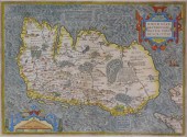 MAP: MAP OF IRELAND, 16TH C., BY ABRAHAM
[more like this]
MAP: MAP OF IRELAND, 16TH C., BY ABRAHAM
[more like this]
-
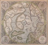 GERARD MERCATOR, FLEMISH 1512-1594, SEPT
[more like this]
GERARD MERCATOR, FLEMISH 1512-1594, SEPT
[more like this]
-
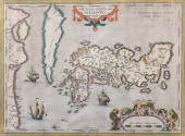 ABRAHAM ORTELIUS, FLEMISH 1527-1598, JAP
[more like this]
ABRAHAM ORTELIUS, FLEMISH 1527-1598, JAP
[more like this]
-
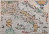 ABRAHAM ORTELIUS, FLEMISH 1527-1598, ITA
[more like this]
ABRAHAM ORTELIUS, FLEMISH 1527-1598, ITA
[more like this]
-
 ABRAHAM ORTELIUS, FLEMISH 1527-1598, MAP
[more like this]
ABRAHAM ORTELIUS, FLEMISH 1527-1598, MAP
[more like this]
-
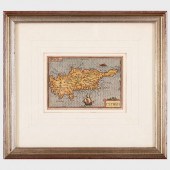
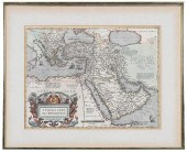 ORTELIUS - TURCICI IMPERII DESCRIPTIO...
[more like this]
ORTELIUS - TURCICI IMPERII DESCRIPTIO...
[more like this]
-
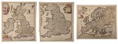 DE WIT - THREE MAPS OF EUROPE, BRITISH I
[more like this]
DE WIT - THREE MAPS OF EUROPE, BRITISH I
[more like this]
-
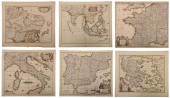 DE WIT - SIX MAPS OF EUROPE AND ASIAFred
[more like this]
DE WIT - SIX MAPS OF EUROPE AND ASIAFred
[more like this]
-
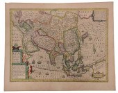 HONDIUS - ASIAE NOVA DESCRIPTIO, MAPJodo
[more like this]
HONDIUS - ASIAE NOVA DESCRIPTIO, MAPJodo
[more like this]
-
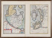 HOLSATIAE DESCRIPTIO. MARCO IORDANO HOLS
[more like this]
HOLSATIAE DESCRIPTIO. MARCO IORDANO HOLS
[more like this]
-
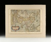 A RENAISSANCE MAP, "ASIæ NOVA DESCRIPTIO
[more like this]
A RENAISSANCE MAP, "ASIæ NOVA DESCRIPTIO
[more like this]
This list is limited to only a few results.
Many more items are available to our members in our
Price Guide!
Ideal research tools for Collectors, Personal Property Appraisers, Antiques & Collectibles
Dealers, Auction Houses, Museums, eBayers or
other online
sellers (Rubylane, Etsy etc) and curious minds interested in appraising & identifying collectibles

EASY. FAST. ACCURATE.
Research at its best

Our research tools include:


