Pricing Guides & Dictionary of Makers Marks for Antiques & Collectibles
Appraise and find values for
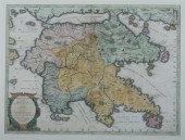
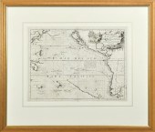
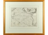
CORONELLI. PELOPONNESO HOGGIDI...
From
marks4antiques.com
- The most updated price guide and makers' marks research online
As a member, you have access to a team of experts
and assistance is always available to you for free
An example from the millions of items in our Price Guide:

CORONELLI. PELOPONNESO HOGGIDI MOREA Circa 1696. Double-page engraved map 17 ? x 23 ? in. hand-colored. Italian text on verso with small map of Navarino....
This is an example from our
values4antiques price guide
We do not buy or sell any items
See more price guides
Check our other research services:
IDENTIFY WORLDWIDE MAKERS' MARKS & HALLMARKS
marks4ceramics:
Porcelain, Pottery, Chinaware, Figurines, Dolls, Vases...
marks4silver
:
Silver, Jewelry, Pewter, Silverplate, Copper & Bronze...
Explore other items from our
Antiques & Collectibles Price Guide
-
 CORONELLI. PELOPONNESO HOGGIDI MOREA Cir
[more like this]
CORONELLI. PELOPONNESO HOGGIDI MOREA Cir
[more like this]
-
 Coronelli's Geographic and Historical De
[more like this]
Coronelli's Geographic and Historical De
[more like this]
-
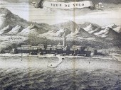
 VINCENZO CORONELLI MAP FORTEZZA VECCHIA
[more like this]
VINCENZO CORONELLI MAP FORTEZZA VECCHIA
[more like this]
-
 VINCENZO MARIA CORONELLI (1650-1718, ITA
[more like this]
VINCENZO MARIA CORONELLI (1650-1718, ITA
[more like this]
-
 VINCENZO MARIA CORONELLI (1650-1718, ITA
[more like this]
VINCENZO MARIA CORONELLI (1650-1718, ITA
[more like this]
-
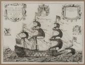
 ENGRAVED MAP, PACIFIC OCEAN, BY CORONELL
[more like this]
ENGRAVED MAP, PACIFIC OCEAN, BY CORONELL
[more like this]
-
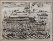 17th Century Italian Maritime Engraving
[more like this]
17th Century Italian Maritime Engraving
[more like this]
-
 17th Century Italian Maritime Engraving
[more like this]
17th Century Italian Maritime Engraving
[more like this]
-
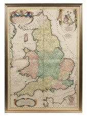 RARE 17TH C MAP OF ENGLAND - Coronelli V
[more like this]
RARE 17TH C MAP OF ENGLAND - Coronelli V
[more like this]
-
 CORONELLI (P) AN HISTORICAL AND GEOGRAPH
[more like this]
CORONELLI (P) AN HISTORICAL AND GEOGRAPH
[more like this]
-
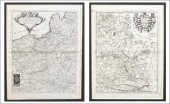 CORONELLI - TWO FRAMED MAPS. Polonia Par
[more like this]
CORONELLI - TWO FRAMED MAPS. Polonia Par
[more like this]
-
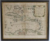 1742 HAND COLORED MAP OF THE ARCHIPELAGU
[more like this]
1742 HAND COLORED MAP OF THE ARCHIPELAGU
[more like this]
-
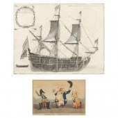 TWO ANTIQUE EUROPEAN PRINTS, A CARICATUR
[more like this]
TWO ANTIQUE EUROPEAN PRINTS, A CARICATUR
[more like this]
-
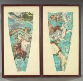
 VINCENZO CORONELLI (ITALIAN, 1650–1718),
[more like this]
VINCENZO CORONELLI (ITALIAN, 1650–1718),
[more like this]
-
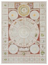
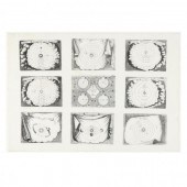
 Magnificently Decorative Sectional Celes
[more like this]
Magnificently Decorative Sectional Celes
[more like this]
-
 Map by Vincenzo Coronelli ca 1650 - 1718
[more like this]
Map by Vincenzo Coronelli ca 1650 - 1718
[more like this]
This list is limited to only a few results.
Many more items are available to our members in our
Price Guide!
Ideal research tools for Collectors, Personal Property Appraisers, Antiques & Collectibles
Dealers, Auction Houses, Museums, eBayers or
other online
sellers (Rubylane, Etsy etc) and curious minds interested in appraising & identifying collectibles

EASY. FAST. ACCURATE.
Research at its best

Our research tools include:


