Pricing Guides & Dictionary of Makers Marks for Antiques & Collectibles
Appraise and find values for
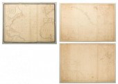
COULTON WAUGH PICTORIAL MAP OF CAPE...
From
marks4antiques.com
- The most updated price guide and makers' marks research online
As a member, you have access to a team of experts
and assistance is always available to you for free
An example from the millions of items in our Price Guide:
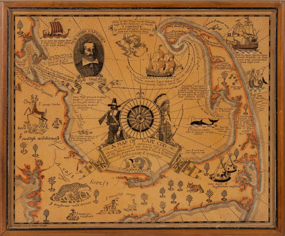
COULTON WAUGH PICTORIAL MAP OF CAPE COD DATED 1926 16" X 19.5" SIGHT. FRAMED 17.5" X 21".COULTON WAUGH PICTORIAL MAP OF CAPE COD, Dated 1926, "A Map of...
This is an example from our
values4antiques price guide
We do not buy or sell any items
See more price guides
Check our other research services:
IDENTIFY WORLDWIDE MAKERS' MARKS & HALLMARKS
marks4ceramics:
Porcelain, Pottery, Chinaware, Figurines, Dolls, Vases...
marks4silver
:
Silver, Jewelry, Pewter, Silverplate, Copper & Bronze...
Explore other items from our
Antiques & Collectibles Price Guide
-
 COULTON WAUGH COLOR LITHOGRAPH "A MAP OF
[more like this]
COULTON WAUGH COLOR LITHOGRAPH "A MAP OF
[more like this]
-
 BRITANNIA, VOL. I & II CAMDEN 1722Camden
[more like this]
BRITANNIA, VOL. I & II CAMDEN 1722Camden
[more like this]
-
 A COMPLETE SYSTEM OF GEOGRAPHY, VOL. I B
[more like this]
A COMPLETE SYSTEM OF GEOGRAPHY, VOL. I B
[more like this]
-
 IMPORTANT ANTIQUE ATLAS DU VOYAGE DE LA
[more like this]
IMPORTANT ANTIQUE ATLAS DU VOYAGE DE LA
[more like this]
-
 COULTON WAUGH PICTORIAL MAP OF CAPE COD
[more like this]
COULTON WAUGH PICTORIAL MAP OF CAPE COD
[more like this]
-
 COULTON WAUGH HAND-COLORED PICTORIAL MAP
[more like this]
COULTON WAUGH HAND-COLORED PICTORIAL MAP
[more like this]
-
 5 KENTUCKY AND TENNESSEE MAPS1st item: "
[more like this]
5 KENTUCKY AND TENNESSEE MAPS1st item: "
[more like this]
-
 A RARE ANTIQUE CIVIL WAR ERA MAP, "PRESS
[more like this]
A RARE ANTIQUE CIVIL WAR ERA MAP, "PRESS
[more like this]
-
 3 KY & TN MAPS: VANCE, TANNER, JOHNSON1s
[more like this]
3 KY & TN MAPS: VANCE, TANNER, JOHNSON1s
[more like this]
-
 SILVER. NORDIC SILVER GROUPING INC. DAVI
[more like this]
SILVER. NORDIC SILVER GROUPING INC. DAVI
[more like this]
-
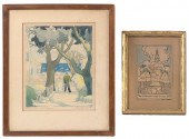 COULTON WAUGH (NEW YORK, 1896-1973), TWO
[more like this]
COULTON WAUGH (NEW YORK, 1896-1973), TWO
[more like this]
-
 4 TN & KY MAPS, 3 FRAMED1st item: "Tenne
[more like this]
4 TN & KY MAPS, 3 FRAMED1st item: "Tenne
[more like this]
-
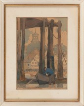 COULTON WAUGH (NEW YORK, 1896-1973), "LO
[more like this]
COULTON WAUGH (NEW YORK, 1896-1973), "LO
[more like this]
-
 A Very Large Collection of Maps, 19th/e
[more like this]
A Very Large Collection of Maps, 19th/e
[more like this]
-
 8 TENNESSEE MILITARY & SURVEY MAPSAssort
[more like this]
8 TENNESSEE MILITARY & SURVEY MAPSAssort
[more like this]
-
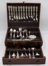 STERLING. REED & BARTON FRANCIS I FLATWA
[more like this]
STERLING. REED & BARTON FRANCIS I FLATWA
[more like this]
-
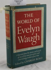 WAUGH (E) PUT OUT MORE FLAGS first editi
[more like this]
WAUGH (E) PUT OUT MORE FLAGS first editi
[more like this]
-
 A TOPOGRAPHICAL MAP OF THE ENVIRONS OF L
[more like this]
A TOPOGRAPHICAL MAP OF THE ENVIRONS OF L
[more like this]
-
 11 PC. MAP COLLECTION: Comprising; 1- La
[more like this]
11 PC. MAP COLLECTION: Comprising; 1- La
[more like this]
-
 16TH / 18TH C. EUROPEAN MAPS OF NEW SPAI
[more like this]
16TH / 18TH C. EUROPEAN MAPS OF NEW SPAI
[more like this]
-
 A LATE MEXICAN-AMERICAN WAR ERA MAP, "MA
[more like this]
A LATE MEXICAN-AMERICAN WAR ERA MAP, "MA
[more like this]
-
 AN IMPORTANT REPUBLIC OF TEXAS MAP, "MAP
[more like this]
AN IMPORTANT REPUBLIC OF TEXAS MAP, "MAP
[more like this]
-
 AN ANTIQUE RECONSTRUCTION ERA MAP, "KOSS
[more like this]
AN ANTIQUE RECONSTRUCTION ERA MAP, "KOSS
[more like this]
-
 3 19TH CENT. AL, KY, & TN MAPS1st item:
[more like this]
3 19TH CENT. AL, KY, & TN MAPS1st item:
[more like this]
-
 MAP AND ATLAS LOT, 3 PCS INCL. MELISH DI
[more like this]
MAP AND ATLAS LOT, 3 PCS INCL. MELISH DI
[more like this]
-
 5 CIVIL WAR MAPSLot of five Civil War ma
[more like this]
5 CIVIL WAR MAPSLot of five Civil War ma
[more like this]
-
 Approximately 32 Volumes by or Relating
[more like this]
Approximately 32 Volumes by or Relating
[more like this]
-
 NATIVE AMERICAN/WESTERN U.S. EXPEDITION
[more like this]
NATIVE AMERICAN/WESTERN U.S. EXPEDITION
[more like this]
-
 ERIK WAUGH (CANADIAN 1963- ) VALO ML #5
[more like this]
ERIK WAUGH (CANADIAN 1963- ) VALO ML #5
[more like this]
-
 FREDERICK WAUGH, (1861-1940), "MEMORIES
[more like this]
FREDERICK WAUGH, (1861-1940), "MEMORIES
[more like this]
-
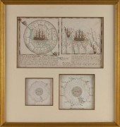
 3 NAUTICAL MAPS INC. SOUTHERN 18611st it
[more like this]
3 NAUTICAL MAPS INC. SOUTHERN 18611st it
[more like this]
-
 13 vols. (Rackham, Arthur, illustrator)
[more like this]
13 vols. (Rackham, Arthur, illustrator)
[more like this]
-
 12 vols. Illustrated Children's Books:
[more like this]
12 vols. Illustrated Children's Books:
[more like this]
-
 CONTINENTAL SCHOOL (CIRCA 1769,), SPANIS
[more like this]
CONTINENTAL SCHOOL (CIRCA 1769,), SPANIS
[more like this]
-
 RARE 1865 MONTANA TERRITORY MAP BY W.W.
[more like this]
RARE 1865 MONTANA TERRITORY MAP BY W.W.
[more like this]
-
 8VOL MARK TWAIN BOOKS, MANY ENGLISH FIRS
[more like this]
8VOL MARK TWAIN BOOKS, MANY ENGLISH FIRS
[more like this]
This list is limited to only a few results.
Many more items are available to our members in our
Price Guide!
Ideal research tools for Collectors, Personal Property Appraisers, Antiques & Collectibles
Dealers, Auction Houses, Museums, eBayers or
other online
sellers (Rubylane, Etsy etc) and curious minds interested in appraising & identifying collectibles

EASY. FAST. ACCURATE.
Research at its best

Our research tools include:


