Pricing Guides & Dictionary of Makers Marks for Antiques & Collectibles
Appraise and find values for
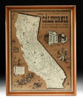
FRAMED ANDY DAGOSTA ILLUSTRATED MAP...
From
marks4antiques.com
- The most updated price guide and makers' marks research online
As a member, you have access to a team of experts
and assistance is always available to you for free
An example from the millions of items in our Price Guide:
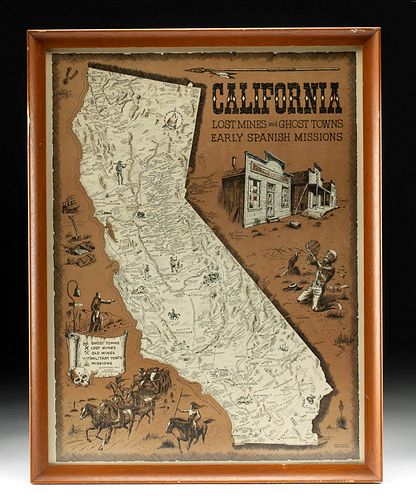
FRAMED ANDY DAGOSTA ILLUSTRATED MAP OF CALIFORNIA, 1969...**Originally Listed At $250** Andrew "Andy" Dagosta (1923-2009). "California Lost Mines and Ghost...
This is an example from our
values4antiques price guide
We do not buy or sell any items
See more price guides
Check our other research services:
IDENTIFY WORLDWIDE MAKERS' MARKS & HALLMARKS
marks4ceramics:
Porcelain, Pottery, Chinaware, Figurines, Dolls, Vases...
marks4silver
:
Silver, Jewelry, Pewter, Silverplate, Copper & Bronze...
Explore other items from our
Antiques & Collectibles Price Guide
-
 BRITANNIA, VOL. I & II CAMDEN 1722Camden
[more like this]
BRITANNIA, VOL. I & II CAMDEN 1722Camden
[more like this]
-
 FRAMED ANDY DAGOSTA ILLUSTRATED MAP OF C
[more like this]
FRAMED ANDY DAGOSTA ILLUSTRATED MAP OF C
[more like this]
-
 A COMPLETE SYSTEM OF GEOGRAPHY, VOL. I B
[more like this]
A COMPLETE SYSTEM OF GEOGRAPHY, VOL. I B
[more like this]
-
 IMPORTANT ANTIQUE ATLAS DU VOYAGE DE LA
[more like this]
IMPORTANT ANTIQUE ATLAS DU VOYAGE DE LA
[more like this]
-
 5 KENTUCKY AND TENNESSEE MAPS1st item: "
[more like this]
5 KENTUCKY AND TENNESSEE MAPS1st item: "
[more like this]
-
 3 KY & TN MAPS: VANCE, TANNER, JOHNSON1s
[more like this]
3 KY & TN MAPS: VANCE, TANNER, JOHNSON1s
[more like this]
-
 ANDY DAGOSTA (1923-2009), FISHING BOATS
[more like this]
ANDY DAGOSTA (1923-2009), FISHING BOATS
[more like this]
-
 ANDY DAGOSTA, (1923-2009, GLENDALE, CA),
[more like this]
ANDY DAGOSTA, (1923-2009, GLENDALE, CA),
[more like this]
-
 ANDY DAGOSTA (1923-2009) WATERCOLOR INDI
[more like this]
ANDY DAGOSTA (1923-2009) WATERCOLOR INDI
[more like this]
-
 SEVEN COFFEE TABLE BOOKS ON ANDY WARHOL
[more like this]
SEVEN COFFEE TABLE BOOKS ON ANDY WARHOL
[more like this]
-
 A RARE ANTIQUE CIVIL WAR ERA MAP, "PRESS
[more like this]
A RARE ANTIQUE CIVIL WAR ERA MAP, "PRESS
[more like this]
-
 ANDY DAGOSTA (1923-2009), "CANYON WALLS,
[more like this]
ANDY DAGOSTA (1923-2009), "CANYON WALLS,
[more like this]
-
 4 TN & KY MAPS, 3 FRAMED1st item: "Tenne
[more like this]
4 TN & KY MAPS, 3 FRAMED1st item: "Tenne
[more like this]
-
 (23) BOOKS: HISTORICAL KNIVES, BOWIE, BA
[more like this]
(23) BOOKS: HISTORICAL KNIVES, BOWIE, BA
[more like this]
-
 11 PC. MAP COLLECTION: Comprising; 1- La
[more like this]
11 PC. MAP COLLECTION: Comprising; 1- La
[more like this]
-
 A Very Large Collection of Maps, 19th/e
[more like this]
A Very Large Collection of Maps, 19th/e
[more like this]
-
 8 TENNESSEE MILITARY & SURVEY MAPSAssort
[more like this]
8 TENNESSEE MILITARY & SURVEY MAPSAssort
[more like this]
-
 A TOPOGRAPHICAL MAP OF THE ENVIRONS OF L
[more like this]
A TOPOGRAPHICAL MAP OF THE ENVIRONS OF L
[more like this]
-
 16TH / 18TH C. EUROPEAN MAPS OF NEW SPAI
[more like this]
16TH / 18TH C. EUROPEAN MAPS OF NEW SPAI
[more like this]
-
 THREE LETTERS FROM ANDREW WYETH (AMERICA
[more like this]
THREE LETTERS FROM ANDREW WYETH (AMERICA
[more like this]
-
 SIGNED WARHOL WATERCOLOR - FERNS & FLOWE
[more like this]
SIGNED WARHOL WATERCOLOR - FERNS & FLOWE
[more like this]
-
 A LATE MEXICAN-AMERICAN WAR ERA MAP, "MA
[more like this]
A LATE MEXICAN-AMERICAN WAR ERA MAP, "MA
[more like this]
-
 AN IMPORTANT REPUBLIC OF TEXAS MAP, "MAP
[more like this]
AN IMPORTANT REPUBLIC OF TEXAS MAP, "MAP
[more like this]
-
 AN ANTIQUE RECONSTRUCTION ERA MAP, "KOSS
[more like this]
AN ANTIQUE RECONSTRUCTION ERA MAP, "KOSS
[more like this]
-
 3 19TH CENT. AL, KY, & TN MAPS1st item:
[more like this]
3 19TH CENT. AL, KY, & TN MAPS1st item:
[more like this]
-
 MAP AND ATLAS LOT, 3 PCS INCL. MELISH DI
[more like this]
MAP AND ATLAS LOT, 3 PCS INCL. MELISH DI
[more like this]
-
 5 CIVIL WAR MAPSLot of five Civil War ma
[more like this]
5 CIVIL WAR MAPSLot of five Civil War ma
[more like this]
-
 NATIVE AMERICAN/WESTERN U.S. EXPEDITION
[more like this]
NATIVE AMERICAN/WESTERN U.S. EXPEDITION
[more like this]
-
 15 BOOKS RELATED TO THE WIZARD OF OZ TO
[more like this]
15 BOOKS RELATED TO THE WIZARD OF OZ TO
[more like this]
-
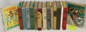
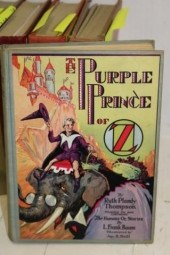 10 BOOKS RELATED TO OZ BY L. FRANK BAUM
[more like this]
10 BOOKS RELATED TO OZ BY L. FRANK BAUM
[more like this]
-
 RARE 1865 MONTANA TERRITORY MAP BY W.W.
[more like this]
RARE 1865 MONTANA TERRITORY MAP BY W.W.
[more like this]
-
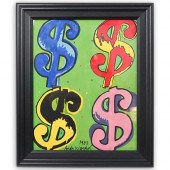 ATTRIB. ANDY WARHOL (AMERICAN, 1928-1987
[more like this]
ATTRIB. ANDY WARHOL (AMERICAN, 1928-1987
[more like this]
-
 ANDY WARHOL (AMERICAN, 1928 - 1987) 8" x
[more like this]
ANDY WARHOL (AMERICAN, 1928 - 1987) 8" x
[more like this]
-
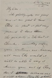
 LETTER FROM ANDREW WYETH (AMERICAN, 1917
[more like this]
LETTER FROM ANDREW WYETH (AMERICAN, 1917
[more like this]
-
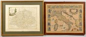 J. SPEED 1626 MAP OF ITALY PLUS SWISS MA
[more like this]
J. SPEED 1626 MAP OF ITALY PLUS SWISS MA
[more like this]
-
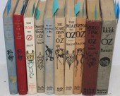 10 BOOKS BY L. FRANK BAUM TO INCLUDE "TH
[more like this]
10 BOOKS BY L. FRANK BAUM TO INCLUDE "TH
[more like this]
This list is limited to only a few results.
Many more items are available to our members in our
Price Guide!
Ideal research tools for Collectors, Personal Property Appraisers, Antiques & Collectibles
Dealers, Auction Houses, Museums, eBayers or
other online
sellers (Rubylane, Etsy etc) and curious minds interested in appraising & identifying collectibles

EASY. FAST. ACCURATE.
Research at its best

Our research tools include:


