Pricing Guides & Dictionary of Makers Marks for Antiques & Collectibles
Appraise and find values for
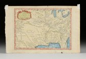
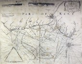
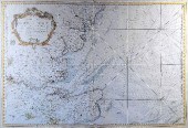
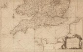
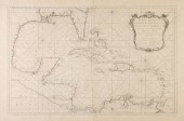
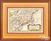
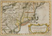
Jaques Nicholas Bellin (1703-1772),...
From
marks4antiques.com
- The most updated price guide and makers' marks research online
As a member, you have access to a team of experts
and assistance is always available to you for free
An example from the millions of items in our Price Guide:
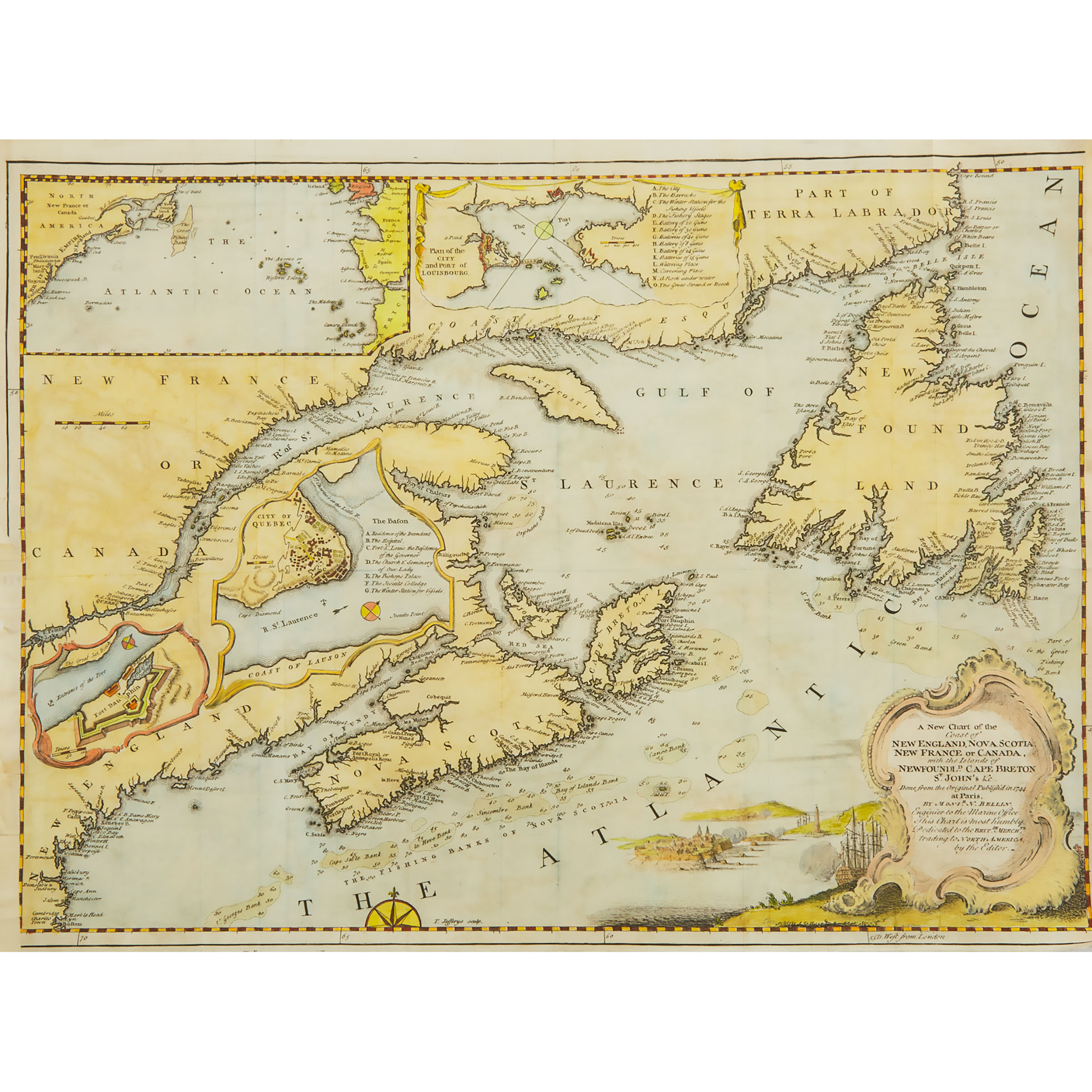
Jaques Nicholas Bellin (1703-1772), French A NEW CHART OF THE COAST OF NEW ENGLAND, NOVA SCOTIA, NEW FRANCE OR CANADA WITH THE ISLANDS OF NEWFOUNDLAND,...
This is an example from our
values4antiques price guide
We do not buy or sell any items
See more price guides
Check our other research services:
IDENTIFY WORLDWIDE MAKERS' MARKS & HALLMARKS
marks4ceramics:
Porcelain, Pottery, Chinaware, Figurines, Dolls, Vases...
marks4silver
:
Silver, Jewelry, Pewter, Silverplate, Copper & Bronze...
Explore other items from our
Antiques & Collectibles Price Guide
-
 JACQUES NICOLAS BELLIN (1703 - 1772): IL
[more like this]
JACQUES NICOLAS BELLIN (1703 - 1772): IL
[more like this]
-
 JACQUES NICOLAS BELLIN (FRENCH, 1703-177
[more like this]
JACQUES NICOLAS BELLIN (FRENCH, 1703-177
[more like this]
-
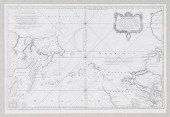
 MAP: "CARTE DU KATAY OU EMPIRE DE KIN",
[more like this]
MAP: "CARTE DU KATAY OU EMPIRE DE KIN",
[more like this]
-
 JACQUES-NICOLAS BELLIN (1703-1772) A FRE
[more like this]
JACQUES-NICOLAS BELLIN (1703-1772) A FRE
[more like this]
-
 Jaques Nicholas Bellin (1703-1772), Fren
[more like this]
Jaques Nicholas Bellin (1703-1772), Fren
[more like this]
-
 AN ANTIQUE MAP, "CARTE DES VARIATIONS DE
[more like this]
AN ANTIQUE MAP, "CARTE DES VARIATIONS DE
[more like this]
-
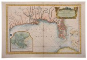 BELLIN - CARTE REDUITE DES COSTES DE LA
[more like this]
BELLIN - CARTE REDUITE DES COSTES DE LA
[more like this]
-
 BELLIN, DEPOT DE LA MARINE - MAP OF THE
[more like this]
BELLIN, DEPOT DE LA MARINE - MAP OF THE
[more like this]
-
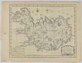 JACQUES-NICOLAS BELLIN MAP OF ICELAND CA
[more like this]
JACQUES-NICOLAS BELLIN MAP OF ICELAND CA
[more like this]
-
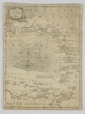 GRP: 5 MAPS OF BRAZIL BLAEU BELLIN KITCH
[more like this]
GRP: 5 MAPS OF BRAZIL BLAEU BELLIN KITCH
[more like this]
-
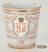 RUSSIAN ENAMEL 1896 CORONATION BLOOD CUP
[more like this]
RUSSIAN ENAMEL 1896 CORONATION BLOOD CUP
[more like this]
-
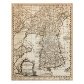 BELLIN'S 18TH-CENTURY MAP OF KOREA<br>Be
[more like this]
BELLIN'S 18TH-CENTURY MAP OF KOREA<br>Be
[more like this]
-
 William Mount (died 1769) and Thomas Pag
[more like this]
William Mount (died 1769) and Thomas Pag
[more like this]
-
 1940 Jaques Federal duck stamp print, "B
[more like this]
1940 Jaques Federal duck stamp print, "B
[more like this]
-
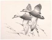
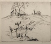
 FRANCIS LEE JAQUES (AMERICAN 1887-1969),
[more like this]
FRANCIS LEE JAQUES (AMERICAN 1887-1969),
[more like this]
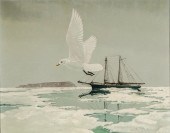
-
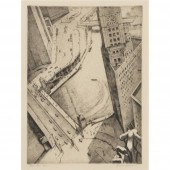
 FRANCIS LEE JAQUES (AMERICAN 1887-1969),
[more like this]
FRANCIS LEE JAQUES (AMERICAN 1887-1969),
[more like this]
-
 JAMES SWANN, ILLINOIS, TEXAS (1905 - 198
[more like this]
JAMES SWANN, ILLINOIS, TEXAS (1905 - 198
[more like this]
-
 JAMES SWANN, AMERICAN (1905-1985), FOUR-
[more like this]
JAMES SWANN, AMERICAN (1905-1985), FOUR-
[more like this]
-
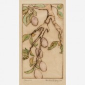 BERTHA JAQUES "PLUMS" 1931 DRYPOINTBerth
[more like this]
BERTHA JAQUES "PLUMS" 1931 DRYPOINTBerth
[more like this]
-
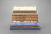 NINE BOOKS"The Classic Decoy Series" by
[more like this]
NINE BOOKS"The Classic Decoy Series" by
[more like this]
-
 JEWELRY. JAQUES & MARCUS 18KT GOLD AND D
[more like this]
JEWELRY. JAQUES & MARCUS 18KT GOLD AND D
[more like this]
-
 GABRIEL HUQUIER (FRENCH, 1695-1772) AFTE
[more like this]
GABRIEL HUQUIER (FRENCH, 1695-1772) AFTE
[more like this]
-
 VERY RARE PAIR OF GRAEME PARK PHILADELPH
[more like this]
VERY RARE PAIR OF GRAEME PARK PHILADELPH
[more like this]
-
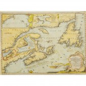
 Jacques Nicolas Bellin (1703-1772) - Col
[more like this]
Jacques Nicolas Bellin (1703-1772) - Col
[more like this]
-
 Jacques Nicolas Bellin (1703-1772)/Carte
[more like this]
Jacques Nicolas Bellin (1703-1772)/Carte
[more like this]
-
 Harrison & Co after James Cook (1728-177
[more like this]
Harrison & Co after James Cook (1728-177
[more like this]
-
 Jacques-Nicolas Bellin (1703-1772)/Carte
[more like this]
Jacques-Nicolas Bellin (1703-1772)/Carte
[more like this]
-
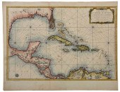
 FOUR 17TH AND 18TH CENTURY MAPS OF THE S
[more like this]
FOUR 17TH AND 18TH CENTURY MAPS OF THE S
[more like this]
-
 AN ANTIQUE MAP, "CARTE REDUITE DU GOLPHE
[more like this]
AN ANTIQUE MAP, "CARTE REDUITE DU GOLPHE
[more like this]
-
 An Impressive Masterwork Andrew Clemens
[more like this]
An Impressive Masterwork Andrew Clemens
[more like this]
-
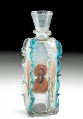 16TH C. FACON DE VENISE GLASS BOTTLE W/
[more like this]
16TH C. FACON DE VENISE GLASS BOTTLE W/
[more like this]
-
 HENRI ABRAHAM CHATELAIN, (1664-1743), "M
[more like this]
HENRI ABRAHAM CHATELAIN, (1664-1743), "M
[more like this]
-
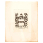 18TH CENTURY RESTRIKE BOOKPLATE, WILLIAM
[more like this]
18TH CENTURY RESTRIKE BOOKPLATE, WILLIAM
[more like this]
-
 JACQUES NICOLAS BELLIN MAP, DATED 1757Ja
[more like this]
JACQUES NICOLAS BELLIN MAP, DATED 1757Ja
[more like this]
-
 JACQUES NICOLAS BELLIN (18TH CENTURY) CA
[more like this]
JACQUES NICOLAS BELLIN (18TH CENTURY) CA
[more like this]
-
 BELLIN - MAP OF THE NORTHWEST PASSAGE, 1
[more like this]
BELLIN - MAP OF THE NORTHWEST PASSAGE, 1
[more like this]
This list is limited to only a few results.
Many more items are available to our members in our
Price Guide!
Ideal research tools for Collectors, Personal Property Appraisers, Antiques & Collectibles
Dealers, Auction Houses, Museums, eBayers or
other online
sellers (Rubylane, Etsy etc) and curious minds interested in appraising & identifying collectibles

EASY. FAST. ACCURATE.
Research at its best

Our research tools include:


