Pricing Guides & Dictionary of Makers Marks for Antiques & Collectibles
Appraise and find values for
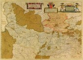
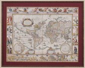
Johannes Blaeu...
From
marks4antiques.com
- The most updated price guide and makers' marks research online
As a member, you have access to a team of experts
and assistance is always available to you for free
An example from the millions of items in our Price Guide:
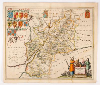
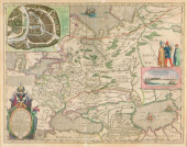
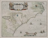
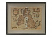
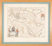
Johannes Blaeu (1650-1712)/Glocestria Ducatus Vulgo Glocestershire/circa 1648/coloured engraved map, 45cm x 56cm and/Joannes Janssonius...
This is an example from our
values4antiques price guide
We do not buy or sell any items
See more price guides
Check our other research services:
IDENTIFY WORLDWIDE MAKERS' MARKS & HALLMARKS
marks4ceramics:
Porcelain, Pottery, Chinaware, Figurines, Dolls, Vases...
marks4silver
:
Silver, Jewelry, Pewter, Silverplate, Copper & Bronze...
Explore other items from our
Antiques & Collectibles Price Guide
-
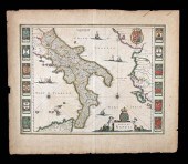 17TH C. DUTCH MAP - REGNO DI NAPOLI - BY
[more like this]
17TH C. DUTCH MAP - REGNO DI NAPOLI - BY
[more like this]
-
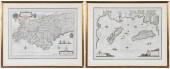
 Three 17th century European maps: two Fr
[more like this]
Three 17th century European maps: two Fr
[more like this]
-
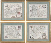
 MAP, JOHANNES BLAEU Johannes Blaeu (Dutc
[more like this]
MAP, JOHANNES BLAEU Johannes Blaeu (Dutc
[more like this]
-
 MAP, JOHANNES BLAEU Johannes Blaeu (Dutc
[more like this]
MAP, JOHANNES BLAEU Johannes Blaeu (Dutc
[more like this]
-
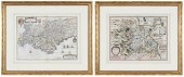
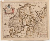 Maps of Scandanavia by Joan Blaeu Anders
[more like this]
Maps of Scandanavia by Joan Blaeu Anders
[more like this]
-
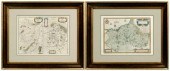
 BLAEU - TWO FRAMED FRENCH REGIONAL MAPSW
[more like this]
BLAEU - TWO FRAMED FRENCH REGIONAL MAPSW
[more like this]
-
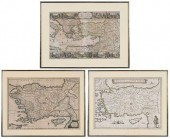 BLAEU, MORTIER, VISSCHER - THREE MAPS OF
[more like this]
BLAEU, MORTIER, VISSCHER - THREE MAPS OF
[more like this]
-
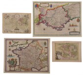
 BLAEU - FOUR FRENCH REGIONAL MAPSWillem
[more like this]
BLAEU - FOUR FRENCH REGIONAL MAPSWillem
[more like this]
-
 HONDIUS AND BLAEU - TWO FRENCH REGIONAL
[more like this]
HONDIUS AND BLAEU - TWO FRENCH REGIONAL
[more like this]
-
 BLAEU, LE ROUGE - THREE MAPS OF FRANCE,
[more like this]
BLAEU, LE ROUGE - THREE MAPS OF FRANCE,
[more like this]
-
 GRP: 5 MAPS OF BRAZIL BLAEU BELLIN KITCH
[more like this]
GRP: 5 MAPS OF BRAZIL BLAEU BELLIN KITCH
[more like this]
-
 MAP: BLAEU, WILLEM & JOAN. "TABULA RUSSI
[more like this]
MAP: BLAEU, WILLEM & JOAN. "TABULA RUSSI
[more like this]
-
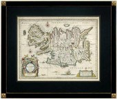 17th century map of Iceland, "Tabul
[more like this]
17th century map of Iceland, "Tabul
[more like this]
-
 JOHANNES BLAEU (1596-1673) MAPJohannes B
[more like this]
JOHANNES BLAEU (1596-1673) MAPJohannes B
[more like this]
-
 DOMINIO FIORENTINO & JOHANNES BLAEU 1646
[more like this]
DOMINIO FIORENTINO & JOHANNES BLAEU 1646
[more like this]
-
 MAP: "PICARDIA VERA ET INFERIOR" BY JOHA
[more like this]
MAP: "PICARDIA VERA ET INFERIOR" BY JOHA
[more like this]
-
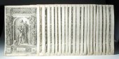 21 BAROQUE ENGRAVINGS OF ARMOR (CUSTODIS
[more like this]
21 BAROQUE ENGRAVINGS OF ARMOR (CUSTODIS
[more like this]
-
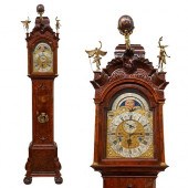 JOHANNES VAN WYK MUSICAL TALL CASE CLOCK
[more like this]
JOHANNES VAN WYK MUSICAL TALL CASE CLOCK
[more like this]
-
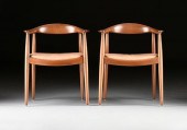 HANS J. WEGNER (DANISH 1914-2007) A PAIR
[more like this]
HANS J. WEGNER (DANISH 1914-2007) A PAIR
[more like this]
-
 A RENAISSANCE MAP, "PTOLEMY MAP OF THE W
[more like this]
A RENAISSANCE MAP, "PTOLEMY MAP OF THE W
[more like this]
-
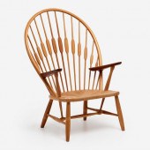 HANS WEGNER PEACOCK CHAIR (JOHANNES HANS
[more like this]
HANS WEGNER PEACOCK CHAIR (JOHANNES HANS
[more like this]
-
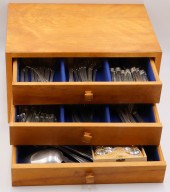 SILVER. ASSORTED GROUPING OF STERLING AN
[more like this]
SILVER. ASSORTED GROUPING OF STERLING AN
[more like this]
-
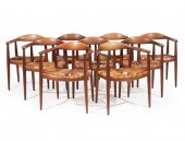 NINE HANS WEGNER FOR JOHANNES HANSEN ROU
[more like this]
NINE HANS WEGNER FOR JOHANNES HANSEN ROU
[more like this]
-
 17th Century Blaeu World Map "Nova Totiu
[more like this]
17th Century Blaeu World Map "Nova Totiu
[more like this]
-
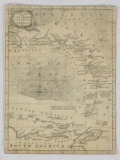
 17th Century Map of the Southeast "Virgi
[more like this]
17th Century Map of the Southeast "Virgi
[more like this]
-
 (ATLAS FRONTISPIECES) A group of four ti
[more like this]
(ATLAS FRONTISPIECES) A group of four ti
[more like this]
-
 Blaeu Map of FlandersEPISCOPATVS GANDEVE
[more like this]
Blaeu Map of FlandersEPISCOPATVS GANDEVE
[more like this]
-
 JOAN BLAEU (NETHERLANDS, 1596-1673) MAP
[more like this]
JOAN BLAEU (NETHERLANDS, 1596-1673) MAP
[more like this]
-
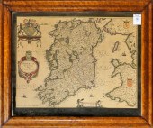
 1631 BLAEU MAP OF THE BRITISH ISLES, FRA
[more like this]
1631 BLAEU MAP OF THE BRITISH ISLES, FRA
[more like this]
-
 WILLEM BLAEU HAND COLORED MAP "SPICE ISL
[more like this]
WILLEM BLAEU HAND COLORED MAP "SPICE ISL
[more like this]
-
 AFTER WILLEM BLAEU STRAITS OF MAGELLAN E
[more like this]
AFTER WILLEM BLAEU STRAITS OF MAGELLAN E
[more like this]
-
 3PC ANTIQUE MAPS OF GERMANY Netherlands,
[more like this]
3PC ANTIQUE MAPS OF GERMANY Netherlands,
[more like this]
-
 WILLEM AND JOAN BLAEU MAPWillem and Joan
[more like this]
WILLEM AND JOAN BLAEU MAPWillem and Joan
[more like this]
-
 MAP: "TERRITORIO DI VERONA", 1640, BY WI
[more like this]
MAP: "TERRITORIO DI VERONA", 1640, BY WI
[more like this]
-
 AFTER J BLAEU, AMSTERDAM, HAND-COLORED E
[more like this]
AFTER J BLAEU, AMSTERDAM, HAND-COLORED E
[more like this]
-
 MAP OF HOLLAND, AFTER GUILJELMUS BLAEU,
[more like this]
MAP OF HOLLAND, AFTER GUILJELMUS BLAEU,
[more like this]
This list is limited to only a few results.
Many more items are available to our members in our
Price Guide!
Ideal research tools for Collectors, Personal Property Appraisers, Antiques & Collectibles
Dealers, Auction Houses, Museums, eBayers or
other online
sellers (Rubylane, Etsy etc) and curious minds interested in appraising & identifying collectibles

EASY. FAST. ACCURATE.
Research at its best

Our research tools include:


