Pricing Guides & Dictionary of Makers Marks for Antiques & Collectibles
Appraise and find values for
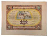
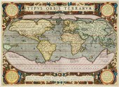
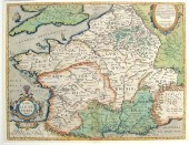
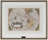
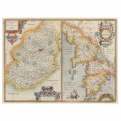
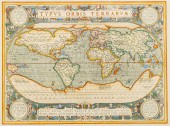
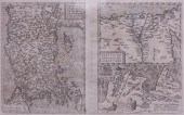
ORTELIUS - AEVI VETERIS, TYPUS...
From
marks4antiques.com
- The most updated price guide and makers' marks research online
As a member, you have access to a team of experts
and assistance is always available to you for free
An example from the millions of items in our Price Guide:
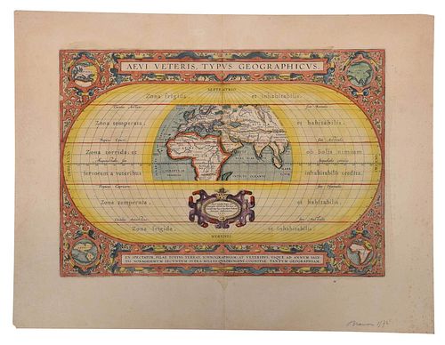
ORTELIUS - AEVI VETERIS, TYPUS GEOGRAPHICUSAbraham Ortelius (1527-1598), Aevi Veteris, Typus Geographicus , Antwerp, circa 1624, text verso, in two sheets,...
This is an example from our
values4antiques price guide
We do not buy or sell any items
See more price guides
Check our other research services:
IDENTIFY WORLDWIDE MAKERS' MARKS & HALLMARKS
marks4ceramics:
Porcelain, Pottery, Chinaware, Figurines, Dolls, Vases...
marks4silver
:
Silver, Jewelry, Pewter, Silverplate, Copper & Bronze...
Explore other items from our
Antiques & Collectibles Price Guide
-
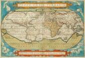
 ORTELIUS - AEVI VETERIS, TYPUS GEOGRAPHI
[more like this]
ORTELIUS - AEVI VETERIS, TYPUS GEOGRAPHI
[more like this]
-
 ABRAHAM ORTELIUS, FLEMISH 1527-1598, TYP
[more like this]
ABRAHAM ORTELIUS, FLEMISH 1527-1598, TYP
[more like this]
-
 ABRAHAM ORTELIUS, BELGIAN 1522-1598, MAP
[more like this]
ABRAHAM ORTELIUS, BELGIAN 1522-1598, MAP
[more like this]
-
 ABRAHAM ORTELIUS (BELGIAN 1527-1598), TY
[more like this]
ABRAHAM ORTELIUS (BELGIAN 1527-1598), TY
[more like this]
-
 ABRAHAM ORTELIUS (BELGIAN 1527-1598), TY
[more like this]
ABRAHAM ORTELIUS (BELGIAN 1527-1598), TY
[more like this]
-
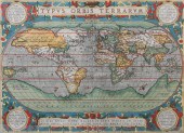
 A RENAISSANCE MAP, "TYPUS ORBIS TERRARUM
[more like this]
A RENAISSANCE MAP, "TYPUS ORBIS TERRARUM
[more like this]
-
 MAP: HORSLEY, JOHANNE, "BRITANNIAE ANTIQ
[more like this]
MAP: HORSLEY, JOHANNE, "BRITANNIAE ANTIQ
[more like this]
-
 1 piece. Hand-Colored Engraved Map. Ort
[more like this]
1 piece. Hand-Colored Engraved Map. Ort
[more like this]
-
 Abraham Ortelius (1527-1598) INDIAE ORIE
[more like this]
Abraham Ortelius (1527-1598) INDIAE ORIE
[more like this]
-
 ABRAHAM ORTELIUS, 1598, MAPAbraham Ortel
[more like this]
ABRAHAM ORTELIUS, 1598, MAPAbraham Ortel
[more like this]
-
 ABRAHAM ORTELIUS - 16TH CENTURY MAP OF F
[more like this]
ABRAHAM ORTELIUS - 16TH CENTURY MAP OF F
[more like this]
-
 ORTELIUS AND HONDIUS - TWO MAPS, FLORIDA
[more like this]
ORTELIUS AND HONDIUS - TWO MAPS, FLORIDA
[more like this]
-
 ORTELIUS 'THEATRUM ORBIS TERRARUM&#
[more like this]
ORTELIUS 'THEATRUM ORBIS TERRARUM&#
[more like this]
-
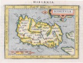
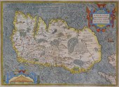 MAP: MAP OF IRELAND, 16TH C., BY ABRAHAM
[more like this]
MAP: MAP OF IRELAND, 16TH C., BY ABRAHAM
[more like this]
-
 ABRAHAM ORTELIUS, BELGIAN 1522-1598, MAP
[more like this]
ABRAHAM ORTELIUS, BELGIAN 1522-1598, MAP
[more like this]
-
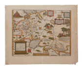
 ABRAHAM ORTELIUS - 16TH CENTURY MAP OF N
[more like this]
ABRAHAM ORTELIUS - 16TH CENTURY MAP OF N
[more like this]
-
 A RENAISSANCE MAP, "EUROPæ," ABRAHAM ORT
[more like this]
A RENAISSANCE MAP, "EUROPæ," ABRAHAM ORT
[more like this]
-
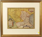 ORTELIUS MAP OF DACIA & MOESIA, ABRAHAM
[more like this]
ORTELIUS MAP OF DACIA & MOESIA, ABRAHAM
[more like this]
-
 RUSSIA MAP ORTELIUS, RUSSIAE, MOSCOVIAE<
[more like this]
RUSSIA MAP ORTELIUS, RUSSIAE, MOSCOVIAE<
[more like this]
-
 MARTIN ANTONIO DEL RIO, ADAGIALIA SACRA
[more like this]
MARTIN ANTONIO DEL RIO, ADAGIALIA SACRA
[more like this]
-
 MARTIN ANTONIO DEL RIO, ADAGIALIA SACRA
[more like this]
MARTIN ANTONIO DEL RIO, ADAGIALIA SACRA
[more like this]
-
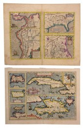
 SHEET WITH EARLY MAPS OF THE WESTERN AND
[more like this]
SHEET WITH EARLY MAPS OF THE WESTERN AND
[more like this]
-
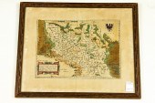 HAND COLORED MAP OF SILESIA TYPUS Hand c
[more like this]
HAND COLORED MAP OF SILESIA TYPUS Hand c
[more like this]
-
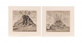 TWO COPPER ENGRAVINGS VESUVIUS & ETNA CA
[more like this]
TWO COPPER ENGRAVINGS VESUVIUS & ETNA CA
[more like this]
-
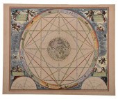 CELLARIUS - TYPUS ASPECTUUM OPPOSITIONUM
[more like this]
CELLARIUS - TYPUS ASPECTUUM OPPOSITIONUM
[more like this]
-
 ORTELIUS. PEREGRINATIONIS DIVI PAULI TYP
[more like this]
ORTELIUS. PEREGRINATIONIS DIVI PAULI TYP
[more like this]
-
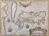
 Abraham Ortelius 'Indiae Orientalis Insu
[more like this]
Abraham Ortelius 'Indiae Orientalis Insu
[more like this]
-
 Antique Abraham Ortelius Handcolored Map
[more like this]
Antique Abraham Ortelius Handcolored Map
[more like this]
-
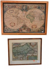 TWO FRAMED MAPSTwo Framed Maps, to inclu
[more like this]
TWO FRAMED MAPSTwo Framed Maps, to inclu
[more like this]
-
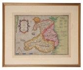 ABRAHAM ORTELIUS (1527-1598), CAMBRIAE T
[more like this]
ABRAHAM ORTELIUS (1527-1598), CAMBRIAE T
[more like this]
-
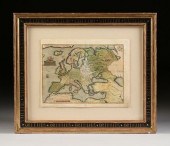
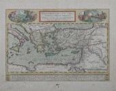
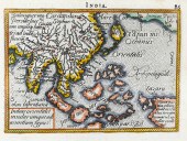
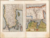 Maps of Asia Minor Nile Delta and Tunis
[more like this]
Maps of Asia Minor Nile Delta and Tunis
[more like this]
-
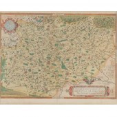 FRENCH BURGUNDY 1579 MAP BURGUNDIAE BY F
[more like this]
FRENCH BURGUNDY 1579 MAP BURGUNDIAE BY F
[more like this]
-
 AFTER ABRAHAM ORTELIUS, MAP OF EGYPT, NA
[more like this]
AFTER ABRAHAM ORTELIUS, MAP OF EGYPT, NA
[more like this]
-
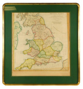
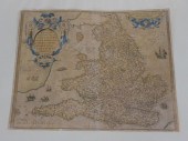 ORTELLIUS 1573 MAP OF ENGLAND AND WALES.
[more like this]
ORTELLIUS 1573 MAP OF ENGLAND AND WALES.
[more like this]
-
 ABRAHAM ORTELIUS (BELGIAN 1527-1598), MA
[more like this]
ABRAHAM ORTELIUS (BELGIAN 1527-1598), MA
[more like this]
-
 ABRAHAM ORTELIUS, FLEMISH 1527-1598, JAP
[more like this]
ABRAHAM ORTELIUS, FLEMISH 1527-1598, JAP
[more like this]
This list is limited to only a few results.
Many more items are available to our members in our
Price Guide!
Ideal research tools for Collectors, Personal Property Appraisers, Antiques & Collectibles
Dealers, Auction Houses, Museums, eBayers or
other online
sellers (Rubylane, Etsy etc) and curious minds interested in appraising & identifying collectibles

EASY. FAST. ACCURATE.
Research at its best

Our research tools include:


