Pricing Guides & Dictionary of Makers Marks for Antiques & Collectibles
Appraise and find values for
[Railroads] Railroads and Roads -...
From
marks4antiques.com
- The most updated price guide and makers' marks research online
As a member, you have access to a team of experts
and assistance is always available to you for free
An example from the millions of items in our Price Guide:
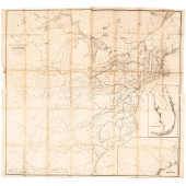
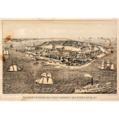
![[Railroads] Railroads and Roads -](/images/railroads-railroads-and-roads--15f0a8-full.jpg)
[Railroads] Railroads and Roads - Booklets and Maps Lot of 6. Report to the Stockholders of the Union Pacific Railway Company for the Year 1883. New York:...
This is an example from our
values4antiques price guide
We do not buy or sell any items
See more price guides
Check our other research services:
IDENTIFY WORLDWIDE MAKERS' MARKS & HALLMARKS
marks4ceramics:
Porcelain, Pottery, Chinaware, Figurines, Dolls, Vases...
marks4silver
:
Silver, Jewelry, Pewter, Silverplate, Copper & Bronze...
Explore other items from our
Antiques & Collectibles Price Guide
-
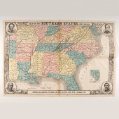
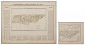
 8 TENNESSEE MILITARY & SURVEY MAPSAssort
[more like this]
8 TENNESSEE MILITARY & SURVEY MAPSAssort
[more like this]
-
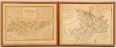
 4 TN & KY MAPS, 3 FRAMED1st item: "Tenne
[more like this]
4 TN & KY MAPS, 3 FRAMED1st item: "Tenne
[more like this]
-
 5 KENTUCKY AND TENNESSEE MAPS1st item: "
[more like this]
5 KENTUCKY AND TENNESSEE MAPS1st item: "
[more like this]
-
 3 KY & TN MAPS: VANCE, TANNER, JOHNSON1s
[more like this]
3 KY & TN MAPS: VANCE, TANNER, JOHNSON1s
[more like this]
-
 3 19TH CENT. AL, KY, & TN MAPS1st item:
[more like this]
3 19TH CENT. AL, KY, & TN MAPS1st item:
[more like this]
-
 KENTUCKY AND TENNESSEE MAP, 1796 HARRIS"
[more like this]
KENTUCKY AND TENNESSEE MAP, 1796 HARRIS"
[more like this]
-
 Civil War-Era Maps Including Harper's Ma
[more like this]
Civil War-Era Maps Including Harper's Ma
[more like this]
-
 JOHN CALVIN SMITH (1809-1890) A TRAVELER
[more like this]
JOHN CALVIN SMITH (1809-1890) A TRAVELER
[more like this]
-
 NASHVILLE BATTLEFIELDS AND TN MAPTwo Ten
[more like this]
NASHVILLE BATTLEFIELDS AND TN MAPTwo Ten
[more like this]
-
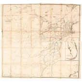
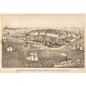
![[Railroads] Railroads and Road](/images/railroads-railroads-and-roads--15f0a8-medium.jpg) [Railroads] Railroads and Roads - Bookle
[more like this]
[Railroads] Railroads and Roads - Bookle
[more like this]
-
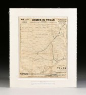 AN ANTIQUE PROMOTIONAL MAP, "CORRECT MAP
[more like this]
AN ANTIQUE PROMOTIONAL MAP, "CORRECT MAP
[more like this]
-
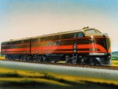 PAUL MEYER PAINTING: GENERAL MOTORS F7 L
[more like this]
PAUL MEYER PAINTING: GENERAL MOTORS F7 L
[more like this]
-
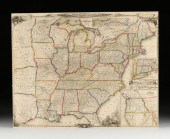
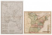
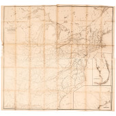 1853 SPECIALIZED MAP, RAILROADS IN THE U
[more like this]
1853 SPECIALIZED MAP, RAILROADS IN THE U
[more like this]
-
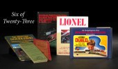 Twenty-Three Books on Lionel and Model T
[more like this]
Twenty-Three Books on Lionel and Model T
[more like this]
-
 1853 SPECIALIZED MAP, RAILROADS IN THE U
[more like this]
1853 SPECIALIZED MAP, RAILROADS IN THE U
[more like this]
-
 1853 SPECIALIZED MAP, RAILROADS IN THE U
[more like this]
1853 SPECIALIZED MAP, RAILROADS IN THE U
[more like this]
-
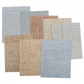 Letters Between the Sturges Brothers Mos
[more like this]
Letters Between the Sturges Brothers Mos
[more like this]
-
 2 MAPS, LA/FL AND US, LATE 18TH AND EARL
[more like this]
2 MAPS, LA/FL AND US, LATE 18TH AND EARL
[more like this]
-
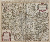
 2 EUROPEAN MAPS OF TN1st item: "Carte Ge
[more like this]
2 EUROPEAN MAPS OF TN1st item: "Carte Ge
[more like this]
-
 AN ANTIQUE RECONSTRUCTION ERA MAP, "TRAV
[more like this]
AN ANTIQUE RECONSTRUCTION ERA MAP, "TRAV
[more like this]
-
 TENN. MAP 1811, PAYNE/LOW"A Map of the T
[more like this]
TENN. MAP 1811, PAYNE/LOW"A Map of the T
[more like this]
-
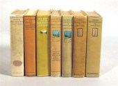 7 vols. Faris, John T. [Philadelphia &
[more like this]
7 vols. Faris, John T. [Philadelphia &
[more like this]
-
 AMERICAN BLACK AND WHITE PAINTED 'THE CR
[more like this]
AMERICAN BLACK AND WHITE PAINTED 'THE CR
[more like this]
-
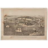 1861 PRINT: FORTRESS MONROE, OLD POINT C
[more like this]
1861 PRINT: FORTRESS MONROE, OLD POINT C
[more like this]
-
 1861 PRINT: FORTRESS MONROE, OLD POINT C
[more like this]
1861 PRINT: FORTRESS MONROE, OLD POINT C
[more like this]
-
 1861 PRINT: FORTRESS MONROE, OLD POINT C
[more like this]
1861 PRINT: FORTRESS MONROE, OLD POINT C
[more like this]
-
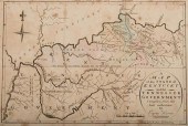
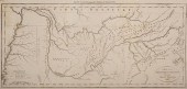
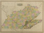 KY AND TN 1823 MAP, H.S. TANNERMap of Ke
[more like this]
KY AND TN 1823 MAP, H.S. TANNERMap of Ke
[more like this]
-
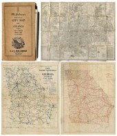 20th century Georgia folding maps: "
[more like this]
20th century Georgia folding maps: "
[more like this]
-
 L'ISLE Guillaume de (1675-1726): Early 1
[more like this]
L'ISLE Guillaume de (1675-1726): Early 1
[more like this]
-
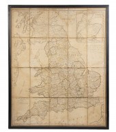 FADEN'S MAP OF GREAT BRITAIN, 1795, FRAM
[more like this]
FADEN'S MAP OF GREAT BRITAIN, 1795, FRAM
[more like this]
-
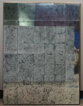
 TWO MODERN COMPOSITIONS, THE FIRST AN OI
[more like this]
TWO MODERN COMPOSITIONS, THE FIRST AN OI
[more like this]
-
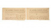 CONFEDERATE GENERAL BEAUREGARD TELEGRAMC
[more like this]
CONFEDERATE GENERAL BEAUREGARD TELEGRAMC
[more like this]
-
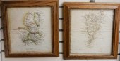 PAIR ENGLISH ROAD MAPS (ROADS MEASURED F
[more like this]
PAIR ENGLISH ROAD MAPS (ROADS MEASURED F
[more like this]
-
 JOHN RICHARD EUROPEAN 20TH CENTURY, CROS
[more like this]
JOHN RICHARD EUROPEAN 20TH CENTURY, CROS
[more like this]
-
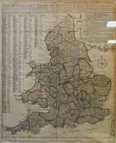 I. V. KIRCHER, 'THE TRAVELLERS GUIDE OR
[more like this]
I. V. KIRCHER, 'THE TRAVELLERS GUIDE OR
[more like this]
-
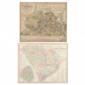 TWO 1830S SOUHEASTERN MAPS BY H. S. TANN
[more like this]
TWO 1830S SOUHEASTERN MAPS BY H. S. TANN
[more like this]
This list is limited to only a few results.
Many more items are available to our members in our
Price Guide!
Ideal research tools for Collectors, Personal Property Appraisers, Antiques & Collectibles
Dealers, Auction Houses, Museums, eBayers or
other online
sellers (Rubylane, Etsy etc) and curious minds interested in appraising & identifying collectibles

EASY. FAST. ACCURATE.
Research at its best

Our research tools include:


