Pricing Guides & Dictionary of Makers Marks for Antiques & Collectibles
Appraise and find values for
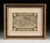
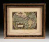
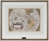
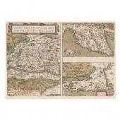
THEATRUM ORBIS TERRARUM: A SERIES...
From
marks4antiques.com
- The most updated price guide and makers' marks research online
As a member, you have access to a team of experts
and assistance is always available to you for free
An example from the millions of items in our Price Guide:
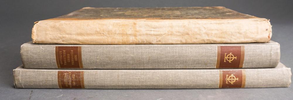
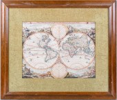
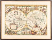
THEATRUM ORBIS TERRARUM: A SERIES OF ATLAS IN FACSIMILE, 2 VOLUMES AND HARDESTY'S ENCYCLOPEDIATheatrum Orbis Terrarum: A Series of Atlas in Facsimile, 2...
This is an example from our
values4antiques price guide
We do not buy or sell any items
See more price guides
Check our other research services:
IDENTIFY WORLDWIDE MAKERS' MARKS & HALLMARKS
marks4ceramics:
Porcelain, Pottery, Chinaware, Figurines, Dolls, Vases...
marks4silver
:
Silver, Jewelry, Pewter, Silverplate, Copper & Bronze...
Explore other items from our
Antiques & Collectibles Price Guide
-
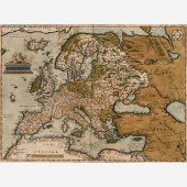
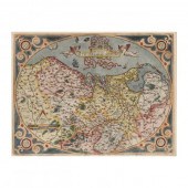
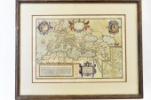
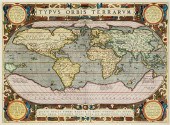 ABRAHAM ORTELIUS (BELGIAN 1527-1598), TY
[more like this]
ABRAHAM ORTELIUS (BELGIAN 1527-1598), TY
[more like this]
-
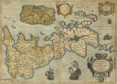
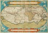 ABRAHAM ORTELIUS (BELGIAN 1527-1598), TY
[more like this]
ABRAHAM ORTELIUS (BELGIAN 1527-1598), TY
[more like this]
-
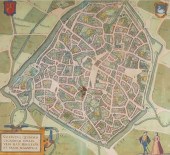
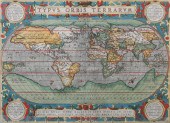 ABRAHAM ORTELIUS, FLEMISH 1527-1598, TYP
[more like this]
ABRAHAM ORTELIUS, FLEMISH 1527-1598, TYP
[more like this]
-
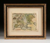
 A RENAISSANCE MAP, "TYPUS ORBIS TERRARUM
[more like this]
A RENAISSANCE MAP, "TYPUS ORBIS TERRARUM
[more like this]
-
 ABRAHAM ORTELIUS 1570 MAP OF EUROPEAbrah
[more like this]
ABRAHAM ORTELIUS 1570 MAP OF EUROPEAbrah
[more like this]
-
 ORTELIUS 'THEATRUM ORBIS TERRARUM&#
[more like this]
ORTELIUS 'THEATRUM ORBIS TERRARUM&#
[more like this]
-
 THEATRUM ORBIS TERRARUM: A SERIES OF ATL
[more like this]
THEATRUM ORBIS TERRARUM: A SERIES OF ATL
[more like this]
-
 1575 BRAUN & HOGENBERG ANTIQUE MAP, VALE
[more like this]
1575 BRAUN & HOGENBERG ANTIQUE MAP, VALE
[more like this]
-
 1575 BRAUN & HOGENBERG ANTIQUE MAP, ST O
[more like this]
1575 BRAUN & HOGENBERG ANTIQUE MAP, ST O
[more like this]
-
 A RENAISSANCE MAP, "AMERICæ SIVE NOVI OR
[more like this]
A RENAISSANCE MAP, "AMERICæ SIVE NOVI OR
[more like this]
-
 ORTELIUS MAP OF DACIA & MOESIA, ABRAHAM
[more like this]
ORTELIUS MAP OF DACIA & MOESIA, ABRAHAM
[more like this]
-
 MAP: "PICARDIA VERA ET INFERIOR" BY JOHA
[more like this]
MAP: "PICARDIA VERA ET INFERIOR" BY JOHA
[more like this]
-
 ABRAHAM ORTELIUS - 16TH CENTURY MAP OF N
[more like this]
ABRAHAM ORTELIUS - 16TH CENTURY MAP OF N
[more like this]
-
 DANIEL STOOPENDAAL, ORBIS TERRARUM TABUL
[more like this]
DANIEL STOOPENDAAL, ORBIS TERRARUM TABUL
[more like this]
-
 2 REPRODUCTION MAPS OF THE WORLD2 reprod
[more like this]
2 REPRODUCTION MAPS OF THE WORLD2 reprod
[more like this]
-
 VAN GEELKERCKEN ORBIS TERRARUM ENGRAVED
[more like this]
VAN GEELKERCKEN ORBIS TERRARUM ENGRAVED
[more like this]
-
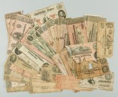 36 SOUTHERN PRE CIVIL WAR AND CSA BILLSL
[more like this]
36 SOUTHERN PRE CIVIL WAR AND CSA BILLSL
[more like this]
-
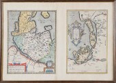
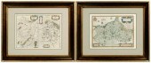 Three 17th century European maps: two Fr
[more like this]
Three 17th century European maps: two Fr
[more like this]
-
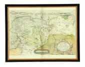 EARLY MAP OF FRIESLAND. ''Utriusque Fri
[more like this]
EARLY MAP OF FRIESLAND. ''Utriusque Fri
[more like this]
-
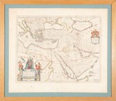
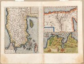 Maps of Asia Minor Nile Delta and Tunis
[more like this]
Maps of Asia Minor Nile Delta and Tunis
[more like this]
-
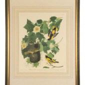 AUDUBON, John James (1784-1851)
Baltimor
[more like this]
AUDUBON, John James (1784-1851)
Baltimor
[more like this]
-
 WILLEM AND JOAN BLAEU MAPWillem and Joan
[more like this]
WILLEM AND JOAN BLAEU MAPWillem and Joan
[more like this]
-
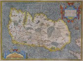 MAP: MAP OF IRELAND, 16TH C., BY ABRAHAM
[more like this]
MAP: MAP OF IRELAND, 16TH C., BY ABRAHAM
[more like this]
-
 ORTELIUS, ABRAHAM. DESCRIPTIO GERMANIAE
[more like this]
ORTELIUS, ABRAHAM. DESCRIPTIO GERMANIAE
[more like this]
-
 ORTELIUS, ABRAHAM. CARINTHIAE DUCATUS, E
[more like this]
ORTELIUS, ABRAHAM. CARINTHIAE DUCATUS, E
[more like this]
-
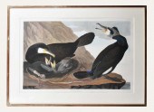 AFTER JOHN JAMES AUDUBON (AMERICAN. 1785
[more like this]
AFTER JOHN JAMES AUDUBON (AMERICAN. 1785
[more like this]
-
 MAP, ABRAHAM ORTELIUS, ROMAN IMPERIL IMA
[more like this]
MAP, ABRAHAM ORTELIUS, ROMAN IMPERIL IMA
[more like this]
-
 17TH C. DUTCH MAP - REGNO DI NAPOLI - BY
[more like this]
17TH C. DUTCH MAP - REGNO DI NAPOLI - BY
[more like this]
-
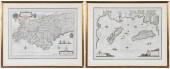 BLAEU - TWO FRAMED FRENCH REGIONAL MAPSW
[more like this]
BLAEU - TWO FRAMED FRENCH REGIONAL MAPSW
[more like this]
-
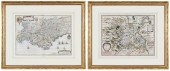 HONDIUS AND BLAEU - TWO FRENCH REGIONAL
[more like this]
HONDIUS AND BLAEU - TWO FRENCH REGIONAL
[more like this]
-
 ORTELIUS - RUSSIAE, MOSCOVIAE ET TARTARI
[more like this]
ORTELIUS - RUSSIAE, MOSCOVIAE ET TARTARI
[more like this]
-
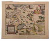
 HOLSATIAE DESCRIPTIO. MARCO IORDANO HOLS
[more like this]
HOLSATIAE DESCRIPTIO. MARCO IORDANO HOLS
[more like this]
-
 A RENAISSANCE MAP, "EUROPæ," ABRAHAM ORT
[more like this]
A RENAISSANCE MAP, "EUROPæ," ABRAHAM ORT
[more like this]
-
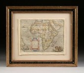 A RENAISSANCE MAP, "AFRICæ TABULA NOVA,"
[more like this]
A RENAISSANCE MAP, "AFRICæ TABULA NOVA,"
[more like this]
-
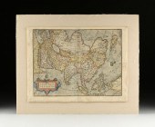 A RENAISSANCE MAP, "ASIæ NOVA DESCRIPTIO
[more like this]
A RENAISSANCE MAP, "ASIæ NOVA DESCRIPTIO
[more like this]
-
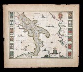
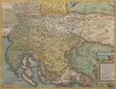 ILLYRICUM, ATLAS MAP OF CROATIA 14 ½" x
[more like this]
ILLYRICUM, ATLAS MAP OF CROATIA 14 ½" x
[more like this]
This list is limited to only a few results.
Many more items are available to our members in our
Price Guide!
Ideal research tools for Collectors, Personal Property Appraisers, Antiques & Collectibles
Dealers, Auction Houses, Museums, eBayers or
other online
sellers (Rubylane, Etsy etc) and curious minds interested in appraising & identifying collectibles

EASY. FAST. ACCURATE.
Research at its best

Our research tools include:


