Pricing Guides & Dictionary of Makers Marks for Antiques & Collectibles
Appraise and find values for
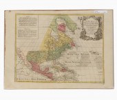
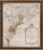
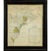
TOBIAS LOTTER, MAP OF NORTH...
From
marks4antiques.com
- The most updated price guide and makers' marks research online
As a member, you have access to a team of experts
and assistance is always available to you for free
An example from the millions of items in our Price Guide:
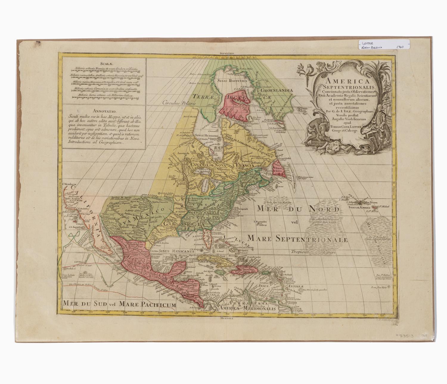
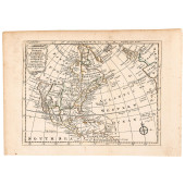
TOBIAS LOTTER, MAP OF NORTH AMERICA, 1760 Tobias Conrad Lotter (Germna, 1717-1777). "America Septentrionalis, concinnata juxta observationes D?n Academi?...
This is an example from our
values4antiques price guide
We do not buy or sell any items
See more price guides
Check our other research services:
IDENTIFY WORLDWIDE MAKERS' MARKS & HALLMARKS
marks4ceramics:
Porcelain, Pottery, Chinaware, Figurines, Dolls, Vases...
marks4silver
:
Silver, Jewelry, Pewter, Silverplate, Copper & Bronze...
Explore other items from our
Antiques & Collectibles Price Guide
-
 BRITANNIA, VOL. I & II CAMDEN 1722Camden
[more like this]
BRITANNIA, VOL. I & II CAMDEN 1722Camden
[more like this]
-
 A COMPLETE SYSTEM OF GEOGRAPHY, VOL. I B
[more like this]
A COMPLETE SYSTEM OF GEOGRAPHY, VOL. I B
[more like this]
-
 IMPORTANT ANTIQUE ATLAS DU VOYAGE DE LA
[more like this]
IMPORTANT ANTIQUE ATLAS DU VOYAGE DE LA
[more like this]
-
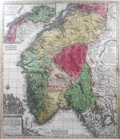 TOBIAS LOTTER, REGNUM NORWEGIAE ACCURATA
[more like this]
TOBIAS LOTTER, REGNUM NORWEGIAE ACCURATA
[more like this]
-
 5 KENTUCKY AND TENNESSEE MAPS1st item: "
[more like this]
5 KENTUCKY AND TENNESSEE MAPS1st item: "
[more like this]
-
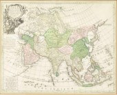 TOBIAS CONRAD LOTTER ATLAS MAP OF ASIA,
[more like this]
TOBIAS CONRAD LOTTER ATLAS MAP OF ASIA,
[more like this]
-
 A RARE ANTIQUE CIVIL WAR ERA MAP, "PRESS
[more like this]
A RARE ANTIQUE CIVIL WAR ERA MAP, "PRESS
[more like this]
-
 3 KY & TN MAPS: VANCE, TANNER, JOHNSON1s
[more like this]
3 KY & TN MAPS: VANCE, TANNER, JOHNSON1s
[more like this]
-
 COLLECTIBLE MAP: TOBIAS CONRAD LOTTER, "
[more like this]
COLLECTIBLE MAP: TOBIAS CONRAD LOTTER, "
[more like this]
-
 A LATE MEXICAN-AMERICAN WAR ERA MAP, "MA
[more like this]
A LATE MEXICAN-AMERICAN WAR ERA MAP, "MA
[more like this]
-
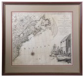
 TOBIAS LOTTER, MAP OF NORTH AMERICA, 176
[more like this]
TOBIAS LOTTER, MAP OF NORTH AMERICA, 176
[more like this]
-
 4 TN & KY MAPS, 3 FRAMED1st item: "Tenne
[more like this]
4 TN & KY MAPS, 3 FRAMED1st item: "Tenne
[more like this]
-
 A Very Large Collection of Maps, 19th/e
[more like this]
A Very Large Collection of Maps, 19th/e
[more like this]
-
 8 TENNESSEE MILITARY & SURVEY MAPSAssort
[more like this]
8 TENNESSEE MILITARY & SURVEY MAPSAssort
[more like this]
-
 BINNACLE TIMEKEEPER BY MORRIS TOBIAS ENG
[more like this]
BINNACLE TIMEKEEPER BY MORRIS TOBIAS ENG
[more like this]
-
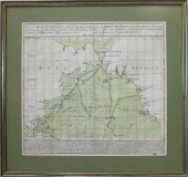
 A TOPOGRAPHICAL MAP OF THE ENVIRONS OF L
[more like this]
A TOPOGRAPHICAL MAP OF THE ENVIRONS OF L
[more like this]
-
 11 PC. MAP COLLECTION: Comprising; 1- La
[more like this]
11 PC. MAP COLLECTION: Comprising; 1- La
[more like this]
-
 16TH / 18TH C. EUROPEAN MAPS OF NEW SPAI
[more like this]
16TH / 18TH C. EUROPEAN MAPS OF NEW SPAI
[more like this]
-
 4 EARLY AMERICAN MAPS: OVERTON, THIERRY,
[more like this]
4 EARLY AMERICAN MAPS: OVERTON, THIERRY,
[more like this]
-
 AN IMPORTANT REPUBLIC OF TEXAS MAP, "MAP
[more like this]
AN IMPORTANT REPUBLIC OF TEXAS MAP, "MAP
[more like this]
-
 AN ANTIQUE RECONSTRUCTION ERA MAP, "KOSS
[more like this]
AN ANTIQUE RECONSTRUCTION ERA MAP, "KOSS
[more like this]
-
 3 19TH CENT. AL, KY, & TN MAPS1st item:
[more like this]
3 19TH CENT. AL, KY, & TN MAPS1st item:
[more like this]
-
 MAP AND ATLAS LOT, 3 PCS INCL. MELISH DI
[more like this]
MAP AND ATLAS LOT, 3 PCS INCL. MELISH DI
[more like this]
-
 5 CIVIL WAR MAPSLot of five Civil War ma
[more like this]
5 CIVIL WAR MAPSLot of five Civil War ma
[more like this]
-
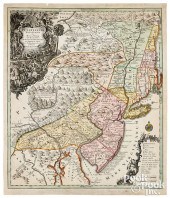
 ALBERT & LOTTER ENGRAVED MAP OF NORTH AM
[more like this]
ALBERT & LOTTER ENGRAVED MAP OF NORTH AM
[more like this]
-
 TOBIAS CONRAD LOTTER & GEORG MATTHäUS SE
[more like this]
TOBIAS CONRAD LOTTER & GEORG MATTHäUS SE
[more like this]
-
 HAND-COLORED MAP OF NORTH AMERICA "CARTE
[more like this]
HAND-COLORED MAP OF NORTH AMERICA "CARTE
[more like this]
-
 1777 HAND-COLORED MAP TITLED: A PLAN OF
[more like this]
1777 HAND-COLORED MAP TITLED: A PLAN OF
[more like this]
-
 NATIVE AMERICAN/WESTERN U.S. EXPEDITION
[more like this]
NATIVE AMERICAN/WESTERN U.S. EXPEDITION
[more like this]
-
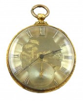 JEWELRY: 18K OPEN FACE M.J. TOBIAS POCKE
[more like this]
JEWELRY: 18K OPEN FACE M.J. TOBIAS POCKE
[more like this]
-
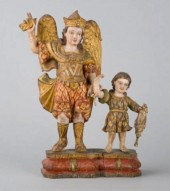 POLYCHROME SCULPTURE GOAA polychrome woo
[more like this]
POLYCHROME SCULPTURE GOAA polychrome woo
[more like this]
-
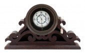
 ANTIQUE ENGLISH TOBIAS 19TH CENTURY MAHO
[more like this]
ANTIQUE ENGLISH TOBIAS 19TH CENTURY MAHO
[more like this]
-
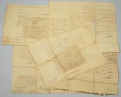 FIVE 18TH CENTURY NC/TN LAND GRANTSGroup
[more like this]
FIVE 18TH CENTURY NC/TN LAND GRANTSGroup
[more like this]
-
 A Rare North or South Carolina “Colored
[more like this]
A Rare North or South Carolina “Colored
[more like this]
-
 1747 MAP OF NORTH AMERICAN BY EMANUEL BO
[more like this]
1747 MAP OF NORTH AMERICAN BY EMANUEL BO
[more like this]
-
 MAP, MATTHEW ALBERT LOTTER Matthew Alber
[more like this]
MAP, MATTHEW ALBERT LOTTER Matthew Alber
[more like this]
This list is limited to only a few results.
Many more items are available to our members in our
Price Guide!
Ideal research tools for Collectors, Personal Property Appraisers, Antiques & Collectibles
Dealers, Auction Houses, Museums, eBayers or
other online
sellers (Rubylane, Etsy etc) and curious minds interested in appraising & identifying collectibles

EASY. FAST. ACCURATE.
Research at its best

Our research tools include:


