Pricing Guides & Dictionary of Makers Marks for Antiques & Collectibles
Appraise and find values for
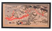
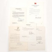
WWII 9TH ARMORED DIVISION MAP, UNIT...
From
marks4antiques.com
- The most updated price guide and makers' marks research online
As a member, you have access to a team of experts
and assistance is always available to you for free
An example from the millions of items in our Price Guide:
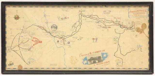
WWII 9TH ARMORED DIVISION MAP, UNIT PATCH, BOOKLETFramed WWII map, "Campaign of the 9th Armored Divison in Western Europe", Major General John W....
This is an example from our
values4antiques price guide
We do not buy or sell any items
See more price guides
Check our other research services:
IDENTIFY WORLDWIDE MAKERS' MARKS & HALLMARKS
marks4ceramics:
Porcelain, Pottery, Chinaware, Figurines, Dolls, Vases...
marks4silver
:
Silver, Jewelry, Pewter, Silverplate, Copper & Bronze...
Explore other items from our
Antiques & Collectibles Price Guide
-
 BRITANNIA, VOL. I & II CAMDEN 1722Camden
[more like this]
BRITANNIA, VOL. I & II CAMDEN 1722Camden
[more like this]
-
 A COMPLETE SYSTEM OF GEOGRAPHY, VOL. I B
[more like this]
A COMPLETE SYSTEM OF GEOGRAPHY, VOL. I B
[more like this]
-
 WWII 9TH ARMORED DIVISION MAP, UNIT PATC
[more like this]
WWII 9TH ARMORED DIVISION MAP, UNIT PATC
[more like this]
-
 IMPORTANT ANTIQUE ATLAS DU VOYAGE DE LA
[more like this]
IMPORTANT ANTIQUE ATLAS DU VOYAGE DE LA
[more like this]
-
 5 KENTUCKY AND TENNESSEE MAPS1st item: "
[more like this]
5 KENTUCKY AND TENNESSEE MAPS1st item: "
[more like this]
-
 ALPAKA WW2 3RD ARMY DIVISION "SPEARHEAD"
[more like this]
ALPAKA WW2 3RD ARMY DIVISION "SPEARHEAD"
[more like this]
-
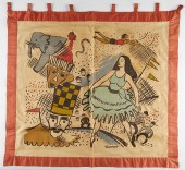 WPA MILWAUKEE HANDICRAFT PROJECT CIRCUS
[more like this]
WPA MILWAUKEE HANDICRAFT PROJECT CIRCUS
[more like this]
-
 A RARE ANTIQUE CIVIL WAR ERA MAP, "PRESS
[more like this]
A RARE ANTIQUE CIVIL WAR ERA MAP, "PRESS
[more like this]
-
 3 KY & TN MAPS: VANCE, TANNER, JOHNSON1s
[more like this]
3 KY & TN MAPS: VANCE, TANNER, JOHNSON1s
[more like this]
-
 4 TN & KY MAPS, 3 FRAMED1st item: "Tenne
[more like this]
4 TN & KY MAPS, 3 FRAMED1st item: "Tenne
[more like this]
-
 A TOPOGRAPHICAL MAP OF THE ENVIRONS OF L
[more like this]
A TOPOGRAPHICAL MAP OF THE ENVIRONS OF L
[more like this]
-
 A Very Large Collection of Maps, 19th/e
[more like this]
A Very Large Collection of Maps, 19th/e
[more like this]
-
 8 TENNESSEE MILITARY & SURVEY MAPSAssort
[more like this]
8 TENNESSEE MILITARY & SURVEY MAPSAssort
[more like this]
-
 A LATE MEXICAN-AMERICAN WAR ERA MAP, "MA
[more like this]
A LATE MEXICAN-AMERICAN WAR ERA MAP, "MA
[more like this]
-
 FOCUSED COLLECTION OF 640 DIFFERENT KORE
[more like this]
FOCUSED COLLECTION OF 640 DIFFERENT KORE
[more like this]
-
 WWII 1945 4TH ARMORED DIVISION PICTORIAL
[more like this]
WWII 1945 4TH ARMORED DIVISION PICTORIAL
[more like this]
-
 11 PC. MAP COLLECTION: Comprising; 1- La
[more like this]
11 PC. MAP COLLECTION: Comprising; 1- La
[more like this]
-
 16TH / 18TH C. EUROPEAN MAPS OF NEW SPAI
[more like this]
16TH / 18TH C. EUROPEAN MAPS OF NEW SPAI
[more like this]
-
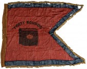 Civil War 15th Army Corps Forty Rounds H
[more like this]
Civil War 15th Army Corps Forty Rounds H
[more like this]
-
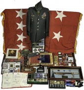 General Fred K. Mahaffey Archive Archive
[more like this]
General Fred K. Mahaffey Archive Archive
[more like this]
-
 AN IMPORTANT REPUBLIC OF TEXAS MAP, "MAP
[more like this]
AN IMPORTANT REPUBLIC OF TEXAS MAP, "MAP
[more like this]
-
 AN ANTIQUE RECONSTRUCTION ERA MAP, "KOSS
[more like this]
AN ANTIQUE RECONSTRUCTION ERA MAP, "KOSS
[more like this]
-
 3 19TH CENT. AL, KY, & TN MAPS1st item:
[more like this]
3 19TH CENT. AL, KY, & TN MAPS1st item:
[more like this]
-
 MAP AND ATLAS LOT, 3 PCS INCL. MELISH DI
[more like this]
MAP AND ATLAS LOT, 3 PCS INCL. MELISH DI
[more like this]
-
 5 CIVIL WAR MAPSLot of five Civil War ma
[more like this]
5 CIVIL WAR MAPSLot of five Civil War ma
[more like this]
-
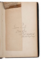
 Autographs of World War II Generals Eigh
[more like this]
Autographs of World War II Generals Eigh
[more like this]
-
 NATIVE AMERICAN/WESTERN U.S. EXPEDITION
[more like this]
NATIVE AMERICAN/WESTERN U.S. EXPEDITION
[more like this]
-
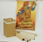 TWENTY-ONE UNFRAMED WAR BOND POSTERSWWI
[more like this]
TWENTY-ONE UNFRAMED WAR BOND POSTERSWWI
[more like this]
-
 1915 KING ARMORED MOTOR CAR TEST BOOKLET
[more like this]
1915 KING ARMORED MOTOR CAR TEST BOOKLET
[more like this]
-
 RARE 1865 MONTANA TERRITORY MAP BY W.W.
[more like this]
RARE 1865 MONTANA TERRITORY MAP BY W.W.
[more like this]
-
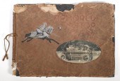
 Civil War Autograph Book of the 96th New
[more like this]
Civil War Autograph Book of the 96th New
[more like this]
-
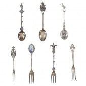 19TH-20TH C. EUROPEAN STERLING FORKS & S
[more like this]
19TH-20TH C. EUROPEAN STERLING FORKS & S
[more like this]
-
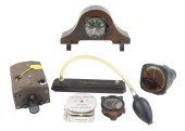 WWII AERONAUTICAL GROUPING, SIX PIECES:
[more like this]
WWII AERONAUTICAL GROUPING, SIX PIECES:
[more like this]
-
 AN ANTIQUE REPUBLIC OF TEXAS MAP, "MAP O
[more like this]
AN ANTIQUE REPUBLIC OF TEXAS MAP, "MAP O
[more like this]
-
 AN ANTIQUE REPUBLIC OF TEXAS MAP, "MAP O
[more like this]
AN ANTIQUE REPUBLIC OF TEXAS MAP, "MAP O
[more like this]
-
 AN ANTIQUE RECONSTRUCTION ERA MAP, "TRAV
[more like this]
AN ANTIQUE RECONSTRUCTION ERA MAP, "TRAV
[more like this]
This list is limited to only a few results.
Many more items are available to our members in our
Price Guide!
Ideal research tools for Collectors, Personal Property Appraisers, Antiques & Collectibles
Dealers, Auction Houses, Museums, eBayers or
other online
sellers (Rubylane, Etsy etc) and curious minds interested in appraising & identifying collectibles

EASY. FAST. ACCURATE.
Research at its best

Our research tools include:


