Pricing Guides & Dictionary of Makers Marks for Antiques & Collectibles
Appraise and find values for
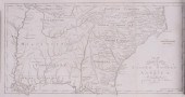
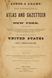
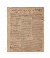
[Maps] R. S. Fisher Gazetteer of...
From
marks4antiques.com
- The most updated price guide and makers' marks research online
As a member, you have access to a team of experts
and assistance is always available to you for free
An example from the millions of items in our Price Guide:
![[Maps] R. S. Fisher Gazetteer of](/images/maps-r-s-fisher-gazetteer--1397d3-full.jpg)
[Maps] R. S. Fisher Gazetteer of the State of Maryland compiled from the returns of the seventh census of the Unites States and other official documents...
This is an example from our
values4antiques price guide
We do not buy or sell any items
See more price guides
Check our other research services:
IDENTIFY WORLDWIDE MAKERS' MARKS & HALLMARKS
marks4ceramics:
Porcelain, Pottery, Chinaware, Figurines, Dolls, Vases...
marks4silver
:
Silver, Jewelry, Pewter, Silverplate, Copper & Bronze...
Explore other items from our
Antiques & Collectibles Price Guide
-
 A Very Large Collection of Maps, 19th/e
[more like this]
A Very Large Collection of Maps, 19th/e
[more like this]
-
 HARRISON FISHER (AMERICAN, 1875-1934) FI
[more like this]
HARRISON FISHER (AMERICAN, 1875-1934) FI
[more like this]
-
 FOUR AMERICAN MAPS, LATE 18TH/EARLY 19TH
[more like this]
FOUR AMERICAN MAPS, LATE 18TH/EARLY 19TH
[more like this]
-
 EARLY AMERICAN BOOKSEarly American books
[more like this]
EARLY AMERICAN BOOKSEarly American books
[more like this]
-
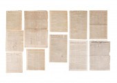 9PCS COLONIAL UNITED STATES NEWSPAPERS,
[more like this]
9PCS COLONIAL UNITED STATES NEWSPAPERS,
[more like this]
-
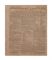 BILL OF RIGHTS, THE INDEPENDANT GAZETTEE
[more like this]
BILL OF RIGHTS, THE INDEPENDANT GAZETTEE
[more like this]
-
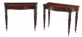 Pair Massachusetts late Federal carved c
[more like this]
Pair Massachusetts late Federal carved c
[more like this]
-
 2 vols. American 19th-Century State Atl
[more like this]
2 vols. American 19th-Century State Atl
[more like this]
-
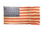 LT. COMMANDER JAMES PARKER'S FLAG FROM T
[more like this]
LT. COMMANDER JAMES PARKER'S FLAG FROM T
[more like this]
-
 MARK FISHER OIL ON CANVAS LANDSCAPE W/ C
[more like this]
MARK FISHER OIL ON CANVAS LANDSCAPE W/ C
[more like this]
-
 DICTIONARIES AND GAZETTEERS
A QUANTITY,
[more like this]
DICTIONARIES AND GAZETTEERS
A QUANTITY,
[more like this]
-
 4 vols. (Pennsylvania Property Atlases
[more like this]
4 vols. (Pennsylvania Property Atlases
[more like this]
-
 1 vol. (Philadelphia Atlas.) Smedley, S
[more like this]
1 vol. (Philadelphia Atlas.) Smedley, S
[more like this]
-
 DU HALDE, Jean-Baptiste, (French, 1674-1
[more like this]
DU HALDE, Jean-Baptiste, (French, 1674-1
[more like this]
-
 MITCHELL. A NEW UNIVERSAL ATLAS CONTAINI
[more like this]
MITCHELL. A NEW UNIVERSAL ATLAS CONTAINI
[more like this]
-
 2 FRAMED 18TH C. FADEN MAPS - GREECE & D
[more like this]
2 FRAMED 18TH C. FADEN MAPS - GREECE & D
[more like this]
-
 HENRY MOUZON - MAP OF NORTH AND SOUTH CA
[more like this]
HENRY MOUZON - MAP OF NORTH AND SOUTH CA
[more like this]
-
 AN ANTIQUE MAP, "CARTE DES VARIATIONS DE
[more like this]
AN ANTIQUE MAP, "CARTE DES VARIATIONS DE
[more like this]
-
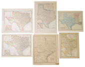 (6) ANTIQUE TEXAS MAPS<br>(lot of 6)&nbs
[more like this]
(6) ANTIQUE TEXAS MAPS<br>(lot of 6)&nbs
[more like this]
-
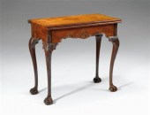 The Francis-Fisher-Coxe Chippendale carv
[more like this]
The Francis-Fisher-Coxe Chippendale carv
[more like this]
-
 FISHER BODY CRAFTSMAN'S GUILD NAPOLEONIC
[more like this]
FISHER BODY CRAFTSMAN'S GUILD NAPOLEONIC
[more like this]
-
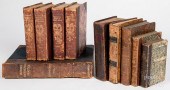 GROUP OF LEATHER BOUND BOOKSGroup of lea
[more like this]
GROUP OF LEATHER BOUND BOOKSGroup of lea
[more like this]
-
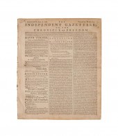 BILL OF RIGHTS, INDEPENDENT GAZETTEER, 1
[more like this]
BILL OF RIGHTS, INDEPENDENT GAZETTEER, 1
[more like this]
-
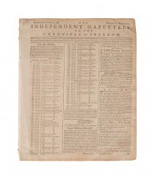 US CONSTITUTION, INDEPENDENT GAZETTEER,
[more like this]
US CONSTITUTION, INDEPENDENT GAZETTEER,
[more like this]
-
 US CONSTITUTION, INDEPENDENT GAZETTEER,
[more like this]
US CONSTITUTION, INDEPENDENT GAZETTEER,
[more like this]
-
 A Large Collection of Maps of America,
[more like this]
A Large Collection of Maps of America,
[more like this]
-
 2 vols. (Philadelphia Property Atlases.
[more like this]
2 vols. (Philadelphia Property Atlases.
[more like this]
-
 7 vols. Cartography: Brown, Lloyd A. Th
[more like this]
7 vols. Cartography: Brown, Lloyd A. Th
[more like this]
-
 7 vols. Cartography - American Subjects
[more like this]
7 vols. Cartography - American Subjects
[more like this]
-
 1782 Thomas Kitchen atlas, A General Atl
[more like this]
1782 Thomas Kitchen atlas, A General Atl
[more like this]
-
 Military Maps Illustrating the Operation
[more like this]
Military Maps Illustrating the Operation
[more like this]
-
 THE LIFE OF GEORGE WASHINGTON, BY JOHN M
[more like this]
THE LIFE OF GEORGE WASHINGTON, BY JOHN M
[more like this]
-
 MAPS: JOHN SPEED (ENGLAND, 1552-1629), T
[more like this]
MAPS: JOHN SPEED (ENGLAND, 1552-1629), T
[more like this]
-
 6 MISSISSIPPI AND TENNESSEE RIVER MAPSSi
[more like this]
6 MISSISSIPPI AND TENNESSEE RIVER MAPSSi
[more like this]
-
 8 TENNESSEE MILITARY & SURVEY MAPSAssort
[more like this]
8 TENNESSEE MILITARY & SURVEY MAPSAssort
[more like this]
-
 5 CIVIL WAR RELATED BOOKS1st item: Hopki
[more like this]
5 CIVIL WAR RELATED BOOKS1st item: Hopki
[more like this]
This list is limited to only a few results.
Many more items are available to our members in our
Price Guide!
Ideal research tools for Collectors, Personal Property Appraisers, Antiques & Collectibles
Dealers, Auction Houses, Museums, eBayers or
other online
sellers (Rubylane, Etsy etc) and curious minds interested in appraising & identifying collectibles

EASY. FAST. ACCURATE.
Research at its best

Our research tools include:


