Pricing Guides & Dictionary of Makers Marks for Antiques & Collectibles
Appraise and find values for
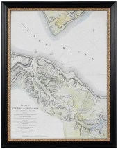
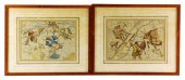
2 FRAMED 18TH C. FADEN MAPS -...
From
marks4antiques.com
- The most updated price guide and makers' marks research online
As a member, you have access to a team of experts
and assistance is always available to you for free
An example from the millions of items in our Price Guide:
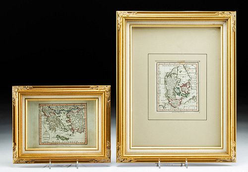
2 FRAMED 18TH C. FADEN MAPS - GREECE & DENMARK**Originally Listed At $200** Cartographer: William Faden (British, 1749-1836). Engraver: William Palmer...
This is an example from our
values4antiques price guide
We do not buy or sell any items
See more price guides
Check our other research services:
IDENTIFY WORLDWIDE MAKERS' MARKS & HALLMARKS
marks4ceramics:
Porcelain, Pottery, Chinaware, Figurines, Dolls, Vases...
marks4silver
:
Silver, Jewelry, Pewter, Silverplate, Copper & Bronze...
Explore other items from our
Antiques & Collectibles Price Guide
-
 2 FRAMED 18TH C. FADEN MAPS - GREECE & D
[more like this]
2 FRAMED 18TH C. FADEN MAPS - GREECE & D
[more like this]
-
 A Very Large Collection of Maps, 19th/e
[more like this]
A Very Large Collection of Maps, 19th/e
[more like this]
-
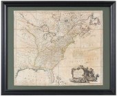
 WM. FADEN REVOLUTIONARY WAR MAP 1776Will
[more like this]
WM. FADEN REVOLUTIONARY WAR MAP 1776Will
[more like this]
-
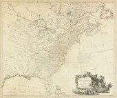
 FADEN - UNITED STATES OF NORTH AMERICA,
[more like this]
FADEN - UNITED STATES OF NORTH AMERICA,
[more like this]
-
 WILLIAM FADEN (1749-1836) A TREATY OF PA
[more like this]
WILLIAM FADEN (1749-1836) A TREATY OF PA
[more like this]
-
 AN ANTIQUE MAP, "CARTE DES VARIATIONS DE
[more like this]
AN ANTIQUE MAP, "CARTE DES VARIATIONS DE
[more like this]
-
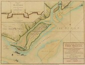
 LT. JOHN HILLS - PLAN OF YORKTOWN AND GL
[more like this]
LT. JOHN HILLS - PLAN OF YORKTOWN AND GL
[more like this]
-
 4 vols. (Pennsylvania Property Atlases
[more like this]
4 vols. (Pennsylvania Property Atlases
[more like this]
-
 1 vol. (Philadelphia Atlas.) Smedley, S
[more like this]
1 vol. (Philadelphia Atlas.) Smedley, S
[more like this]
-
 DU HALDE, Jean-Baptiste, (French, 1674-1
[more like this]
DU HALDE, Jean-Baptiste, (French, 1674-1
[more like this]
-
 MITCHELL. A NEW UNIVERSAL ATLAS CONTAINI
[more like this]
MITCHELL. A NEW UNIVERSAL ATLAS CONTAINI
[more like this]
-
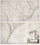
 HENRY MOUZON - MAP OF NORTH AND SOUTH CA
[more like this]
HENRY MOUZON - MAP OF NORTH AND SOUTH CA
[more like this]
-
 FADEN'S MAP OF GREAT BRITAIN, 1795, FRAM
[more like this]
FADEN'S MAP OF GREAT BRITAIN, 1795, FRAM
[more like this]
-
 ANTIQUE CHART ANTILLES AND VIRGIN ISLES
[more like this]
ANTIQUE CHART ANTILLES AND VIRGIN ISLES
[more like this]
-
 MAPS: TWO FRAMED MAPS OF ZUTPHEN, AMSTER
[more like this]
MAPS: TWO FRAMED MAPS OF ZUTPHEN, AMSTER
[more like this]
-
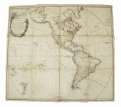 RARE 1797 BRITISH FOLDING MAP OF AMERICA
[more like this]
RARE 1797 BRITISH FOLDING MAP OF AMERICA
[more like this]
-
 DE BRAHM/FADEN - MAP OF SOUTH CAROLINA,
[more like this]
DE BRAHM/FADEN - MAP OF SOUTH CAROLINA,
[more like this]
-
 A Large Collection of Maps of America,
[more like this]
A Large Collection of Maps of America,
[more like this]
-
 2 vols. (Philadelphia Property Atlases.
[more like this]
2 vols. (Philadelphia Property Atlases.
[more like this]
-
 7 vols. Cartography: Brown, Lloyd A. Th
[more like this]
7 vols. Cartography: Brown, Lloyd A. Th
[more like this]
-
 7 vols. Cartography - American Subjects
[more like this]
7 vols. Cartography - American Subjects
[more like this]
-
 1782 Thomas Kitchen atlas, A General Atl
[more like this]
1782 Thomas Kitchen atlas, A General Atl
[more like this]
-
 Military Maps Illustrating the Operation
[more like this]
Military Maps Illustrating the Operation
[more like this]
-
 THE LIFE OF GEORGE WASHINGTON, BY JOHN M
[more like this]
THE LIFE OF GEORGE WASHINGTON, BY JOHN M
[more like this]
-
 MAPS: JOHN SPEED (ENGLAND, 1552-1629), T
[more like this]
MAPS: JOHN SPEED (ENGLAND, 1552-1629), T
[more like this]
-
 6 MISSISSIPPI AND TENNESSEE RIVER MAPSSi
[more like this]
6 MISSISSIPPI AND TENNESSEE RIVER MAPSSi
[more like this]
-
 8 TENNESSEE MILITARY & SURVEY MAPSAssort
[more like this]
8 TENNESSEE MILITARY & SURVEY MAPSAssort
[more like this]
-
 5 CIVIL WAR RELATED BOOKS1st item: Hopki
[more like this]
5 CIVIL WAR RELATED BOOKS1st item: Hopki
[more like this]
-
 5 CIVIL WAR MAPSLot of five Civil War ma
[more like this]
5 CIVIL WAR MAPSLot of five Civil War ma
[more like this]
-
 MAPS: JOHN MARSHALL "THE LIFE OF GEORGE
[more like this]
MAPS: JOHN MARSHALL "THE LIFE OF GEORGE
[more like this]
-
 (5) TEXAS MAPS, 1850'S<br>(lot of 5
[more like this]
(5) TEXAS MAPS, 1850'S<br>(lot of 5
[more like this]
-
 RARE 18TH CENTURY CHINESE ATLASA rare 18
[more like this]
RARE 18TH CENTURY CHINESE ATLASA rare 18
[more like this]
-
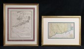 2 MAPS CT AND RI & GENERAL GRANT'S LONG
[more like this]
2 MAPS CT AND RI & GENERAL GRANT'S LONG
[more like this]
-
 A TOPOGRAPHICAL MAP OF THE ENVIRONS OF L
[more like this]
A TOPOGRAPHICAL MAP OF THE ENVIRONS OF L
[more like this]
-
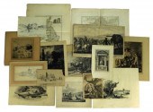 FIFTEEN COLORED MAPS, DRAWINGS, AND ETCH
[more like this]
FIFTEEN COLORED MAPS, DRAWINGS, AND ETCH
[more like this]
-
 MAPS: TWO HAND-COLORED CELESTIAL MAPS, L
[more like this]
MAPS: TWO HAND-COLORED CELESTIAL MAPS, L
[more like this]
This list is limited to only a few results.
Many more items are available to our members in our
Price Guide!
Ideal research tools for Collectors, Personal Property Appraisers, Antiques & Collectibles
Dealers, Auction Houses, Museums, eBayers or
other online
sellers (Rubylane, Etsy etc) and curious minds interested in appraising & identifying collectibles

EASY. FAST. ACCURATE.
Research at its best

Our research tools include:


